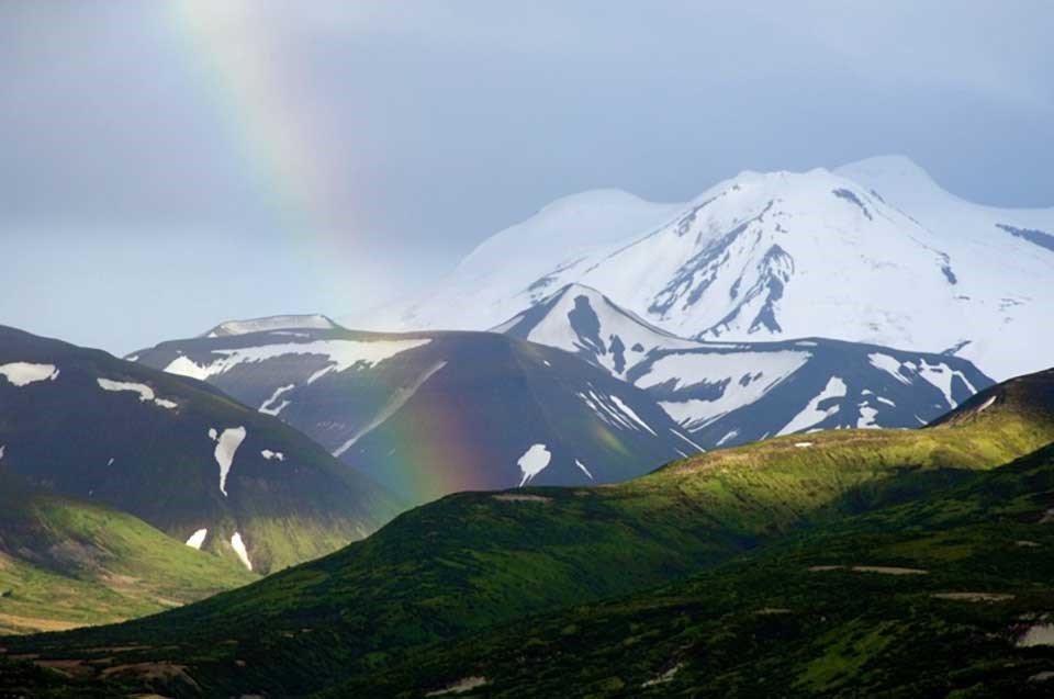
NPS photo.
Introduction
The National Park System contains a majority of the most significant volcanoes in the United States. National parks include
-
Two of the most perfect cinder cones in North America (Capulin Volcano and Sunset Crater Volcano national monuments),
-
The site of the largest eruption in the 20th century (Katmai National Park),
-
The example for resurgent calderas (Valles National Preserve),
-
The greatest concentration of geysers on Earth (Yellowstone National Park),
-
The best example of columnar jointing on the continent (Devils Postpile National Monument),
-
At least 20 volcanoes that are active or potentially active, including Mauna Loa and Kīlauea in Hawaii Volcanoes National Park, Iliamna and Redoubt in Lake Clark National Park, and Lassen Peak in Lassen Volcanic National Park which erupted in 1914-1917.
Nineteen national park sites were set aside primarily for their volcanic resources. These parks have volcanic resources identified as a park significance, listed as a fundamental resource or value, or specifically called-out in their enabling legislation.
Aniakchak National Monument, Alaska
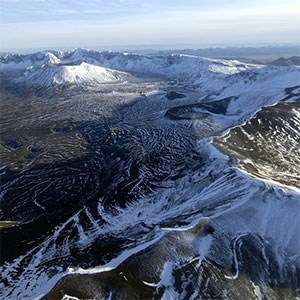
Aniakchak caldera is one of the best exposed calderas on the planet. It is located on the Aleutian Peninsula in Alaska and is one of the least visited units in the National Park System. The Aniakchak caldera formed 3,660 ± 70 years ago during a Volcanic Explosivity Index (VEI) 6 (Colossal) eruption that was one of the largest eruptions of the Holocene. The caldera has a diameter of about 6.6 miles (10.5 km) and is about 2,000 feet (610 m) deep. Post-caldera eruptions have formed a series of domes, cones, maars, and lava flows within the caldera, with the most recent eruption occurring in 1931.
Volcanic Resources
Cider Cones | Composite Volcanoes (Stratovolcanoes) | Explosive Calderas | Summit Calderas | Volcanic Domes | Maars & Tuff Rings | Fumaroles | Crater Lakes
Related Links
Capulin Volcano National Monument, New Mexico
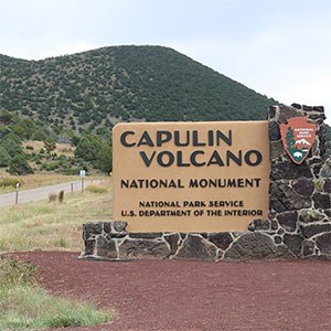
Capulin Volcano is one of the tallest and most perfectly formed cinder cones in North America standing nearly 1,300 ft (400 m) above the surrounding plain in northeastern New Mexico. Capulin Volcano erupted about 54,200 ± 1,800 years ago forming the cinder cone, and erupting a series of lava flows from vents along its base. Capulin Volcano is located near the center of the Raton-Clayton Volcanic Field, the easternmost young volcanic field in the United States which experienced intermittent activity over the last 9 million years.
Volcanic Resources
Cider Cones | Maars & Tuff Rings | Monogenetic Volcanic Fields | Lava Lakes | Volcanic Inverted Topography
Related Links
-
New Mexico Musuem of Natural History and Science—Raton-Clayton Volcanic Field: Capulin Volcano
-
New Mexico Bureau of Geology & Mineral Resources—Capulin Volcano National Monument
Chiricahua National Monument, Arizona
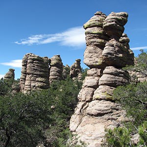
Chiricahua NM was established in 1924 to protect an area known as the Pinnacles which are spires and hoodoos formed by erosion along two sets of vertical joints in the Rhyolite Canyon Tuff. The Rhyolite Canyon Tuff was erupted from the Turkey Creek Caldera located south of the monument about 26.5 million years ago.
Volcanic Resources
Older Caldera Complexes | Volcanic Inverted Topography
Related Links
Crater Lake National Park, Oregon
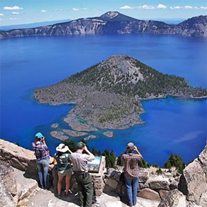
Crater Lake is a summit caldera with a diameter of 5-6 miles (8-10 km) that formed in a Mega-colossal (VEI 7) eruption 7,700 years ago that culminated in caldera collapse. The eruption had an estimated volume of 12 cubic miles (50 cubic km) making it the largest prehistoric eruption in the contiguous United States. Crater Lake is the deepest lake in the United States, with the primary source of water in the lake being precipitation. It took approximately 460 years to fill. The park was established in 1902 and was the third national park set aside for its volcanic resources.
Volcanic Resources
Summit Calderas | Crater Lakes | Volcanic Craters | Volcanic Vents
Related Links
-
USGS—Geologic Field-Trip Guide to Mount Mazama and Crater Lake Caldera, Oregon
-
USGS—Geology and History Summary for Mount Mazama and Crater Lake
-
USGS—Geologic Map of Mount Mazama and Crater Lake Caldera, Oregon
Craters of the Moon National Monument, Idaho
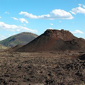
Craters of the Moon is one of the best areas in the contiguous United States to explore a monogenetic volcanic field that has experienced abundant Holocene volcanism. Activity in the field began about 15,000 years ago with the most recent eruption occurring about 2,100 years ago. The field contains the Craters of the Moon, Wapi, and Kings Bowl lava fields along the Great Rift volcanic rift zone on the Snake River Plain.
Volcanic Resources
Monogenetic Volcanic Fields | Volcanic Craters | Lava Lakes | Volcanic Vents | Shield Volcanoes | Cinder Cones | Lava Tree Mold Fossils | Fissure Volcanoes
Related Links
Devils Postpile National Monument, California
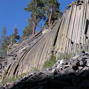
Devils Postpile National Monument contains one of the most spectacular examples of columnar jointing in the United States. The postpile consists of columns that are up to 60 ft (18 m) long and have a diameter up to 2.5 ft (1.1 m). Columnar jointing forms during rapid cooling of lava flows and other igneous bodies due to fracturing caused by contraction. Devils Postpile is in a basalt lava flow that erupted about 100,000 years ago.
Volcanic Resources
Related Links
Devils Tower National Monument, Wyoming
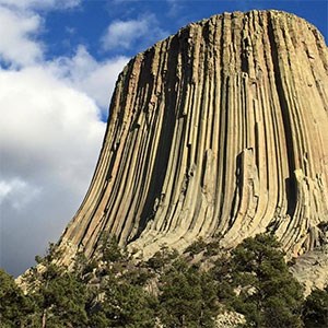
Devils Tower National Monument has the distinction of being the first national monument established under the authority of the Antiquities Act in 1906. Devils Tower stands about 867 feet (265 m) tall, but its origin is not completely understood. It may be a volcanic neck, a remnant of a maar-diatreme volcano, or result from erosion of a shallow intrusion. Spectacularly-developed columnar jointing is one of the tower’s most distinctive features.
Volcanic Resources
Volcanic Necks and Plugs | Columnar Jointing
Related Links
El Malpais National Monument, New Mexico
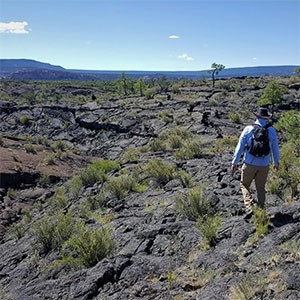
El Malpais National Monument preserves part of the Zuni-Bandera Volcanic Field, which is notable for its lava flows of unusually large length and large volume, and for its diversity of vent types and lava flow morphologies. The Zuni-Bandera Volcanic Field is located along the southern boundary of the Colorado Plateau in New Mexico and experienced three phases of activity in the last 700,000 years. The most recent eruption produced the McCartys Flow 3,900 years ago. El Malpais contains several cinder cones, one of the longest lava tube systems in the world, and the southernmost ice caves in North America. Research on the McCartys Flow has been important for understanding the emplacement of lava flows by inflation, providing new insights into the formation of basaltic lava flows on Earth, the Moon, and Mars.
Volcanic Resources
Monogenetic Volcanic Fields | Volcanic Craters | Shield Volcanoes | Cinder Cones | Lava Tree Mold Fossils | Fissure Volcanoes
Related Links
Haleakalā National Park, Hawai’i
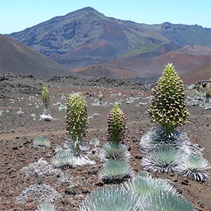
Haleakalā Volcano, otherwise known as East Maui volcano, is on the island of Maui, the second youngest island in the Hawaiian chain. It is the only Hawaiian volcano not located on the Big Island that is potentially active today. Its most recent eruption occurred about 400 years ago. The volcano began erupting about 2 million years ago, and about 97% of its volume is below sea level. Haleakalā Crater in the summit region is actually an erosional feature. The volcano is in the post-shield phase with a lower magma production rate. Several young cinder cones are located near the summit and along the flanks of the volcano.
Volcanic Resources
Volcanic Craters | Shield Volcanoes | Cinder Cones
Related Links
Hawai’i Volcanoes National Park, Hawai’i
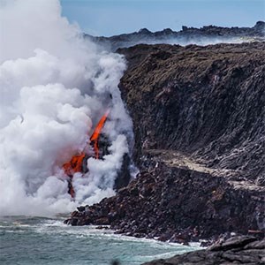
Hawai’i Volcanoes National Park contains parts of Mauna Loa and Kīlauea, two of the most active shield volcanoes on Earth. Mauna Loa is the largest active volcano on the planet. From its base on the sea floor, Mauna Loa is almost 33,500 feet (10,211 m) tall.
With the exception of a quiet period between 1924 and 1952, Kīlauea mostly has been in eruption since 1780 CE (e.g., since reliable written record-keeping began). Eruptions have occurred from both the rift zones and the summit caldera. Shield volcanoes have numerous summit calderas during their lifespans. Kīlauea’s current summit caldera has been in existence for about the last 500 years and has intermittently hosted a lava lake in the Halemaʻumaʻu pit crater. The Kīlauea caldera recently underwent further collapse in 2018 when an eruption along the lower East Rift Zone partially drained the summit magma chamber.
Volcanic Resources
Nonexplosive Calderas | Volcanic Craters | Lava Lakes | Fumaroles | Crater Lakes | Volcanic Vents | Shield Volcanoes | Cinder Cones | Lava Tree Mold Fossils
Volcanic Processes
Hawaiian Eruptions | Phreatomagmatic (Hydrovolcanic) Eruptions | Landslides
Related Links
Katmai National Park, Alaska
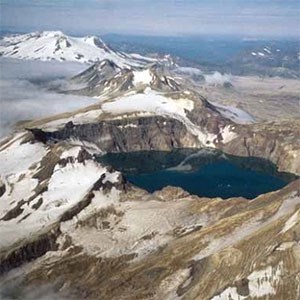
Katmai NP is within one of the most active volcanic areas on Earth as it sits along the Pacific Ring of Fire. The park contains 14 volcanoes that have had historic or prehistoric activity. Ten of these volcanoes are considered active by the USGS Alaska Volcano Observatory.
The 1912 Valley of Ten Thousand Smokes eruption was the largest of the 20th Century. This VEI 6 (Colossal) eruption from Novarupta, a vent about 6 mi (10 km) from Mount Katmai, lasted for about 60 hours and drained the magma reservoir underneath Katmai leading to caldera collapse. The eruption left a thick ignimbrite in the Valley of Ten Thousand Smokes, so named for the vigorous fumaroles that persisted for decades after its emplacement. Ash from the eruption rose to 19 mi (30 km) into the stratosphere and produced thick ash deposits formed throughout much of southern Alaska. The Novarupta vent was plugged with a lava dome at the end of the eruption.
The most recent volcanic activity in Katmai NP includes eruptions at Trident Volcano (1954-1973) and Fourpeaked (2006).
Volcanic Resources
Summit Calderas | Explosive Calderas | Fumaroles | Crater Lakes | Volcanic Vents | Composite Volcanoes (Stratovolcanoes) | Cinder Cones | Volcanic Domes
Volcanic Processes
Plinian Eruptions | Vulcanian Eruptions | Phreatic Eruptions | Lahars
Related Links
-
Series: Alaska Park Science - Volume 11 Issue 1: Volcanoes of Katmai and the Alaska Peninsula
-
USGS—Geologic Map of the Katmai Volcanic Cluster, Katmai National Park, Alaska
Lake Clark National Park and Preserve, Alaska
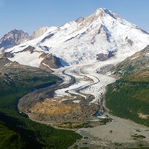
Lake Clark National Park contains two active composite volcanoes, Iliamna and Redoubt, which are both also National Natural Landmarks. Redoubt has experienced several eruptions since 1900, most recently in 1989-1990 and again in 2009. These eruptions reached a maximum 3 (Catastrophic) on the Volcanic Explosivity Index (VEI) and sent ash clouds to an elevation as high as 62,000 feet (19 km), and formed lava domes, ash-flows, and lahars. Iliamna is considered active, although reports of historic activity are not definitive. Both volcanoes also have active fumaroles.
Volcanic Resources
Fumaroles | Volcanic Vents | Composite Volcanoes (Stratovolcanoes) | Volcanic Domes
Volcanic Processes
Sub-Plinian Eruptions | Vulcanian Eruptions | Lahars
Related Links
Lassen Volcanic National Park, California
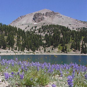
Lassen Volcanic National Park is home to four different types of volcanoes (dome, composite volcano, cinder cone, and shield volcano). Two of the most recent eruptions in the contiguous United States took place within the park boundary, with Lassen Peak erupting between 1914 and 1917 and Cinder Cone erupting in approximately 1666 CE (Common Era).
Lassen Peak is considered to be the world’s largest dome with a peak elevation of 10,457 feet (3,187 m) and was emplaced about 27,000 years ago. Lassen Peak’s eruptive activity in 1915 included directed blasts that blew out a crater at the summit, sent an eruption column 30,000 feet (9,000 m) into the atmosphere, and generated pyroclastic flows and lahars. The park also has several active hydrothermal areas.
Volcanic Resources
Fumaroles | Composite Volcanoes (Stratovolcanoes) | Shield Volcanoes | Cinder Cones | Volcanic Domes
Volcanic Processes
Vulcanian Eruptions | Strombolian Eruptions | Landslides | Lahars
Related Links
-
USGS—How Old is "Cinder Cone"?–Solving a Mystery in Lassen Volcanic National Park, California
-
USGS—A Sight “Fearfully Grand”—Eruptions of Lassen Peak, California, 1914 to 1917
Lava Beds National Monument, California
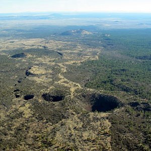
Lava Beds NM contains a number of lava flows that were erupted from fissures on the flank of Medicine Lake Volcano in northern California, a large shield which is mostly outside of the monument. Medicine Lake Volcano, the largest volcano by volume in the Cascade Range, has been active since about 500,000 years ago. The park contains fissure volcanoes, cinder cones, and spatter cones. Lava Beds NM also protects the largest concentration of lava tube caves in North America and contains more than 700 lava tube caves.
Volcanic Resources
Lava Lakes | Shield Volcanoes | Cinder Cones | Lava Tree Mold Fossils | Volcanic Domes | Fissure Volcanoes
Related Links
Mount Rainier National Park, Washington
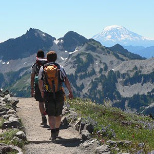
Mount Rainier is the tallest volcano in the Cascades with an elevation of 14,410 ft (4,392 m). The most recent magmatic eruption at this composite volcano occurred approximately 1,000 years ago, and reports of historic eruptions are not considered reliable. Mount Rainier is considered to be the most dangerous volcano in the continental United States because of its propensity for unleashing catastrophic lahars and its proximity to densely populated areas. Mount Rainier is heavily glaciated, and the presence of ice, snow, and abundant surface water, along with the prevalence of weak hydrothermally-altered rock on the volcano’s slopes, make Mount Rainier especially susceptible to lahars. The Osceola Mudflow travelled all the way to Puget Sound 5,600 years ago area and left lahar deposits covering approximately 212 square miles (550 square kilometers).
Volcanic Resources
Fumaroles | Composite Volcanoes (Stratovolcanoes) | Cinder Cones
Related Links
Pinnacles National Park, California
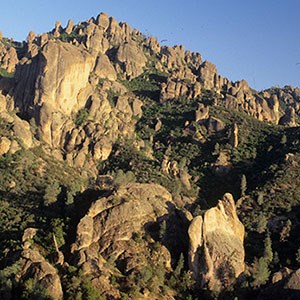
Pinnacles National Park contains the deeply-eroded remnants of a volcanic center or field that erupted approximately 23 million years ago. The park is located along the San Andreas Fault, and movement along the fault has moved the western portion of this ancient volcano approximately 200 miles (320 km) north relative to its eastern part. Rocks exposed in the park include volcanic breccias, lava flows, and tuffs. The park’s namesake pinnacles result from erosion along vertical joint systems.
Volcanic Resources
Related Links
Sunset Crater Volcano National Monument, Arizona
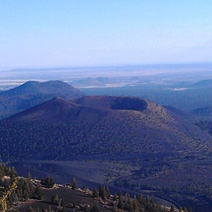
Sunset Crater is the youngest volcano in the San Francisco Volcanic Field in northern Arizona, erupting in 1085 CE (common era). The volcano was named for the oxidized red cinders along its rim. Sunset Crater’s eruption was especially vigorous for a cinder cone, being Sub-Plinian with a VEI of 4. It was propelled by unusually high concentrations of CO2 in the magma. The eruption column reached an estimated elevation of 65,000 ft (20 km), and tephra deposits from the eruption covered an area of almost 200 square miles (500 square km). The eruption greatly impacted the ancestral Puebloan people living in the region.
Volcanic Resources
Monogenetic Volcanic Fields | Volcanic Inverted Topography | Cinder Cones
Related Links
Valles Caldera National Preserve, New Mexico
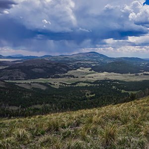
Valles Caldera, a resurgent caldera located in the Jemez Mountains of north-central New Mexico, formed 1.24 million years ago. The Valles Caldera is nearly 14-mi (22 km) in diameter, and its resurgent dome, Redondo Peak, is approximately 3,300 ft (1,000 m) higher than the caldera floor. A previous caldera-forming eruption took place 1.6 million years ago just to the northeast of Valles Caldera. Both eruptions produced voluminous air-fall and ash-flow tuffs including the Bandelier Tuff exposed in Frijoles Canyon in Bandelier National Monument. Valles Caldera is the type example for resurgent calderas, and is one of the best studied examples of this type of volcanic center.
Volcanic Resources
Resurgent Calderas | Explosive Calderas | Fumaroles | Crater Lakes | Volcanic Domes
Related Links
-
New Mexico Museum of Natural History and Science—Valles Caldera, Jemez Volcanic Field
-
New Mexico Bureau of Geology & Mineral Resources—Geologic map of the Valles Caldera
-
New Mexico Bureau of Geology & Mineral Resources—Valles Caldera National Preserve
Yellowstone National Park, Wyoming, Idaho, and Montana
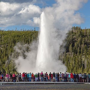
Volcanism has occurred in the Yellowstone region over the last 50 million years. During the last 2.1 million years, Yellowstone was the site of three large caldera-forming eruptions. The first of these eruptions was the largest. The eruption of the Huckleberry Ridge Tuff coincided with the formation of a resurgent caldera 53 by 28 miles (85 by 50 km) in diameter and the eruptive volume of 590 cubic miles (2,450 cubic km), making it one of the largest eruptions in geologic history. The most recent caldera-forming eruption occurred 640,000 years ago. The Yellowstone region is underlain by a mantle plume.
Post-caldera volcanisms has produced large volume rhyolitic lava flows, with the most recent eruption occurring about 70,000 years ago.
Yellowstone is also one of the planet’s most impressive geothermal areas and includes the greatest concentration of geysers on the planet. The park contains more than 10,000 hydrothermal features, including approximately 500 geysers and approximately 2,000 fumaroles, as well as mud pots and hot springs.
Volcanic Resources
Resurgent Calderas | Explosive Calderas | Fumaroles | Crater Lakes | Composite Volcanoes (Stratovolcanoes) | Shield Volcanoes | Cinder Cones | Volcanic Domes
Related Links
Enabling Legislation
Excerpts Related to Volcanic and Geologic Resources
Aniakchak NM -- 16 U.S.C. 410hh(1)
-- 1978
-- “The Aniakchak Caldera is located in the heart of the Aloaska Peninsula. It is so unexpected a feature that it remained unknown to all but the Natives of the region until
about 1920. With its average diameter of approximately six miles, Aniakchak is one of the world’s largest calderas.
In the interior of the caldera are textbook examples of certain volcanic features such as lava flows, cinder cones, and explosion pits. Also lying within the caldera is Surprise Lake which is fed by warm springs and is uniquely charged with chemicals. Surprise Lake is the source of the Aniakchak River, which cascades through a 1,500 foot gash in the caldera wall and downward 27 miles to the Pacific Ocean.
The flanks of the caldera provide a geological and biological continuum by which to make a comparative study of the formation of the caldera and the significant process of biological succession of both plant and animal species occurring in the vicinity of the caldera, an area that was rendered virtually devoid of life forms by a major eruption of the volcano in 1931….
The land withdrawn and reserved by this Proclamation [is] for the protection of the geological, biological, climatological and other phenomena…
NOW, THEREFORE, I, JIMMY CARTER … set apart … the Aniakchak National Monument…” 93 Stat 1448-49 (1978).
-- "The following areas are hereby established as units of the National Park System and shall be administered by the Secretary under the laws governing the administration of such lands and under the provisions of this Act:
(1) Aniakchak National Monument . . . and Aniakchak National Preserve . . . . The monument and preserve shall be managed for the following purposes, among others: To maintain the caldera and its associated volcanic features and landscape, including the Aniakchak River and other lakes and streams, in their natural state; to study, interpret, and assure continuation of the natural process of biological succession; to protect habitat for, and populations of, fish and wildlife, including, but not limited to, brown/grizzly bears, moose, caribou, sea lions, seals, and other marine mammals, geese, swans, and other waterfowl and in a manner consistent with the foregoing, to interpret geological and biological processes for visitors. . . ."" 16 USC Sec. 410hh (2006).
-- "Subject to valid existing rights, the Secretary shall administer the lands, waters, and interests therein added to existing areas or established by the foregoing sections of this subchapter as new areas of the National Park System, pursuant to the provisions of sections 1, 2, 3, and 4 of this title, as amended and supplemented, and, as appropriate, under section 3201 of this title and the other applicable provisions of this Act . . . ."" 16 USC Sec. 410hh-2 (2006).
-- This land was set aside under the Alaska National Interest Lands Conservation Act, PL 96-487, 94 Stat. 2371 (Dec. 2, 1980), providing:
“(a) In order to preserve for the benefit, use, education, and inspiration of present and future generations certain lands and waters in the State of Alaska that contain nationally significant natural, scenic, historic, archeological, geological, scientific, wilderness, cultural, recreational, and wildlife values, the units described in the following titles are hereby established.
(b) It is the intent of Congress in this Act to preserve unrivaled scenic and geological values associated with natural landscapes; to provide for the maintenance of sound
populations of, and habitat for, wildlife species of inestimable value to the citizens of Alaska and the Nation, including those species dependant on vast relatively undeveloped areas; to preserve in their natural state extensive unaltered arctic tundra, boreal forest, and coastal rainforest ecosystems; to protect the resources related to subsistence needs; to protect and preserve historic and archeological sites, rivers, and lands, and to preserve wilderness resource values and related recreational opportunities including but not limited to hiking, canoeing, fishing, and sport hunting, within large arctic and subarctic wildlands and on freeflowing rivers; and to maintain opportunities for scientific research and undisturbed ecosystems.” 94 Stat. 2374-75 (1980).
Capulin Volcano NM -- 39 Stat. 1792
-- 1916
-- PRE-ORGANIC ACT (1916)
-- "WHEREAS Capulin Mountain . . . is a striking example of recent extinct volcanoes and is of great scientific and especially geologic interest,
Now, therefore, I, Woodrow Wilson, President of the United States of America . . . set apart as Capulin Mountain National Monument . . . ." 39 Stat. 1792 (1916).
Chiricahua NM -- 43 Stat. 1946
-- 1924
-- "WHEREAS, certain natural formations, known as ""The Pinnacles,"" within the Coronado National Forest, in the State of Arizona, are of scientific interest, and it appears the public interests will be promoted by reserving as much land as may be necessary for the proper protection thereof, as a National Monument." 43 Stat. 1946 (1924).
-- ORIGINALLY ADMINISTERED BY USFS
Crater Lake NP -- 16 U.S.C. 121
-- PRE ORGANIC ACT (1902)
-- “That in order to preserve for the benefit, education, and inspiration of the people of the United States certain unique and ancient volcanic features, including Crater Lake, together with significant forest and fish and wildlife resources, there is hereby established the Crater Lake National Park in the State of Oregon.” 16 USC Sec. 121 (2006).
Craters of the Moon NM -- 43 Stat. 1947
-- 1924
-- "WHEREAS, there is located in . . . Idaho, an area which contains a remarkable fissure eruption together with its associated volcanic cones, craters, rifts, lava flows, caves, natural bridges, and other phenomena characteristic of volcanic action which are of unusual scientific value and general interest; and
WHEREAS, this area contains many curious and unusual phenomena of great educational value and has a weird and scenic landscape peculiar to itself; and
WHEREAS, it appears that the public interest would be promoted by reserving these volcanic features as a National Monument, together with as much land as may be needed for the protection thereof.
NOW, THEREFORE, I, Calvin Coolidge . . . set apart … the Craters of the Moon National Monument…" 43 Stat. 1947 (1924).
-- “[T]he Craters of the Moon National Preserve shall be administered in accordance with--
(A) Presidential Proclamation 7373 of November 9, 2000 [16 USCS § 431 note];
(B) the Act of June 8, 1906, (commonly referred to as the ""Antiquities Act""; 34 Stat. 225; 16 U.S.C. 431); and
(C) the laws generally applicable to units of the National Park System, including the Act entitled ""An Act to establish a National Park Service, and for other purposes"", approved August 25, 1916 (16 U.S.C. 1 et seq.).” 16 USC Sec. 698w (2006)." Geologic 1924.
Devils Postpile National Monument -- 37 Stat. 1715
-- PRE-ORGANIC ACT (1911)
-- "WHEREAS the natural formations known as the Devil Postpile and Rainbow Falls . . . are of scientific interest, and it appears that the public interest will be promoted by reserving said formations as a National Monument ;
Now, therefore, I, William H. Taft … set apart as a National Monument... Devil Postpile National Monument." 37 Stat. 1715 (1911).
Devils Tower NM -- 34 Stat. 3236
-- PRE-ORGANIC ACT (1906)
-- "[W]hereas, the lofty and isolated rock in the State of Wyoming, known as the 'Devils Tower,' situated upon public lands owned and controlled by the United States is such an extraordinary example of the effect of erosion in the higher mountains as to be a natural wonder and an object of historic and great scientific interest and it appears that the public good would be promoted by reserving this tower as a National monument with as much land as may be necessary for the proper protection thereof;
Now, therefore, I, THEODORE ROOSEVELT, President of the United States of America . . . do hereby set aside as the Devils Tower National Monument, the lofty and isolated rock situated in Crook County, Wyoming . . . ."" 34 Stat. 3236 (1906).
El Malpais NM -- 16 U.S.C. 460uu
-- 1987
-- "In order to preserve, for the benefit and enjoyment of present and future generations, that area in western New Mexico containing the nationally significant Grants Lava Flow, the Las Ventanas Chacoan Archeological Site, and other significant natural and cultural resources, there is hereby established the El Malpais National Monument . . . ." 16 USC Sec. 460uu (2006).
-- “The Secretary, acting through the Director of the National Park Service, shall manage the monument in accordance with the provisions of this Act, the Act of August 25, 1916 (39 Stat. 535; 16 U.S.C. 1 et seq.), and other provisions of law applicable to units of the National Park System. The Secretary shall protect, manage, and administer the monument for the purposes of preserving the scenery and the natural, historic, and cultural resources of the monument and providing for the public understanding and enjoyment of the same in such a manner as to perpetuate these qualities for future generations.” 16 USC Sec. 460uu-2 (2006).
Hawaii Volcanoes NP -- 16 U.S.C. 391
-- 1916
-- "The tracts of land on the island of Hawaii and on the island of Maui, in the Territory of Hawaii, hereinafter described, shall be perpetually dedicated and set apart as a public park or pleasure ground for the benefit and enjoyment of the people of the United States, to be known as Hawaii National Park."" 16 USC Sec. 391 (2006).
“The provisions of the Act of August 1, 1916 (39 Stat. 432), entitled ‘An Act to establish a national park in the Territory of Hawaii’ [16 USCS §§ 391, 393, 394]; the Act of August 25, 1916 (39 Stat. 535), entitled ‘An Act to establish a National Park Service, and for other purposes’ [16 USCS §§ 1, 2-4]; the Act of February 27, 1920 (41 Stat. 452), entitled ‘An Act to authorize the Governor of the Territory of Hawaii to acquire privately owned lands and rights-of-way within the boundaries of the Hawaii National Park’ [16USCS § 392]; and all Acts supplementary to and amendatory of said Acts are made applicable to and extended over the lands hereby added to the park…” 16 USC Sec. 391b-1 (2006).
Katmai NP -- 16 U.S.C. 410hh-1(2)
-- 1918
-- “WHEREAS, There exists upon the southern coast of Alaska a belt of unusual volcanic activity which has during the last several years exhibited at various points energy of a violence which attracts the special attention of scientific watchers,
AND WHEREAS, Mount Katmai, one of the volcanoes in this belt, has proved upon investigation to have unusual size and character, and to be of importance in the study of volcanism, inasmuch as its eruption of June, 1912, was one of excessive violence, ranking in the first order of volcanic explosive eruptions and emitting several cubic miles of material during its first three days of activity,
AND WHEREAS, The results of this eruption are still fresh, offering excellent opportunities for studying the causes of the catastrophe and its results and affording a conspicuous object lesson in volcanism to visitors interested in the operation of the great forces which have made and still are making America,
AND WHEREAS, The volcanic neighborhood is shown by the explorations of the National Geographic Society to contain many other striking features of an active volcanic belt produced so recently that they are still in the formative stage; and in particular The Valley of the Ten Thousand Smokes, a valley of hot springs in a condition of development toward a possible future geyser field, in distinction from the present dying geyser field of Yellowstone,
AND WHEREAS, This wonderland may become of popular scenic, as well as scientific, interest for generations to come, inasmuch as all its phenomena exist upon a scale of great magnitude, arousing emotions of wonder at the inspiring spectacles, thus affording inspiration to patriotism and to the study of nature,
NOW, THEREFORE, I, WOODROW WILSON… set apart … the Katmai National Monument…”
40 Stat. 1855-56 (1918).
-- "The following units of the National Park System are hereby expanded:
* * * *
(2) Katmai National Monument . . . . Approximately three hundred and eight thousand acres of additional public land is hereby established as Katmai National Preserve . . . furthermore, the monument is hereby redesignated as 'Katmai National Park'. The monument addition and preserve shall be managed for the following purposes, among others: To protect habitats for, and populations of, fish and wildlife including, but not limited to, high concentrations of brown/grizzly bears and their denning areas; to maintain unimpaired the water habitat for significant salmon populations; and to protect scenic, geological, cultural and recreational features."" 16 USC Sec. 410hh-1(2) (2006).
-- "Subject to valid existing rights, the Secretary shall administer the lands, waters, and interests therein added to existing areas or established by the foregoing sections of this subchapter as new areas of the National Park System, pursuant to the provisions of
sections 1, 2, 3, and 4 of this title, as amended and supplemented . . . ."" 16 USC Sec. 410hh-2 (2006).
-- This land was set aside under the Alaska National Interest Lands Conservation Act, PL 96-487, 94 Stat. 2371 (Dec. 2, 1980), providing:
“(a) In order to preserve for the benefit, use, education, and inspiration of present and future generations certain lands and waters in the State of Alaska that contain nationally significant natural, scenic, historic, archeological, geological, scientific, wilderness, cultural, recreational, and wildlife values, the units described in the following titles are hereby established.
(b) It is the intent of Congress in this Act to preserve unrivaled scenic and geological values associated with natural landscapes; to provide for the maintenance of sound populations of, and habitat for, wildlife species of inestimable value to the citizens of Alaska and the Nation, including those species dependant on vast relatively undeveloped areas; to preserve in their natural state extensive unaltered arctic tundra, boreal forest, and coastal rainforest ecosystems; to protect the resources related to subsistence needs; to protect and preserve historic and archeological sites, rivers, and lands, and to preserve wilderness resource values and related recreational opportunities including but not limited to hiking, canoeing, fishing, and sport hunting, within large arctic and subarctic wildlands and on freeflowing rivers; and to maintain opportunities for scientific research and undisturbed ecosystems.” 94 Stat. 2374-75 (1980).
Lake Clark NP -- 16 U.S.C. 410hh(7)(a)
-- 1978
-- “An area in south-central Alaska contains examples of geological phenomena associated with two major mountains [sic] chains, the Alaska Range and the Chigmit Mountains, in an array that includes jagged peaks and two symmetrical, steaming volcanoes. These volcanoes, Redoubt and Iliamna, have been listed on the National Registry of Natural Landmarks…
The land [is] withdrawn and reserved by this proclamation for the protection of geological, archeological, historical, biological and other phenomena…
NOW, THEREFORE, I, JIMMY CARTER … set apart .. th Lake Clark National Monument …” 93 Stat. 1465 (1978).
-- "The following areas are hereby established as units of the National Park System and shall be administered by the Secretary under the laws governing the administration of such lands and under the provisions of this Act:
* * * *
(7)(a) Lake Clark National Park . . . and Lake Clark National Preserve . . . . The park and preserve shall be managed for the following purposes, among others: To protect the watershed necessary for perpetuation of the red salmon fishery in Bristol Bay; to maintain unimpaired the scenic beauty and quality of portions of the Alaska Range and the Aleutian Range, including active volcanoes, glaciers, wild rivers, lakes, waterfalls, and alpine meadows in their natural state; and to protect habitat for and populations of fish and wildlife including but not limited to caribou, Dall sheep, brown/grizzly bears, bald eagles, and peregrine falcons."" 16 USC Sec. 410hh(7)(a) (2006).
-- "Subject to valid existing rights, the Secretary shall administer the lands, waters, and interests therein added to existing areas or established by the foregoing sections of this subchapter as new areas of the National Park System, pursuant to the provisions of sections 1, 2, 3, and 4 of this title, as amended and supplemented . . . ."" 16 USC Sec. 410hh-2 (2006).
-- Lake Clark was set aside under the Alaska National Interest Lands Conservation Act, PL 96-487, 94 Stat. 2371 (Dec. 2, 1980), providing:
) In order to preserve for the benefit, use, education, and inspiration of present and future generations certain lands and waters in the State of Alaska that contain nationally significant natural, scenic, historic, archeological, geological, scientific, wilderness, cultural, recreational, and wildlife values, the units described in the following titles are hereby established.
(b) It is the intent of Congress in this Act to preserve unrivaled scenic and geological values associated with natural landscapes; to provide for the maintenance of sound populations of, and habitat for, wildlife species of inestimable value to the citizens of Alaska and the Nation, including those species dependant on vast relatively undeveloped areas; to preserve in their natural state extensive unaltered arctic tundra, boreal forest, and coastal rainforest ecosystems; to protect the resources related to subsistence needs; to protect and preserve historic and archeological sites, rivers, and lands, and to preserve wilderness resource values and related recreational opportunities including but not limited to hiking, canoeing, fishing, and sport hunting, within large arctic and subarctic wildlands and on freeflowing rivers; and to maintain opportunities for scientific research and undisturbed ecosystems.” 94 Stat. 2374-75 (1980).
Lassen Volcanic NP -- 16 U.S.C. 201
-- 1907
-- "WHEREAS, Lassen Peak, which is situated upon public land in the State of California, within the Lassen Peak National Forest, marks the southern terminus of the long line of extinct volcanoes in the Cascade Range from which one of the greatest volcanic fields in the world extends, and is of special importance in tracing the history of the volcanic phenomena of that vicinity…
Now, therefore, I, Theodore Roosevelt … set apart … the Lassen Peak National Monument…” 35 Stat. 2132 (1907).
-- “That said park shall be under the exclusive control of the Secretary of the Interior, whose duty it shall be … to make and publish such rules and regulations…being primarily aimed at the freest use of the said park for recreation purposes by the public and for the preservation from injury or spoliation of all timber, mineral deposits, and natural curiosities or wonders within said park and their retention in their natural condition as far as practicable and for the preservation of the park in a state of nature so far as is consistent with the purposes of this Act. He shall provide against the wanton destruction of the fish and game found within said park and against their capture or destruction for purposes of merchandise or profit, and generally shall be authorized to take all such measures as shall be necessary to fully carry out the objects and purposes of this Act.” 39 Stat. 442, 444 (1916).
-- "The provisions of sections 1, 2, 3, 4, 201, 202, and 203 of this title and all Acts supplementary to and amendatory of said sections are made applicable to and extended over the lands added to the park by section 201a of this title . . . ."" 16 USC Sec. 201b (2006).
-- Secondary Source Information:
"All four types of volcanoes in the world are found in the park. Over 150 miles of trails and a culturally significant scenic highway provide access to volcanic wonders including steam vents, mudpots, boiling pools, volcanic peaks, and painted dunes."" http://www.nps.gov/lavo/index.htm
Lava Beds NM -- 44 Stat. 2591
-- 1925
-- "WHEREAS, lands of the United States within the area hereinafter described in the State of California contain objects of such historic and scientific interest as to justify their reservation and protection as a National Monument;
NOW, THEREFORE, I, CALVIN COOLIDGE, President of the United States of America . . . do proclaim . . . and set apart . . . the Lava Beds National Monument . . . ."" 44 Stat. 2591 (1925).
-- ORIGINALLY ADMINSTERED BY USFS
-- Secondary Source Information:
“Lava Beds National Monument covers 72 square miles within Siskiyou and Modoc counties in northeastern California. The Monument is the site of the largest concentration of lava tube caves in the United States. The monument lies on the northeast flank of the Medicine Lake shield volcano, the largest volcano in the Cascade Range. The region in and around the monument is unique because is lies on the junction of the Sierra-Klamath, Cascade, and Great Basin geological provinces. In addition, the monument is geologically outstanding because of its great variety of ""textbook"" volcanic formations; i.e., lava tube caves, fumaroles, cinder cones, spatter cones, maar volcanoes, and lava flows. Over 30 separate lava flows located in the park range in age from 2,000,000 years BP to 1,110 years BP. Some of the major Lava Flows within Lava Beds National Monument include: Callahan Flow, Schonchin Flow, Mammoth Crater Flow, Modoc Crater Flow, and Devils Homestead Flow. In addition to these surface geologic resources , the monument has a significant and popular underground resource. Presently over 460 lava tube caves and features have been identified in the monument. The field inventory process for cave resources is not yet complete. These caves are notable in their abundance, length of passage, and excellent preservation of primary volcanic features; several also contain specific features of interest such as pictographs, ice formations, and biological resources of scientific interest.” Source: http://www.nps.gov/labe/pphtml/naturalfeatures.html
Mount Rainier NP -- 16 U.S.C. 91
-- PRE ORGANIC ACT (1899)
-- "All those certain tracts, pieces, or parcels of land lying and being in the State of Washington, and within the boundaries particularly described as follows, to wit . . . . are dedicated and set apart as a public park to be known and designated as the Mount Rainier National Park, for the benefit and enjoyment of the people . . . ."" 16 USC Sec. 91 (2006).
-- “Said public park shall be under the exclusive control of the Secretary of the Interior, [whose duty it shall be to make and publish, as soon as practicable, such rules and regulations as he may deem necessary or proper for the care and management of the same. Such regulations shall provide for the preservation from injury or spoliation of all timber, mineral deposits, natural curiosities, or wonders within said park, and their retention in their natural condition].” 16 USC Sec. 92 (2006).
-- "The provisions of sections 1, 2, 3, 4, 91, 92, 93, 95, 98 and 99 of this title, and all Acts supplementary to and amendatory of said sections are made applicable to and extended over the lands added to the park by section 107 of this title . . . ."" 16 USC Sec. 108 (2006).
-- Secondary Source Information
“The protection, study and management of the park’s natural resources and processes is essential for achieving the park’s purpose and mission goals. The park includes outstanding geologic and hydrologic resources that represent key physical elements in the park ecosystem, including glaciers and snowfields, geomorphic features such as watersheds and landforms, soils, and paleoecologic deposits. Glaciers, snowfields, watersheds, and soils are especially sensitive to air pollution and climatic change.” Source: http://www.nps.gov/mora/pphtml/naturalfeatures.html
Pinnacles NM -- 35 Stat. 2177 (1908)
-- PRE ORGANIC ACT (1908)
-- "WHEREAS, the natural formations, known as the Pinnacles Rocks, with a series of caves underlying them . . . are of scientific interest, and it appears that the public interests would be promoted by reserving these formations and caves as a National Monument, with as much land as may be necessary for the proper protection thereof;
Now, therefore, I, Theodore Roosevelt, President of the United States of America . . . do proclaim . . . and set apart as a National Monument . . . the Pinnacles National Monument . . . ." 35 Stat. 2177 (1908).
Boundary change in 1923 provides that the Director of the National Park Service shall supervise, manage and control the monument as provided in the Organic Act. 43 Stat. 1911 (1923).
Sunset Crater Volcano NM -- 46 Stat. 3023 (1930)
-- "WHEREAS certain geologic formations on lands of the United States . . . are of scientific and public interest, and
WHEREAS the proper protection of such formations appears to be desirable;
NOW, THEREFORE, I, HERBERT HOOVER … set apart … the Sunset Crater National Monument…" 46 Stat. 3023-24 (1930).
-- ORIGINALLY ADMINISTERED BY USFS
Yellowstone NP -- 16 U.S.C. 21
-- PRE ORGANIC ACT (1872)
-- "The tract of land in the Territories [States] of Montana and Wyoming, lying near the headwaters of the Yellowstone River and described as follows . . . is reserved and withdrawn from settlement, occupancy, or sale under the laws of the United States, and dedicated and set apart as a public park or pleasuring ground for the benefit and enjoyment of the people . . . ." 16 USC Sec. 21 (2006).
-- "The provisions of the Act of March 1, 1872 [16 USCS § 21], reserving lands for park purposes, the Act of July 10, 1890, admitting the State of Wyoming into the Union, the Act of May 7, 1894, entitled ‘An Act to protect the birds and animals in the Yellowstone National Park and to punish crimes in said park, and for other purposes [16 USCS §§ 24, 26, 30, 30a],’ the Act of August 25, 1916, entitled ‘An Act to establish a National Park Service, and for other purposes [16 USCS §§ 1, 2-4],’ and all Acts supplementary to and amendatory of said Acts are made applicable to and extended over the lands hereby added to the park. . . ." 16 USC Sec. 21b (2006).
-- Secondary Source Information:
“With half of the earth’s geothermal features, Yellowstone holds the planet’s most diverse and intact collection of geysers, hot springs, mudpots, and fumaroles. Its more than 300 geysers make up two thirds of all those found on earth. Combine this with more than 10,000 thermal features comprised of brilliantly colored hot springs, bubbling mudpots, and steaming fumaroles, and you have a place like no other. Geyserland, fairyland, wonderland--through the years, all have been used to describe the natural wonder and magic of this unique park that contains more geothermal features than any other place on earth.” Source: http://www.nps.gov/yell/naturescience/geothermal.htm
Photos
Parks with Volcanic Primary Significance
-
Aniakchak National Monument (ANIA), Alaska—[ANIA Geodiversity Atlas] [ANIA Park Home] [ANIA npshistory.com]
-
Capulin Volcano National Monument (CAVO), New Mexico—[CAVO Geodiversity Atlas] [CAVO Park Home ] [CAVO npshistory.com]
-
Chiricahua National Monument (CHIR), Arizona—[CHIR Geodiversity Atlas] [CHIR Park Home] [CHIR npshistory.com]
-
Crater Lake National Park (CRLA), Oregon—[CRLA Geodiversity Atlas] [CRLA Park Home] [CRLA npshistory.com]
-
Craters of the Moon National Monument (CRMO), Idaho—[CRMO Geodiversity Atlas] [CRMO Park Home] [CRMO npshistory.com]
-
Devils Postpile National Monument (DEPO), California—[DEPO Geodiversity Atlas] [DEPO Park Home] [DEPO npshistory.com]
-
Devils Tower National Monument (DETO), Wyoming—[DETO Geodiversity Atlas] [DETO Park Home] [DETO npshistory.com]
-
El Malpais National Monument (ELMA), New Mexico—[ELMA Geodiversity Atlas] [ELMA Park Home] [ELMA npshistory.com]
-
Haleakala National Park (HALE), Hawaii—[HALE Geodiversity Atlas] [HALE Park Home] [HALE npshistory.com]
-
Hawai’i Volcanoes National Park (HAVO), Hawai’i—[HAVO Geodiversity Atlas] [HAVO Park Home] [HAVO npshistory.com]
-
Katmai National Park (KATM), Alaska—[KATM Geodiversity Atlas] [KATM Park Home] [KATM npshistory.com]
-
Lake Clark National Park and Preserve (LACL), Alaska—[LACL Geodiversity Atlas] [LACL Park Home] [LACL npshistory.com]
-
Lassen Volcanic National Park (LAVO), California—[LAVO Geodiversity Atlas] [LAVO park Home] [LAVO npshistory.com]
-
Lava Beds National Monument (LABE), California—[LABE Geodiversity Atlas] [LABE Park Home] [LABE npshistory.com]
-
Mount Rainier National Park (MORA), Washington—[MORA Geodiversity Atlas] [MORA Park Home] [MORA npshistory.com]
-
Pinnacles National Monument (PINN), California—[PINN Geodiversity Atlas] [PINN Park Home] [PINN npshistory.com]
-
Sunset Crater Volcano National Monument (SUCR), Arizona—[SUCR Geodiversity Atlas] [SUCR Park Home] [SUCR npshistory.com]
-
Valles Caldera National Preserve (VALL), New Mexico—[VALL Geodiversity Atlas] [VALL Park Home] [VALL npshistory.com]
-
Yellowstone National Park (YELL), Wyoming—[YELL Geodiversity Atlas] [YELL Park Home] [YELL npshistory.com]
Related Links
Last updated: April 24, 2023
