Last updated: July 18, 2024
Article
NPS Geodiversity Atlas—Yellowstone National Park, Wyoming, Montana, and Idaho
Geodiversity refers to the full variety of natural geologic (rocks, minerals, sediments, fossils, landforms, and physical processes) and soil resources and processes that occur in the park. A product of the Geologic Resources Inventory, the NPS Geodiversity Atlas delivers information in support of education, Geoconservation, and integrated management of living (biotic) and non-living (abiotic) components of the ecosystem.

Introduction
Yellowstone National Park (YELL) is located in parts of Wyoming, Montana, and Idaho. Established on March 1, 1872, YELL is the first and oldest national park in the United States and spans an area of 898,317.5 hectares (2,219,791 acres) (Anderson 2017). YELL forms the core of the Greater Yellowstone Ecosystem–one of the largest nearly intact temperate-zone ecosystems on Earth, home to elk, bison, bighorn sheep, wolves, grizzly bears, and more than 1,000 species of native plants. Old Faithful Geyser, Grand Prismatic Spring, Mammoth Hot Springs, and some 10,000 other geothermal features make this park the greatest geyser area on the planet (Anderson 2017). The vast natural wealth of YELL also includes lakes, waterfalls, high mountain meadows, and the Grand Canyon of the Yellowstone. YELL has been designated as both a Biosphere Reserve in 1976 and World Heritage Site in 1978.
Geologic Setting
Yellowstone National Park represents one of the most geologically dynamic areas on Earth, with a landscape that has been shaped by a variety of processes. Large areas of the park have been buried by multiple cycles of Tertiary and Quaternary volcanism associated with the Yellowstone hotspot in addition to Pleistocene glacial deposits. Older Paleozoic and Mesozoic rocks are exposed in a few areas where erosion and glacial scouring has uncovered these units (Santucci 1998). Precambrian through Upper Cretaceous strata are exposed in the Gallatin Range. Jurassic rocks and a thick section of Cretaceous strata are exposed on Mount Everts. Precambrian and Paleozoic units outcrop in the northeast corner of the park. Paleozoic rocks are also exposed in the Birch Hills and Snake River areas along the southern boundary of Yellowstone (Santucci 1998).
Geologc Features
The Yellowstone National Park Foundation Document (2014) references the following significance statement, “Yellowstone National Park was set aside because of its geothermal wonders — the planet’s most active, diverse, and intact collection of geothermal, geologic, and hydrologic features and systems and the underlying volcanic activity that sustains them.”
The following geological fundamental resources and values have been identified for YELL:
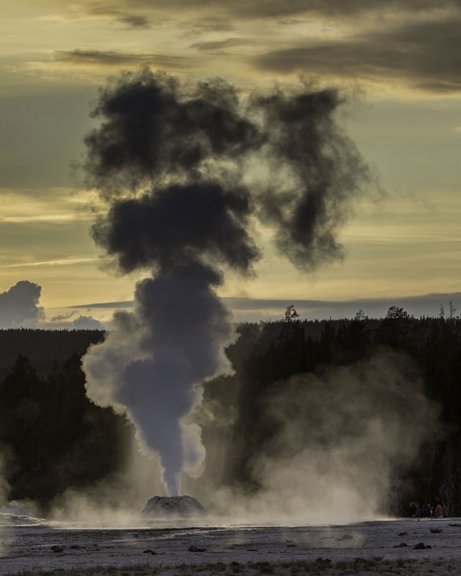
1) Geothermal wonders. YELL contains an unparalleled collection of more than 10,000 thermal features, including geysers, hot springs, mud pots, and fumaroles, which are fed by underground geothermal and hydrothermal systems. They provide habitats for microorganisms and other wildlife, and unique opportunities for research.
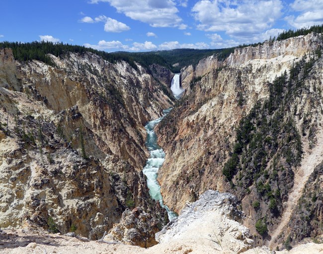
2) Dynamic geologic processes and features. YELL’s dramatic landscapes, including the Grand Canyon of the Yellowstone, Overhanging Cliff, and Obsidian Cliff, were shaped by volcanism, glaciation, erosion, and seismic activity. These processes have resulted in exposed and hidden geology and produce a varied landscape that provides unique habitat for many species.
Learn More
Regional Geology
Yellowstone National Park is a part of the Middle Rocky Mountains Physiographic Province and shares its geologic history and some characteristic geologic formations with a region that extends well beyond park boundaries.
- Scoping summaries are records of scoping meetings where NPS staff and local geologists determined the park’s geologic mapping plan and what content should be included in the report.
- Digital geologic maps include files for viewing in GIS software, a guide to using the data, and a document with ancillary map information. Newer products also include data viewable in Google Earth and online map services.
- Reports use the maps to discuss the park’s setting and significance, notable geologic features and processes, geologic resource management issues, and geologic history.
- Posters are a static view of the GIS data in PDF format. Newer posters include aerial imagery or shaded relief and other park information. They are also included with the reports.
- Projects list basic information about the program and all products available for a park.
Source: NPS DataStore Saved Search 3204. To search for additional information, visit the NPS DataStore.
A NPS Soil Resources Inventory project has not been completed for Yellowstone National Park, information can be found on the NPS Data Store.
Source: NPS DataStore Saved Search 3229. To search for additional information, visit the NPS DataStore.

Related Links
Related Articles
Yellowstone National Park
National Park Service Geodiversity Atlas
The servicewide Geodiversity Atlas provides information on geoheritage and geodiversity resources and values within the National Park System. This information supports science-based geoconservation and interpretation in the NPS, as well as STEM education in schools, museums, and field camps. The NPS Geologic Resources Division and many parks work with National and International geoconservation communities to ensure that NPS abiotic resources are managed using the highest standards and best practices available.
Tags
- yellowstone national park
- geology
- geodiversity atlas
- science
- nature
- rock formations
- erosion
- geothermal
- glaciers
- mountains
- volcanoes
- wyoming
- montana
- idaho
- waterfalls
- greater yellowstone network
- gryn
- inventory
- interior region 5
- interior region 7
- interior region 9
- missouri basin
- columbia-pacific northwest
- upper colorado basin
- volcano parks
- grd
