Last updated: June 14, 2024
Article
NPS Geodiversity Atlas—Crater Lake National Park, Oregon
Geodiversity refers to the full variety of natural geologic (rocks, minerals, sediments, fossils, landforms, and physical processes) and soil resources and processes that occur in the park. A product of the Geologic Resources Inventory, the NPS Geodiversity Atlas delivers information in support of education, Geoconservation, and integrated management of living (biotic) and non-living (abiotic) components of the ecosystem.

Introduction
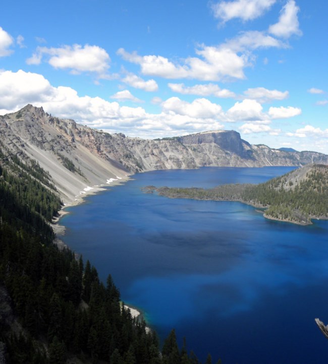
Crater Lake National Park (CRLA) is located in the Cascades Range in Klamath County, southwestern Oregon. Established as an NPS unit on May 22, 1902, CRLA preserves approximately 74,148 hectares (183,224 acres) of pristine forest and alpine terrain (Anderson 2017). The iconic Crater Lake lies within the caldera of Mount Mazama which climactically erupted 7,700 years ago (Bacon 1983). The caldera is an 8 x 10 km (5 x 6 mi) basin more than 1 km (0.6 mi) deep, making Crater Lake the deepest lake in the United States (KellerLynn 2013). Prior to eruption, Mount Mazama consisted of several overlapping volcanic edifices in the immediate vicinity of Crater Lake. Visitors to CRLA can enjoy fishing, bicycling, hiking the over 145 km (90 mi) of trails, or taking in the spectacular views of the clear, blue waters of Crater Lake.
Geologic Features and Processes
Volcanic
Crater Lake partly fills Crater Lake caldera that formed when Mount Mazama, a 3,700-m- (12,000-ft-) high volcano, climactically erupted and collapsed about 7,700 years ago. Since that eruption, all volcanic activity within the park area has occurred within the caldera. Five vents extruded lava onto the caldera floor, including the vent for Wizard Island, which is the only “post caldera” (occurring since the climactic, caldera-forming eruption) volcano to break the surface of Crater Lake. The post caldera volcanoes, including Wizard Island volcano, were active while Crater Lake was filling with water. Today, Crater Lake is maintained by a balance between precipitation/inflow and surface evaporation/seepage. The lake has no outlet or inlet. An average annual water supply of 224 cm (88 in) and a thick layer of permeable glacial till in the caldera wall, which serves as a “bathtub drain,” are significant factors in lake level.
Before its caldera-forming explosion, Mount Mazama was one of the major volcanoes of the Cascade arc—a chain of prominent composite cones, also called “stratovolcanoes,” and hundreds of smaller regional volcanoes (shield volcanoes and cinder cones) that extend from northern California to southern British Columbia (Bacon 2008). Cascade-arc volcanoes, including Mount Mazama, lie above the easterly dipping Cascadia subduction zone, where the Juan de Fuca oceanic plate, and Gorda and Explorer subplates, are sliding beneath the North American continental plate on the western edge of North America. The volcanic arc is active, with eruptions occurring within the past century.
Mount Mazama
Mount Mazama consisted of a succession of overlapping shield and stratovolcanoes built upon lava flows older than 400,000 years. Volcanoes that helped to build up the edifice of Mount Mazama each were probably active for a comparatively short period of time—a few thousand years to perhaps 40,000 years. As Mount Mazama grew, the focus of activity migrated in a west– northwest direction. The climactic eruption of Mount Mazama lasted only a few days, but erupted approximately 50 km3 (12 mi3 ) of magma. This eruption took place in two phases: a single-vent phase that produced a towering column of pumice and ash, called a “Plinian eruption,” and a ring-vent phase that started as the volcano began to collapse in upon itself, creating circular cracks that opened up around the peak. The ring-vent phase produced pyroclastic flows—rapidly moving, chaotic mixtures of rock fragments, gas, and ash, greater than 800°C (1,470°F)— fed by vents that circumscribed the upper part of Mount Mazama.
Mazama Ash
During the climactic eruption of Mount Mazama, principally the single-vent phase, ash rose into the air and settled over much of the western United States and southwestern Canada, blanketing an area of about 1.7 million km2 (656,000 mi2 ). The shortlived nature of the climactic eruption and the extent and thickness of the deposit make Mazama ash a valuable stratigraphic marker and an important time horizon across many depositional environments.
Shield Volcanoes and Cinder Cones
Shield volcanoes and cinder cones partly surround Mount Mazama, and are representative of the magma input to the Mazama system over time. These small, individual volcanoes are a manifestation of regional volcanism.
Crater Lake Caldera and Fill
The eruption and collapse of Mount Mazama created Crater Lake caldera, which is 1,200 m (3,900 ft) deep and 8–10 km (5–6 mi) in diameter at the rim. Since formation of the caldera 7,700 years ago, volcanic and sedimentary materials have been filling the basin. Initially, the collapsing caldera walls provided ample material. Later, postcaldera volcanic activity and lacustrine sedimentary processes added volcanic rocks and lacustrine sediment, respectively. Sedimentation continues today
Cave and Karst
There are about 40 caves known in Crater Lake National Park. Most are found at old lake levels within the caldera of the volcano and formed by wave action, but there are at least five significant caves outside the caldera. Caves and shelters within the caldera, at least in the past, harbored sensitive archeological materials. Crater Lake is home to at least nine species of bats, however it is unclear if the bats are using the caves as shelter or not.
All NPS cave resources are protected under the the Federal Cave Resources Protection Act of 1988 (FCRPA)(16 U.S.C. § 4301 et seq.).
Geothermal
Hydrothermal Features and Geothermal Development: The Geothermal Steam Act of 1970 as amended in 1988 designated Crater Lake as a significant thermal feature. Physical evidence of hydrothermal activity includes pools of relatively warm and solute-laden water, bacterial mats associated with venting of warm water, and high silica spires (subaqueous thermal-spring deposits) formed by thermal chimneys on the floor of Crater Lake caldera.
Glacial Landforms
Crater Lake National Park has long been noted as a place of “fire and ice,” where volcanoes and glaciers met. No glaciers occur on the landscape today, but features such as ice-bounded lava flows with polygonal, columnar jointing, as well as tuyas (table mountains), provide evidence of past glacial activity and lava-ice interactions. In addition, the park contains classic glacial features such as till and moraines, polish and striations, U-shaped valleys and notches, cirques, and horns. As many as six advances of glacial ice occurred within the park, for example, carving the notches into the heads of Sun and Kerr valleys. A seventh advance is recorded in the caldera walls. Investigators have correlated these advances with global ice ages.
Regional Geology
Crater Lake is a part of the Cascade-Sierra Mountains Province and shares its geologic history and some characteristic geologic formations with a region that extends well beyond park boundaries.
- Scoping summaries are records of scoping meetings where NPS staff and local geologists determined the park’s geologic mapping plan and what content should be included in the report.
- Digital geologic maps include files for viewing in GIS software, a guide to using the data, and a document with ancillary map information. Newer products also include data viewable in Google Earth and online map services.
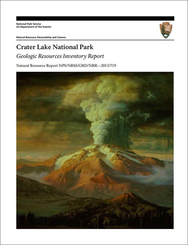
- Reports use the maps to discuss the park’s setting and significance, notable geologic features and processes, geologic resource management issues, and geologic history.
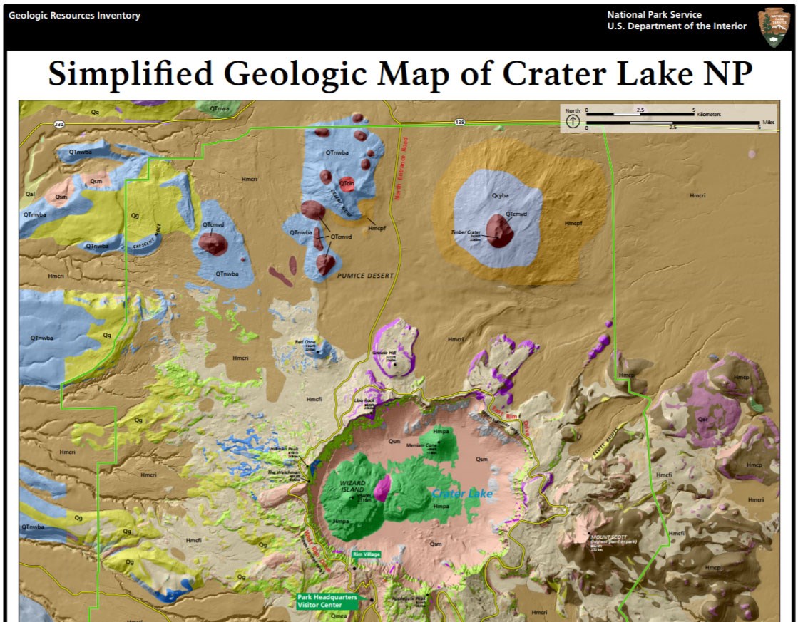
- Posters are a static view of the GIS data in PDF format. Newer posters include aerial imagery or shaded relief and other park information. They are also included with the reports.
- Projects list basic information about the program and all products available for a park.
Source: NPS DataStore Saved Search 2796. To search for additional information, visit the NPS DataStore.
A NPS Soil Resources Inventory project has been completed for Crater Lake National Park and can be found on the NPS Data Store.
Source: NPS DataStore Saved Search 2838. To search for additional information, visit the NPS DataStore.

Related Links
-
Oregon Department of Geology and Mineral Industries (State Survey)
Related Articles
Crater Lake National Park
National Park Service Geodiversity Atlas
The servicewide Geodiversity Atlas provides information on geoheritage and geodiversity resources and values within the National Park System. This information supports science-based geoconservation and interpretation in the NPS, as well as STEM education in schools, museums, and field camps. The NPS Geologic Resources Division and many parks work with National and International geoconservation communities to ensure that NPS abiotic resources are managed using the highest standards and best practices available.

