Part of a series of articles titled Geologic Time Periods in the Cenozoic Era.
Article
Quaternary Period—2.58 MYA to Today

NPS image
Introduction
The Quaternary Period is the third and last of the three periods of the Cenozoic Era. You and I are living in this period, which began only 2.58 million years ago. This is less than 0.1% of all of geologic time! A thin layer of sediments deposited during the Quaternary covers much of the Earth’s land surface. In the future, only a small part of this cover will become preserved as rocks, just as what we see for every other period represents only a small part of what was originally deposited. The Quaternary Period is famous for the many cycles of glacial growth and retreat, the extinction of many species of large mammals and birds, and the spread of humans. The Quaternary Period is divided into two epochs, from youngest to oldest: the Holocene and Pleistocene. We are living in the Holocene.
Holocene Epoch
The Holocene Epoch is the most recent span of geologic time. Marked climatic warming and the disappearance of the continental glaciers mark the transition between the Pleistocene and Holocene. The extinction of megafauna (large animals) such as mammoths, mastodons, giant ground sloths, saber-toothed cats, and short-faced bears also denotes the end of the Pleistocene and beginning of the Holocene. Because the interglacial (warm) periods of the Pleistocene were of longer duration than the time elapsed since the end of the Pleistocene, the present Holocene Epoch may be another interglacial stage, with large-scale glaciers returning at some future time. However, this natural pattern may be perturbed by the activities of humans, which have caused CO2 to increase in the atmosphere, steadily warming since the Industrial Revolution. This warming impacting natural systems in many national parks.
Pleistocene Epoch

NPS image
Popularly known as the “Ice Age”, geologists pinpoint the beginning of the Pleistocene Epoch when the climate cooled and ice sheets began covering Earth’s landmasses. During the Pleistocene the accumulation of snow and ice into continental-scale glaciers resulted in tremendous drops in sea level. This lowering of marine waters exposed dry land in what is now the Bering Strait between Alaska and Siberia. The resultant land bridge permitted animals to move between the two continents, including the dispersal of the first humans into the Americas.
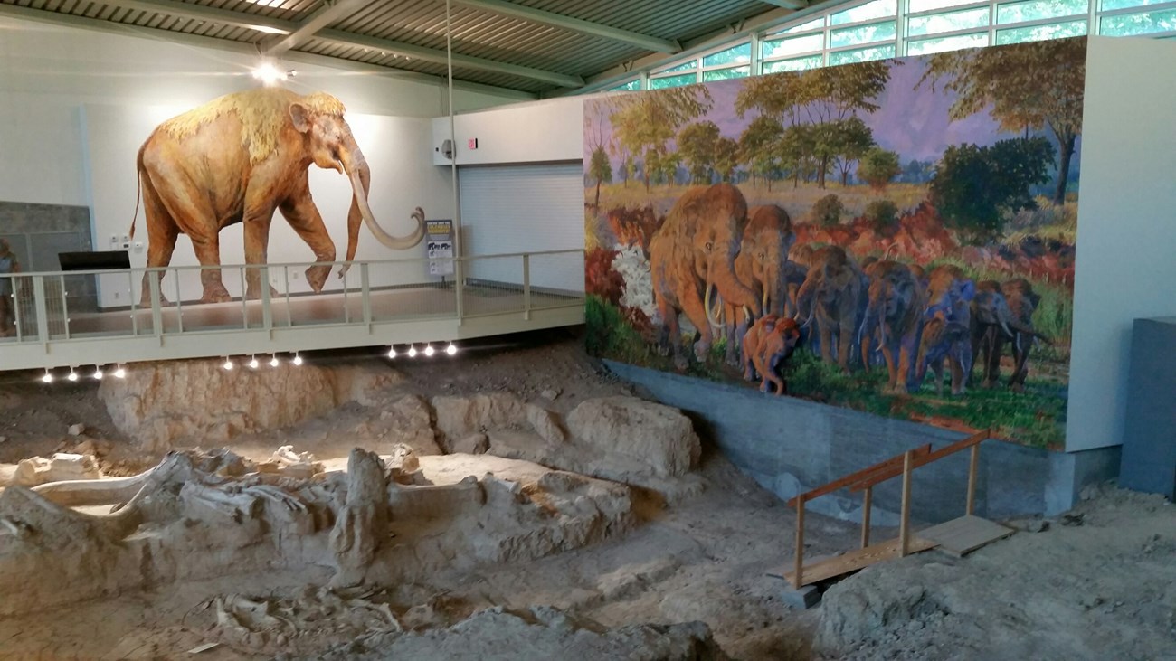
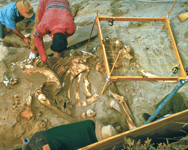
Among the better known animals of the Pleistocene are the extinct relatives of elephants—mammoths and mastodons—along with giant ground sloths and large predators such as the saber-toothed cat and short-faced bear. Investigators have found the remains of dwarf mammoths from the Pleistocene on San Miguel, Santa Rosa, and Santa Cruz islands in Channel Islands National Park off the coast of California. Researchers have found the remains of other Pleistocene animals such as the Shasta ground sloth, the extinct Harrington’s mountain goat, and an extinct vampire bat in caves in Carlsbad Caverns, Guadalupe Mountains, Mammoth Cave, and Grand Canyon national parks.
Significant Quaternary events
The most distinctive physical features were land bridges, which affected the migration of organisms during the Neogene. Climates cooled somewhat over the duration of this period culminating in continental glaciations during the Pleistocene Epoch. At the end of the Pleistocene a catastrophe destroyed two-thirds of the large mammals in North America and South America. The reason for the late-Pleistocene extinction is unresolved but climate change and over-hunting may have been factors.
Learn more about events in the Quaternary Period
During the Pleistocene Epoch, vast continental glaciers covered much of northern North America and Eurasia. In some places, ice sheets were two miles (3 km) thick. With so much water locked up in the form of ice, sea level dropped to about 430 feet (130 m) below current levels. When sea level was lowered, North America and Eurasia became connected by the Bering “land bridge.” [Note: There was intermittent contact between Asia and North America before the Pleistocene, which allowed proboscideans to arrive during the Miocene.] During the Pleistocene, mammoths arrived in North America and mastodons, which evolved in America, appear to have spread into Eurasia.
The cause of the extinction; the reason it was restricted mostly to large, land-dwelling mammals; and why it took place primarily in the Americas and Australia have been the subjects of heated scientific debate. According to one hypothesis, these animals died out because they could not adapt to rapid climatic changes at the end of the Pleistocene. A competing hypothesis, known as “prehistoric overkill,” holds that human hunters killed off these large animals. Further study may show that the extinction resulted from a combination of many different factors. Populations that were already under stress from climatic changes were perhaps more vulnerable to hunting when humans began to occupy new areas (Wicander and Monroe 2000).
Visit—Quaternary Parks
Every park contains some slice of geologic time. Here we highlight a few parks associated with Quaternary Period. This is not to say that a particular park has only rocks from the specified period. Rather, rocks in selected parks exemplify a certain event or preserve fossils or rocks from a certain geologic age.
-
Aniakchak National Monument and Preserve (ANIA), Alaska—[ANIA Geodiversity Atlas] [ANIA Park Home] [ANIA npshistory.com]
-
Bandelier National Monument (BAND), New Mexico—[BAND Geodiversity Atlas] [BAND Park Home] [BAND npshistory.com]
-
Big Bend National Park (BIBE), Texas—[BIBE Geodiversity Atlas] [BIBE Park Home] [BIBE npshistory.com]
-
Bryce Canyon National Park (BRCA), Utah—[BRCA Geodiversity Atlas] [BRCA Park Home] [BRCA npshistory.com]
-
Carlsbad Caverns National Park (CAVE), New Mexico—[CAVE Geodiversity Atlas] [CAVE Park Home] [CAVE npshistory.com]
-
Capulin Volcano National Monument (CAVO), New Mexico—[CAVO Geodiversity Atlas] [CAVO Park Home] [CAVO npshistory.com]
-
Channel Islands National Park (CHIS), California—[CHIS Geodiversity Atlas] [CHIS Park Home] [CHIS npshistory.com]
-
Crater Lake National Park (CRLA), Oregon—[CRLA Geodiversity Atlas] [CRLA Park Home] [CRLA npshistory.com]
-
Craters of the Moon National Monument & Preserve (CRMO), Idaho—[CRMO Geodiversity Atlas] [CRMO Park Home] [CRMO npshistory.com]
-
Devils Postpile National Monument (DEPO), California—[DEPO Geodiversity Atlas] [DEPO Park Home] [DEPO npshistory.com]
-
El Malpais National Monument (ELMA), New Mexico—[ELMA Geodiversity Atlas] [ELMA Park Home] [ELMA npshistory.com]
-
Glen Canyon National Recreation Area (GLCA), Arizona & Utah—[GLCA Geodiversity Atlas] [GLCA Park Home] [GLCA npshistory.com]
-
Grand Canyon National Park (GRCA), Arizona—[GRCA Geodiversity Atlas] [GRCA Park Home] [GRCA npshistory.com]
-
Guadalupe Mountains National Park (GUMO), Texas—[GUMO Geodiversity Atlas] [GUMO Gark Home] [GUMO npshistory.com]
-
Haleakala National Park (HALE), Hawaii—[HALE Geodiversity Atlas] [HALE Park Home] [HALE npshistory.com]
-
Hawaii Volcanoes National Park (HAVO), Hawaii—[HAVO Geodiversity Atlas] [HAVO Park Home] [HAVO npshistory.com]
-
Joshua Tree National Park (JOTR), California—[JOTR Geodiversity Atlas] [JOTR Park Home] [JOTR npshistory.com]
-
Katmai National Park (KATM), Alaska—[KATM Geodiversity Atlas] [KATM Park Home] [KATM npshistory.com]
-
Lassen Volcanic National Park (LAVO), California—[LAVO Geodiversity Atlas] [LAVO Park Home] [LAVO npshistory.com]
-
Lava Beds National Monument (LABE), California—[LABE Geodiversity Atlas] [LABE Park Home] [LABE npshistory.com]
-
Mount Rainier National Park (MORA), Washington—[MORA Geodiversity Atlas] [MORA Park Home] [MORA npshistory.com]
-
Pu'ukohola Heiau National Historic Site (PUHE), Hawai'i—[PUHE Geodiversity Atlas] [PUHE Park Home] [PUHE npshistory.com]
-
Sunset Crater National Monument (SUCR), Arizona—[SUCR Geodiversity Atlas] [SUCR Park Home] [SUCR npshistory.com]
-
Theodore Roosevelt National Park (THRO), North Dakota—[THRO Geodiversity Atlas] [THRO Park Home] [THRO npshistory.com]
-
Tule Springs Fossil Beds National Monument (TUSK), Nevada—[TUSK Geodiversity Atlas] [TUSK Park Home] [TUSK npshistory.com]
-
Valley Forge National Historical Site (VAFO), Pennsylvania—[VAFO Geodiversity Atlas] [VAFO Park Home] [VAFO npshistory.com]
-
Valles Caldera National Preserve (VALL), New Mexico—[VALL Geodiversity Atlas] [VALL Park Home] [VALL npshistory.com]
-
Waco Mammoth National Monument (WACO), Texas—[WACO Geodiversity Atlas] [WACO Park Home] [WACO npshistory.com]
-
Yellowstone National Park (YELL), Idaho, Montana, Wyoming—[YELL Geodiversity Atlas] [YELL Park Home] [YELL npshistory.com]
More about the Cenozoic
►
Tags
- aniakchak national monument & preserve
- bandelier national monument
- big bend national park
- bryce canyon national park
- capulin volcano national monument
- carlsbad caverns national park
- channel islands national park
- crater lake national park
- craters of the moon national monument & preserve
- devils postpile national monument
- el malpais national monument
- glen canyon national recreation area
- grand canyon national park
- guadalupe mountains national park
- haleakalā national park
- hawaiʻi volcanoes national park
- joshua tree national park
- katmai national park & preserve
- lassen volcanic national park
- lava beds national monument
- mount rainier national park
- puʻukoholā heiau national historic site
- sunset crater volcano national monument
- theodore roosevelt national park
- tule springs fossil beds national monument
- valles caldera national preserve
- valley forge national historical park
- waco mammoth national monument
- yellowstone national park
- fossils
- paleontology
- geology
- geologic time
Last updated: April 27, 2023

