Last updated: January 3, 2025
Article
NPS Geodiversity Atlas—Tule Springs Fossil Beds National Monument, Nevada
Geodiversity refers to the full variety of natural geologic (rocks, minerals, sediments, fossils, landforms, and physical processes) and soil resources and processes that occur in the park. A product of the Geologic Resources Inventory, the NPS Geodiversity Atlas delivers information in support of education, Geoconservation, and integrated management of living (biotic) and non-living (abiotic) components of the ecosystem.

Introduction
The Tule Springs Fossil Beds National Monument was established as the 405th unit of the national park system on December 19, 2014, through the National Defense Authorization Bill and the transfer of 22,650 acres of land from the Bureau of Land Management to the National Park Service. The monument is located in the upper Las Vegas Wash, north of the cities of Las Vegas and North Las Vegas, Nevada, and is bounded on the northeast by the Sheep and Las Vegas Ranges. Neighbors of the monument include the cities of Las Vegas and North Las Vegas, Clark County, tribal lands owned by the Las Vegas Paiute Tribe, federal lands managed by the Bureau of Land Management and the U.S. Fish and Wildlife Service, lands owned by the State of Nevada, and Nellis and Creech Air Force Bases, which use the monument’s airspace for training missions (TUSK Foundation Doc, NPS 2019).
Fossil Resources
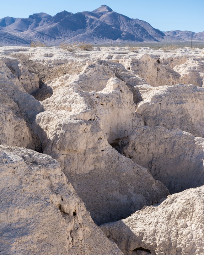
Pleistocene deposits contain paleontological and paleoecological resources such as fossilized plants, animals, and their traces that were deposited in spring-fed ponds, meadows, marshes, and streams during periods of abundant rainfall in the Pleistocene Epoch. These fine-grained paleospring deposits are known as the Las Vegas Formation. The paleontological record represented at the monument ranges from approximately 100,000 to 12,500 years ago, part of a geologic formation that spans multiple important global climate cooling and warming episodes during at least the last 500,000 years. The monument is rich with paleontological resources, including a vertebrate fossil assemblage known as the Tule Springs local fauna comprising mammoth, horse, camel, bison, ground sloth, dire wolf, saber-toothed cat, and North American lion. In addition to vertebrate fossils, invertebrates, plant macrofossils, and pollen are found at Tule Springs. The spring deposits from Tule Springs help to tell an important story regarding how the region’s climate varied. The composition of the modern fauna and flora that now dominate the North American landscape are evidence of those animals that survived the last Ice Age (TUSK Foundation Doc, NPS 2019).
Regional Geology
Tule Springs Fossil Beds National Monument is a part of the Southern Basin and Range Physiographic Province and shares its geologic history and some characteristic geologic formations with a region that extends well beyond park boundaries.
- Scoping summaries are records of scoping meetings where NPS staff and local geologists determined the park’s geologic mapping plan and what content should be included in the report.
- Digital geologic maps include files for viewing in GIS software, a guide to using the data, and a document with ancillary map information. Newer products also include data viewable in Google Earth and online map services.
- Reports use the maps to discuss the park’s setting and significance, notable geologic features and processes, geologic resource management issues, and geologic history.
- Posters are a static view of the GIS data in PDF format. Newer posters include aerial imagery or shaded relief and other park information. They are also included with the reports.
- Projects list basic information about the program and all products available for a park.
Source: NPS DataStore Saved Search 3399. To search for additional information, visit the NPS DataStore.

Related Links
Related Articles
Tule Springs Fossil Beds National Monument
National Park Service Geodiversity Atlas
The servicewide Geodiversity Atlas provides information on geoheritage and geodiversity resources and values within the National Park System. This information supports science-based geoconservation and interpretation in the NPS, as well as STEM education in schools, museums, and field camps. The NPS Geologic Resources Division and many parks work with National and International geoconservation communities to ensure that NPS abiotic resources are managed using the highest standards and best practices available.
