Last updated: July 5, 2024
Article
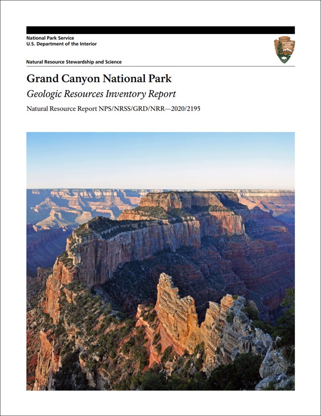
NPS Geodiversity Atlas—Grand Canyon National Park, Arizona
Geodiversity refers to the full variety of natural geologic (rocks, minerals, sediments, fossils, landforms, and physical processes) and soil resources and processes that occur in the park. A product of the Geologic Resources Inventory, the NPS Geodiversity Atlas delivers information in support of education, Geoconservation, and integrated management of living (biotic) and non-living (abiotic) components of the ecosystem.

Introduction
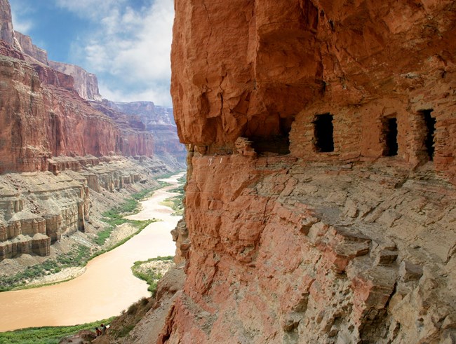
Grand Canyon National Park is among the most stunning geologic experiences on the planet, let alone in the National Park System, and it hardly needs an introduction. People have lived in, marveled at, held sacred, explored, and studied the canyon for centuries.
Geologic Significance & Geodiversity Highlights
Grand Canyon National Park is one of the most heralded geologic landscapes in the world. It is a UNESCO World Heritage Site, has had an outsized role in the history of the geosciences in the United States, is an important site for both geoscience research and education at all levels.
History of Geology at Grand Canyon
Geologists played an important role in the human history of Grand Canyon. Geologists accompanied the earliest explorations of the Grand Canyon region by European Americans. Geologist and ethnologist John Wesley Powell led the first river trip through Grand Canyon, which was the “great unknown” at the time of his exploration in 1869.
The early geologists who pioneered research at Grand Canyon are among the who’s who of the science, and understanding of many geologic principles has been obtained through studies conducted at Grand Canyon. Research into several different fields within the geosciences continue to today, with investigations related to the origin and evolution of the Colorado River in Grand Canyon being particularly active.
The Development of Geological Studies in the Grand Canyon
This history of geological studies in Grand Canyon by Earle Spamer, an archivist who has maintained a bibliography of Grand Canyon since 1974, was published in 1989. This excellent publication provides an overview of John Strong Newberry, G.K., Gilbert, John Wesley Powell, Clarence Dutton, Charles Doolittle Walcott, and many other pioneering American geologists who studied Grand Canyon.
Geology Education
Grand Canyon National Park is a classroom for geology students of all ages, from elementary, middle, and high school students to graduate students in geology.
The National Park Service and its official park partner the Grand Canyon Conservancy has these educational resources available for teachers and their students:
-
Npshistory.com—Geology Training Manual (2006) by former Geologist-in-Park Stacy Timmons.
The Yavapai Museum of Geology is one of the oldest museums in the National Park System.
Geologic Time & Numeric Ages of Grand Canyon Rocks
Grand Canyon is all about time—geologic time. It is impossible to understand the geology of Grand Canyon without the perspective of deep time. Grand Canyon’s oldest rocks are nearly 2 billion years old and the canyon’s youngest rock layer which holds up the rims, was deposited prior to the age of dinosaurs and is about 270 million years old.
This article series provides the best numeric ages for Grand Canyon rocks and the science behind them.
Geologic History and Stratigraphy
Grand Canyon National Park contains one of the best exposures of the rock record on the North American continent, presenting what is arguably the best-known stratigraphic column in the world.
The canyon’s rock record contains the three major types of rocks (igneous, metamorphic, and sedimentary).
Grand Canyon’s Three Sets of Rocks
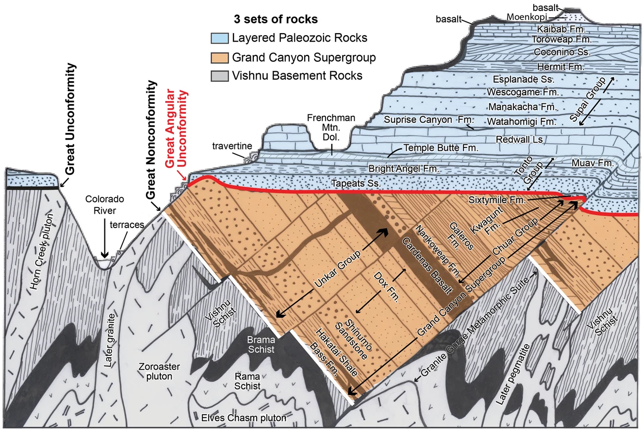
Rocks exposed in Grand Canyon can be divided into three primary packages, or sets, of rocks.

Angular Unconformity (red line) and Great Unconformity (black line). Fm = Formation; Ss = Sandstone; Ls = Limestone.
Vishnu Basement Rocks
The Vishnu Basement Rocks are the oldest rocks exposed in Grand Canyon. These igneous and metamorphic rocks formed deep in the crust during continental collisions that built this part of North America during the Precambrian (Paleoproterozoic and Mesoproterozoic) between 1,840 and 1,375 million years ago.
Grand Canyon Supergroup
The Grand Canyon Supergroup is a thick sequence of mostly sedimentary rocks that were deposited during the Precambrian (Mesoproterozoic and Neoproterozoic) between 1,255 and 729 million years ago. These rocks were deposited in basins during the assembly and breaking up of the supercontinent Rodinia.
Layered Paleozoic Rocks
The Layered Paleozoic Rocks are the nearly horizontal sedimentary units exposed in the upper portion of Grand Canyon’s rock walls. They were deposited during the Paleozoic Era between about 270 and 510 million years ago.
These rocks consist of the Cambrian Tonto Group that sits on top of the Great Unconformity and records a major marine transgression at the base to the Permian Kaibab Formation on the rim of Grand Canyon.
Type Section Inventory
The National Park Service completed an inventory of geologic stratotypes found in park units in order to document and protect these areas for future studies. Grand Canyon National Park contains 54 identified stratotypes including 24 type sections, 16 type localities, 6 type areas, and 8 reference sections.
Pleistocene Deposits
A wide variety Pleistocene deposits are present in Grand Canyon, including those in caves. Other Pleistocene deposits are associated with springs and landslides.
Cenozoic Volcanism in the Grand Canyon Region
The western part of Grand Canyon National Park, as well as the adjoining Grand Canyon-Parashant National Monument, are within the Uinkaret Volcanic Field, a mostly Pleistocene volcanic field whose most recent eruption occurred about 950 years ago.
The Uinkaret Volcanic Field is located on the Uinkaret Plateau between the Hurricane and Toroweap Faults north of the Colorado River. It consists of a large number of cinder cone volcanoes such as Vulcans Thrown on the rim of Grand Canyon in Tuweap and associated lava flows. A number of the lava flows cascaded down the canyon’s walls and formed lava dams in Grand Canyon. These lava dams held short-lived lakes and likely failed catastrophically.
Origin and Evolution of Grand Canyon and the Colorado River
The Grand Canyon is a geologically young. The Colorado River within the last 6 million years. However, the full history and evolution of the Colorado River through Grand Canyon is highly complex and is the subject of active research and intense scientific debate. This research touches on many different geologic disciplines including tectonics, structural geology, geomorphology, and geologic history.
Fossils and Paleontology
Grand canyon National Park has an exceptionally rich and diverse fossils record with fossils ranging from Precambrian microfossils to Pleistocene Shasta ground sloths.
The majority of the fossils in the park are Paleozoic marine invertebrate fossils including trilobites, brachiopods, bryozoans, sponges, corals, and crinoids in rock units such as the Bright Angel Formation, Muav Formation, Redwall Limestone, and Kaibab Formation. The terrestrial Hermit Formation contains plant fossils and vertebrate and invertebrate fossil trackways.
The Pleistocene fossils found in some caves in Grand Canyon National Park are both exceptionally preserved as well as scientifically significant. Fossils of Shasta ground sloths include bones, fur, and dung. Fossils of California condors, mountain goats, North American horses, bats, and other species are also known from Grand Canyon caves.
In 2019, in honor of for Grand Canyon National Park’s centennial, the National Park Service initiated a comprehensive paleontological inventory for the park.
Caves and Karst
Grand Canyon National Park contains more karst area than any other NPS unit except Everglades National Park. Almost all (97%) of Grand Canyon National Park is underlain by karst, with another 3% being underlain by pseudokarst.
It is estimated that Grand Canyon may contain as many as 2,500 caves with several hundred caves having been documented. Under the current park policy, all caves in Grand Canyon National Park are currently closed to public visitation, and may only be entered by scientists with research permits.
The Redwall Limestone hosts the majority of the park’s caves, with the majority being nearly inaccessible due to openings on vertical cliffs.
Caves in Grand Canyon National Park contain delicate cave speleothems (cave features) rare minerals, important archeological sites, and significant Pleistocene fossils. They also provide important habitat for many wildlife species from the endangered California condor to a number of different species of bats.
Other Geologic Features & Processes
Unconformities—Missing Time at Grand Canyon
Unconformities are gaps in the rock record that represent periods of missing time. Many significant unconformities are present in Grand Canyon. The most well-known is the Great Unconformity at the base of the Tonto Group between the Layered Paleozoic Rocks and the Vishnu Basement Rocks, which was originally described by geologist John Wesley Powell.
Unconformities are also present between the Grand Canyon Supergroup and the Vishnu Basement Rocks, as well as between the Layered Paleozoic Rocks and the Grand Canyon Supergroup.
Other unconformities are present between some sedimentary rock layers such as between the Redwall Limestone and Surprise Canyon Formation.
Springs and Seeps
Springs and seeps are found throughout Grand Canyon, and they are very important to the park’s geology, ecology, and human history. Springs make up less a tiny fraction a percent of Grand Canyon by acreage, but these areas have 500 times more species concentrated in them than in the surrounding desert.
Springs may be emerge from nearly any rock layer in the canyon, but many of the largest and most prominent come from the R aquifer in the Redwall Limestone.
Mining History at Grand Canyon
In the late 1880s and early 1990s, prior to its protection first as a national monument and later as a national park, miners scoured Grand Canyon for mineral deposits. Copper, lead, and asbestos were all mined in relatively small quantities from the canyon.
The richest ores found in and around Grand Canyon were actually uranium, which were not recognized as valuable until the uranium boom of the 1950s. Significant quantities of uranium was mined from the Orphan Mine which was in a private inholding but right on the rim of Grand Canyon from 1953 through 1969.
Most uranium deposits in and around Grand Canyon are in breccia pipes which form from collapse of caverns in the Redwall Limestone. Breccia pipes frequently have both uranium and copper minerals, including some rare minerals such as grandviewite, which is only known from Grand Canyon.
Abandoned Mineral Lands
The National Park Service has documented 38 Abandoned Mineral Lands (AML) sites containing 75 features in Grand Canyon National Park. Twelve sites require mitigation.
NPS AML sites can be important cultural resources and habitat, but many pose risks to park visitors and wildlife, and degrade water quality, park landscapes, and physical and biological resources. Possible hazards at AML features in the park include high levels of radon, radioactive soils, occurrence of asbestos, unstable debris, unstable slopes/overhanging boulders, hazardous openings or structures, and subsidence.
Be safe near AML sites—Stay Out and Stay Alive!
Related Link
Burghardt, J. E., E. S. Norby, and H. S. Pranger, II. 2014. Abandoned mineral lands in the National Park System—comprehensive inventory and assessment. Natural Resource Technical Report NPS/NRSS/GRD/NRTR—2014/906. National Park Service, Fort Collins, Colorado. [IRMA—PDF]
Geohazards
Geohazards present in Grand Canyon National Park range from those associated with rockfall, mass wasting, and slope stability, caves and karst, flooding (both along the Colorado River and in side canyons), and abandoned mineral lands.
Related Link
Schaller, E. M., V. L. Santucci, S. B. Newman, T. B. Connors, and E. L. Bilderback. 2014. Summary and categorization of documented geologic hazards of the National Park System. Natural Resource Report NPS/NRSS/GRD/NRR—2014/813. National Park Service, Fort Collins, Colorado. [IRMA—PDF]
- Scoping summaries are records of scoping meetings where NPS staff and local geologists determined the park’s geologic mapping plan and what content should be included in the report.
- Digital geologic maps include files for viewing in GIS software, a guide to using the data, and a document with ancillary map information. Newer products also include data viewable in Google Earth and online map services.
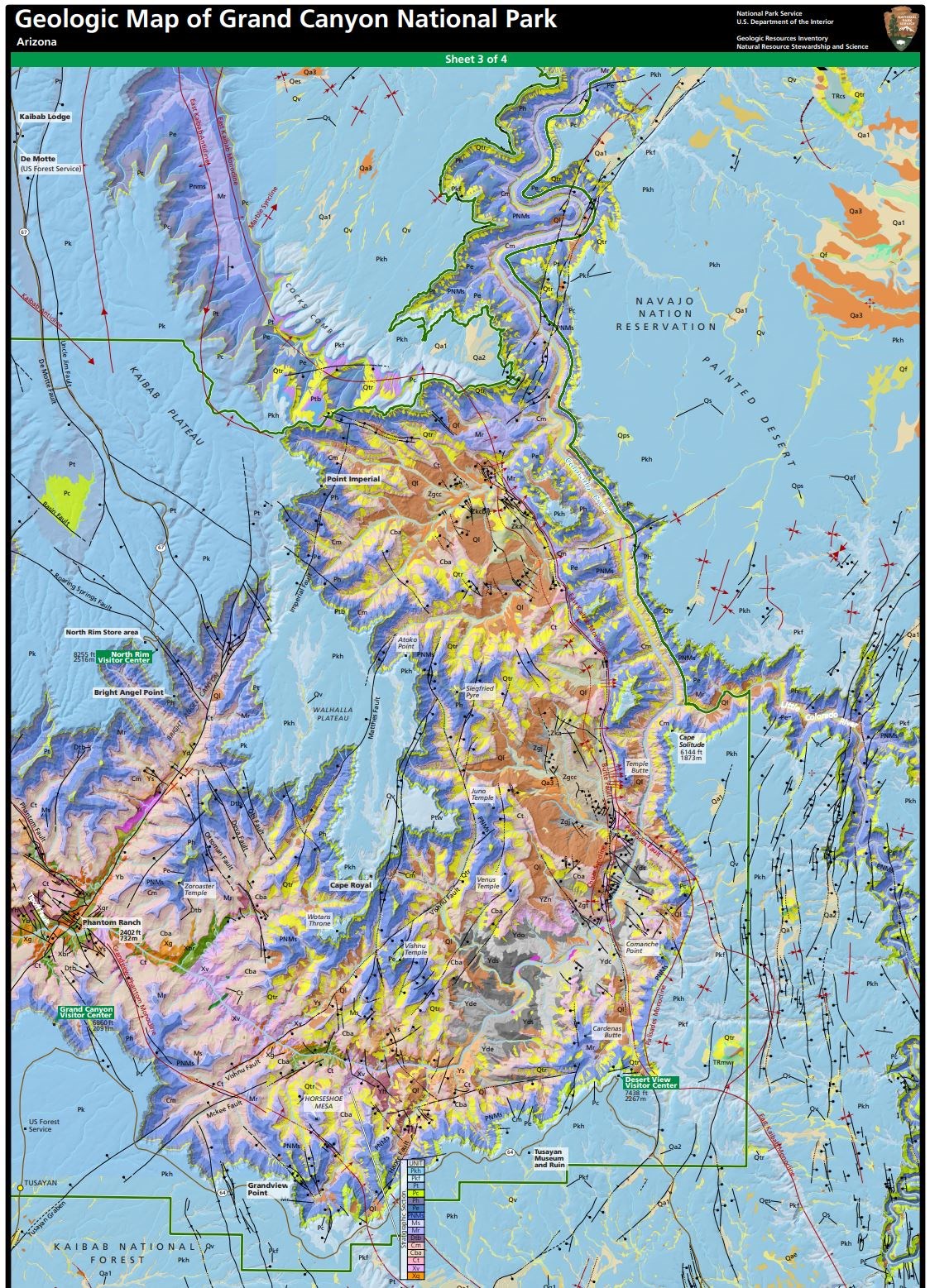
- Reports use the maps to discuss the park’s setting and significance, notable geologic features and processes, geologic resource management issues, and geologic history.
- Posters are a static view of the GIS data in PDF format. Newer posters include aerial imagery or shaded relief and other park information. They are also included with the reports.
- Projects list basic information about the program and all products available for a park.
Source: NPS DataStore Saved Search 2883. To search for additional information, visit the NPS DataStore.
A NPS Soil Resources Inventory project has been completed for Grand Canyon National Park and can be found on the NPS Data Store.
Source: NPS DataStore Saved Search 2954. To search for additional information, visit the NPS DataStore.
GRI Geology Image Gallery

Related Links
Related Articles
Grand Canyon National ParkNational Park Service Geodiversity Atlas
The servicewide Geodiversity Atlas provides information on geoheritage and geodiversity resources and values within the National Park System. This information supports science-based geoconservation and interpretation in the NPS, as well as STEM education in schools, museums, and field camps. The NPS Geologic Resources Division and many parks work with National and International geoconservation communities to ensure that NPS abiotic resources are managed using the highest standards and best practices available.

