USGS Photo by Kenichi Maehara.
Introduction
Volcanoes are alive in that they are evidence of our dynamic planet. Volcanic eruptions are expulsions of gases, rock fragments, and/or molten lava from within the Earth through a vent onto the Earth’s surface or into the atmosphere.
Eruptions may be explosive and devastate large areas via massive blasts: they can send destructive mudflows (lahars) down river valleys that travel great distances from the volcano, and their eruptive columns may extend into the stratosphere and produce ash-fall deposits that can cover large amounts of territory.
Or volcanic eruptions may be effusive, such as in Hawai‘i Volcanoes National Park. Kīlauea and Mauna Loa may emit lava through fire fountains that feed lava flows that typically travel at their leading edge at speeds of only a few miles per hour.
Volcanoes in 17 units of the National Park System have experienced prehistoric or historic eruptions. These eruptions have built cinder cones, volcanic domes, built new land on the island of Hawai‘i, and sent ash into the stratosphere that caused widespread fallout deposits of ash.
Historic eruptions have occurred at 11 volcanoes (Kīlauea, Mauna Loa, Aniakchak, Fourpeaked, Katmai, Kukak, Novarupta, Trident, Redoubt, Wrangell, and Lassen Peak) in six national parks.
Historic eruptions in national parks range from the largest eruption in the 20th century (the 1912 eruption of Katmai-Novarupta in Katmai National Park in Alaska) to relatively quiet emissions of lava flows in Hawai‘i Volcanoes National Park that people can safely observe with proper precautions and adequate distance.
Definitions and Notes
This page uses the following definitions for historic and prehistoric eruptions.
Historic eruptions
Verified eruptions that have occurred since 1700 CE (Common Era). The use of 1700 CE as the cutoff between historic and prehistoric eruptions follows its usage as one of the parameters that define historically active volcanoes in Alaska.
-
Cameron, C.E., Schaefer, J.R., and Ekberg, P.G., 2020, Historically active volcanoes of Alaska: Alaska Division of Geological & Geophysical Surveys Miscellaneous Publication 133 v. 4, 2 sheets. https://doi.org/10.14509/30426
Prehistoric eruptions
Eruptions that occurred during the Holocene (e.g., in the last 11,700 years), but prior to 1700 CE.
-
Any volcanic eruption in North America during the Holocene was likely witnessed by people, see Traditional Knowledge of Prehistoric Eruptions. A distinction between historic and prehistoric eruptions is used mostly to differentiate between eruptions that have written and/or scientific records and older ones that do not.
Notes
-
As with any other type of historic event, more recent historic eruptions are better documented than older ones. For example, far more information is available about eruptions at Kīlauea in Hawai’i Volcanoes National Park during the last few years than those a hundred years ago.
-
Dates or approximate dates of eruptions are provided when available.
-
The magnitude and intensity of explosive eruptions is expressed in the Volcanic Explosivity Index (VEI) which is a scale that goes from 0 for Effusive (nonexplosive) activity such as Hawaiian eruptions to 8 for Apocalyptic super eruptions such as occurred at Yellowstone Caldera.
Hawai‘i

USGS photo.
Haleakalā National Park: Prehistoric
Haleakalā NP is on the island of Maui, the second youngest island in the Hawaiian chain. Haleakalā Volcano, otherwise known as East Maui volcano, is considered potentially active. Its most recent eruption occurred about 400 years ago.
The most recent volcanic activity at the Haleakalā shield volcano produced lava flows, vent deposits and tephra deposits that are part of the Hāna phase of activity that began about 120,000 years ago.
Related Links
Hawai’i Volcanoes National Park: Historic

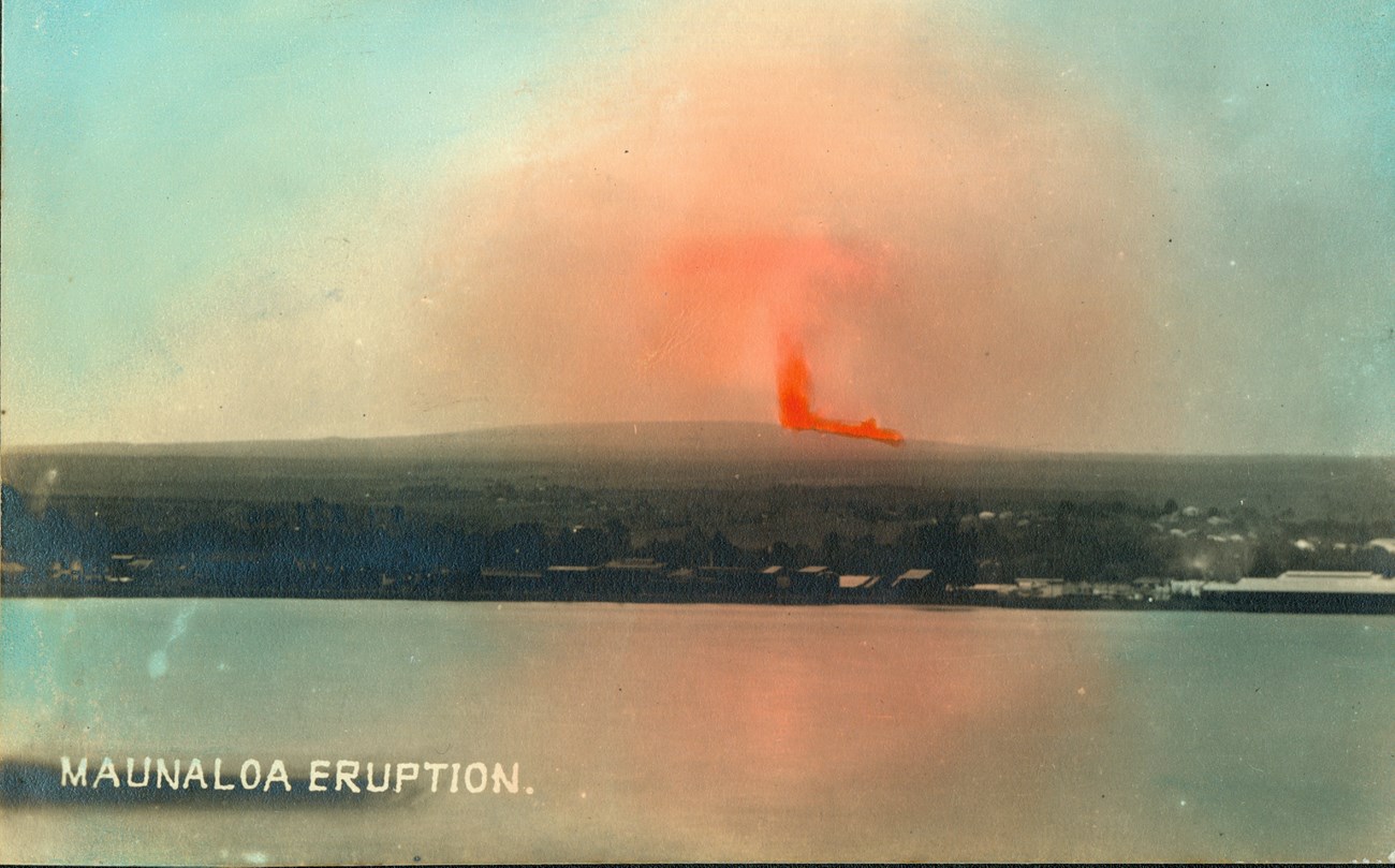
Photo courtesy of Hawaiian Mission Houses Historic Site and Archives (http://www.missionhouses.org/).

USGS image.
Hawai’i Volcanoes NP contains Kīlauea and Mauna Loa, two of the most active volcanoes on Earth.
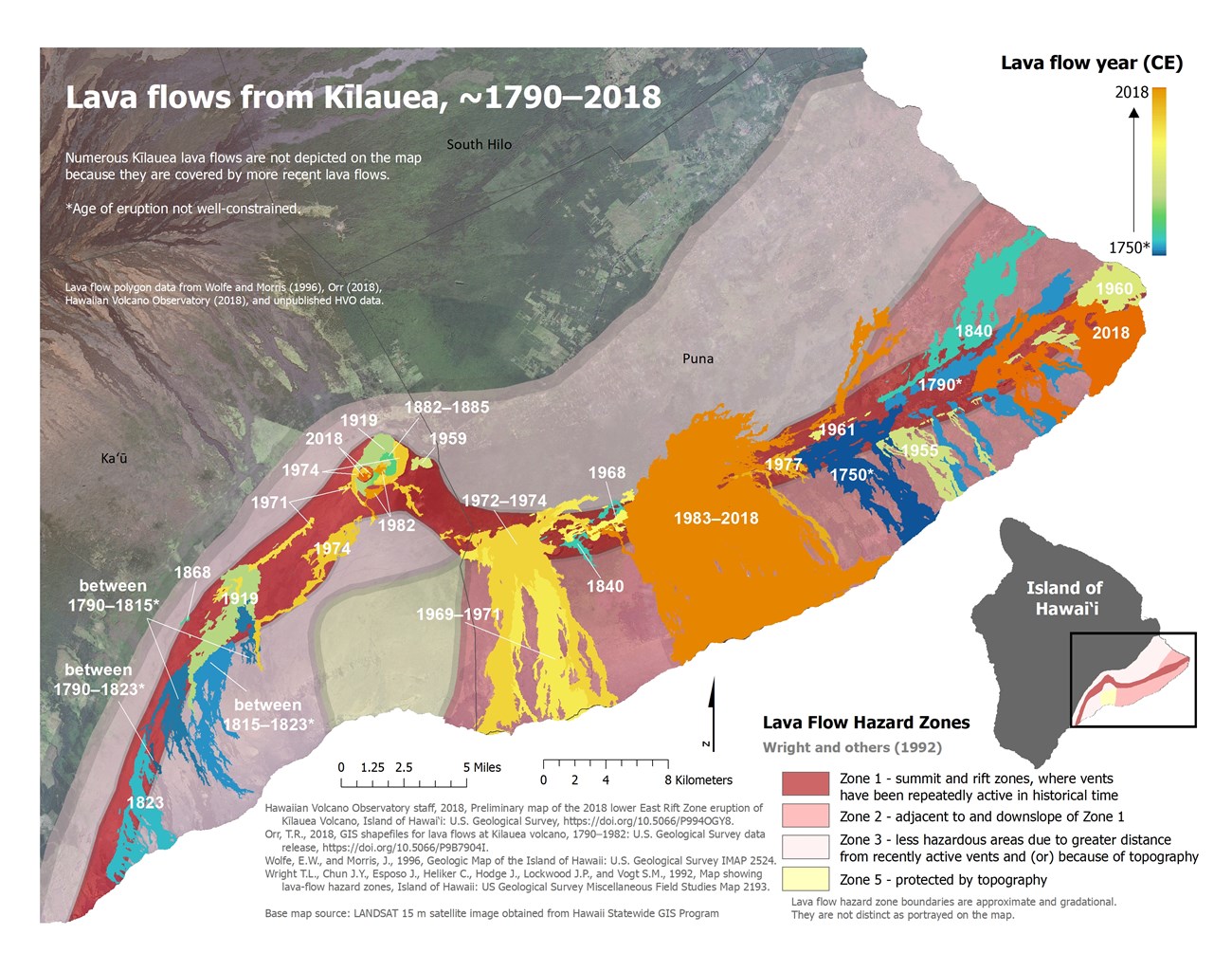
Kīlauea has experienced multiple historic and prehistoric eruptions. It erupted nearly continuously from 1983 to 2018 from the East Rift Zone. Since then, there have been eruptions at the summit from December 2020 through May 2021, and one that started in September 2021.
Recent Activity
Live Views
Spectacular Eruptions!
Most (90%) of the surface rocks on Kīlauea were erupted in the last 1,000 years, including about 20% that were erupted in the last 200 years.
Mauna Loa last erupted in 1984, and has erupted a total of 33 times since 1846, when eruptions started being well-documented. The 1984 eruption lasted nearly three weeks. It started at the summit and then moved to the Northeast Rift Zone, and produced ‘a‘ā lava flows. The 1984 eruption took place nearly nine years after the 1975 eruption which lasted less than a day.
USGS image.
Related Links
Kaloko-Honokōhau National Historical Park: Prehistoric
Kaloko-Honokōhau NHP is on the flank of Hualālai, the third youngest shield volcano on the island of Hawai‘i. Hualālai is older than Mauna Loa and Kīlauea in Hawai‘i Volcanoes National Park. Lava flows in the park were emplaced between 1,500 and 10,000 years ago.
Related Links
Pu’uhonau o Honaunau National Historic Park: Prehistoric
Bedrock geology of the park consists of lava flows and volcanic deposits from Mauna Loa. Lava flows in Pu’uhonau o Honaunau National Historic Park are from three periods of volcanic activity: 5,000-3,000, 3,000-1,500, and 1,500-750 years ago. Tree molds are present in lava flows that are approximately 1,100 years old.
Related Links
Alaska
Aniakchak National Monument: Historic
One of the largest eruptions of the Holocene formed Aniakchak Crater 3,660 ± 70 years ago. This caldera-forming eruption ranked at 6 (Colossal) on the Volcanic Explosivity Index (VEI) scale. It produced widespread ash fall deposits, pyroclastic flow deposits that are up to 300 ft (100 m) thick, and the approximately 6-mile (10-km) wide caldera.
Volcanic activity began in the Aniakchak region about 850,000 years ago. At least 20 explosive eruptions occurred during the Holocene prior to the caldera-forming Anaikchak II eruption. One of these eruptions, Aniakchak I, was also a 6 (Colossal) on the VEI, and may have also formed a caldera.
Post-caldera magmatic eruptions produced four lava domes, two composite cones, and a cinder cone. Phreatomagmatic eruptions formed two maars and three tuff cones (tuff cones are taller and steeper than tuff rings).
The most recent eruption at Aniakchak occurred between May and June 1931. A Cataclysmic (VEI 4) eruption formed features known as Main Crater and Doublet Crater, as well the Slag Heap lava flow in the southwestern part of the caldera. The 1931 eruption was one of the largest historic eruptions documented in Alaska.

USGS photo by Plucinski, T. A.
The eruption lasted uninterruptedly until the eleventh of May, when a final terrific explosion shook the surrounding country and sent into the air rocks and ashes which descended in such great masses as to make it pitch dark for several hours at distances more than sixty miles from the volcano. Wilson left Meshik after the explosion of May 1, and on the way to Bristol Bay, where he met the author and narrated the story of the eruption, had the paint scraped off his boat and engine ruined, pushing his way through more than five miles of floating pumice the size of water buckets.
The volcano was quiet only for a few days, breathing dense clouds of gas and smoke. Then explosive activity heard 200 miles away culminated in another major eruption on May 20. For several more days the detonations of the volcano sounded like the beatings of distant surf from Ugashik, more than sixty miles away. Lava then welled up into the new vents and another phase of activity began…
The most distant sufferers were the reindeer in the interior back of Nushagak. It was fawning time, and when volcanic ash covered the feed, the reindeer started to migrate, leaving the helpless young to perish. Reindeer and caribou ground their soft teeth down to the gums from the grit in their food and died. Dead swans and geese floated down the rivers from lakes on the tundra of the Alaska Peninsula, and cutting them open revealed the cause of their destruction—entrails full of volcanic ash. Hibernating bears, squirrels, and small game living inside the crater probably were consumed in the first great explosion…
So much heat suddenly liberated, as well as millions of tons of powdered ash filling the air, caused an interesting phenomenon shortly after the eruption. Clouds condensed rapidly all over the region and rain drops, which had formed about the tiny ash bits, started falling. Turning the ashes to mud, it literally rained mud balls the size of walnuts for hours at a time, making the snowfields and glaciers black as ink and causing the surrounding country to look as though covered by a huge funeral pall. The ash mud was sticky, too, and insisted on getting into every crack and corner and penetrating the closest-woven fabric.
[This account of the eruption is from Meshik resident Frank Wilson, as told to Bernard Hubbard, was reported in Mush You Malemutes! (Hubbard, B. R. 1932. Mush, You Malamutes! The America Press, New York, New York, p. 56-58; and in Aniakchak National Monument and Preserve: Geologic resources inventory report, 2015)]
Related Links
-
USGS Professional Paper 1810
Bacon, C.R., Neal, C.A., Miller, T.P., McGimsey, R.G., and Nye, C.J., 2014, Postglacial eruptive history, geochemistry, and recent seismicity of Aniakchak volcano, Alaska Peninsula: U.S. Geological Survey Professional Paper 1810, 74 p., http://dx.doi.org/10.3133/pp1810. -
USGS—90th Anniversary of the 1931 eruption of Aniakchak Volcano, Alaska
Bering Land Bridge National Preserve: Prehistoric
NPS photograph by Tahzay Jones.
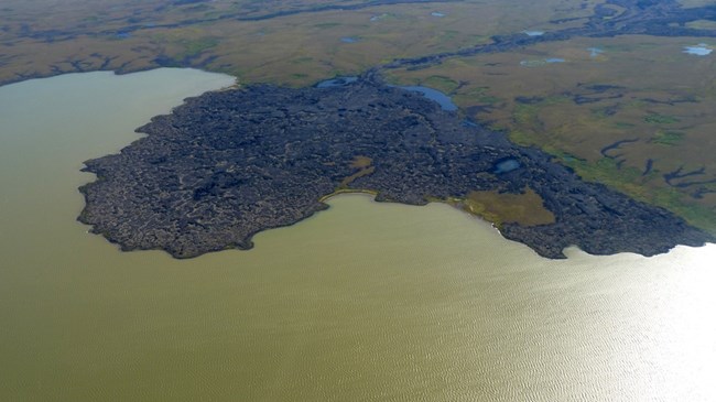
The Lost Jim lava flow in the Imuruk Lake Volcanic Field in Bering Land Bridge NPres was erupted between 1,000 and 2,000 years ago. The flow covers more than 60 square miles (155 square km)
The Imuruk Lake Volcanic Field is one of two monogenetic volcanic fields in the preserve.
Katmai National Park and Preserve: Historic
Katmai National Park contains 14 volcanoes that have had historic or prehistoric activity. Ten of these volcanoes are considered active by the USGS Alaska Volcano Observatory because they meet one of the following criteria:
- Documented, unquestioned eruption or a strongly suspected eruption since 1700 CE,
- Persistent fumaroles with temperatures within 10°C of the boiling point,
- Significant volcanic-related non-eruptive deformation or documented earthquake swarm with strongly suspected volcanic cause
[Source: Alaska Geological & Geophysical Surveys—Historically active volcanoes of Alaska]
NPS photograph by Robert Peterson, accession number KATM-399.
Five volcanoes in Katmai NP have experienced historic eruptions
-
Kukak: 1889. A questionable report of a phreatic eruption.
-
Mount Katmai: 1912. Most of the magma erupted at Novarupta during the Valley of Ten Thousand Smokes eruption was stored underneath Mount Katmai, which collapsed to form a 6-mi (10-km) diameter caldera.
-
Novarupta: 1912. The vent source of the 1912 Valley of Ten Thousand Smokes eruption. The eruption lasted three days. The vent is plugged with a 1,300-ft (40-m) diameter dome.
-
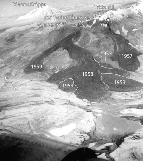
Trident: 1953–1974. Intermittent eruptions produced numerous blocky lava flows, pyroclastic deposits, and ash plumes. This activity built a new volcanic edifice on this complex volcano which consists of overlapping composite volcanoes.
-
Fourpeaked: 2006. A phreatic eruption on September 17 eruption formed a 20,000 ft (6,100 m) high plume.
Katmai National Park Volcanoes
| Volcano | Prehistoric or Historic | Most Recent Eruption | Active | VEI (if known) | Volcano Type | Description |
|---|
Related Links
-
Alaska Geological & Geophysical Surveys—Historically active volcanoes of Alaska
-
Katmai—Valley of Ten Thousand Smokes and the 1912 Novarupta-Katmai Eruption
-
USGS—Professional Paper 1791
Hildreth, W., and Fierstein, J., 2012, The Novarupta-Katmai eruption of 1912—largest eruption of the twentieth century; centennial perspectives: U.S. Geological Survey Professional Paper 1791, 259 p. -
USGS—Alaska Volcano Observatory—[Mount Katmai] [Mount Martin] [Mount Mageik] [Trident Volcano] [Novarupta] [Mount Griggs] [Snowy Mountain] [Mount Denison] [Mount Steller] [Kukak Volcano] [Devils Desk] [Fourpeaked Mountain] [Mount Douglas]
Lake Clark National Park: Historic
AVO/USGS photo by Read, Cyrus.
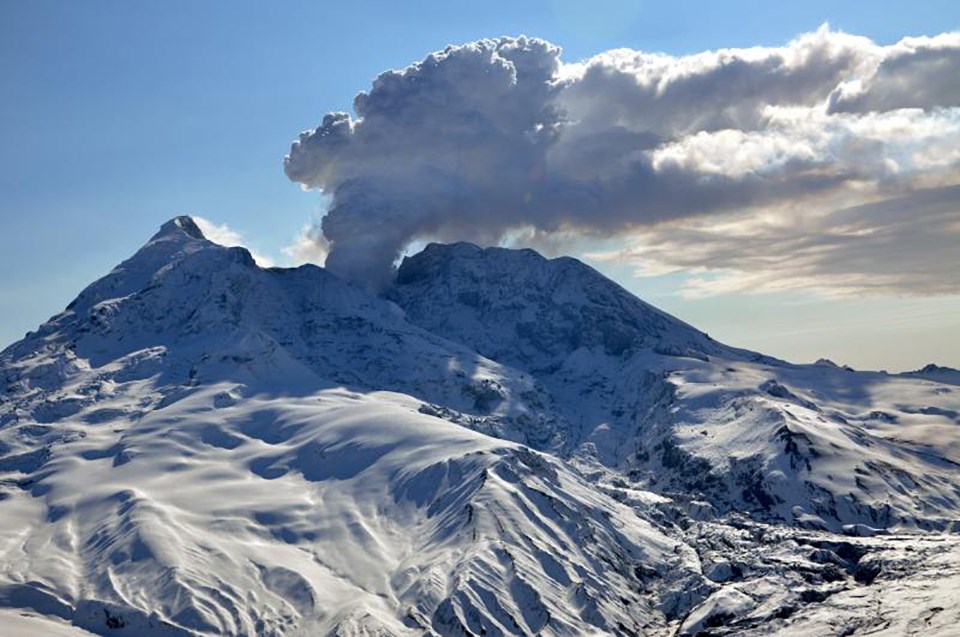
Lake Clark NP contains two active composite volcanoes: Iliamna Volcano and Redoubt Volcano.
Redoubt has erupted several times since 1900, including in 1902, 1966, 1989-1990, and 2009.
-
1902: Redoubt experienced several explosive eruptions over a period of six months with the maximum at VEI 3. The initial eruption caused a tsunami.
-
1966: Eruptions over the course of four months caused ash fall, lahars, and glacial outburst floods. The maximum VEI was 3.
-
1989-1990: Twenty-three major explosive eruptions (maximum VEI 3) occurred between December 1989 and April 1990. These eruptions caused widespread impacts by ash fall, and several large lahars flowed down the Drift River Valley. An airliner flew into the ash cloud and caused engine failure, but the crew managed to restart the engines. Several domes grew and were subsequently destroyed during the eruption.
-
2009: The 2009 eruptions were similar to the previous ones in 1966 and 1989-1990. They had a maximum VEI of 3, lava domes formed in the crater and then were destroyed by explosions. The eruptions caused widespread ash-fall deposits and large lahars flowed down the Drift River Valley.
Periodic reports of steam or ash columns above Iliamna Volcano are in the historical record, but these reports are not considered definitive. Small, shallow earthquakes have been detected beneath the summit in the 1990s.
Related Links
Wrangell-St. Elias National Park and Preserve: Historic
NPS photo.
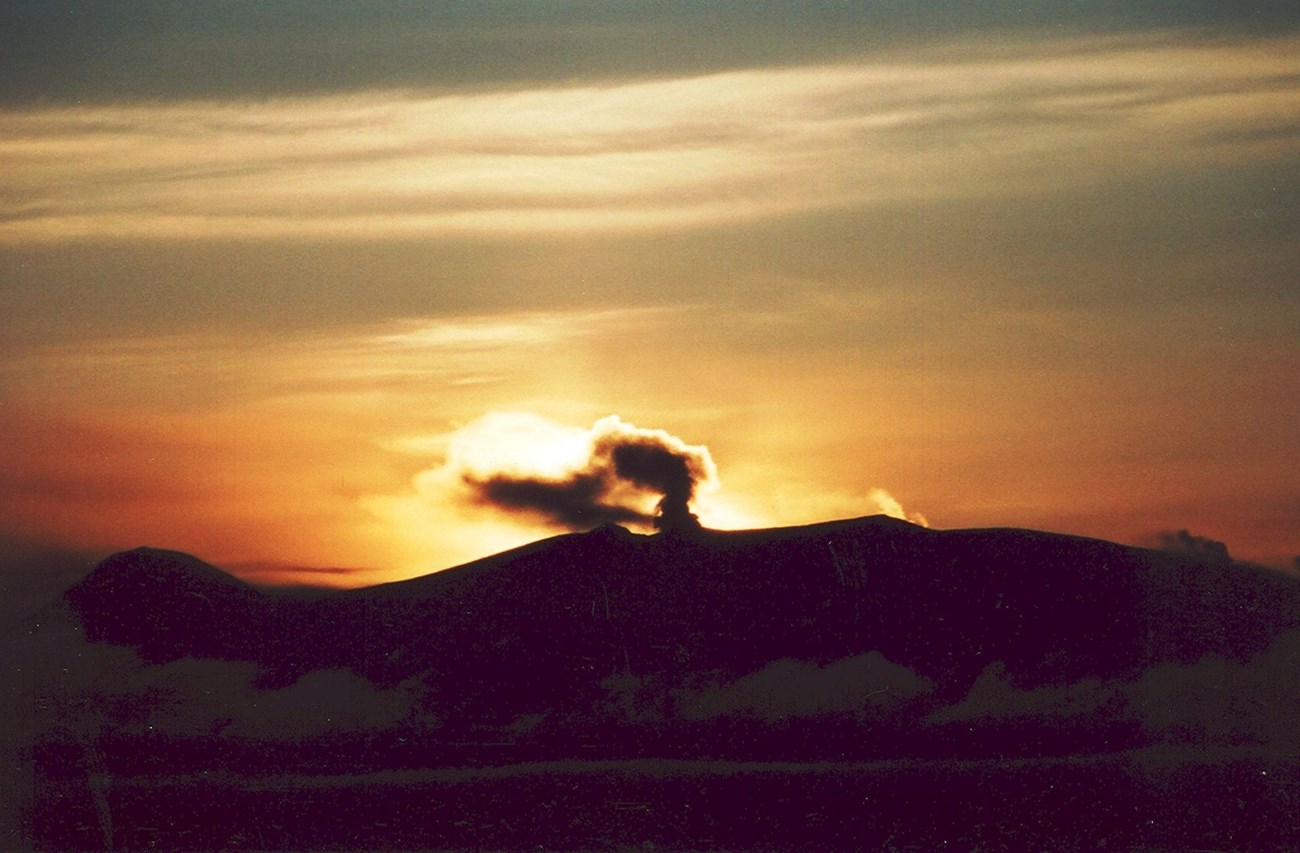
Wrangell-St. Elias NP contains Mount Wrangell, an andesitic shield volcano. Wrangell is reported to have experienced a short explosive eruption in 1930. Reports exist for several other historic eruptions prior to 1930, but these have not been verified.
Related Links
Contiguous United States
Crater Lake National Park: Prehistoric
NPS image.
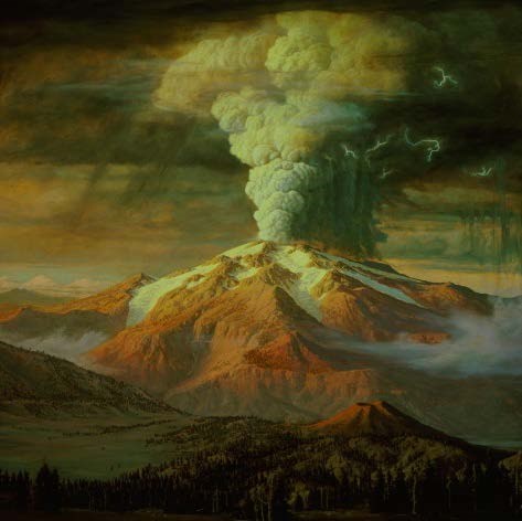
The caldera-forming eruption that formed Crater Lake occurred 7,700 years ago. This eruption was a 7 (Mega-colossal) on the Volcanic Explosivity Index (VEI).
A number of post-caldera eruptions occurred after the climatic eruption, including the eruption that created the Wizard Island cinder cone approximately 7,200 years ago. The most recent eruption formed a small lava dome that is below the surface of the lake about 4,800 years ago.
Related Links
Craters of the Moon National Monument: Prehistoric
NASA Goddard Space Flight Center image from Landsat 7 data.
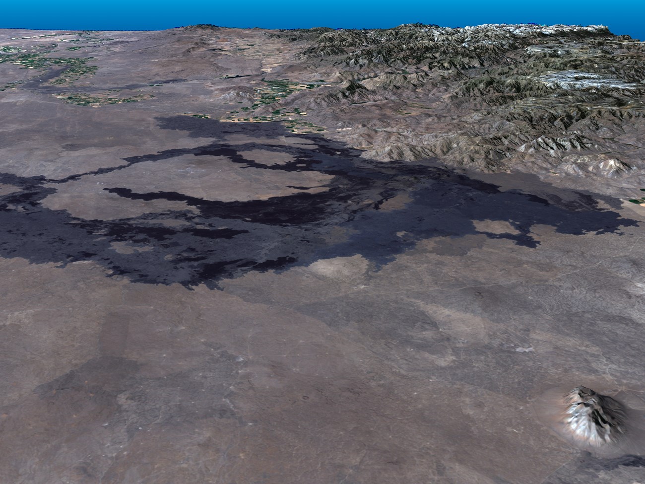
The most recent volcanic activity in Craters of the Moon occurred 2,100 years ago. These eruptions produced the Wapi lava field and the Kings Bowl lava field.
Related Links
Death Valley National Park: Prehistoric
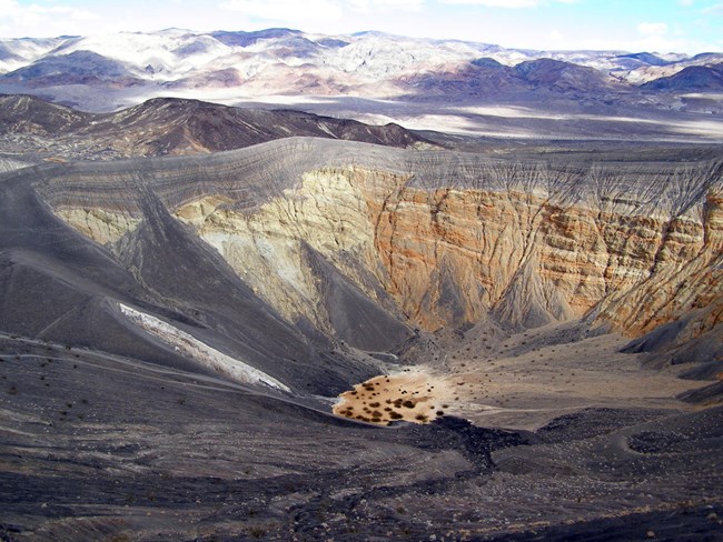
USGS photo.
Ubehebe Crater is the largest of a group of maars that formed in a single eruptive episode approximately 2,100 years before present.
Related Links
El Malpais National Monument: Prehistoric
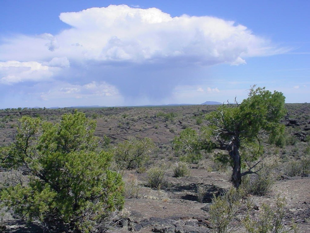
NPS photo
The McCarthy’s lava flow was erupted from a vent at a small cinder cone approximately 3,900 years ago. The McCarthy’s flow is one of the longest lava flows on North America. Four previous eruptions occurred in El Malpais NM during the last 60,000 years.
Featured Article
Related Links
Grand Canyon-Parashant National Monument: Prehistoric
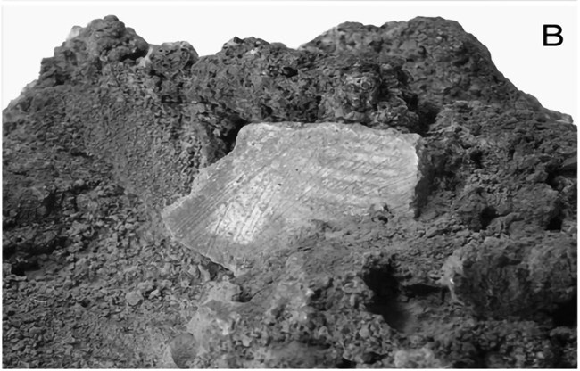
Photo by Helga Teiwes courtesy of Desert Archaeology, Inc.
The most recent eruption in the Uinkaret Volcanic Field was within Grand Canyon-Parashant NM and was the eruption of the basalt of Little Springs about 1,000 years ago. While it wasn’t an explosive eruption like at the nearby Sunset Crater Volcano, it clearly had a profound impact on the people living in the area.
Activity in the Uinkaret Volcanic Field started approximately 3.6 million years ago.
Related Links
-
Grand Canyon-Parashant—The Little Springs Eruption at Mt. Trumbull
-
Grand Canyon-Parashant—Parashant's Volcanic Fields and Lava Dams in the Grand Canyon
-
USGS—Yellowstone Volcano Observatory—Uinkaret Volcanic Field
Lassen Volcanic National Park: Historic
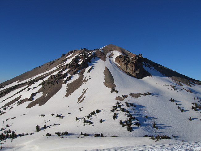
NPS photo.
Lassen Volcanic NP experienced three Holocene eruptions.
-
Chaos Crags is a set of six rhyodacitic lava domes and associated pyroclastic deposits that formed in eruptions 1,100 years ago.
-
An eruptive episode in about 1666 CE formed Cinder Cone as well as a previous cinder cone and five lava flows.
-
Lassen Peak experienced a series of eruptions between 1914 and 1917 that began with a series of phreatic (steam) explosions. In May 2015, two directed blasts formed the Devastated Area and produced lahars. The May 22, 1915 eruption produced an ash column that reached a height of more than 30,000 feet (9.000 m) and also generated a pyroclastic flow. Phreatic explosions formed a new crater in 1917.
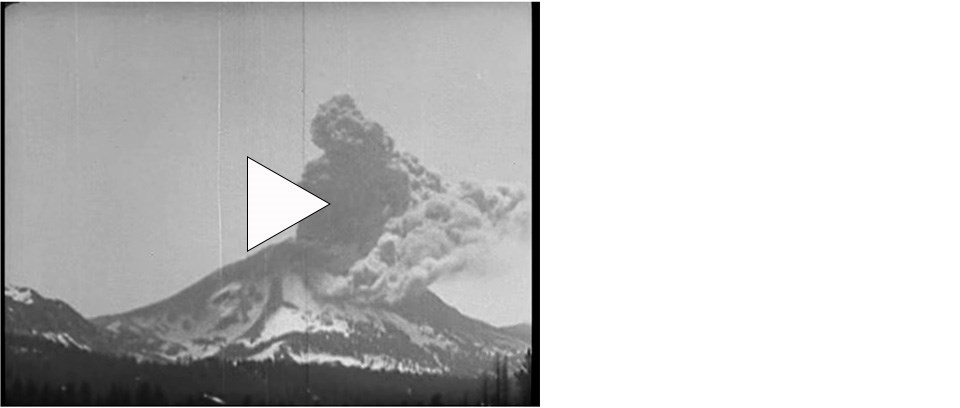
Watch a YouTube video of a 1917 eruption of Lassen Peak.
The 1980 eruption of Mount St Helens and the 1914-1917 eruption of Lassen Peak are the only two eruptions in the contiguous United States since the late 1700s when Mount Hood in Oregon was active for approximately a decade.
Related Links
Mount Rainier National Park: Prehistoric
NPS Photo.
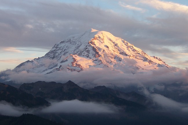
Mount Rainier experience multiple periods of eruptions during the Holocene. These eruptions produced lahars, tephra deposits, and possibly pyroclastic flows. The most recent eruptive episode generated one or two lahars approximately 1,000 to 1,100 years ago. A more recent lahar that occurred 500 years ago was triggered by an unknown event.
Reports of small eruptions of Mount Rainier in the late 1800s are considered both scanty and tenuous by the US Geological Survey
Related Links
Sunset Crater Volcano National Monument: Prehistoric
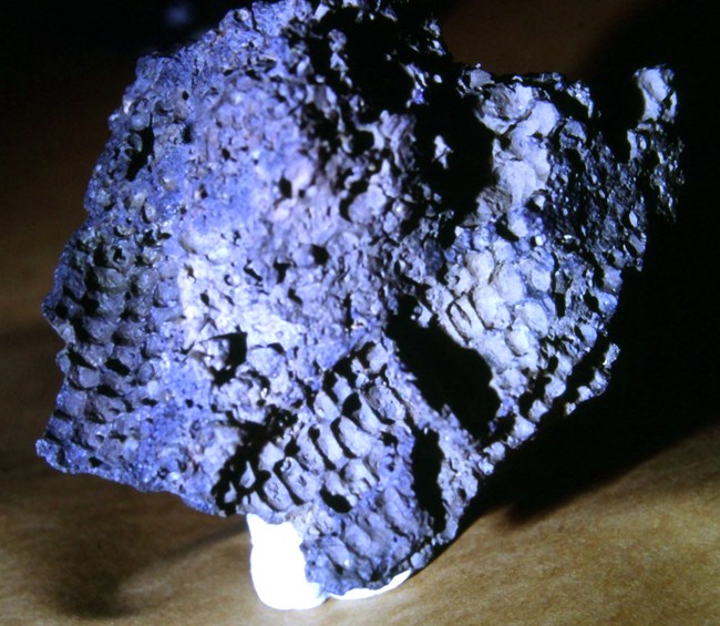
Photo by Helga Teiwes courtesy of Desert Archaeology, Inc.
Sunset Crater Volcano erupted in 1085 CE in the most recent eruption in the San Francisco Volcanic Field. The Sunset Crater eruption was unusually vigorous for a cinder cone, as it was Sub-Plinian with a VEI of 4. The Sunset Crater eruption lasted at most a few years. The eruption had a profound impact on the ancestral Puebloan people living in the area.
Related Links
Parks with Historic Eruptions
-
Aniakchak National Monument (ANIA), Alaska—[ANIA Geodiversity Atlas] [ANIA Park Home] [ANIA npshistory.com]
-
Hawaii Volcanoes National Park (HAVO), Hawai'i—[HAVO Geodiversity Atlas] [HAVO Park Home] [HAVO npshistory.com]
-
Katmai National Park (KATM), Alaska—[KATM Geodiversity Atlas] [KATM Park Home] [KATM npshistory.com]
-
Lake Clark National Park and Preserve (LACL), Alaska—[LACL Geodiversity Atlas] [LACL Park Home] [LACL npshistory.com]
-
Lassen Volcanic National Park (LAVO), California—[LAVO Geodiversity Atlas] [LAVO Park Home] [LAVO npshistory.com]
-
Wrangell-St. Elias National Park and Preserve (WRST), Alaska—[WRST Geodiversity Atlas] [WRST Park Home] [WRST npshistory.com]
Parks with Prehistoric Eruptions
-
Crater Lake National Park (CRLA), Oregon—[CRLA Geodiversity Atlas] [CRLA Park Home] [CRLA npshistory.com]
-
Craters of the Moon National Monument (CRMO), Idaho—[CRMO Geodiversity Atlas] [CRMO Park Home] [CRMO npshistory.com]
-
Death Valley National Park (DEVA), California and Nevada—[DEVA Geodiversity Atlas] [DEVA Park Home] [DEVA npshistory.com]
-
El Malpais National Monument (ELMA), New Mexico—[ELMA Geodiversity Atlas] [ELMA Park Home] [ELMA npshistory.com]
-
Grand Canyon National Park (GRCA), Arizona—[GRCA Geodiversity Atlas] [GRCA Park Home] [GRCA npshistory.com]
-
Grand Canyon-Parashant National Monument (PARA), Arizona—[PARA Park Home] [PARA npshistory.com]
-
Haleakala National Park (HALE), Hawaii—[HALE Geodiversity Atlas] [HALE Park Home] [HALE npshistory.com]
-
Mount Rainier National Park (MORA), Washington—[MORA Geodiversity Atlas] [MORA Park Home] [MORA npshistory.com]
-
Sunset Crater Volcano National Monument (SUCR), Arizona—[SUCR Geodiversity Atlas] [SUCR Park Home] [SUCR npshistory.com]
Last updated: April 14, 2023
