
NPS photo
The Coastal Plain province, the flattest province, stretches over 3,540 km (2,200 mi) from Cape Cod to the Mexican border. The plain slopes gently seaward from the inland highlands in a series of terraces. This gentle slope continues far into the Atlantic and Gulf of Mexico, forming the continental shelf.
This region was formed during the breakup of the supercontinent Pangea in the early Mesozoic Era. From about 280-230 million years ago, (Late Paleozoic Era until the Late Triassic) the continent we now know as North America was connected with Africa, South America, and Europe.
As Pangea broke apart, rifting began as magma welled up through the weakness in the crust and created a volcanic rift zone. The rift between the spreading continents gradually grew to form a new ocean basin, the Atlantic. The rift zone known as the Mid-Atlantic Ridge continues to provide the raw volcanic materials for the still expanding ocean basin. As the edge of North America moved away from the hot rift zone, it began to cool and subside beneath the new Atlantic Ocean. This once-active divergent plate boundary became the passive, trailing edge of westward moving North America. In plate tectonic terms, the Coastal Plain is a classic example of a passive continental margin.
The Coastal Plain is divided into six sections:
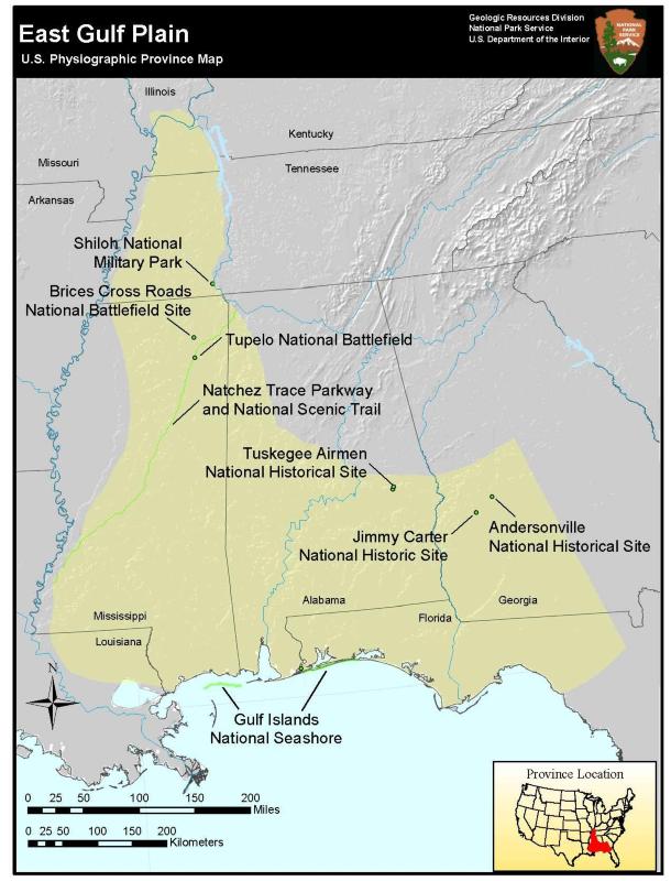
- East Gulf Coastal Plain (Map)
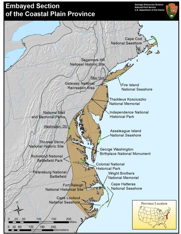
- Embayed section (Map)
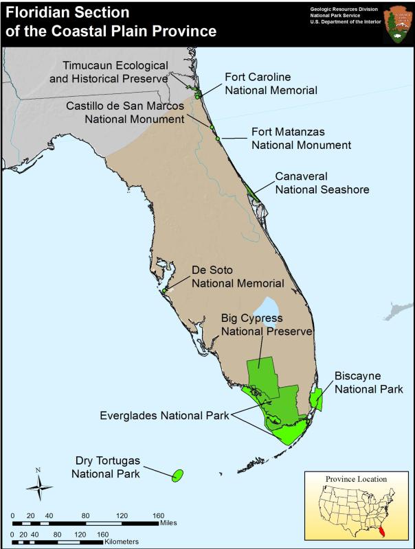
- Floridian section (Map)
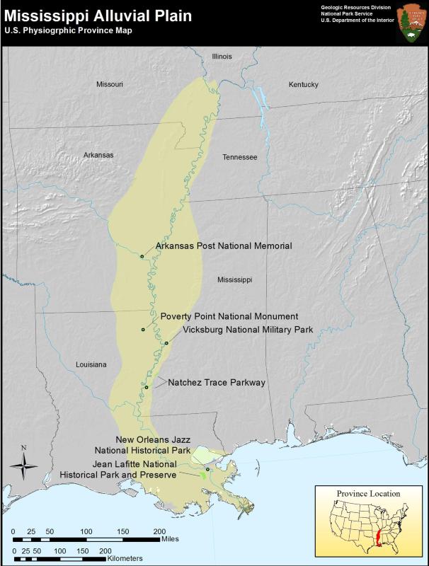
- Mississippi Alluvial Plain (Map)
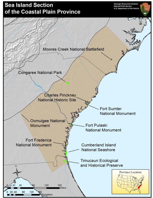
- Sea Island section (Map)
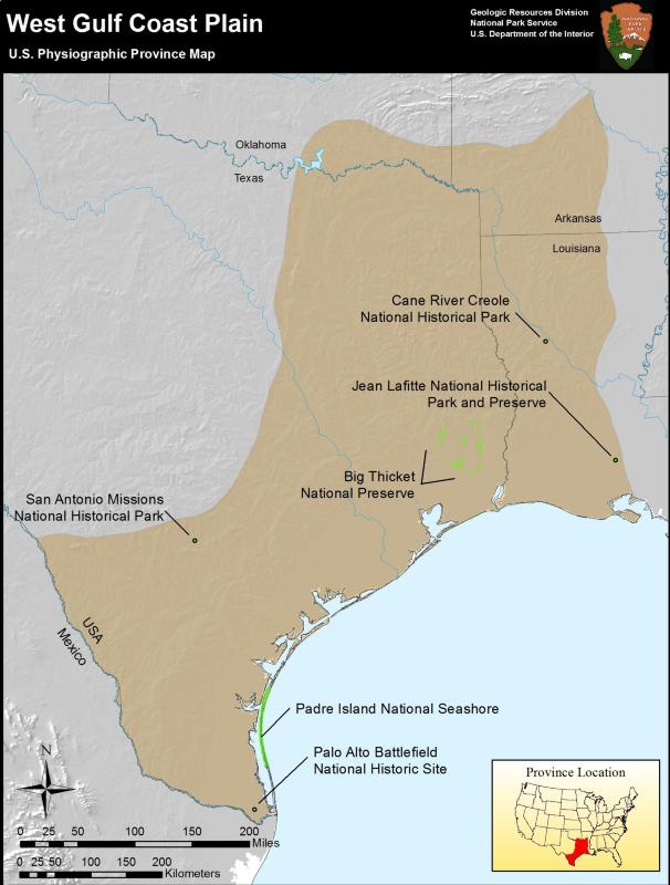
- West Gulf Coastal Plain (Map)
Return to Physiographic Provinces

NPS photo/Rodney Cammauf
Coastal Plains Parks
- Andersonville National Historical Site, Georgia—[Geodiversity Atlas] [Park Home]
- Arkansas Post National Memorial, Arkansas—[Geodiversity Atlas] [Park Home]
- Assateague Island National Seashore, Maryland & Virginia—[Geodiversity Atlas] [Park Home]
- Big Cypress National Preserve, Florida—[Geodiversity Atlas] [Park Home]
- Big Thicket National Preserve, Texas—[Geodiversity Atlas] [Park Home]
- Biscayne National Park, Florida—[Geodiversity Atlas] [Park Home]
- Brices Cross Roads National Battlefield Site, Mississippi—[Geodiversity Atlas] [Park Home]
- Canaveral National Seashore, Florida—[Geodiversity Atlas] [Park Home]
- Cane River Creole National Historical Park, Louisiana—[Geodiversity Atlas] [Park Home]
- Cape Cod National Seashore, Massachusetts—[Geodiversity Atlas] [Park Home]
- Cape Hatteras National Seashore, North Carolina—[Geodiversity Atlas] [Park Home]
- Cape Lookout National Seashore, North Carolina—[Geodiversity Atlas] [Park Home]
- Castillo de San Marcos National Monument, Florida—[Geodiversity Atlas] [Park Home]
- Charles Pinckney National Historic Site, South Carolina—[Geodiversity Atlas] [Park Home]
- Colonial National Historical Park, Virginia—[Geodiversity Atlas] [Park Home]
- Congaree National Park, South Carolina—[Geodiversity Atlas] [Park Home]
- Cumberland Island National Seashore, Georgia—[Geodiversity Atlas] [Park Home]
- De Soto National Monument, Florida—[Geodiversity Atlas] [Park Home]
- Dry Tortugas National Park, Florida—[Geodiversity Atlas] [Park Home]
- Everglades National Park, Florida—[Geodiversity Atlas] [Park Home]
- Fort Frederica National Monument, Georgia—[Geodiversity Atlas] [Park Home]
- Fire Island National Seashore, New York—[Geodiversity Atlas] [Park Home]
- Fort Caroline National Memorial, Florida—[Geodiversity Atlas] [Park Home]
- Fort Matanzas National Monument, Florida—[Geodiversity Atlas] [Park Home]
- Fort Pulaski National Monument, Georgia—[Geodiversity Atlas] [Park Home]
- Fort Raleigh National Historical Site, North Carolina—[Geodiversity Atlas] [Park Home]
- Fort Sumter National Monument, South Carolina—[Geodiversity Atlas] [Park Home]
- Gateway National Recreation Area, New York & New Jersey—[Geodiversity Atlas] [Park Home]
- George Washington Birthplace National Monument, Virginia—[Geodiversity Atlas] [Park Home]
- Gulf Islands National Seashore, Florida and Mississippi—[Geodiversity Atlas] [Park Home]
- Independence National Historical Park, Pennsylvania—[Geodiversity Atlas] [Park Home]
- Jean Lafitte National Historical Park and Preserve, Louisiana—[Geodiversity Atlas] [Park Home]
- Jimmy Carter National Historic Site, Georgia—[Geodiversity Atlas] [Park Home]
- Moores Creek National Battlefield, North Carolina—[Geodiversity Atlas] [Park Home]
- Natchez Trace Parkway, Alabama, Mississippi & Tennessee—[Geodiversity Atlas] [Park Home]
- National Mall and Memorial Parks, District of Columbia—[Geodiversity Atlas] [Park Home]
- New Orleans Jazz National Historical Park, Louisiana—[Geodiversity Atlas] [Park Home]
- Ocmulgee National Monument, Georgia—[Geodiversity Atlas] [Park Home]
- Padre Island National Seashore, Texas—[Geodiversity Atlas] [Park Home]
- Palo Alto Battlefield National Historic Site, Texas—[Geodiversity Atlas] [Park Home]
- Petersburg National Battlefield, Virginia—[Geodiversity Atlas] [Park Home]
- Poverty Point National Monument, Louisiana—[Geodiversity Atlas] [Park Home]
- Richmond National Battlefield Park, Virginia—[Geodiversity Atlas] [Park Home]
- Sagamore Hill National Historic Site, New York—[Geodiversity Atlas] [Park Home]
- San Antonio Missions National Historical Park, Texas—[Geodiversity Atlas] [Park Home]
- Shiloh National Military Park, Tennessee & Mississippi—[Geodiversity Atlas] [Park Home]
- Thaddeaus Kosciuszko National Memorial, Pennsylvania—[Geodiversity Atlas] [Park Home]
- Thomas Stone National Historic Site, Maryland—[Geodiversity Atlas] [Park Home]
- Timucuan Ecological and Historical Preserve, Florida—[Geodiversity Atlas] [Park Home]
- Tupelo National Battlefield, Mississippi—[Geodiversity Atlas] [Park Home]
- Tuskegee Airmen National Historical Site, Alabama—[Geodiversity Atlas] [Park Home]
- Vicksburg National Military Park, Mississippi—[Geodiversity Atlas] [Park Home]
- Wright Brothers National Memorial, North Carolina—[Geodiversity Atlas] [Park Home]
Part of a series of articles titled Physiographic Provinces.
Previous: Central Lowland Province
Last updated: April 30, 2018