Last updated: April 18, 2023
Article
Pyroclastic Flows and Ignimbrites, and Pyroclastic Surges
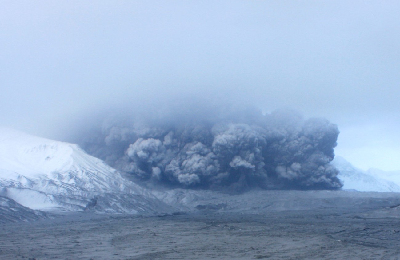
USGS image from a time-lapse camera.
Introduction
Explosive volcanic eruptions can produce pyroclastic flows and surges, both among the most awesome and most destructive of all volcanic phenomena. They travel faster than lava flows and also greater distances than many lava flows. Some can even overcome topographic barriers.
Pyroclastic density currents are ground-hugging flows of hot volcanic gases and particles (volcanic ash, pumice, crystals, and small rock fragments) that are propelled by gravity and move extremely rapidly, travelling at speeds more than 200 miles per hour (320 km per hour).
There are two types of pyroclastic density currents: pyroclastic flows and pyroclastic surges.
-
Pyroclastic flows are high-density currents of pumice, ash, blocks, and volcanic gas that rapidly move down the slopes of a volcano.
-
Pyroclastic surges are low-density currents of ash, pumice, crystals, and volcanic gases that are more dilute than pyroclastic flows.
Pyroclastic surges and flows sometimes occur together, with surges occurring immediately before flows.
Pyroclastic Flows
Pyroclastic flow may be initiated by collapse of Plinian eruptive columns due to loss of buoyancy, by explosive eruptions that boil over instead of forming a high eruption column, or by the collapse of lava domes.
Pyroclastic flows usually occur during highly explosive eruptions of silicic magmas at composite volcanoes and resurgent calderas. Pyroclastic flow deposits are important components of most composite volcanoes. Caldera-forming eruptions, at both resurgent and summit calderas, are accompanied by the production of voluminous pyroclastic flows.
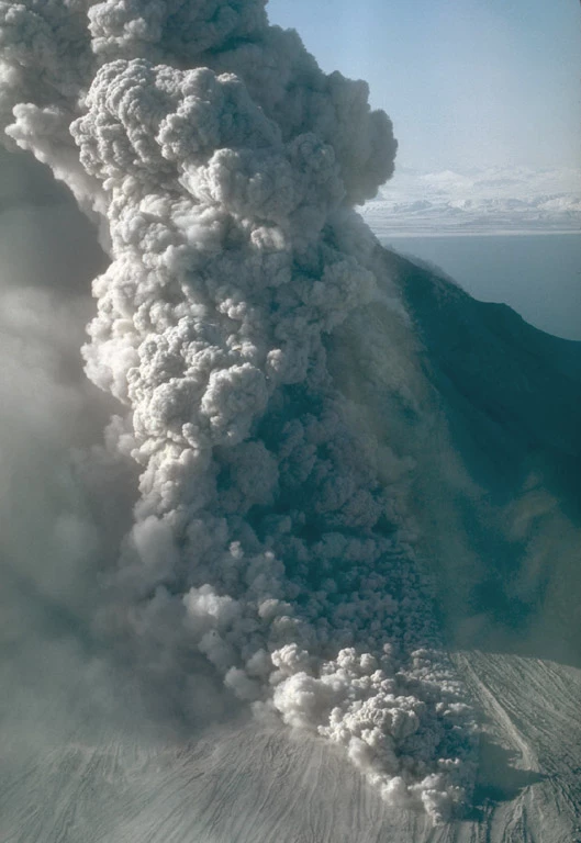
USGS AVO photo by M. E. Yount.
Pyroclastic Surges
Pyroclastic surges are less dense and travel faster than pyroclastic flows. They sometimes occur close to the start of an explosive eruption and may precede pyroclastic flows.
A specific type of pyroclastic surge (base surge) is associated with phreatomagmatic (hydrovolcanic) eruptions where hot magma encounters shallow groundwater, surface water, or permafrost.
Like for pyroclastic flows, most surges occur during the eruption of silicic magmas, except for base surges that are common at maars and tuff rings that may be of basaltic or intermediate compositions.
Pyroclastic Density Current Deposits and Ash-Flow Tuffs (Ignimbrites)
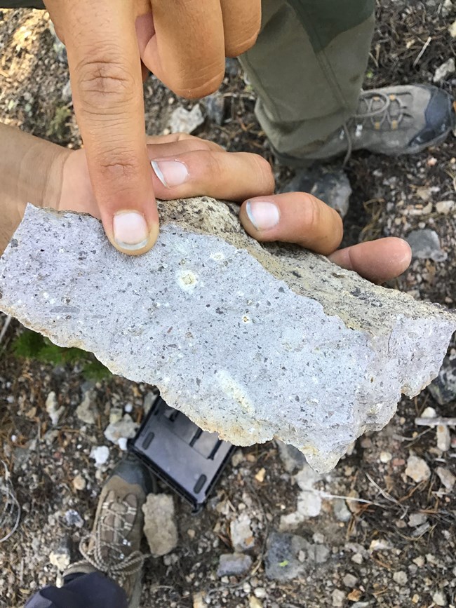
USGS photo by Ray Salazar (Montana State University), public domain.
Any rock made of consolidated or welded deposits of volcanic ash, tephra, and other volcanic debris is known as a tuff. Tuffs form either by fallout (ash-fall) or by pyroclastic flows or surges.
Pyroclastic flow deposits are also known as ash-flow tuffs or ignimbrites.
Ignimbrites are typically massive (e.g., without bedding or layering), and are composed of a poorly-sorted mixture of pumice fragments, rock fragments, and crystals in a groundmass of volcanic ash. They compact under their own weight. If they are still hot enough when they are emplaced, the ash particles fuse or weld together and pumice fragments collapse into flattened structures known as fiamme.
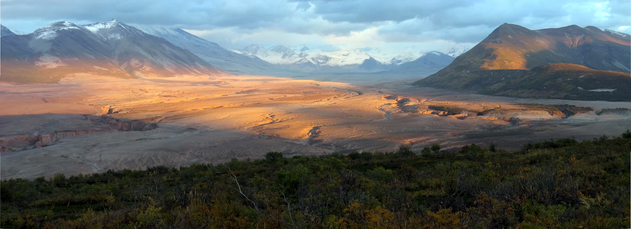
Frequently only the interior or central part of an ash-flow tuff is densely welded due to heat retention in that part of a deposit. Ignimbrite sheets can be very thick. For example, the Valley of Ten Thousand Smokes ignimbrite in Katmai National Park is up to 670 feet (200 m) thick. They also may have extremely large volumes and cover large geographic areas.
Pyroclastic surge deposits are usually better sorted than flow deposits and usually have a greater proportion of crystals and lithics (rock fragments). They may be bedded with low-angle crossbedding. They usually have a much smaller volume than ash-flow tuffs, are relatively thin, and are not as geographically extensive as large ash-flow tuffs.
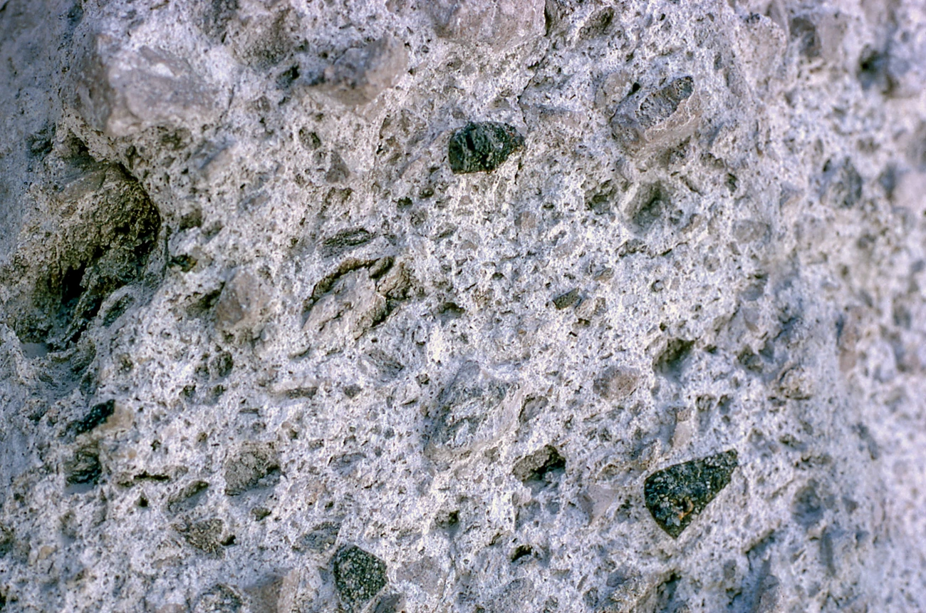
NPS photo byJohn Good.
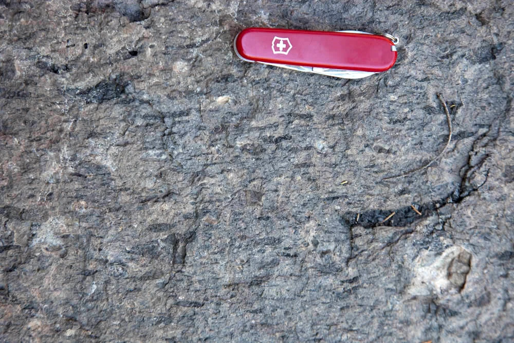
Photo by / © Marli Miller, geologypics.com.
National Park Pyroclastic Flow Deposits
Pyroclastic flow deposits are found in at least 21 units of the National Park System including:
Aniakchak National Monument
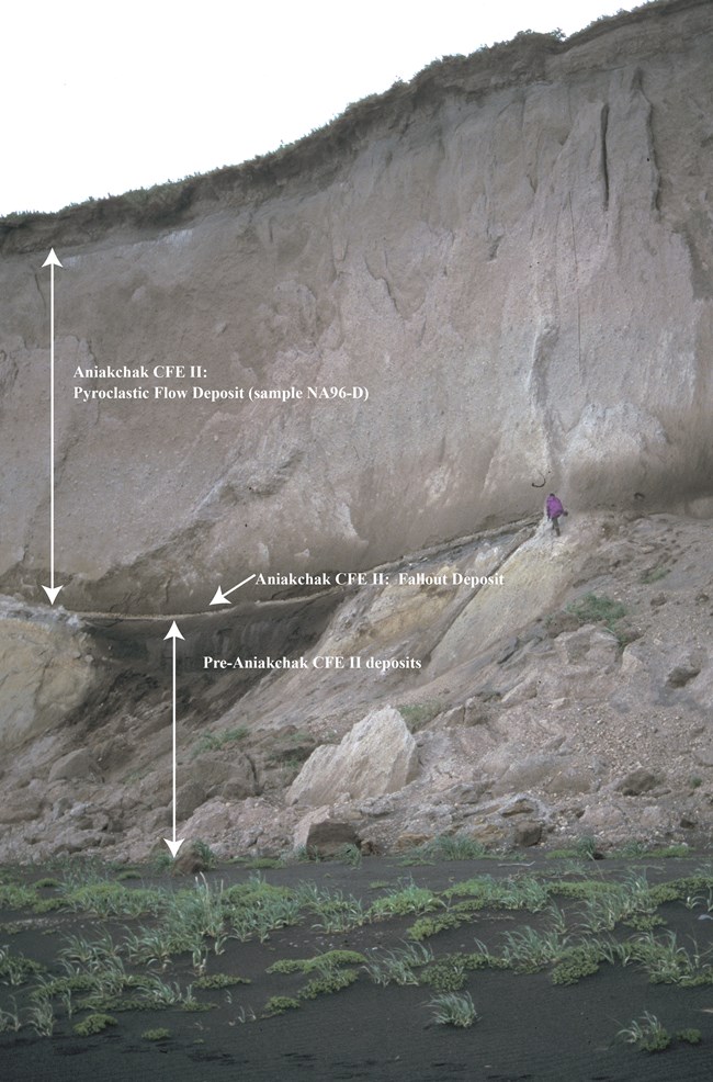
The eruption that formed Aniakchak caldera about 3,660 years ago was one of the largest eruptions of the Holocene. It was accompanied by the eruption of a voluminous pyroclastic flow that flowed north into Bristol Bay and caused a tsunami. To the south, it surmounted passes as high as 850 feet (260 m). The ignimbrite left by this pyroclastic flow covers an area of 965 square miles (2,500 square km).
Photo (right): Pyroclastic-flow deposits from the climatic eruption of Aniakchak caldera. The thick pyroclastic-flow deposits overlie a thin ash-fall deposit.
USGS AVO photo by Christina Neal.
Chiricahua National Monument
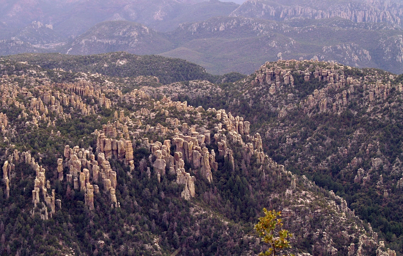
The hoodoos that make up Chiricahua NM’s wonderland of rocks are made of welded ignimbrite. The Rhyolite Canyon Tuff was erupted from the Turkey Creek Caldera approximately 26.9 million years ago. The rocks spires formed as a result of weathering and erosion along intersecting systems of vertical joints.
NPS photo by Ron Kerbo.
Crater Lake National Park
The climactic eruption of Mount Mazama approximately 7,700 years ago formed the Crater Lake caldera. The collapse of the eruption column sent thick pyroclastic flows that traveled down valleys on the flanks of the volcano producing the Wineglass Welded Tuff.
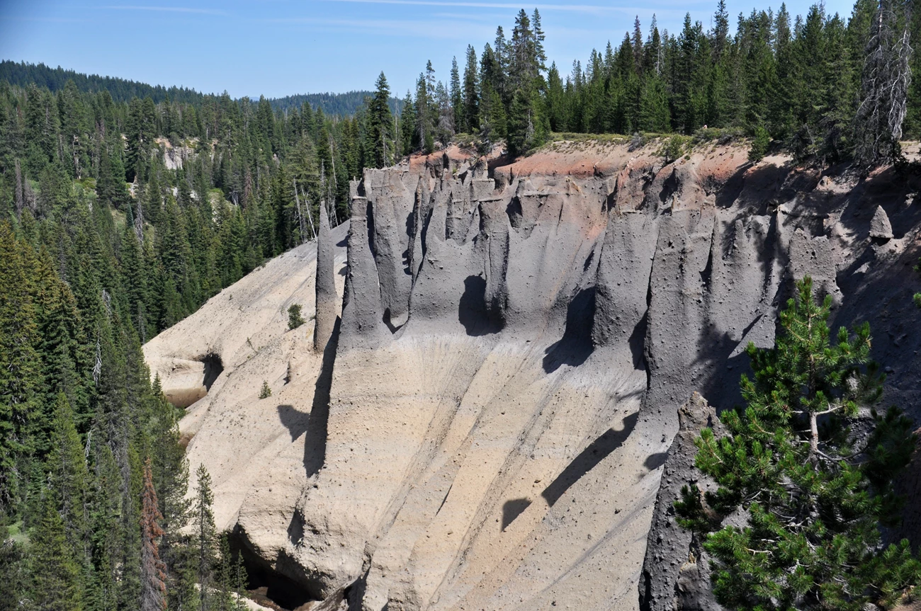
Photo by / © James St. John on Flickr.
Katmai National Park
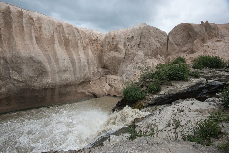
The eruption of Novarupta-Mount Katmai in 1912 was the largest eruption of the 20th century (VEI 3, Catastrophic). The eruption deposited a thick pyroclastic flow in the area to be named the Valley of Ten Thousand Smokes for the numerous fumaroles produced by the cooling ignimbrite in the decades after the eruption. Today, the Valley of Ten Thousand Smokes is a stark landscape because the surface of the ignimbrite sheet is mostly still barren and is cut by narrow gorges where streams have incised into it.
NPS photo.
NPS photo.
Lake Clark National Park
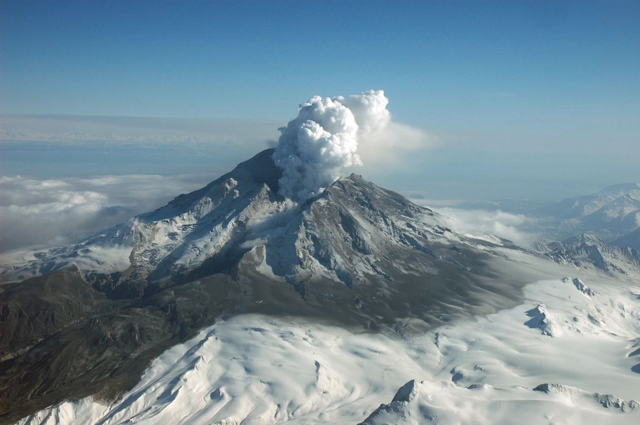
Composite volcanoes such as Redoubt Volcano and Iliamna Volcano in Lake Clark National Park commonly produce pyroclastic flows during their eruptions. Pyroclastic flows may be initiated when a lava dome growing in the summit crater collapses or when eruption columns collapse.
Recent eruptive episodes at Redoubt Volcano in 2009 and 1989-1990 have produced small pyroclastic flows.
USGS AVO photo by R. G. McGimsey.
Valles Caldera National Preserve and Bandelier National Monument
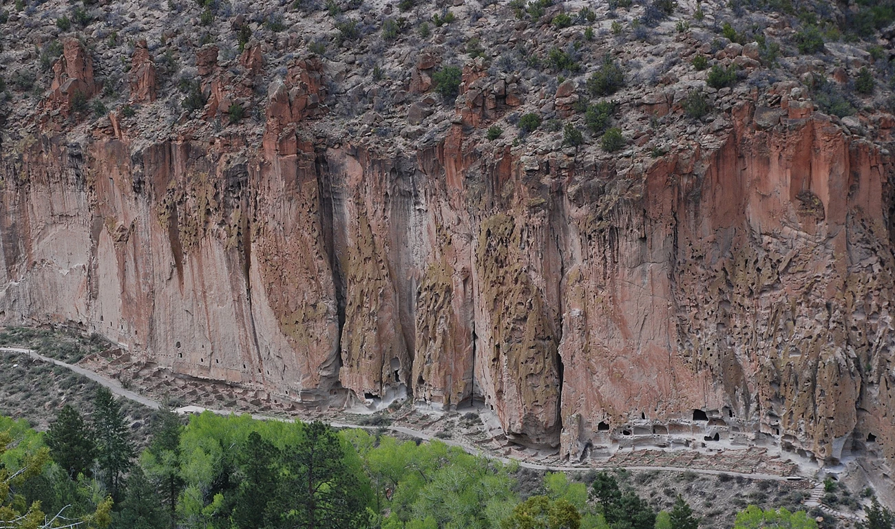
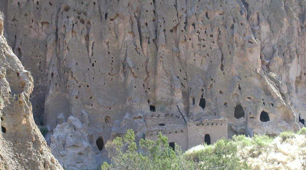
The Bandelier Tuff consists of a series of thick ash flow tuffs that were erupted from the Valles and Toledo Calderas. The Tshirege Member of the Bandelier Tuff was erupted 1.26 million years ago during the eruption that formed the Valles Caldera, the younger of the two resurgent calderas in the area. This tuff weathers to form a swiss-cheese type surface (with pockets in the cliff face called tafoni). The nonwelded lower section of this ignimbrite is soft and the Ancestral Puebloans who lived in the area enlarged tafoni and carved the cliff face to excavate cavates (Human-made hollowed out chambers cut in soft rock) to be the interior rooms of their cliff-side pueblos.
NPS photo by Sally King.
NPS photo by Katie KellerLynn (Colorado State University).
Yellowstone National Park
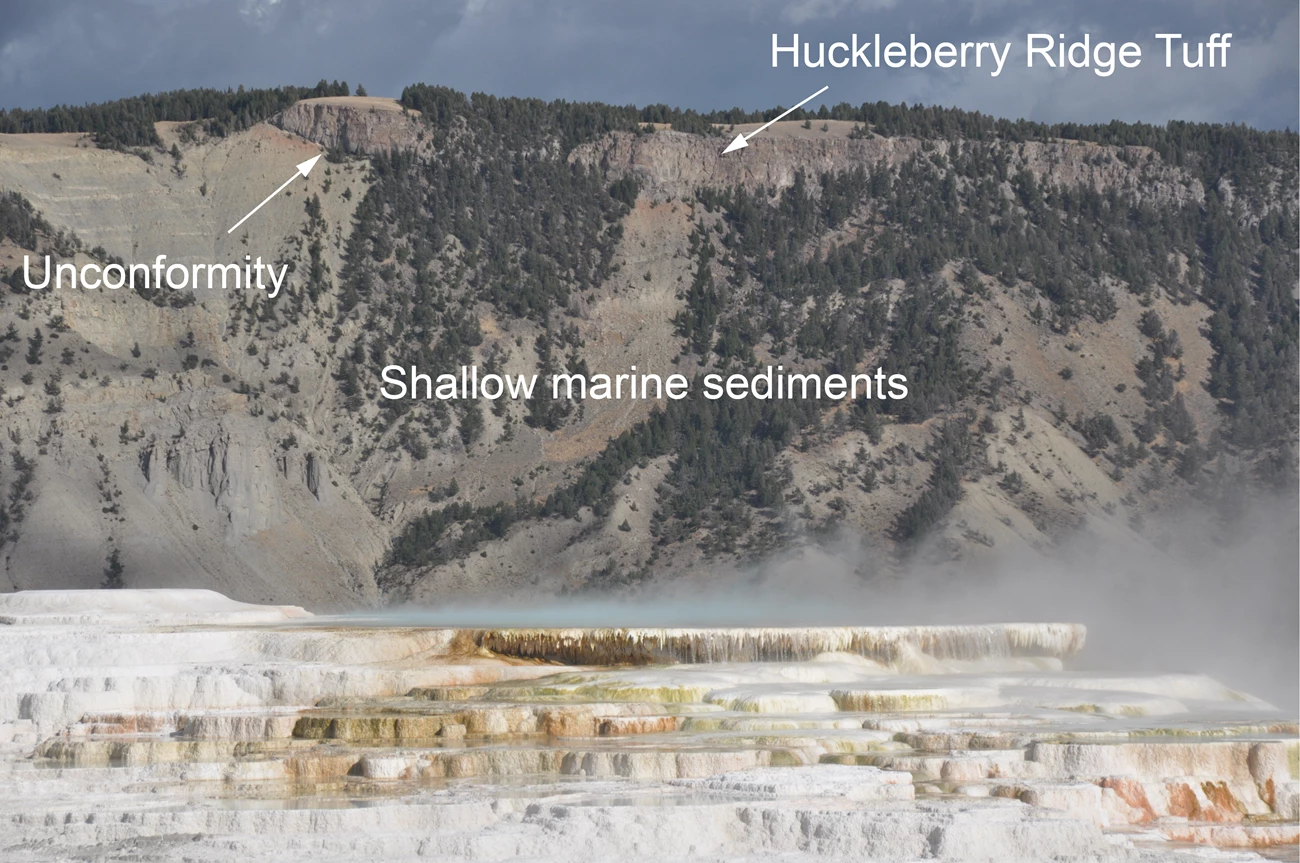
Yellowstone’s three caldera-forming eruptions at 2.1, 1.3, and 0.64 million years ago each produced large-volume silicic ash-flow tuffs.
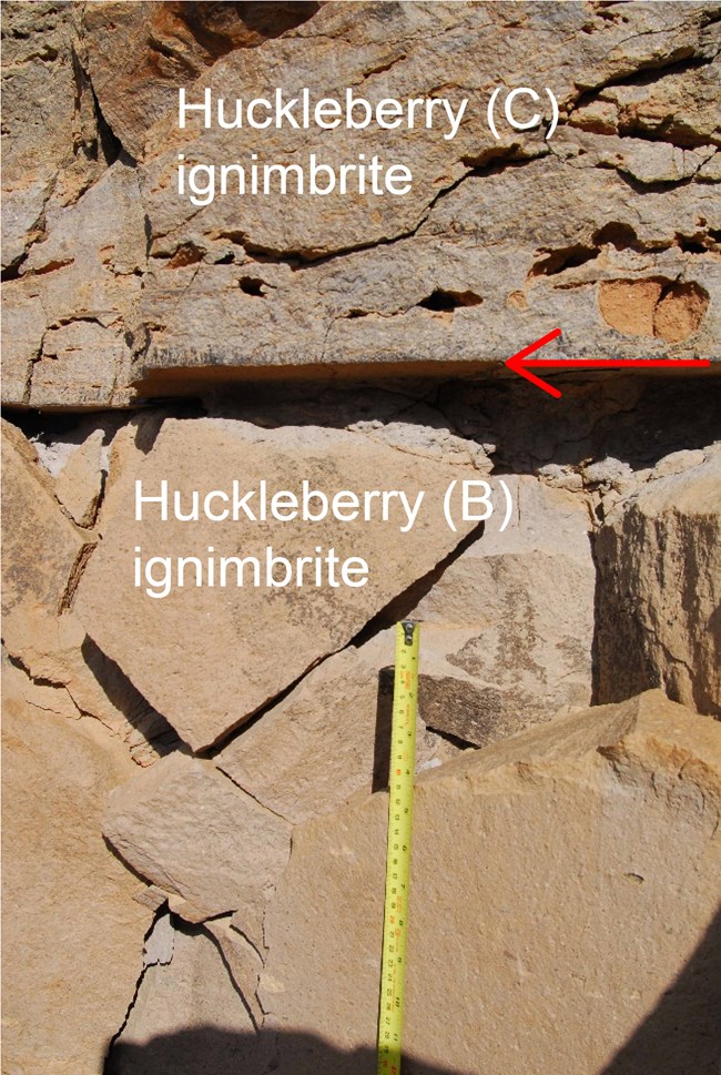
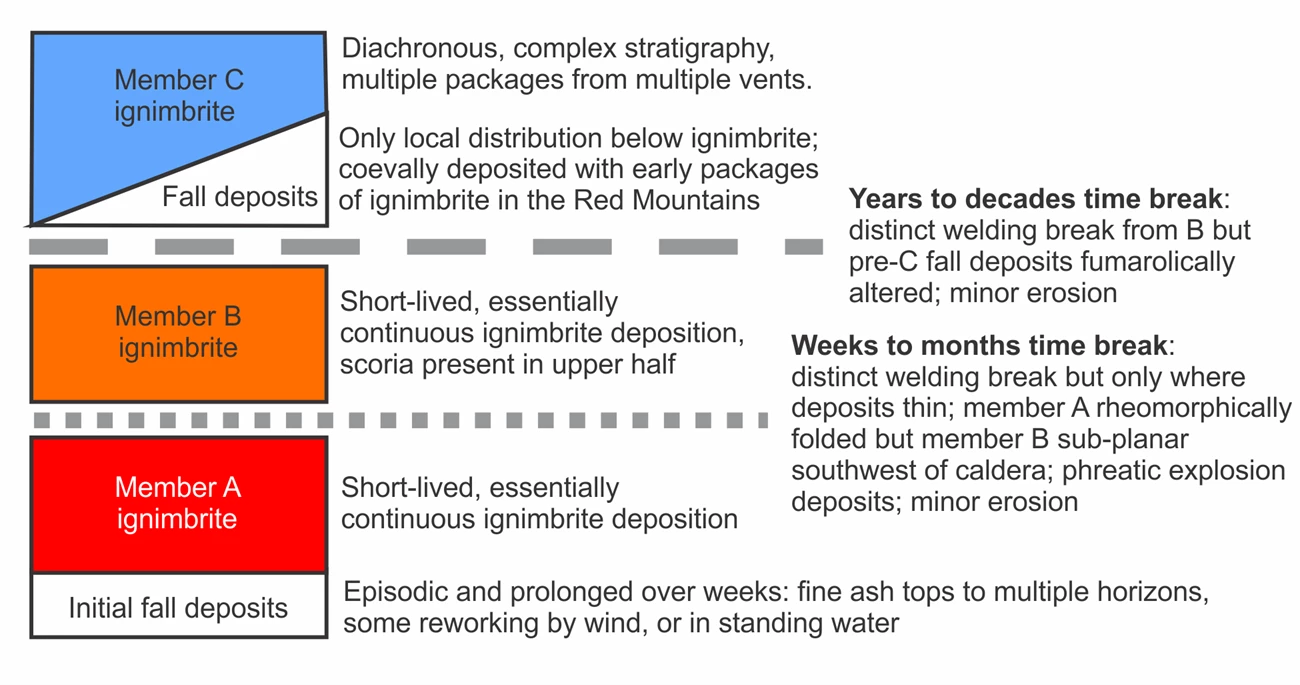
Large ignimbrites such at the Huckleberry Ridge Tuff were formed in multiple eruptive episodes. The Huckleberry Ridge Tuff was erupted from the First Caldera (Island Park Caldera or Huckleberry Ridge Tuff Caldera) about 2.1 million years ago. It actually consists of three different ignimbrite members and two pyroclastic-fall members.
Each of the three pyroclastic flow members was emplaced in a single event that may have lasted a number of days. But there were time gaps between eruptions that produced the different members. For example, a period of time that perhaps lasted as long as a few decades separates the B and C ignimbrites. The B ignimbrite had had time to at least partially cool as is seen in a chilled margin at the base of ignimbrite C.
Photo (right): The arrow marks the contact between two different ignimbrite sheets (members B and C) in the Huckleberry Ridge Tuff. The base of member C shows shows that ignimbrite B has at least partially cooled by the time it was emplaced.
USGS photo by Colin Wilson (Victoria University of Wellington), public domain.
USGS image, Public Domain.
USGS photo illustration.
Related Link
National Park Pyroclastic Surge Deposits
At least four units of the National Park System contain pyroclastic surge deposits, including
Aniakchak National Monument
Pyroclastic surge deposits are present in Aniakchak caldera associated Half Cone, a small composite volcano within the caldera. Its most recent eruption approximately 400 years ago produced pumice-fall, pyroclastic flow, and pyroclastic surge deposits. The surge deposits are about 42 feet (13 m) thick and have low-angle crossbedding.
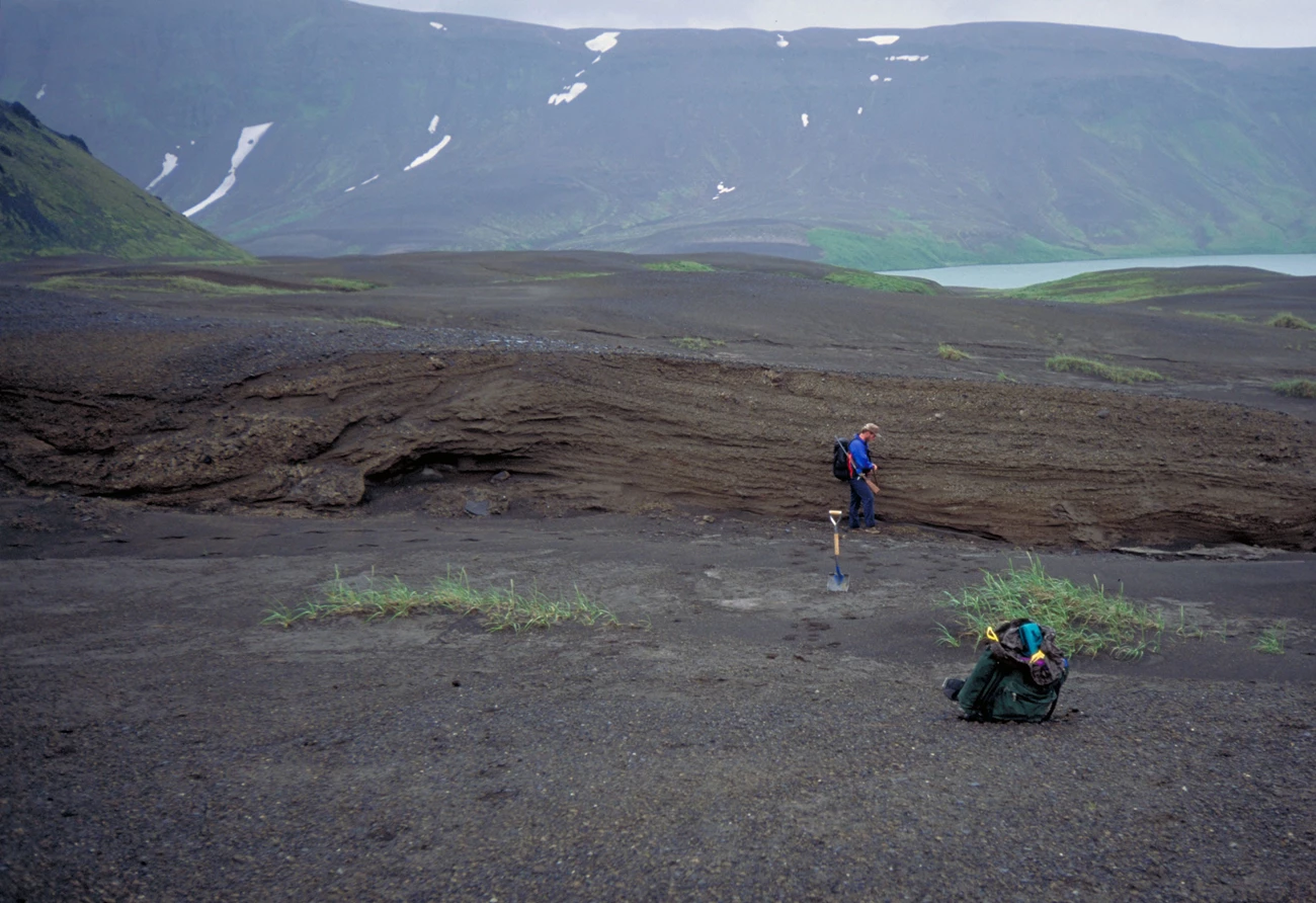
USGS AVO photo by C. A. Neil.
Bering Land Bridge National Preserve
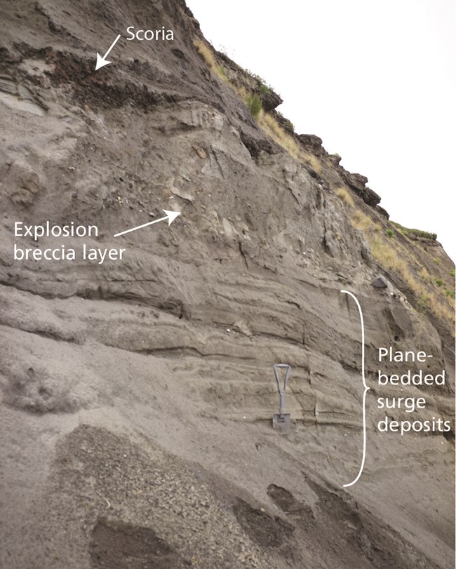
The Espenberg maars in Bering Land Bridge National Preserve (Alaska) formed from the extremely explosive interaction between magma and permafrost. Pyroclastic surges are typical in phreatomagmatic (hydrovolcanic) eruptions such as the ones that formed these maars. Phreatomagmatic eruptions cause base surges where ground-hugging surges that move laterally from the base of eruption columns and leave wedge-shaped deposits that are typical of both maars and tuff rings.
Photo (right): Pyroclastic surge deposits on the rim of Devil Mountain maar.
NPS Photo by Chad Hults.
Learn More
Death Valley National Park
Ubehebe Craters in Death Valley National Park are maars formed during phreatomagmatic (hydrovolcanic) eruptions caused when magma encountered shallow groundwater. The pyroclastic surge deposits at Ubehebe Craters show bedding and crossbedding.
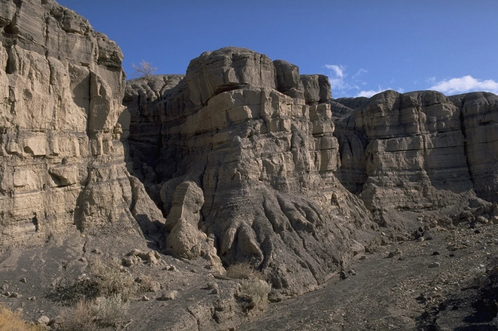
Photo by Lee Siebert (Smithsonian Institution).
National Parks Containing (Ignimbrites Ash Flow Tuffs) or Pyroclastic Surge Deposits
-
Aniakchak National Monument (ANIA), Alaska—[ANIA Geodiversity Atlas] [ANIA Park Home] [ANIA npshistory.com]
-
Bandelier National Monument (BAND), New Mexico—[BAND Geodiversity Atlas] [BAND Park Home] [BAND npshistory.com]
-
Bering Land Bridge National Preserve (BELA), Alaska—[BELA Geodiversity Atlas] [BELA Park Home] [BELA npshistory.com]
-
Big Bend National Park (BIBE), Texas—[BIBE Geodiversity Atlas] [BIBE Park Home] [BIBE npshistory.com]
-
Chiricahua National Monument (CHIR), Arizona—[CHIR Geodiversity Atlas] [CHIR Park Home] [CHIR npshistory.com]
-
Coronado National Monument (CORO), Arizona—[CORO Geodiversity Atlas] [CORO Park Home] [CORO npshistory.com]
-
Crater Lake National Park (CRLA), Oregon—[CRLA Geodiversity Atlas] [CRLA Park Home] [CRLA npshistory.com]
-
Death Valley National Park (DEVA), California & Nevada—[DEVA Geodiversity Atlas] [DEVA Park Home] [DEVA npshistory.com]
-
Gila Cliff Dwellings National Monument (GICL), New Mexico—[GICL Geodiversity Atlas] [GICL Park Home] [GICL npshistory.com]
-
Grand Teton National Park (GRTE), Wyoming—[GRTE Geodiversity Atlas] [GRTE Park Home] [GRTE npshistory.com]
-
John D. Rockefeller Jr. Memorial Parkway (JODR), Wyoming—[Network Geodiversity Atlas] [GRTE Park Home] [JODR npshistory.com]
-
Katmai National Park (KATM), Alaska—[KATM Geodiversity Atlas] [KATM Park Home] [KATM npshistory.com]
-
Lake Clark National Park and Preserve (LACL), Alaska—[LACL Geodiversity Atlas] [LACL Park Home] [LACL npshistory.com]
-
Lassen Volcanic National Park (LAVO), California—[LAVO Geodiversity Atlas] [LAVO Park Home] [LAVO npshistory.com]
-
Mojave National Preserve (MOJA), California—[MOJA Geodiversity Atlas] [MOJA Park Home] [MOJA npshistory.com]
-
Mount Rainier National Park (MORA), Washington—[MORA Geodiversity Atlas] [MORA Park Home] [MORA npshistory.com]
-
Organ Pipe Cactus National Monument (ORPI), Arizona—[ORPI Geodiversity Atlas] [ORPI Park Home] [ORPI npshistory.com]
-
Pinnacles National Monument, California—[PINN Geodiversity Atlas] [PINN Park Home] [PINN npshistory.com]
-
Saguaro National Park (SAGU), Arizona—[SAGU Geodiversity Atlas] [SAGU Park Home] [SAGU npshistory.com]
-
Valles Caldera National Preserve (VALL), New Mexico—[VALL Geodiversity Atlas] [VALL Park Home] [VALL npshistory.com]
-
Wrangell-St. Elias National Park and Preserve (WRST), Alaska—[WRST Geodiversity Atlas] [WRST Park Home] [WRST npshistory.com]
- Yellowstone National Park (YELL), Wyoming—[YELL Geodiversity Atlas] [YELL Park Home] [YELL npshistory.com]
Related Links
Tags
- aniakchak national monument & preserve
- bandelier national monument
- bering land bridge national preserve
- big bend national park
- chiricahua national monument
- coronado national memorial
- crater lake national park
- death valley national park
- gila cliff dwellings national monument
- grand teton national park
- john day fossil beds national monument
- katmai national park & preserve
- lake clark national park & preserve
- lassen volcanic national park
- mojave national preserve
- mount rainier national park
- organ pipe cactus national monument
- pinnacles national park
- saguaro national park
- valles caldera national preserve
- wrangell - st elias national park & preserve
- yellowstone national park
- volcanoes
- pyroclastic flow
- ignimbrites
- pyroclastic surges
- geology
- geohazards
