Last updated: July 16, 2024
Article
NPS Geodiversity Atlas—Saguaro National Park, Arizona
Geodiversity refers to the full variety of natural geologic (rocks, minerals, sediments, fossils, landforms, and physical processes) and soil resources and processes that occur in the park. A product of the Geologic Resources Inventory, the NPS Geodiversity Atlas delivers information in support of education, Geoconservation, and integrated management of living (biotic) and non-living (abiotic) components of the ecosystem.

Introduction
Saguaro National Park (SAGU) consists of two non-contiguous park districts (the western Rincon Mountain District and eastern Tucson Mountain District) that flank the city of Tucson in Pima County, Arizona. Originally proclaimed as a national monument on March 1, 1933, the park unit was redesignated on October 4, 1994 (National Park Service 2016a). Encompassing approximately 37,005 hectares (91,442 acres), SAGU was established to preserve and protect giant saguaro cacti, diverse biological communities of the Sonoran Desert, associated mountain ecosystems, and Rincon Creek, as well as a rich collection of cultural resources that record a continuous history of diverse human occupation in the Southwest from prehistoric to modern times (National Park Service 2014a). The saguaro cacti that are the namesake of the park are the tallest cactus species in the United States and have a distinctive morphology that is globally recognized as an iconic symbol of the American Southwest. The park contains one of the largest concentrations of rare and distinct aquatic microhabitats such as tinajas, seeps, and springs in the desert Southwest, supporting rare and special status species such as the lowland leopard frog, yellow-billed cuckoo, gray hawk, and southwestern willow flycatcher, as well as plant species uncommon to the desert, including sycamore and ash.
Geologic Setting
The geology of Saguaro National Park records a tectonic and depositional history spanning approximately 1.6 billion years and reveals several geologic episodes that include: (1) Precambrian continent development; (2) ocean inundation of southeast Arizona in the Paleozoic; (3) volcanic upheaval and mountain-building events in the Mesozoic; and (4) continental rifting in the Cenozoic (Graham 2010). Some of the oldest units in SAGU occur in the Rincon Mountain District and include Precambrian igneous and metamorphic rocks such as the Pinal Schist, Wrong Mountain Quartz Monzonite, Continental Granodiorite, Dripping Spring Formation, and granodiorite of Rincon Valley. The Tucson Mountain District contains markedly different geology, consisting predominantly of Cretaceous units including the Cat Mountain Tuff, Amole Arkose, Amole pluton, volcanics of Yuma Mine, and unnamed granodiorite intrusive rocks. Quaternary surficial deposits are mapped in both districts of SAGU and consist of alluvial fan deposits, alluvium, colluvium, terrace gravels, and rubble deposits.
Geologic Features and Processes
The Tucson Mountains Caldera is the eroded remains of a colossal volcanic eruption that occurred approximately 70 to 75 million years ago.
The Rincon Mountain District provides one of the best exposures of a metamorphic core complex in western North America. Unique to the mountainous North American Cordillera, metamorphic core complexes consist of metamorphosed basement rocks overlain by unmetamorphosed rock units. Rock outcrops along Cactus Forest Drive are considered to be the “showpiece” of diagnostic features of metamorphic core complexes, and the geology of the Rincon Mountain District served as the basis for distinguishing and classifying the fundamental structural characteristics of metamorphic core complexes.
Both the Tucson Mountain District and the Rincon Mountain District contain features distinctive to the geological processes in the southwestern desert environment, such as pediments, alluvial fans, bajadas, and rock varnish. In addition, tectonic and depositional features that represent various plate tectonic episodes are present in both districts.
Tinajas are ephemeral pools in either unconsolidated deposits or bedrock. They are important water sources for wildlife, particularly the leopard frog.
Paleontological Resources
Cambrian-aged marine invertebrates (brachiopods and trilobites) have been discovered within the park although they are not abundant (Tweet et al. 2008). Packrat middens are also known from the park and are important components of regional paleoecology studies. Potential exists for new and continued fossil discoveries.
All NPS fossil resources are protected under the Paleontological Resources Preservation Act of 2009 (Public Law 111-11, Title VI, Subtitle D; 16 U.S.C. §§ 470aaa - 470aaa-11).
Cave and Karst
Tilted beds of Permian and Pennsylvanian age Horquilla limestone (320 million years to 245 million years old) and the Mississippian age Escabrosa limestone (359 million years to 323 million years old) are exposed at the surface in the Tucson Mountains District. One cave has been reported in the area.
All NPS cave resources are protected under the the Federal Cave Resources Protection Act of 1988 (FCRPA)(16 U.S.C. § 4301 et seq.).
Geohazards
Flooding and debris flows have been major issues in the past and will likely continue to be in the future. Events with estimated recurrence intervals of hundreds to more than a thousand years occurred during the summers of 2005 and 2006. Flooding and debris flows are more typical after fire has removed stabilizing vegetation, but those in 2006 showed that fire is not necessary for major debris flows.
Potential Threats: Flooding and debris flows can impact landforms in the park, accelerate erosion, as well as limit access and create visitor safety issues. Occasionally, debris flows wash out roads within the park causing temporary closures. Sediment moved via debris flows or other slope processes may contribute to tinaja sedimentation.
Abandoned Mineral Lands
Saguaro has a rich mining history and evidence of past mining can be seen in several areas. The Servicewide AML Database indicates that the park has 177 AML sites with 541 individual features. The sites inventoried are related to underground mines that were predominantly mined for gold, silver, copper, and lead. These sites are considered hazardous due to native metal contaminants and unstable conditions.
NPS AML sites can be important cultural resources and habitat, but many pose risks to park visitors and wildlife, and degrade water quality, park landscapes, and physical and biological resources. Be safe near AML sites—Stay Out and Stay Alive!
Regional Geology
Saguaro National Park is a part of the Basin and Range Physiographic Province and shares its geologic history and some characteristic geologic formations with a region that extends well beyond park boundaries.
- Scoping summaries are records of scoping meetings where NPS staff and local geologists determined the park’s geologic mapping plan and what content should be included in the report.
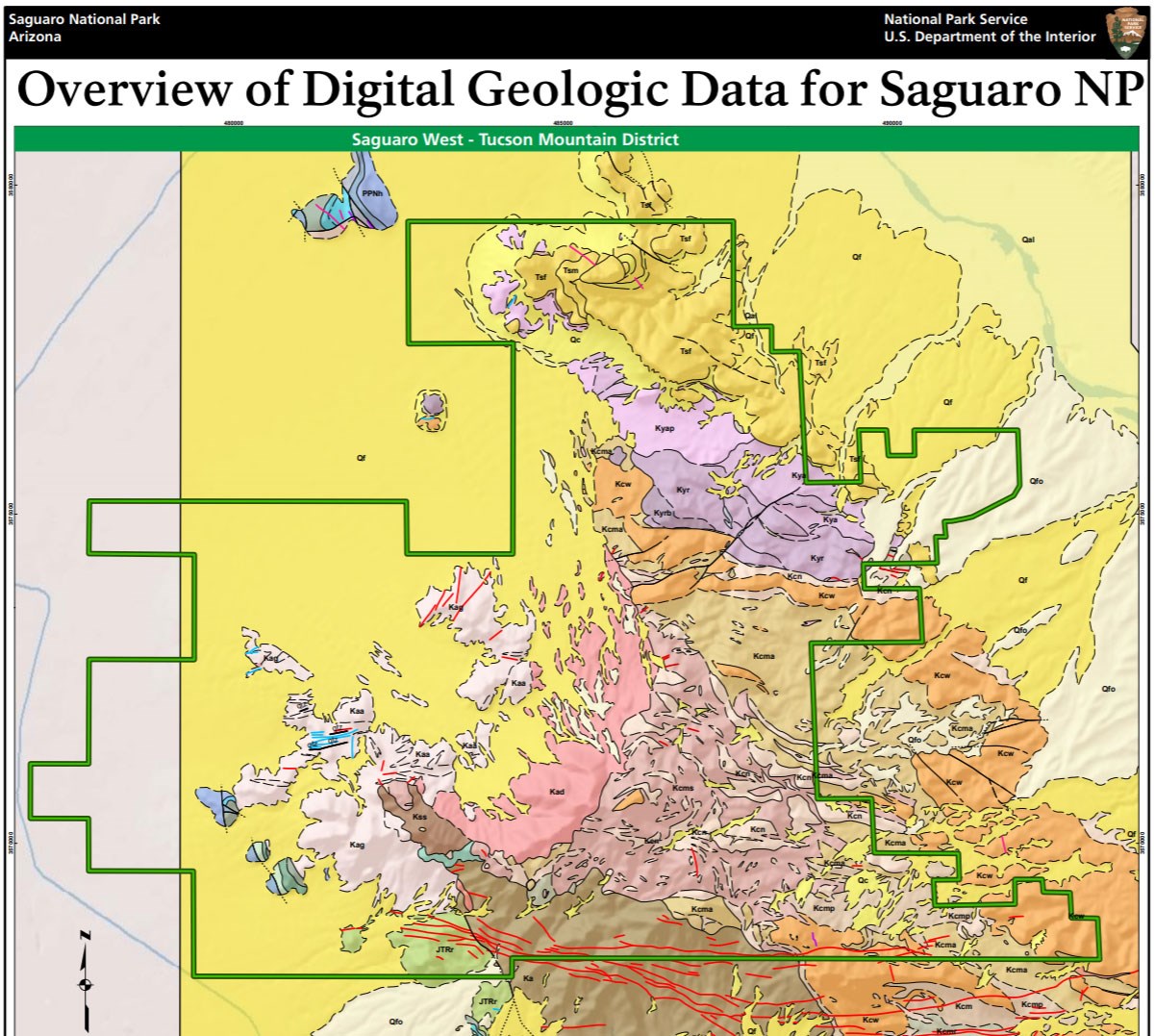
- Digital geologic maps include files for viewing in GIS software, a guide to using the data, and a document with ancillary map information. Newer products also include data viewable in Google Earth and online map services.
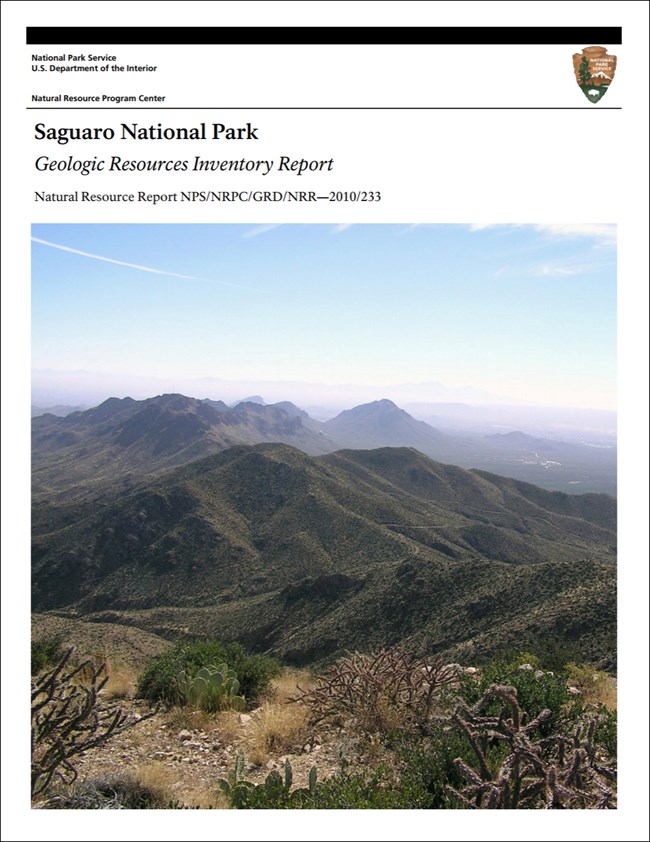
- Reports use the maps to discuss the park’s setting and significance, notable geologic features and processes, geologic resource management issues, and geologic history.
- Posters are a static view of the GIS data in PDF format. Newer posters include aerial imagery or shaded relief and other park information. They are also included with the reports.
- Projects list basic information about the program and all products available for a park.
Source: NPS DataStore Saved Search 3161. To search for additional information, visit the NPS DataStore.
A NPS Soil Resources Inventory project has been completed for Saguaro National Park and can be found on the NPS Data Store.
Source: NPS DataStore Saved Search 3112. To search for additional information, visit the NPS DataStore.
Related Articles
Saguaro National Park
National Park Service Geodiversity Atlas
The servicewide Geodiversity Atlas provides information on geoheritage and geodiversity resources and values within the National Park System. This information supports science-based geoconservation and interpretation in the NPS, as well as STEM education in schools, museums, and field camps. The NPS Geologic Resources Division and many parks work with National and International geoconservation communities to ensure that NPS abiotic resources are managed using the highest standards and best practices available.


