Last updated: July 11, 2024
Article
NPS Geodiversity Atlas—Organ Pipe Cactus National Monument, Arizona
Geodiversity refers to the full variety of natural geologic (rocks, minerals, sediments, fossils, landforms, and physical processes) and soil resources and processes that occur in the park. A product of the Geologic Resources Inventory, the NPS Geodiversity Atlas delivers information in support of education, Geoconservation, and integrated management of living (biotic) and non-living (abiotic) components of the ecosystem.

Introduction
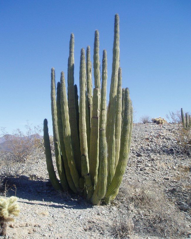
Organ Pipe Cactus National Monument (ORPI) is situated along the U.S.–Mexico border about 170 km (106 mi) southwest of Phoenix and 64 km (40 mi) south of Ajo in Pima County, Arizona. Proclaimed on April 13, 1937, ORPI contains approximately 133,825 hectares (330,689 acres) and preserves the diverse natural resources of the Sonoran Desert, including mountains, bajadas, valleys, and washes that support unique biological communities including the namesake organ pipe cactus. The rich biological diversity of ORPI has been continuously studied since the early 1940s, serving an international role in research, conservation, and education (National Park Service 2016g). Natural communities in ORPI have adapted to the extreme temperatures, intense sunlight, and little rainfall associated with the Sonoran Desert, and include 26 species of cactus, numerous rare plants, and endangered species such as the Quitobaquito pupfish, Sonoran pronghorn, and lesser long-nosed bat. In 1976 the monument was designated a United Nations Educational, Scientific and Cultural Organization (UNESCO) Biosphere Reserve in recognition for its globally significant biological resources that are representative of the natural Sonoran Desert ecosystem (National Park Service 2016a).
Geologic Setting
Organ Pipe Cactus National Monument encompasses a diverse suite of rock lithologies and unique morphologic features that record a complex geologic history. A simplified history of the ORPI region since the beginning of the Mesozoic can be broken down into three main geologic episodes: (1) Jurassic and Cretaceous igneous intrusions, volcanic activity, and deformation; (2) Late Cretaceous and early Cenozoic igneous intrusions accompanied by widespread metamorphism and contractional deformation; and (3) Neogene (Miocene–Quaternary) volcanism and extension that lowered the landscape elevation (Bezy et al. 2000). Widespread bedrock units mapped in ORPI include Jurassic rocks of La Abra and Miocene igneous rocks of the Childs Latite, Batamote Andesite complex, and rhyolite of Montezuma’s Head. The landscape of the monument is dominated by Cenozoic alluvium and colluvium that form broad alluvial plains typical of the Basin and Range physiographic province.

Volcanic Features and Processes
Organ Pipe Cactus National Monument includes part of the ancient Pinacate volcanic field, which covers more than 1,900 square miles (4,920 km2 ). Distinctive rocks of this volcanic field are displayed along the steep mountain front of the northern Ajo Range in the monument. These volcanic rocks are rhyolite and tuff. Opal and silica veins occur in the rhyolite. As discussed in A Guide to the Geology of Organ Pipe Cactus National Monument and Pinacate Biosphere Reserve, rhyolite formed from short, thick, bulbous lava flows during relatively quiet, non-explosive eruptions. Being relatively rich in silica, these rhyolite flows were viscous, which resulted in flowage of only a few miles from their eruptive vents. These flows are representative of the entire Ajo Range, which is a testament to high viscosity. The rhyolite flows appear as massive, darker rocks in the mountain faces. Lighter-colored layers of tuff separate the rhyolite flows. Tuff is composed of rhyolitic volcanic ash and small rock fragments ejected during shorter, explosive eruptions. The sequence of flows is more than 2,000 feet (610 m) thick, highlighting a brief but intense burst of volcanic activity between 16 and 18 million years ago. The most recent eruptions of the field occurred during the 1600s about 400 miles (250 km) southwest of the monument. Present-day eruptions from this volcanic field would result in ash or cinders being deposited in the monument.
Regional Geology
Organ Pipe Cactus National Monument is a part of the Basin and Range Physiographic Province and shares its geologic history and some characteristic geologic formations with a region that extends well beyond park boundaries.
- Scoping summaries are records of scoping meetings where NPS staff and local geologists determined the park’s geologic mapping plan and what content should be included in the report.
- Digital geologic maps include files for viewing in GIS software, a guide to using the data, and a document with ancillary map information. Newer products also include data viewable in Google Earth and online map services.
- Reports use the maps to discuss the park’s setting and significance, notable geologic features and processes, geologic resource management issues, and geologic history.
- Posters are a static view of the GIS data in PDF format. Newer posters include aerial imagery or shaded relief and other park information. They are also included with the reports.
- Projects list basic information about the program and all products available for a park.
Source: NPS DataStore Saved Search 3136. To search for additional information, visit the NPS DataStore.
A NPS Soil Resources Inventory project has been completed for Organ Pipe Cactus National Monument and can be found on the NPS Data Store.
Source: NPS DataStore Saved Search 3087. To search for additional information, visit the NPS DataStore.
Related Articles
Organ Pipe Cactus National Monument
National Park Service Geodiversity Atlas
The servicewide Geodiversity Atlas provides information on geoheritage and geodiversity resources and values within the National Park System. This information supports science-based geoconservation and interpretation in the NPS, as well as STEM education in schools, museums, and field camps. The NPS Geologic Resources Division and many parks work with National and International geoconservation communities to ensure that NPS abiotic resources are managed using the highest standards and best practices available.

