Last updated: December 29, 2022
Article
Stratotype Inventory—Yellowstone National Park, Wyoming, Montana, and Idaho
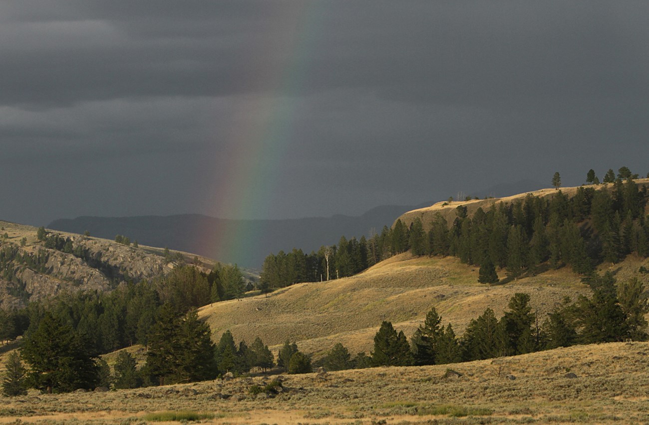
NPS photo by Jim Peaco.
Introduction
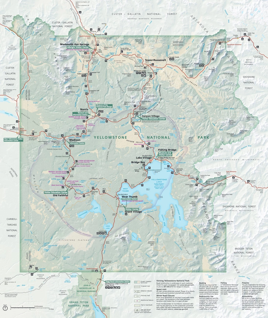
Yellowstone National Park (YELL) is located in parts of Wyoming, Montana, and Idaho (Figure 19). Established on March 1, 1872, YELL is the first and oldest national park in the United States and spans an area of 898,317.5 hectares (2,219,791 acres) (Anderson 2017). YELL forms the core of the Greater Yellowstone Ecosystem–one of the largest nearly intact temperate-zone ecosystems on Earth, home to elk, bison, bighorn sheep, wolves, grizzly bears, and more than 1,000 species of native plants. Old Faithful Geyser, Grand Prismatic Spring, Mammoth Hot Springs, and some 10,000 other geothermal features make this park the greatest geyser area on the planet (Anderson 2017). The vast natural wealth of YELL also includes lakes, waterfalls, high mountain meadows, and the Grand Canyon of the Yellowstone. YELL has been designated as both a Biosphere Reserve in 1976 and World Heritage Site in 1978.
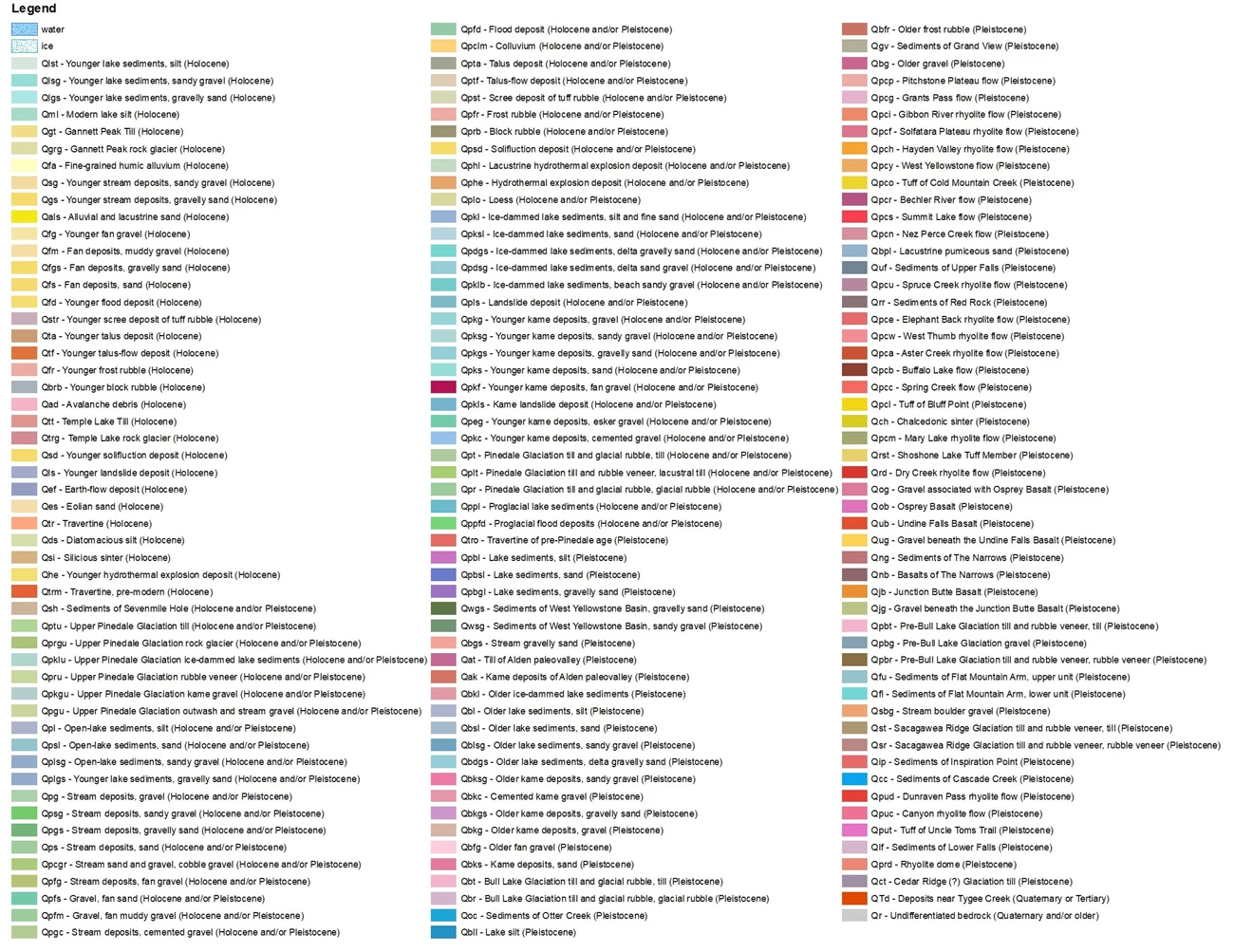
YELL represents one of the most geologically dynamic areas on Earth, with a landscape that has been shaped by a variety of processes. Large areas of the park have been buried by multiple cycles of Tertiary (Paleogene Period) and Quaternary volcanism associated with the Yellowstone hotspot in addition to Pleistocene glacial deposits (Figures 20–23). Older Paleozoic and Mesozoic rocks are exposed in a few areas where erosion and glacial scouring has uncovered these units (Santucci 1998). Precambrian through Upper Cretaceous strata are exposed in the Gallatin Range. Jurassic rocks and a thick section of Cretaceous strata are exposed on Mount Everts. Precambrian and Paleozoic units outcrop in the northeast corner of the park. Paleozoic rocks are also exposed in the Birch Hills and Snake River areas along the southern boundary of Yellowstone (Santucci 1998).
Significance and Geologic Resource Values
The Yellowstone National Park Foundation Document (2014) references the following significance statement, “Yellowstone National Park was set aside because of its geothermal wonders — the planet’s most active, diverse, and intact collection of geothermal, geologic, and hydrologic features and systems and the underlying volcanic activity that sustains them.”
The following geological fundamental resources and values have been identified for YELL:
- Geothermal wonders. YELL contains an unparalleled collection of more than 10,000 thermal features, including geysers, hot springs, mud pots, and fumaroles, which are fed by underground geothermal and hydrothermal systems. They provide habitats for microorganisms and other wildlife, and unique opportunities for research.
- Dynamic geologic processes and features. YELL’s dramatic landscapes, including the Grand Canyon of the Yellowstone, Overhanging Cliff, and Obsidian Cliff, were shaped by volcanism, glaciation, erosion, and seismic activity. These processes have resulted in exposed and hidden geology and produce a varied landscape that provides unique habitat for many species.
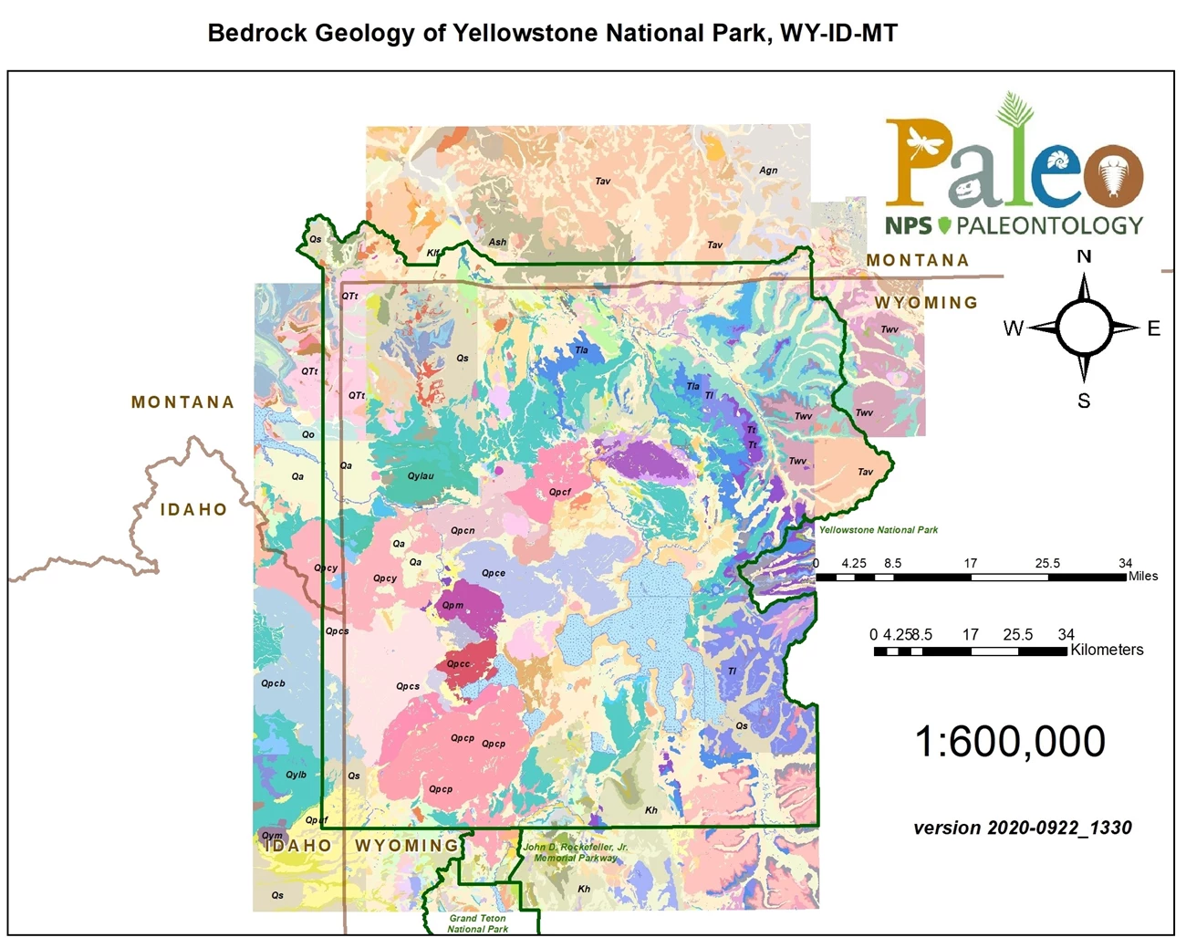
NPS Geologic Resources Inventory map.
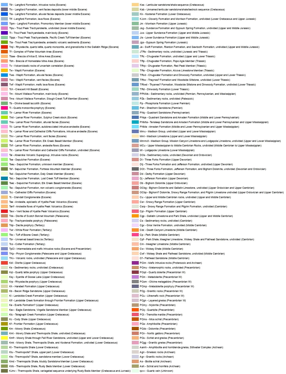
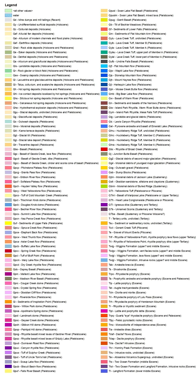
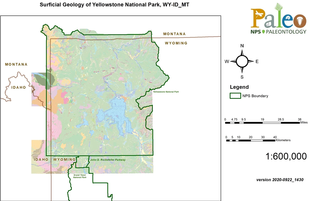
NPS Geologic Resources Inventory map.
Stratotypes in Yellowstone
YELL contains a total of 31 stratotypes that can be subdivided into three type sections, three reference sections, five type localities, and 20 type areas (see Table below; Figure 24).
| Unit Name (map symbol) | Reference | Stratotype Location | Age |
|---|
Geologic Time Scale
Location Map
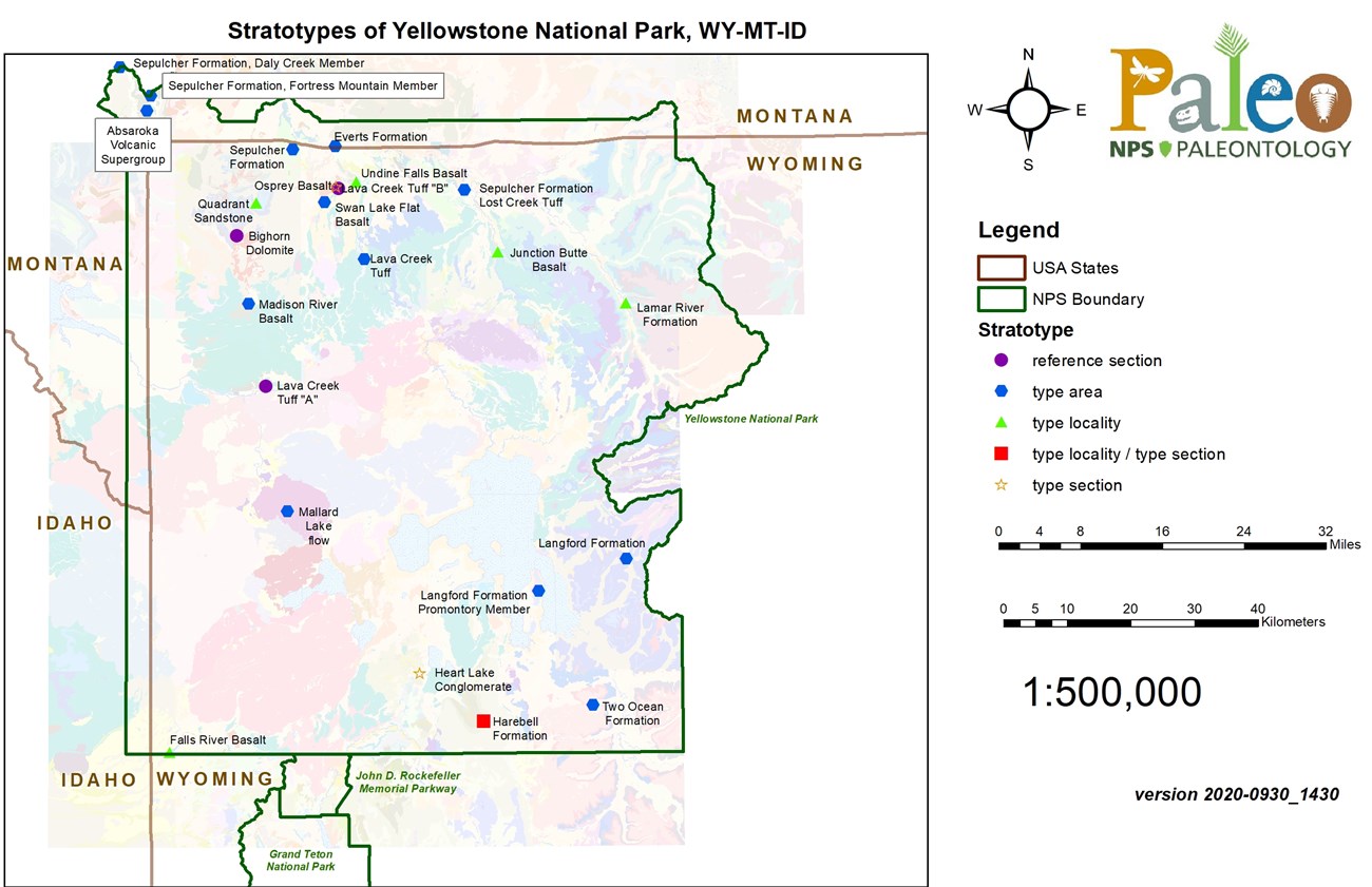
NPS Geologic Resources Inventory base map.
The oldest stratotype unit for YELL is the Ordovician Bighorn Dolomite. Originally named by Darton (1904) after exposures in the Bighorn Mountains, the formation is described as a massive, light-brownish-gray dolomite that weathers pale yellowish brown to light gray and has a distinctive irregular or pitted surface (Figure 25; Darton 1904; Ruppel 1972). Texturally, the dolomite is very fine- to fine-grained, partly laminated, and contains light gray to yellowish-orange chert lenses that are as much as 3 cm (0.1 ft) thick and 1.5 m (5 ft) long (Ruppel 1972). Ruppel (1972) designated the reference section after 30.5 m (100 ft)-thick exposures on Three Rivers Peak at the head of the Gallatin River (Figure 24).
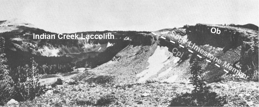
Figure modified from Ruppel (1972).
The Pennsylvanian Quadrant Sandstone was originally named by Peale (1893) from the Quadrant Mountains in the Gallatin Range in the northwest corner of YELL, Wyoming. The unit is described as consisting of brown, cross-bedded sandstone and white, yellowish, and occasionally pink beds of quartzite, with intercalated beds of drab saccharoidal limestones (Weed 1896; Sando et al. 1985). The type locality is designated in the Quadrant Mountains where the formation averages 122 m (400 ft) thick and forms a picturesque bluff encircling the mountain (Figure 24; Weed 1896).
The Upper Cretaceous Everts Formation was first described by Fraser et al. (1969) as the upper Cretaceous strata that overlie the Eagle Sandstone and unconformably underlie the Landslide Creek Formation on Mount Everts southeast of Gardiner. The formation is characterized by interbedded light-colored, fine-grained, lenticular sandstone and medium to light-gray mudstone. Fraser et al. (1969) described the type area as the west half of the northern projection of Mount Everts, where it extends northward about 4 km (2.5 mi) from the Wyoming–Montana border nearly to the Yellowstone River (Figure 24). Type area exposures of the Everts Formation measured on Mount Everts reach a thickness of approximately 381 m (1,250 ft).
The Upper Cretaceous Harebell Formation represents the oldest type section unit of the park and was named after Harebell Creek along the south boundary of YELL. Love (1956) used the name to describe a 1,524 m (5,000 ft) succession of quartzite pebble conglomerate, olive-drab to gray sandstone, drab-colored siltstone, claystone, and shale unconformably overlying older Cretaceous rocks and unconformably overlain by Paleocene and younger Tertiary rocks (Figure 26). The type locality was first described as extending from the head of the Snake River gorge southward over Big Game Ridge, about 3 km (2 mi) east of Mount Hancock, and on across Wolverine Creek to the north base of Pinyon Peak (Love 1956). Love (1973) later designated a type section extending from the Snake River southward along the top of Big Game Ridge (Figures 24 and 27). The basal type section is exposed in the bottom of Snake River Canyon about 1.6 km (1 mi) southwest of Barlow Peak, in southern YELL and the top is exposed at the head of a north-facing cirque wall on the divide between Wolverine and Fox creeks, 5.6 km (3.5 mi) south of the park boundary (Love 1973).
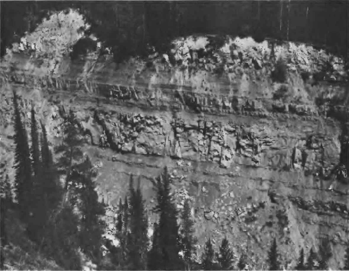
Figure from Love (1973).

Figure 27. View looking northeast from top of Mount Hancock showing, at extreme right margin, the basal part of the type section of the Harebell Formation. Indicated are the unconformable contact between the Bacon Ridge Sandstone (Kb) and Harebell Formation (Kh) (A), Chicken Ridge and exposure of 914 m (3,000 ft) of Harebell (B), Sickle Creek (C), Barlow Peak and exposure of 823 m (2,700 ft) of Harebell (D), Cody Shale (E), and Southeast Arm of Yellowstone Lake (F).
Figure modified from Love (1973).
The Eocene Sepulcher Formation, and the associated Lost Creek, Daly Creek, and Fortress Mountain Members, all occur in northwestern and north-central YELL and were proposed by Smedes and Prostka (1972). The formation is named for the type area of Sepulcher Mountain, where a nearly complete section is exposed in the cliffs on the north face (Figure 24; Smedes and Prostka 1972). Type area exposures are more than 914 m (3,000 ft) thick and consist of coarse alluvial facies that grade upward into vent facies rock (Figure 28; Smedes and Prostka 1972). Andesite lava flows and flow breccias constitute the upper 366 m (1,200 ft) of section.

Figure from Smedes and Prostka (1972).
The Lost Creek Tuff Member of the Sepulcher Formation was formally named by Howard (1937) to describe scattered outcrops of buff- to yellow-weathering purple and gray welded tuff found in the Tower Junction area of YELL. The unit is named after typical exposures that occur in the meadow of Lost Creek. Stratigraphically, the Lost Creek Tuff Member overlies the Elk Creek Basalt Member and is overlain by the Daly Creek Member in the vicinities of Sepulcher Mountain and Crescent Hill. The member is characterized as a sequence of yellowish-gray rhyodacite welded ash-flow sheets containing abundant phenocrysts of sanidine, andesine, and biotite with minor amounts of hornblende (Smedes and Prostka 1972). Flattened pumice fragments and bits of charred wood are common (Brown 1961; Smedes and Prostka 1972). The type area is located near Lost Creek, northwest of Tower Junction where exposures are about 107 m (350 ft) thick and thicken westward to a maximum 305 m (1,000 ft) north of Sepulcher Mountain (Figure 24; Smedes and Prostka 1972).
The Daly Creek Member represents the lower part of the Sepulcher Formation in the Bighorn Peak region of the Gallatin Range and is characterized by Smedes and Prostka (1972) as a sequence of light-colored andesitic volcaniclastic strata consisting of vent and alluvial facies. Stratigraphically, the Daly Creek Member unconformably overlies highly deformed rocks of Late Cretaceous or Paleocene (Paleogene Period) age and underlies the Fortress Mountain Member (Smedes and Prostka 1972). The type area is defined as the headwaters region of Daly Creek in the northwest corner of YELL, where the unit consists of 244 m (800 ft) of vent facies near the mouth of Specimen Creek and grades northward to 122 m (400 ft) of fine-grained alluvial facies on the ridge at the head of Daly Creek (Figure 24; Smedes and Prostka 1972).
Smedes and Prostka (1972) proposed the Fortress Mountain Member after the upper, dark-gray coarse alluvial facies of andesitic volcaniclastic rocks of the Sepulcher Formation. The type area is located at Bighorn Peak, where the member is divided into three informal units that are well-exposed on the south slope (Figure 24; Smedes and Prostka 1972). Exposures in the type area consist of upper and lower dark-gray cliff-forming units of crudely bedded, poorly sorted conglomerate, and a middle unit of light-gray poorly resistant conglomerate with multi-colored clasts in an ashy matrix (Smedes and Prostka 1972). All three informal units contain tuffaceous sandstone, siltstone, and mudstone with an abundant concentration of petrified trees in more than 30 distinct fossil horizons; some trees exceed 1.2 m (4 ft) in diameter and are preserved in their upright growth position (Smedes and Prostka 1972).
The Eocene (Paleogene Period) Lamar River Formation was named after exposures found along the rugged valley walls of the Lamar River and its tributaries (Smedes and Prostka 1972). Sections of the Lamar River Formation found in the valley walls show nearly all of the lithologic variation of the formation, which led Smedes and Prostka (1972) to designate this region the type area (Figure 24). The formation is unconformably overlain by the Langford Formation and unconformably overlies the Sepulcher Formation. The unit is characterized as a sequence of medium-brown andesitic lavas and volcaniclastic rocks with minor mafic lava flows (Smedes and Prostka 1972). The well-bedded coarse alluvial facies volcanic conglomerates, breccias, and tuffs of the Lamar River Formation are known to contain some of the most impressive and best-preserved fossil forests in YELL (Figure 29; Smedes and Prostka 1972). Concentrated in at least 27 horizons, these fossil forests include hundreds of petrified tree trunks, and thousands of fossilized leaves, twigs, needles, cones, and seeds of more than 100 species of plants (Smedes and Prostka 1972).
The Eocene Slough Creek Tuff Member of the Mount Wallace Formation was named by Smedes and Prostka (1972). The unit is exposed in only two areas of the park:
- in the type area west of Slough Creek 3 km (2 mi) south of the northern YELL boundary (Figure 24); and
- along Buffalo Creek (Smedes and Prostka 1972). At the type area the unit is approximately 213 m (700 ft) thick and underlies mafic lava flows (Smedes and Prostka 1972).
The tuff is characterized as a composite sheet of rhyodacite welded ash-flow tuff. Ash flows of the member contain variable proportions of quartz, sanidine, biotite phenocrysts, as well as abundant basaltic and andesitic fragments of the Mount Wallace Formation (Smedes and Prostka 1972).
The Eocene Langford Formation was named after well-exposed 610 m (2,000 ft)-sections that occur in the type area at Mount Langford (Figure 24; Smedes and Prostka 1972). The Langford Formation overlies the Trout Peak Trachyandesite and is unconformably overlain by the Two Ocean Formation in the east-central region of YELL. Smedes and Prostka (1972) described the unit as a thick section of light-colored andesitic volcaniclastic strata and lava flows of vent and alluvial facies (Figure 30). The Promontory Member of the Langford Formation is named for several eastward-thinning tongues of dark massive volcanic conglomerate and breccia found interbedded with the more typical lighter colored strata of the Langford Formation (Smedes and Prostka 1972). Well-exposed 183 m (600 ft)-thick sections of the Promontory Member occur in the type area of the Promontory, a peninsula separating the Southeast Arm and South Arm of Yellowstone Lake (Figure 24; Smedes and Prostka 1972).

Figure 29. Well-bedded coarse alluvial facies, volcanic conglomerates, sandstones, breccias and air-fall tuff of the Lamar River Formation in the Fossil Forest, along the northeast side of Specimen Ridge, YELL. Figure from Smedes and Prostka (1972).

Figure from Smedes and Prostka (1972).
The Eocene (Paleogene Period) Two Ocean Formation was proposed by Smedes and Prostka (1972) for a sequence of dark-colored thick-bedded coarse andesitic volcaniclastic rock of alluvial and vent facies which overlie the Langford Formation in the southeastern park of YELL. Named for the type area designated along the precipitous east edge of Two Ocean Plateau, the exposed sections occur in prominent dark cliffs between the light-colored less resistant Langford Formation below and Wiggins Formation above (Figure 24; Smedes and Prostka 1972). In the Eagle Peak region, the Two Ocean Formation reaches a maximum thickness of approximately 610 m (2,000 ft).
Volcanic rocks of the Absaroka Volcanic Supergroup in the YELL region are of Early, Middle and possibly Late Eocene age and consist of deeply eroded andesitic and basaltic strata (Smedes and Prostka 1972). The name and type area were designated by Smedes and Prostka (1972) after the Absaroka volcanic field of northwestern Wyoming and southwestern Montana (Figure 24).
The Pliocene–Pleistocene ( see Neogene, Quaternary) age Heart Lake Conglomerate is characterized as a distinctive conglomerate that overlaps Mesozoic rocks and the Pinyon Conglomerate and underlies Pleistocene rhyolitic sequences in the Mount Sheridan area. The conglomerate has distinctive features that include: lithic fragments ranging in size from sand to boulders 0.9 m (3 ft) in diameter, most of which were derived from the Mississippian Madison Limestone; an abundance of waxy talc and chloritic claystone fragments; and an increased abundance of rhyolitic debris in the middle and upper parts (Love and Keefer 1969). The type section location is described as the east and south slopes of Mount Sheridan, where the strata are exposed on a steep south-facing headwall at the base of the great bare precipitous slope that rises 518 m (1,700 ft) to the top of the mountain (Figures 24 and 31; Love and Keefer 1969). The type section of the Heart Lake Conglomerate is approximately 100 m (330 ft) thick.
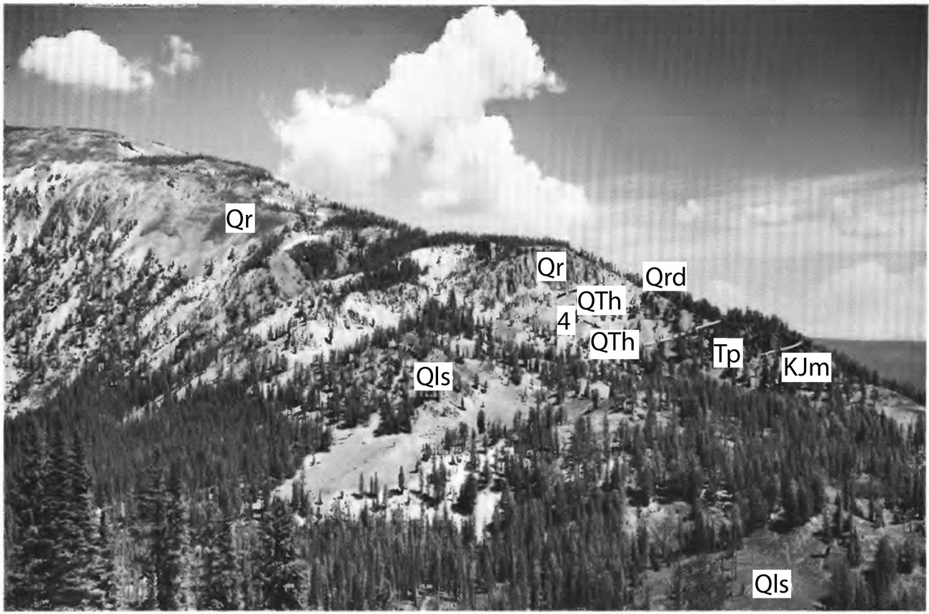
Figure 31. View north across Basin Creek toward the type section of the Heart Lake Conglomerate, YELL. Indicated are the main mass of rhyolite welded tuff (Qr) on Mount Sheridan, the Heart Lake Conglomerate (QTh), marker bed (4) described in measured section of Love and Keefer (1969), Pinyon Conglomerate (Tp), Cloverly and Morrison(?) Formations (KJm), dike of rhyolite mixed with Pinyon Conglomerate (Qrd), and landslide debris (Qls). Figure modified from Love and Keefer (1969).
The Pliocene (Neogene Period) Junction Butte Basalt was originally named by Howard (1937) after the prominent butte separating the Yellowstone and Lamar rivers. Stratigraphically, the Junction Butte Basalt conformably underlies the Huckleberry Ridge Tuff and is considered the oldest unit associated with the first volcanic cycle of the rhyolite plateau in YELL (Christiansen and Blank 1972; Christiansen 2001). The basalt is characterized as being aphanitic with sparse to abundant phenocrysts of labradorite plagioclase and an abundant olivine groundmass (Christiansen 2001). Although outcrops of Junction Butte Basalt occur in the Yellowstone River valley and on adjacent uplands from Deep Creek to Blacktail Deer Creek and Mount Everts, the type locality is designated as the west side of the Grand Canyon of the Yellowstone opposite the mouth of Deep Creek (Figure 24; Christiansen and Blank 1972). Christiansen and Blank (1972) state that the type locality basalt section is approximately 90 m (300 ft) thick, consists of three or four thick flows, and is overlain unconformably by the Wapiti Lake flow of the Mount Jackson Rhyolite and by the Lava Creek Tuff. A few kilometers downstream, the Junction Butte Basalt is exposed in the Overhanging Cliff flow, a spectacular roadside cliff north of Tower Creek where the flow is characterized by well-developed two-tiered columnar jointing (Figure 32; Christiansen and Blank 1972; Christiansen 2001).

Figure from Christiansen (2001).
The Pleistocene Mount Jackson Rhyolite was named by Christiansen and Blank (1972) after exposures high in the cliffs forming the north wall of the Madison Canyon 5.5 km (3.4 mi) west of Madison Junction, YELL. The type area is designated as the Madison Canyon near Mount Jackson (Figure 24; Christiansen and Blank 1972). In the type area the base of the Mount Jackson Rhyolite lava flows are not exposed, but the formation is conformably overlain by the Lava Creek Tuff (Christiansen and Blank 1972). The formation is characterized as consisting of rhyolitic lava flows that are quite varied in appearance, typically containing 30–50% large phenocrysts of quartz, sanidine, plagioclase, and minor opaque oxides and clinopyroxenes (Christiansen and Blank 1972).
The Quaternary Undine Falls Basalt was named by Christiansen and Blank (1972) for the waterfall on Lava Creek near the Mammoth–Tower Junction Road just south of Mount Everts, Yellowstone National Park, Wyoming. The Undine Falls Basalt erupted during the third volcanic cycle of the Yellowstone Plateau and conformably underlies the Lava Creek Tuff and overlies lower Tertiary intrusive dacite and Cretaceous sedimentary rocks (Christiansen and Blank 1972; Christiansen 2001). Christiansen and Blank (1972) designated the type locality as the cliff on the north side of Lava Creek canyon just west of the falls (Figure 24). The type locality basalt section measures 6 m (20 ft) thick and consists of several thin basaltic flows. Flows of the Undine Falls Basalt in and near the type locality originated from unknown vents located north and northwest of the Washburn Range and flowed down deeply eroded valleys that follow the present courses of the Gardner and Yellowstone Rivers (Christiansen 2001).
The Pleistocene (Quaternary Period) Lava Creek Tuff represents the upper ash-flow sheet of the Yellowstone Group that overlies the Huckleberry Ridge Tuff and is overlain by most of the younger units of the third volcanic cycle in and near YELL (Christiansen and Blank 1972). The unit was named by Christiansen and Blank (1972) after the type area in the upper canyon walls of Lava Creek and its tributary, Arrow Creek (Figure 24). Type area exposures overlie the Huckleberry Ridge Tuff and consist of a 210 m (689 ft)-thick section.
Two distinct members of the Lava Creek Tuff, A and B, were described by Christiansen and Blank (1972) and Christiansen (2001). The two members are separated by a zone of strongly jointed but weakly welded crystal ash and have a noticeable difference in the welding-density profile of the tuff, with lower member A representing a less densely welded section than upper member B (Figures 33–35; Christiansen and Blank 1972; Christiansen 2001). Christiansen and Blank (1972) designated the reference section for member A as the south-facing cliff of Purple Mountain above an old gravel pit about 1 km (0.6 mi) east of Madison Junction (Figure 24). The 180 m (590 ft) thick exposures overlie the Mount Jackson Rhyolite, are overlain by member B, and contain conspicuous collapsed pumice and an abundance of rhyolitic lithic inclusions (Christiansen and Blank 1972). The reference section for member B is on the east wall of Sheepeater Canyon on the Gardner River, 1 km (0.6 mi) northeast of Osprey Falls (Figure 24). The well-exposed section is 140 m (459 ft) thick, overlies the Undine Falls Basalt, and is overlain by the Swan Lake Flat Basalt (Christiansen and Blank 1972).

Figure from Christiansen (2001).
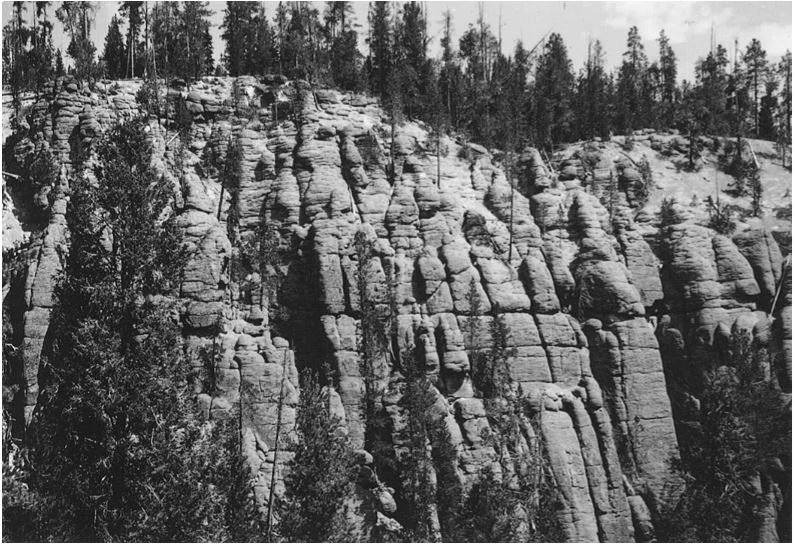
Figure from Christiansen (2001).
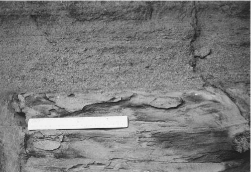
Figure from Christiansen (2001).
The Pleistocene (Quaternary Period) Swan Lake Flat Basalt was introduced by Christiansen and Blank (1972) to describe basalts younger than the Lava Creek Tuff but older than an unconformity that represents the first major period of canyon cutting into the Lava Creek in the area north of Obsidian Cliff, YELL. Christiansen and Blank (1972) named the unit after a valley partly surrounded and largely underlain by lavas about 8 km (5 mi) southwest of Mammoth. The type area of the Swan Lake Flat Basalt is designated as the Sheepeater Cliffs, on the east side of the canyon of the Gardner River southeast of Bunsen Peak (Figure 24; Christiansen and Blank 1972). Exposures in the type area are from the lower part of the sequence and conformably overlie the Lava Creek Tuff and are locally overlain by flows of the Plateau Rhyolite (Christiansen and Blank 1972; Christiansen 2001).
The Pleistocene Falls River Basalt was originally described by Christiansen and Blank (1972) to include all basalts younger than the Lava Creek Tuff and older than the Central Plateau Member of the Plateau Rhyolite in the southwest corner of YELL. The unit takes its name from the Falls River that drains the nearby area. The Falls River Basalt is characterized as a moderate gray basalt that forms dense, thin flows with vesicular tops (Christiansen and Blank 1972). Lithologically, the basalts contain sparse phenocrysts of plagioclase approximately 0.5–1.0 cm (0.2–0.4 in) in diameter. The type locality is designated as the west rim of the valley of Falls River just below Cave Falls, where the basalt exposures conformably overlie the Lava Creek Tuff and are overlain by upper Pleistocene glacial deposits (Figure 24; Christiansen and Blank 1972).
The Pleistocene Upper Basin Member of the Plateau Rhyolite was defined by Christiansen and Blank (1972) to include early post-caldera rhyolitic lava flows and associated pyroclastic deposits that erupted within the Yellowstone caldera after resurgent doming. Christiansen and Blank (1972) named the member after its type area in the Upper Geyser Basin of YELL, where outcrops of the unit are widely distributed among the sediments and hydrothermal deposits that blanket the floor of the basin (Figure 24). Lava flows of the Upper Basin Member in the type area overlie the Mallard Lake Member and underlie the Central Plateau Member of the Plateau Rhyolite (Christiansen and Blank 1972). The member is characterized by abundant plagioclase phenocrysts, commonly containing oligoclase that is highly embayed (Christiansen and Blank 1972).
The Pleistocene-age Obsidian Creek Member of the Plateau Rhyolite was named by Christiansen and Blank (1972) for a series of isolated, extracaldera rhyolitic lava flows and domes located along Obsidian Creek, YELL. The type area consists of the mixed lavas of Gardner River and Grizzly Lake, as well as the eruptive domes of Paintpot Hill, Willow Park, Apollinaris Spring, Landmark, Gibbon Hill, and Geyser Creek (Figure 24; Christiansen and Blank 1972). The mixed lavas and domes occur in a north-trending belt that parallels Obsidian Creek between the Norris Geyser Basin area and the Gardner River (Christiansen and Blank 1972).
The Pleistocene Roaring Mountain Member of the Plateau Rhyolite was designated by Christiansen and Blank (1972) for four, isolated rhyolitic lava flows north of Yellowstone caldera near Roaring Mountain, YELL. The member consists of the Crystal Spring, Obsidian Cliff, Cougar Creek, and Riverside flows, which Christiansen and Blank (1972) designated as the type area (Figure 24). The lava flows of the Roaring Mountain Member are characterized as phenocryst-free or phenocryst-poor rhyolitic lava flows which contain abundant, fresh black obsidian as well as crystallized and partly crystallized material (Christiansen and Blank 1972).
The Pleistocene Madison River Basalt was designated by Christiansen and Blank (1972) to describe scattered patches of post-Lava Creek basalts that occur in the area south and west of the Gallatin Range near West Yellowstone. The type area is located in the basalt-covered uplands west of the south end of the Gallatin Range, south of upper Maple Creek (Figure 24; Christiansen and Blank 1972). Type area exposures lie on an eroded surface on the Lava Creek Tuff and are deeply mantled by upper Pleistocene glacial deposits and till of Bull Lake age (Christiansen and Blank 1972).
The Pleistocene Mallard Lake Member of the Plateau Rhyolite was defined by Christiansen and Blank (1972) and consists of a single rhyolitic lava flow (the Mallard Lake flow) that is approximately 120 m (390 ft) thick. The unit is named after the type area around Mallard Lake, a small lake about 5 km (3 mi) northeast of Old Faithful geyser (Figure 24; Christiansen and Blank 1972). A complex, northwest-trending graben system has uplifted and faulted the rhyolitic flow on the resurgent Mallard Lake dome (Christiansen and Blank 1972; Christiansen 2001). Christiansen and Blank (1972) report that the base of the Mallard Lake Member is obscure in outcrop and no complete sections are exposed.
The Pleistocene Osprey Basalt was named by Pierce et al. (1970) after Osprey Falls and described as a sequence of interlayered basalts and gravels which fill or partly fill the paleotopography cut in, or through both the upper part of the Yellowstone Tuff and conformably overlying basalts in the northern region of YELL. Christiansen and Blank (1972) redefined the Osprey Basalt to include basalts and interlayered gravels that are younger than the Swan Lake Flat Basalt and Lava Creek Tuff. The type section of the formation is described as the cliff exposure on the west side of Sheepeater Canyon, 975 m (3,200 ft) almost due north of Osprey Falls and just east of the closest approach in this vicinity of the Bunsen Peak Road to the rim of the canyon (Figure 24; Pierce et al. 1970). The type section exposure is approximately 61 m (200 ft) thick and consists of six flows of columnar-jointed basalt, several of which are separated by as much as 6 m (20 ft) of gravel in the lower part of the section (Pierce et al. 1970). The type section basalt rests above an eroded Eocene intrusive body which forms Bunsen Peak (Pierce et al. 1970).
The Pleistocene Central Plateau Member of the Plateau Rhyolite was named by Christiansen and Blank (1972) after the type area designation of the Central Plateau, located in the middle of the Yellowstone Caldera (Figure 24). Lava flows of the member form the Madison, Pitchstone, Central, and Solfatara plateaus, constituting the greatest portion of the total volume of the Plateau Rhyolite (Christiansen and Blank 1972). Eighteen separate lava flows have been mapped as parts of the member, with some flows measured at over 300 m (984 ft) thick. The flows are described as containing abundant phenocrysts, generally consisting of quartz and sanidine with no plagioclase (Christiansen and Blank 1972).
In addition to the designated stratotypes located within YELL boundaries, a list of stratotypes located within 48 km (30 mi) of park boundaries is included here for reference. These nearby stratotypes include the Cambrian Snowy Range Formation (type locality); Permian Shedhorn Sandstone (type section); Paleocene–Eocene (Paleogene Period) Pinyon Conglomerate (reference section); Eocene-age units of the Wapiti Formation (type section), Cathedral Cliffs Formation (type section), Hyalite Peak Volcanics (reference section), Mount Wallace Formation (type area), and Trout Peak Trachyandesite Pacific Creek Tuff Member (type area); and Pleistocene-age units of the Gerrit Basalt (type area) and Island Park Rhyolite Mesa Falls Tuff Member (type section & reference section).
Type Section Inventory Report—Greater Yellowstone Inventory & Monitoring Network
The information on this page is excerpted from a report covering four parks within the Greater Yellowstone Inventory and Monitoring Network (GRYN):
The full Network report is available in digital format from https://irma.nps.gov/DataStore/Reference/Profile/2280034
Please cite this publication as:
Henderson, T., V. L. Santucci, T. Connors, and J. S. Tweet. 2020. National Park Service geologic type section inventory: Greater Yellowstone Inventory & Monitoring Network. Natural Resource Report NPS/GRYN/NRR—2020/2198. National Park Service, Fort Collins, Colorado.
Leave No Trace—Protect Type Sections for Science

Many type sections and paleontological sites are vunerable to damage from careless visitation and over-use. Be sure to practice Leave No Trace princples whenever you are in the outdoors. Of particular importance at geoheritage sites is to:
-
Travel and camp on durable surfaces, and
-
Leave what you find.
If you see signs of vandalism or someone acting inappropriately during your visit to a park site, please contact a ranger at the park or make a report through NPS Investigative Services.
Related Links
- Bighorn Canyon National Recreation Area, Montana & Wyoming—[Geodiversity Atlas] [Park Home]
- Grand Teton National Park, Wyoming—[Geodiversity Atlas] [Park Home]
- Yellowstone National Park, Idaho, Montana, and Wyoming [Geodiversity Atlas] [Park Home]
- Geologic Time Scale
- America's Geoheritage
- NPS Paleontological Resource Inventory
- NPS Geologic Resources Inventory
- NPS Geodiversity Atlas
