Last updated: December 29, 2022
Article
Stratotype Inventory—Bighorn Canyon National Recreation Area, Wyoming and Montana
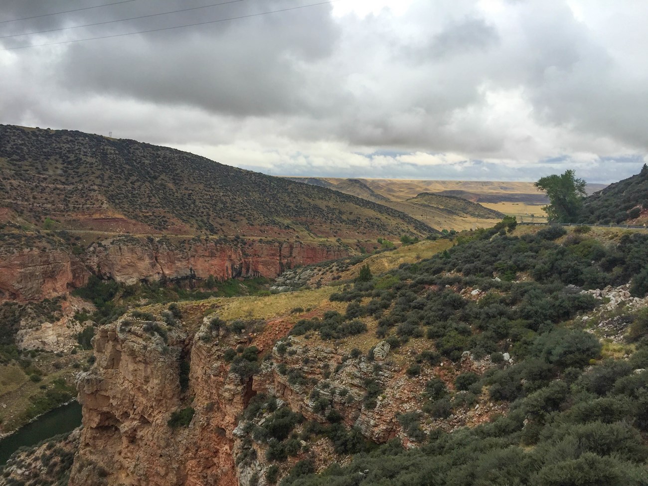
NPS photo by Victoria Stauffenberg.
Introduction
Bighorn Canyon National Recreation Area (BICA), located in Big Horn and Carbon counties, Montana and Big Horn County, Wyoming, was established on October 15, 1966 after construction of the Yellowtail Dam created the 114 km (71 mi) long Bighorn Lake (Figure 6). BICA serves as a national recreational area with boating, water skiing, fishing, swimming, hiking, sightseeing, and camping as popular activities. The national recreation area encompasses 48,641 hectares (120,196 acres), where archeological and historical resources complement the natural scene (Anderson 2017). Geographically located on the Montana–Wyoming border and adjacent to Crow tribal land, the national recreation area cooperates with two state governments, the Crow tribal government, and several federal entities including the Bureau of Land Management and the Bureau of Reclamation (KellerLynn 2011).
Bighorn Lake is nestled within the steep walls of Bighorn Canyon and is surrounded by a diverse landscape of broad valleys, flat uplands, and the Bighorn and Pryor mountain ranges (KellerLynn 2011). Shaped by the forces of stream erosion and mountain uplift, much of Bighorn Canyon is narrow with sheer vertical walls that rise above Bighorn Lake. The depth of Bighorn Canyon ranges considerably, from approximately 305 m (1,000 ft) at Devil Canyon to 760 m (2,500 ft) on Bull Elk Ridge. Such depths expose significant sections of the rock record ranging in age from the Archean Eon (4.0–2.5 billion years ago) (see The Precambrian) at the base of the Pryor Mountains, the Cambrian Period (542–488 million years ago), and the Mississippian Period (359–318 million years ago) (Figures 7 and 8).
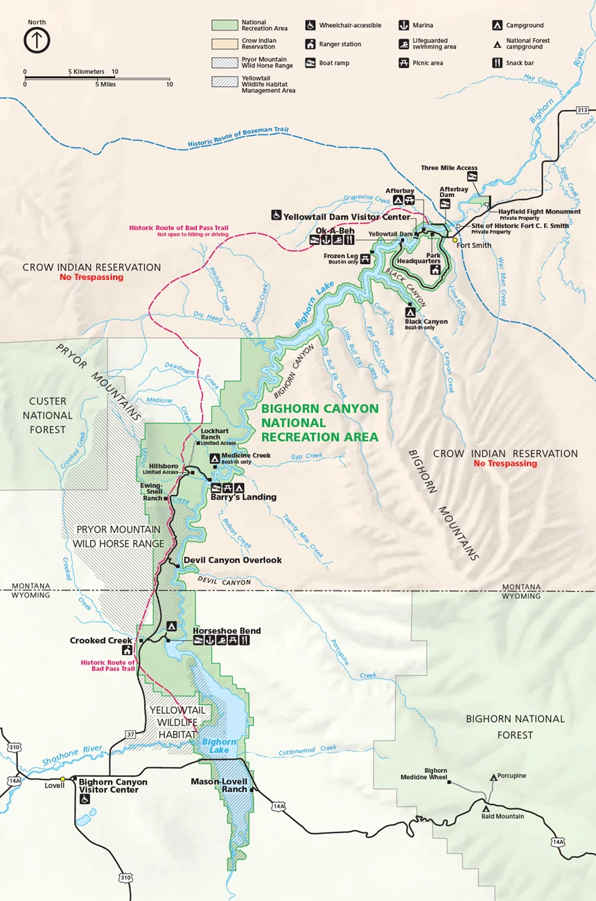
NPS image.
Significance and Geologic Resource Values
The Bighorn Canyon National Recreation Area Foundation Document (2016) references the following significance statement: “Landforms, remnant fossils, and evidence of ancient ecological conditions offer insight and comparison of the region’s geologic history and processes. These actions were critical to forming the canyon, the surrounding mountains, and the region’s water resources.”
The following fundamental resources and values have been identified for BICA: “Bighorn Canyon, created by geologic processes of uplift and erosion beginning about 75 million years ago. Bighorn Canyon reveals a record of its origin, ancient climate, and depositional environments within layers of exposed limestone and other rock strata. Fossil plants and animals exist in sedimentary rock layers deposited by bygone seas. Additional sedimentary layers formed after the seas receded. The Bighorn River gradually carved out the 50-mile-long canyon, with walls that rise to approximately 1,000 feet at Devil Canyon Overlook and more than 2,000 feet where the canyon crosses the northern end of the Bighorn Mountains.”
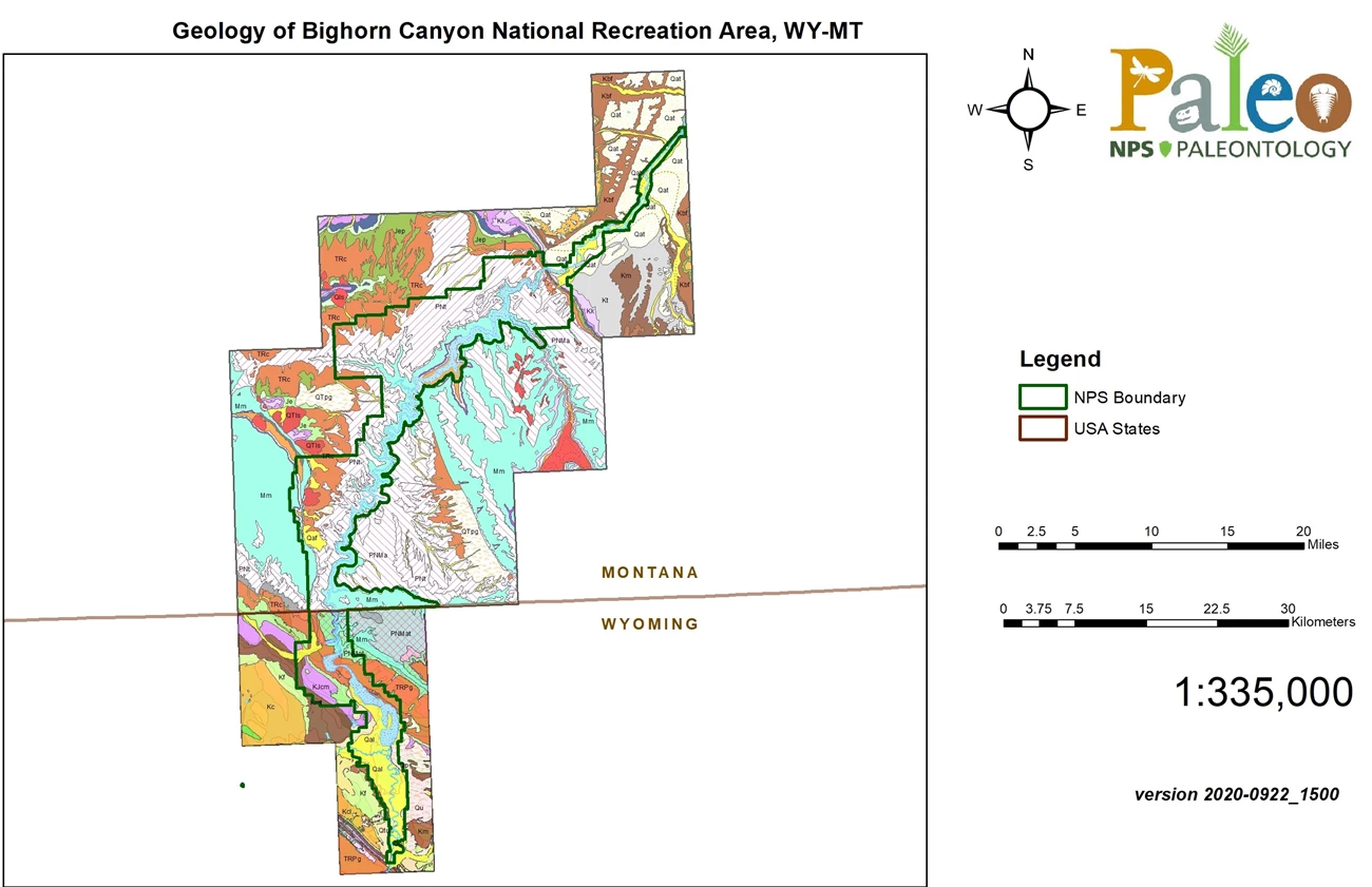
NPS Geologic Resources Inventory base map.

Stratotypes in Bighorn Canyon NRA
As of the writing of this paper, there are no designated stratotypes identified within the boundaries of BICA. There is one stratotype located within 48 km (30 mi) of BICA boundaries, for the Cretaceous Thermopolis Formation Muddy Sandstone Member (reference section).
Type Section Inventory Report—Greater Yellowstone Inventory & Monitoring Network
The information on this page is excerpted from a report covering four parks within the Greater Yellowstone Inventory and Monitoring Network (GRYN):
The full Network report is available in digital format from the Greater Yellowstone Inventory and Monitoring Network and Natural Resource Publications Management websites. To receive this report in a format optimized for screen readers, please email irma@nps.gov.
Please cite this publication as:
Henderson, T., V. L. Santucci, T. Connors, and J. S. Tweet. 2020. National Park Service geologic type section inventory: Greater Yellowstone Inventory & Monitoring Network. Natural Resource Report NPS/GRYN/NRR—2020/XXX. National Park Service, Fort Collins, Colorado.
Leave No Trace—Protect Type Sections for Science

Many type sections and paleontological sites are vunerable to damage from careless visitation and over-use. Be sure to practice Leave No Trace princples whenever you are in the outdoors. Of particular importance at geoheritage sites is to:
-
Travel and camp on durable surfaces, and
-
Leave what you find.
If you see signs of vandalism or someone acting inappropriately during your visit to a park site, please contact a ranger at the park or make a report through NPS Investigative Services.
Related Links
- Bighorn Canyon National Recreation Area, Montana and Wyoming—[Geodiversity Atlas] [Park Home] [NPSHistory.com]
- Geologic Time Scale
- America's Geoheritage
- NPS Paleontological Resource Inventory
- NPS Geologic Resources Inventory
- NPS Geodiversity Atlas
