
Last updated: January 31, 2025
Article
PARKS...IN...SPAAAACE!!!
When visiting parks, we often go in search of that perfect overlook to enjoy the scenery of parks from as high as we possibly can climb. NASA astronauts have quite literally an out-of-this-world view of national parks and take some pretty stellar pictures to share. Travel along with the space station on its journey west to east getting the extreme bird’s eye view of national parks across the country. And compare it to a more down-to-earth view.
Special thanks to our friends at NASA for taking pictures of us! Learn about other ways that NASA and the National Park Service work and play together.
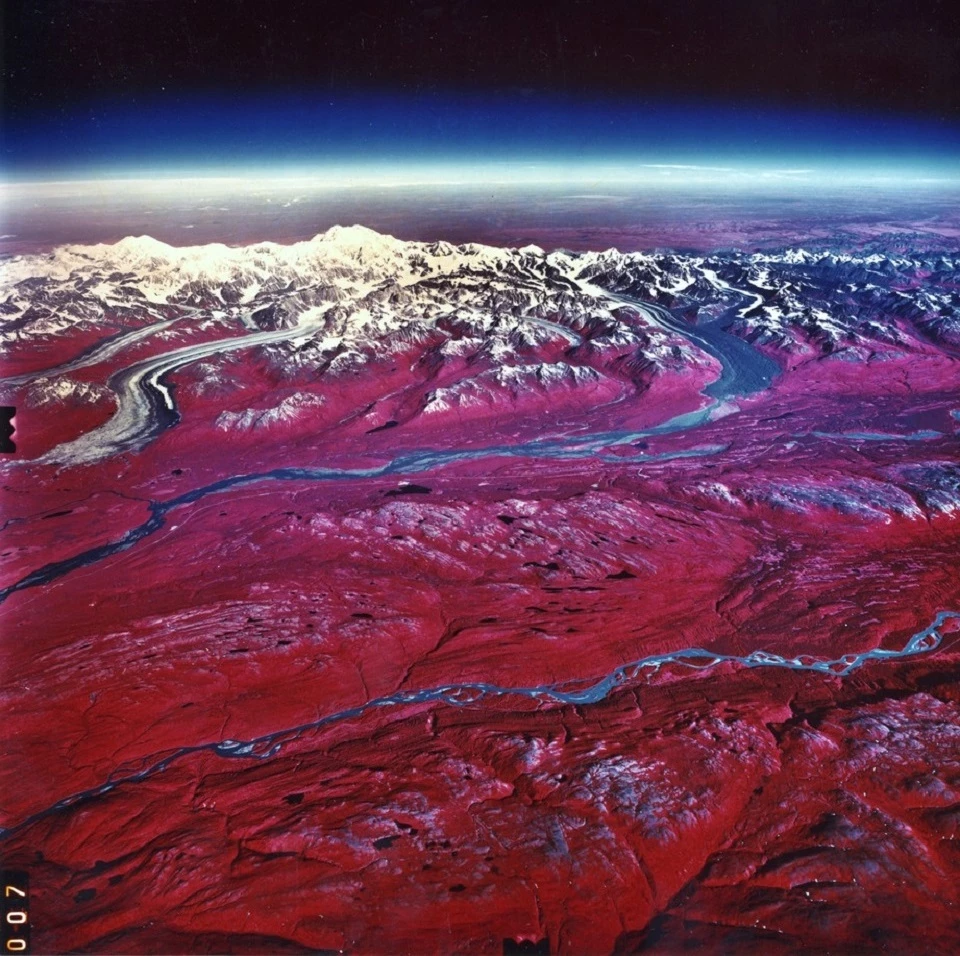
Katmai National Park & Preserve, Alaska
Left image
Aerial view of Katmai National Park & Preserve
Credit: (NASA / Jeff Williams)
Right image
Mount Katmai in the Valley of Ten Thousand Smokes
Credit: (NPS)
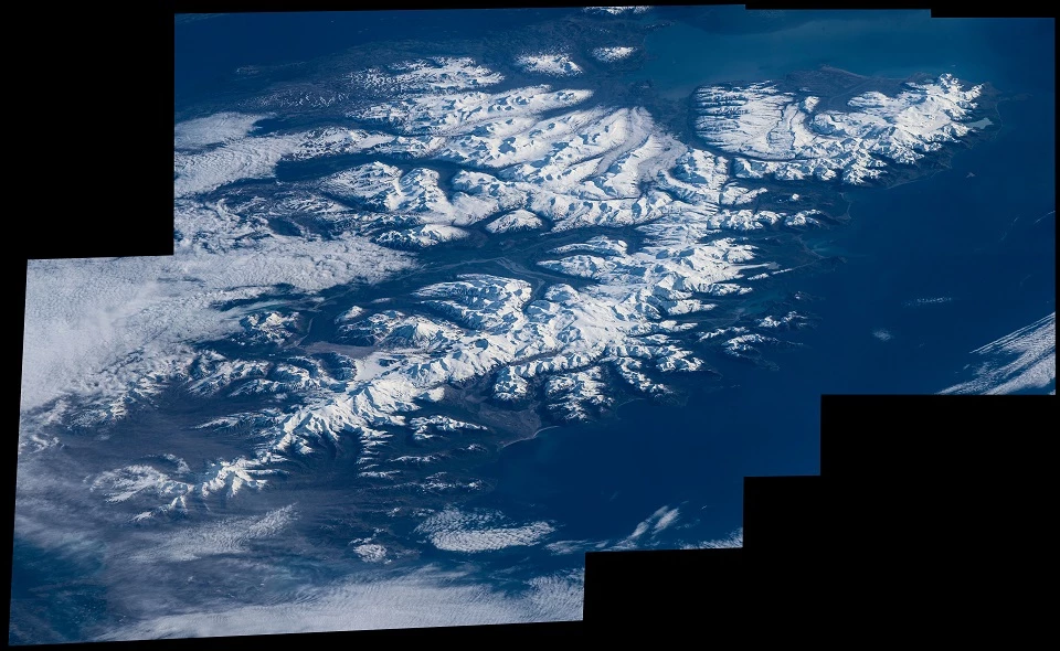
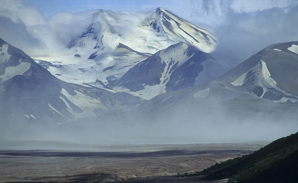
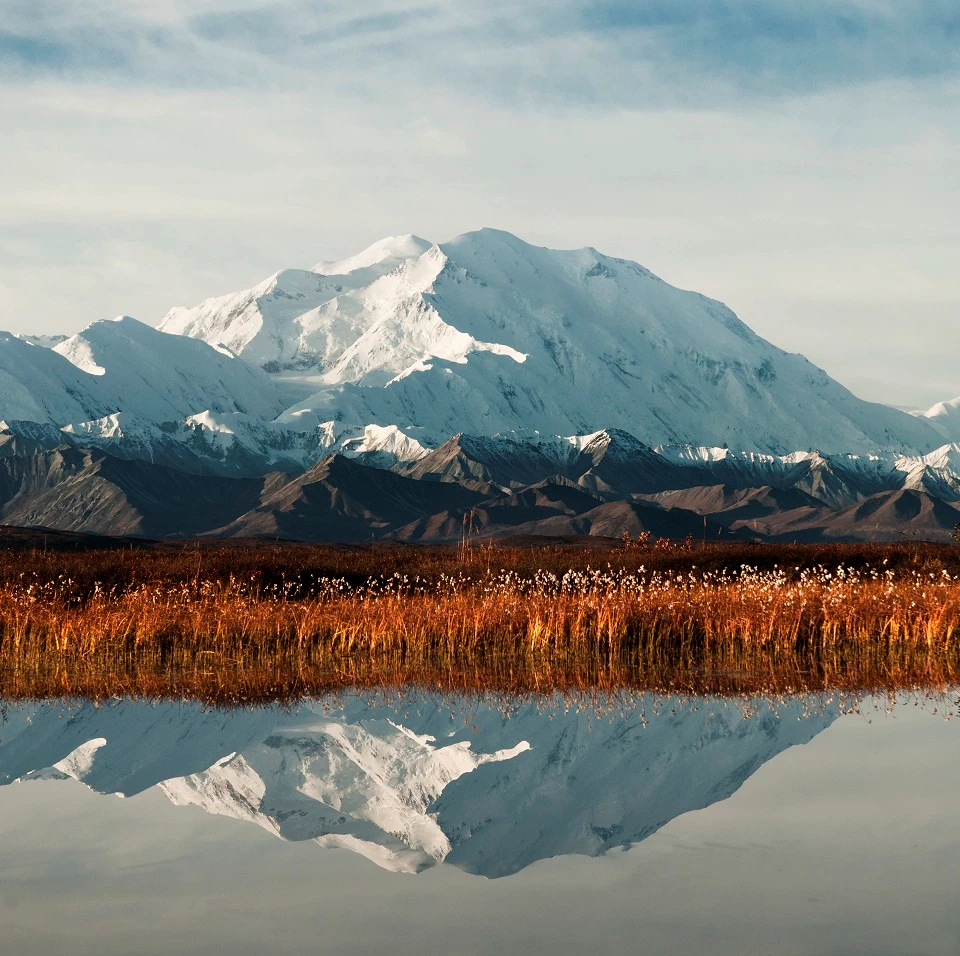
Denali National Park & Preserve, Alaska
Left image
Aerial view of Denali National Park & Preserve
Credit: (NASA / Charles Anderson)
Right image
Mount McKinley during autumn
Credit: (NPS / Tim Rains)
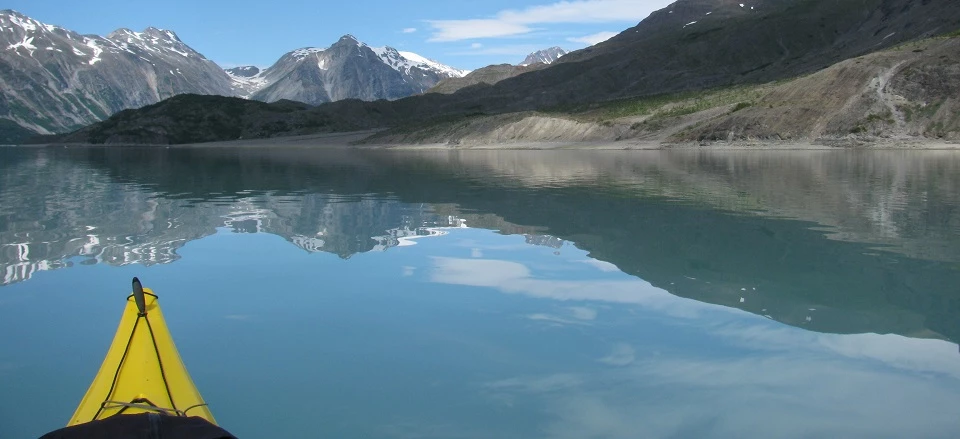
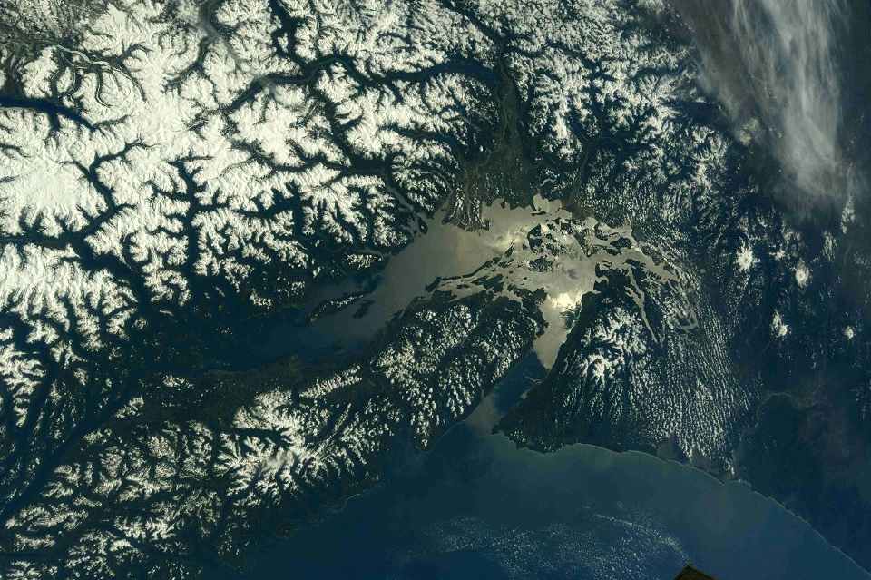
Glacier Bay National Park & Preserve, Alaska
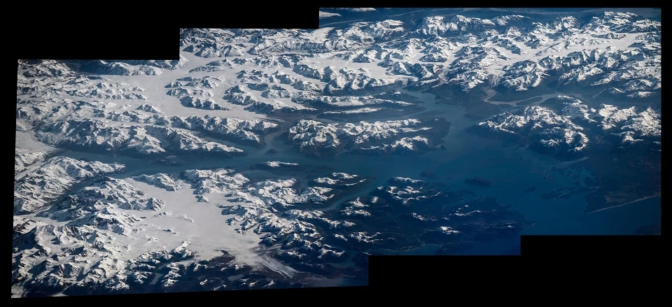
Left image
Aerial view of Glacier Bay National Park & Preserve
Credit: (NASA / Jeff Williams)
Right image
Exploring the waterways by boat
Credit: (NPS)
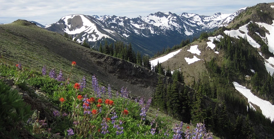
Olympic National Park, Washington
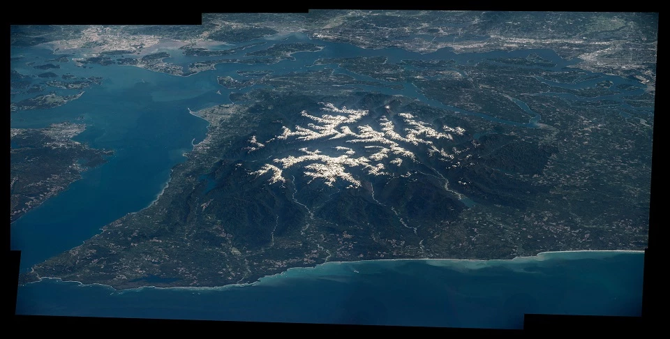
Left image
Aerial view of Olympic National Park
Credit: (NASA / Jeff Williams)
Right image
Mountain flowers
Credit: (NPS)
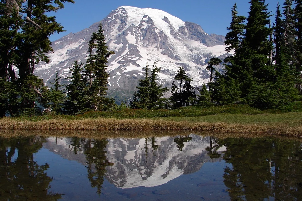
Mount Rainier National Park, Washington
Left image
Aerial View of Mount Rainier National Park
Credit: (NASA / Ricky Arnold)
Right image
Mount Rainier
Credit: (NPS)
Yosemite National Park, California
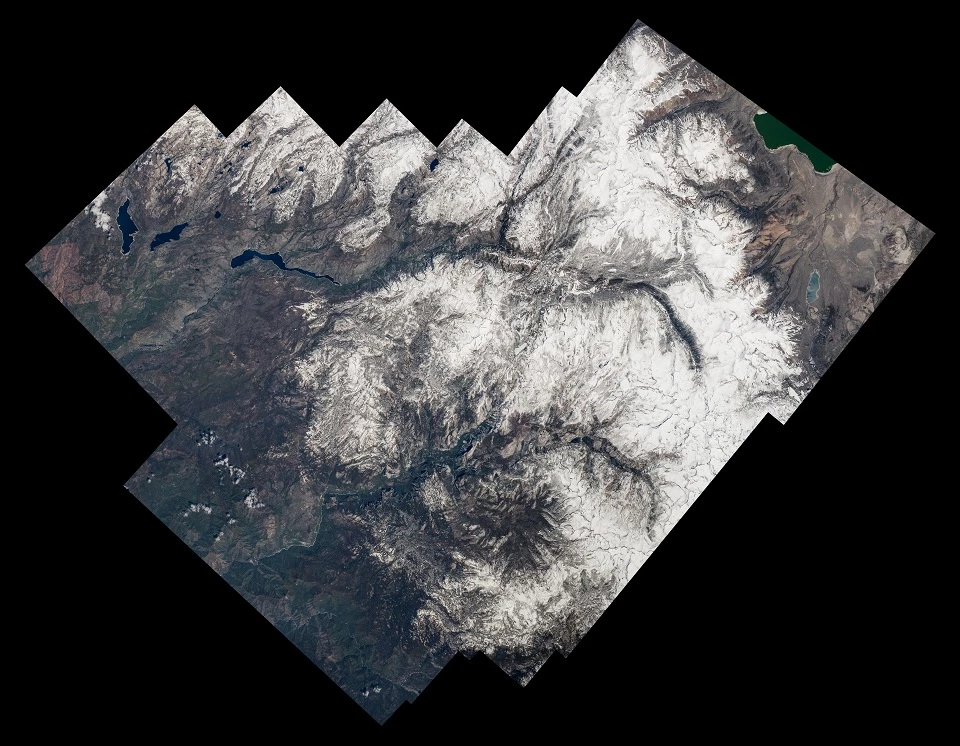
Left image
Aerial view of Yosemite National Park
Credit: (NASA / Jeff Williams)
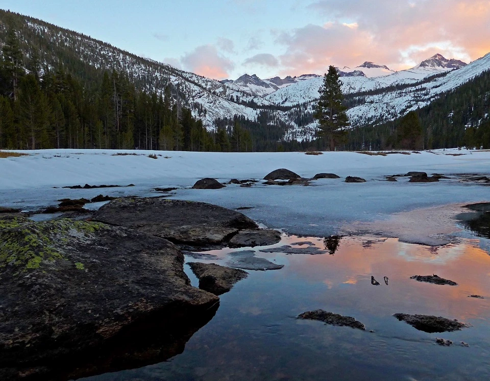
Right image
Sunset over Upper Lyell Canyon
Credit: (NPS)
Death Valley National Park, California & Nevada
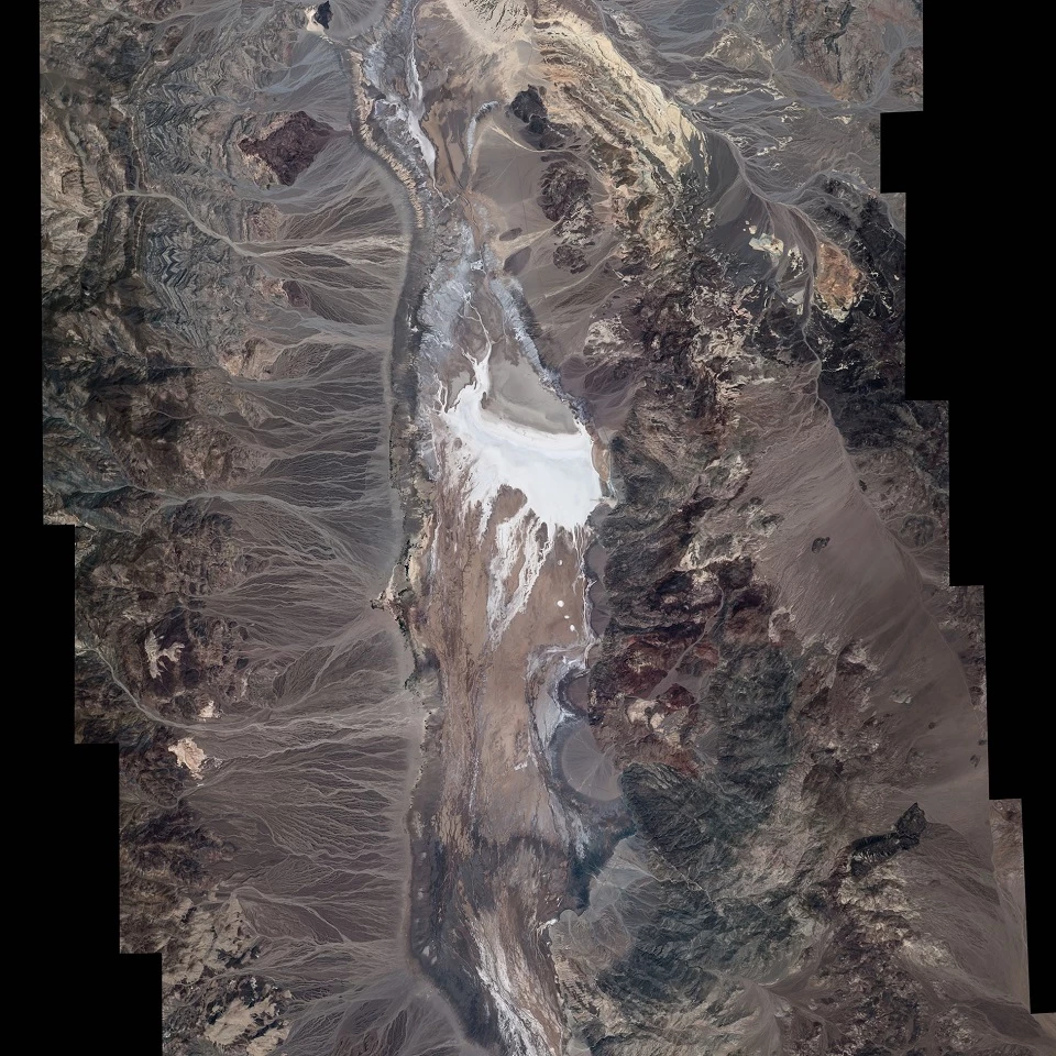
Left image
Aerial view of Death Valley National Park
Credit: (NASA / Jeff Williams)
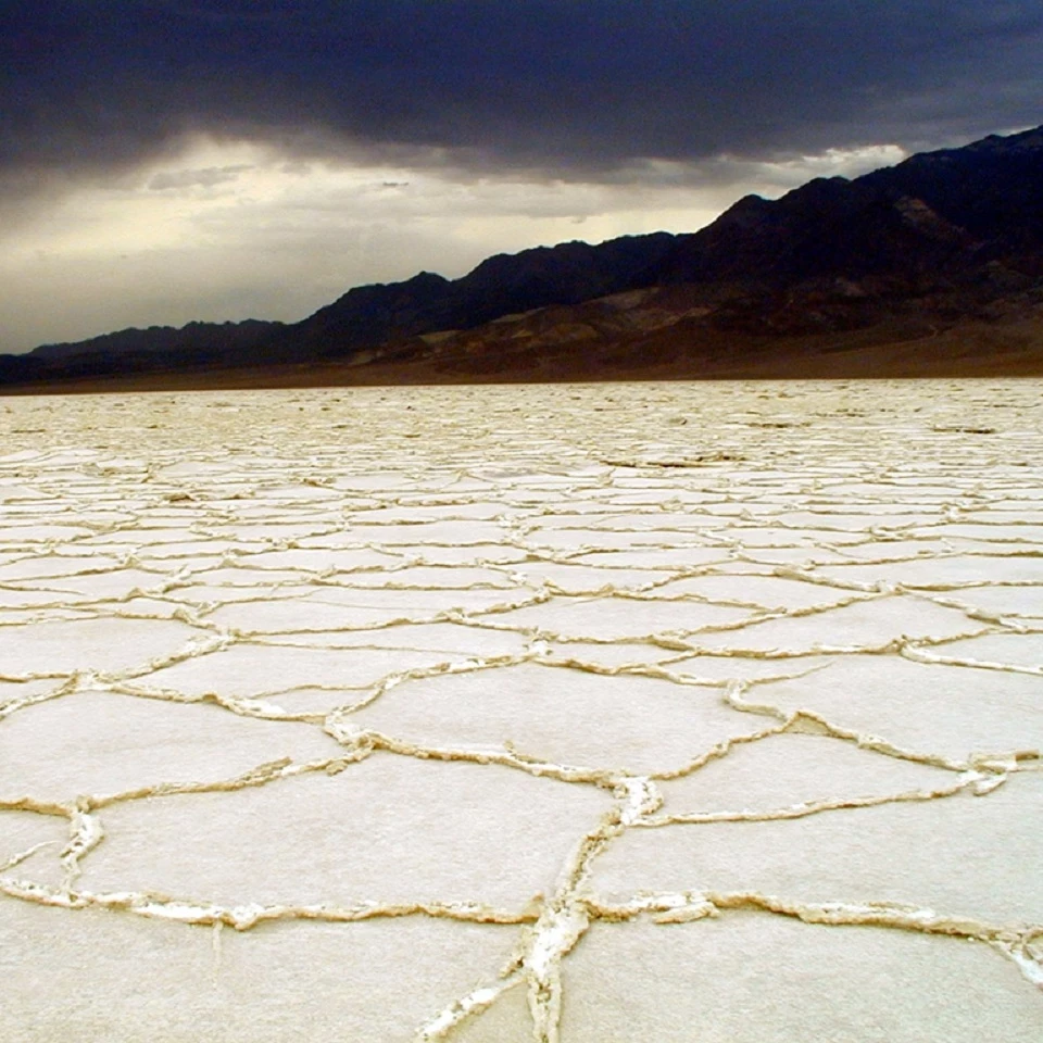
Right image
Badwater Basin after a storm
Credit: (NPS)
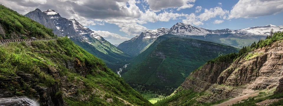
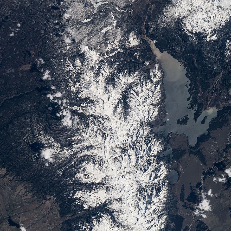
Glacier National Park, Montana
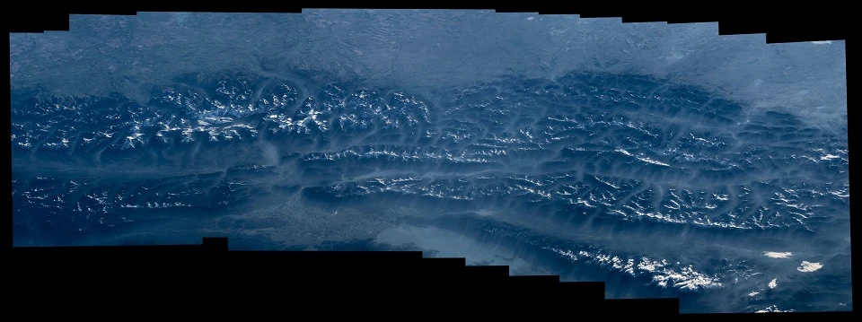
Left image
Aerial view of the northern Rocky Mountains and Glacier National Park
Credit: (NASA / Jeff Williams)
Right image
Going-to-the-Sun Road
Credit: (NPS / Tim Rains)
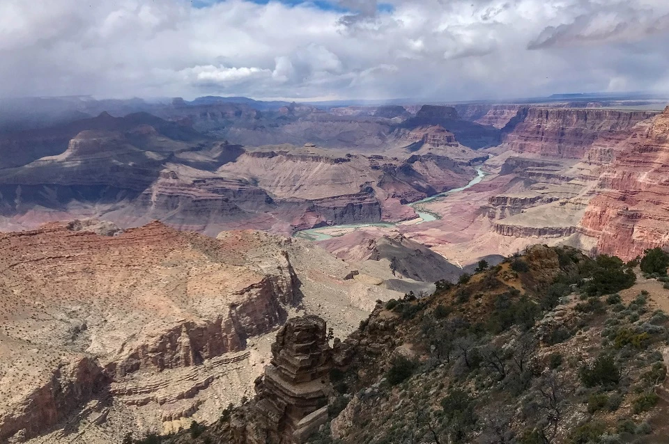
Grand Canyon National Park, Arizona
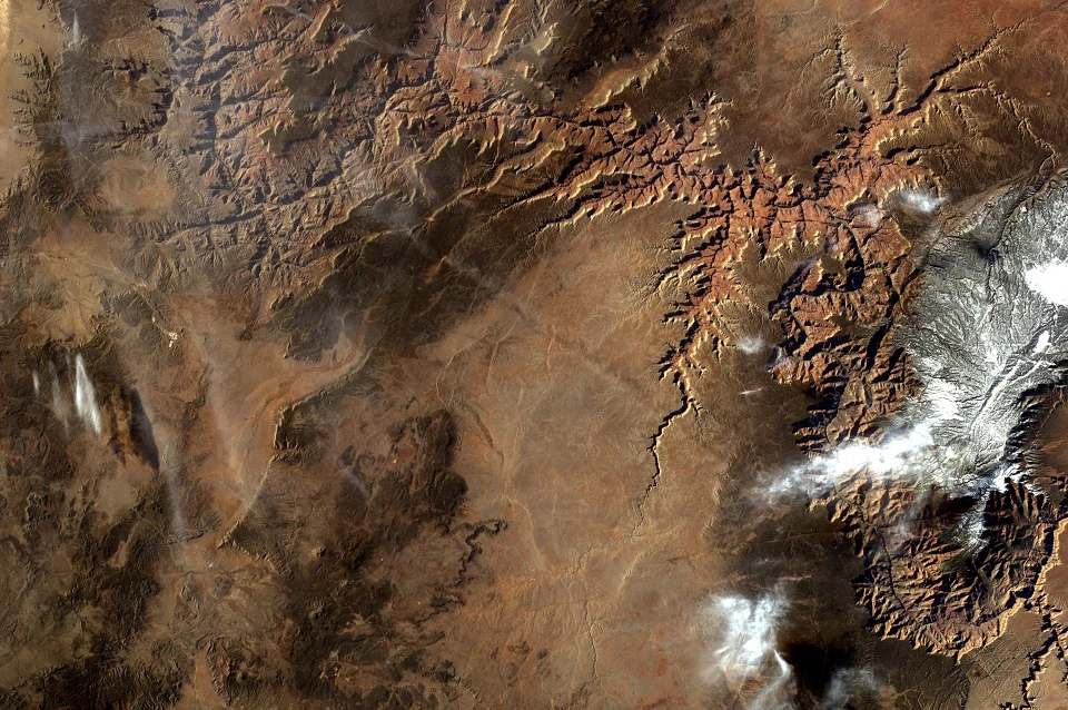
Left image
Aerial view of Grand Canyon National Park
Credit: (NASA)
Right image
Desert View after a storm
Credit: (NPS)
Capitol Reef National Park, Canyonlands National Park & Arches National Park, Utah
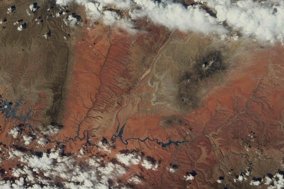

Left image
Aerial view of national parks in southern Utah
Credit: (NASA / Ricky Arnold)
Right image
Double Arch in Arches National Park
Credit: (NPS / Jacob W. Frank)
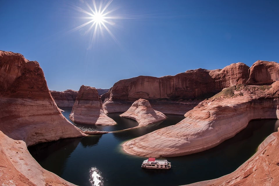
Glen Canyon National Recreation Area, Arizona & Utah
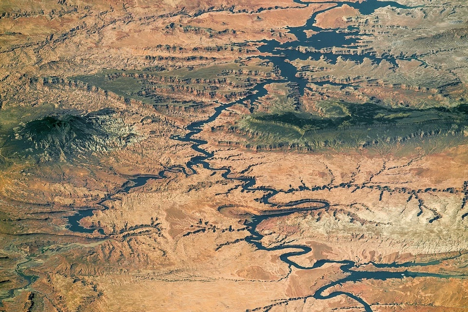
Left image
Aerial view of Glen Canyon National Recreation Area
Credit: (NASA)
Right image
Winding through Reflection Canyon
Credit: (NPS / Gary Ludd)
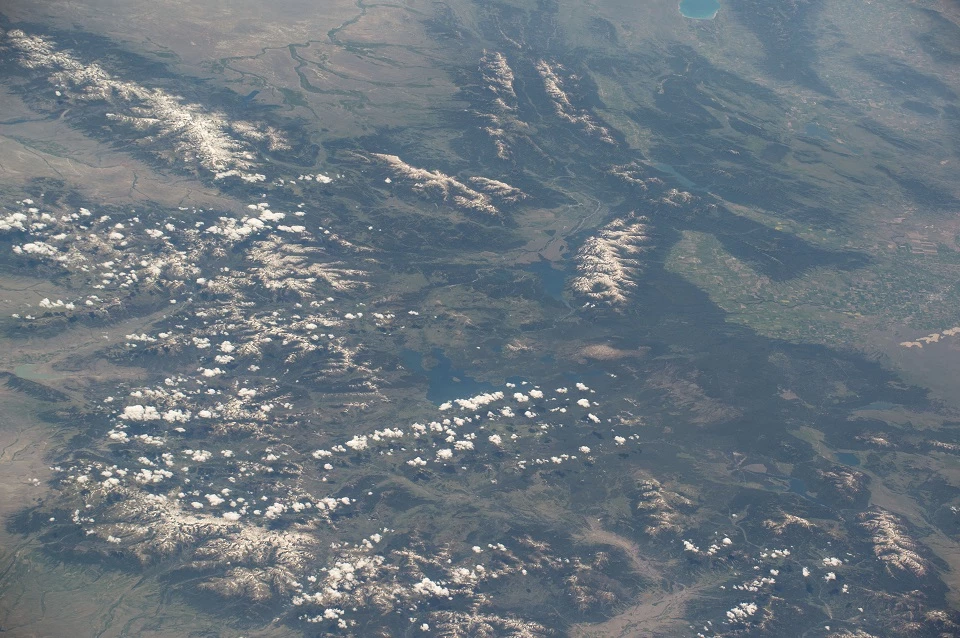
Grand Teton National Park, Wyoming
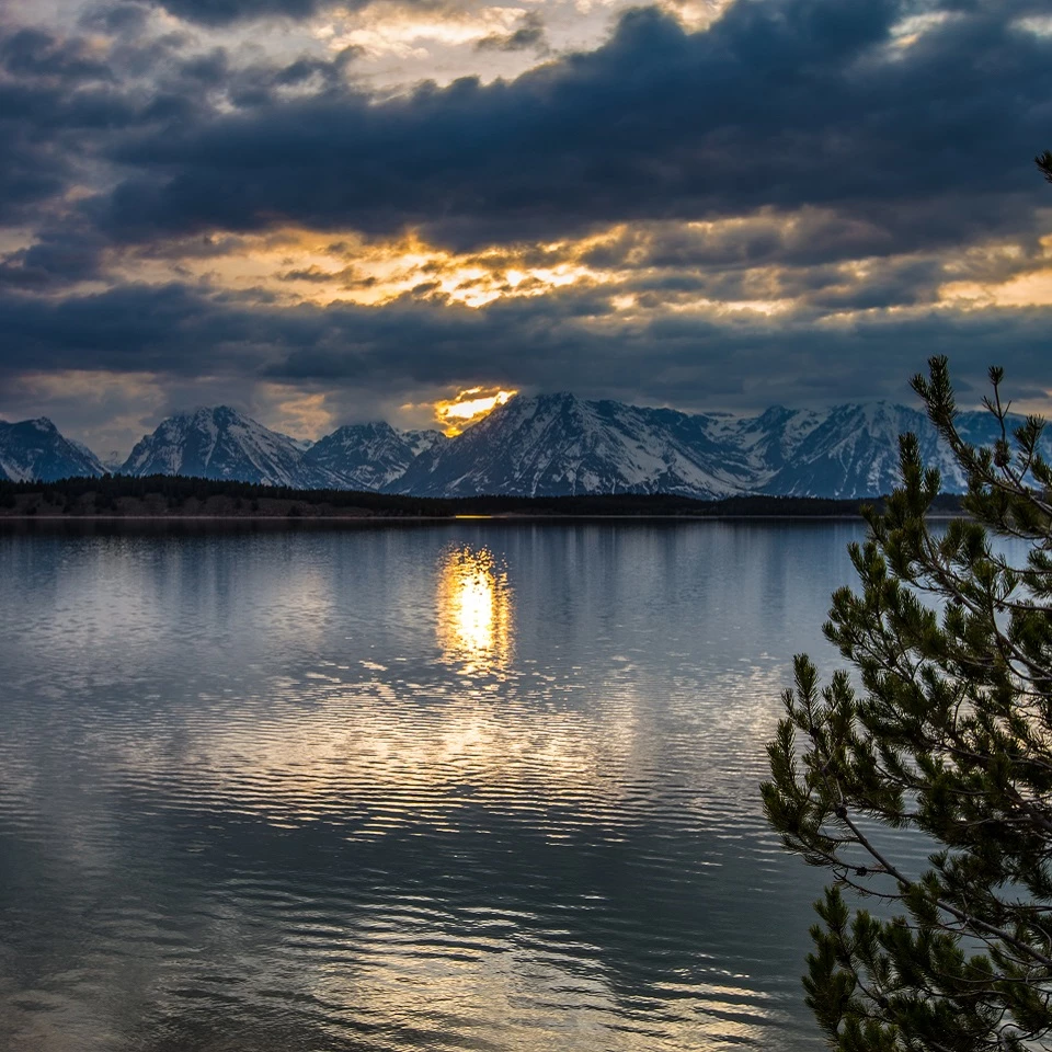
Left image
Aerial view of Grand Teton National Park
Credit: (NASA / Jeff Williams)
Right image
Sunset over Catholic Bay
Credit: NPS / Tobiason
Yellowstone National Park, Idaho, Montana & Wyoming

Left image
Aerial view of Yellowstone National Park
Credit: (NASA / Jeff Williams)
Right image
Rainbow next to a Beehive Geyser eruption
Credit: (NPS / Jacob W. Frank)
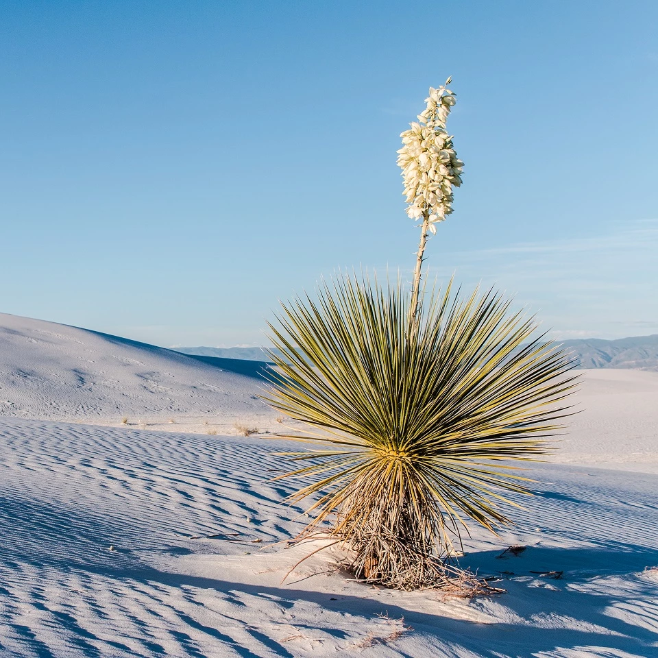
WHITE SANDS NATIONAL MONUMENT, NEW MEXICO

Left image
Aerial view of White Sands National Monument
Credit: (NASA)
Right image
A blooming soaptree yucca on the dunes
Credit: (NPS)
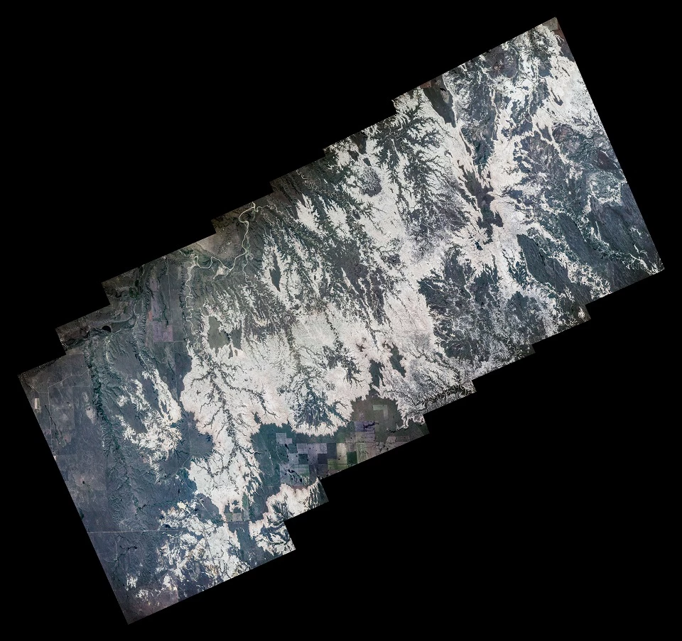
Jewel Cave National Monument, Mount Rushmore National Memorial & Wind Cave National Park, South Dakota
Left image
Aerial view of the Black Hills of South Dakota
Credit: (NASA / Jeff Williams)
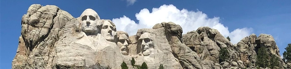
Right image
Mount Rushmore National Memorial
Credit: (NPS)
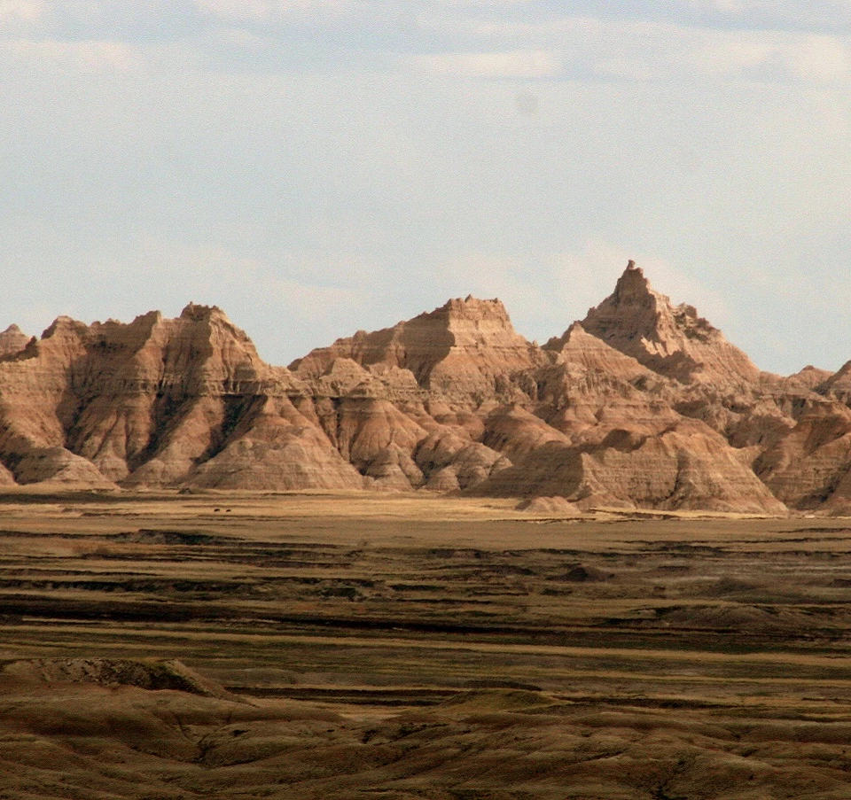
Badlands National Park, South Dakota
Left image
Aerial view of Badlands National Park
Credit: (NASA)
Right image
Badlands at dusk
Credit: (NPS / Lee McDowell)
Everglades National Park, Florida
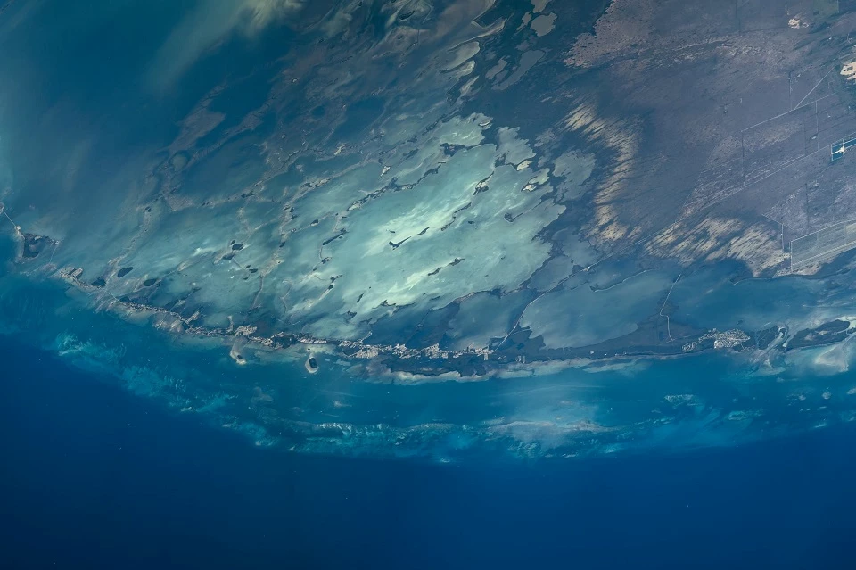
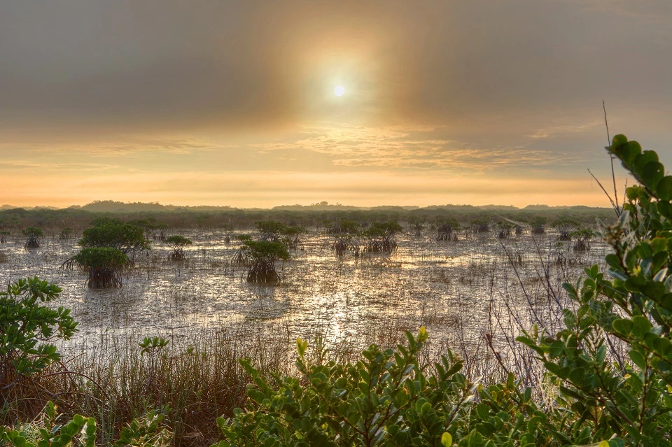
Left image
Aerial view of Everglades National Park
Credit: (NASA / Jeff Williams)
Right image
Mangroves in a river of grass
Credit: (NPS / G. Gardner
Chesapeake & Ohio Canal National Historical Park, DC, Maryland & West Virginia

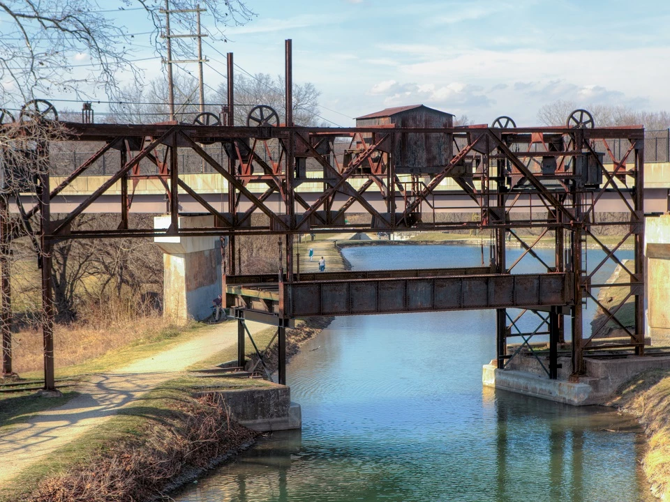
Left image
Aerial view of a section of the Chesapeake & Ohio Canal from Hancock to Cumberland, Maryland
Credit: (NASA)
Right image
Lift Bridge along the Canal Towpath
Credit: (NPS)
Fort McHenry National Monument and Historic Shrine, Maryland


Left image
Aerial view of Fort McHenry in Baltimore Harbor
Credit: (NASA / Jeff Williams)
Right image
Star-spangled banner flying over Fort McHenry
Credit: (NPS)
Acadia National Park, Maine

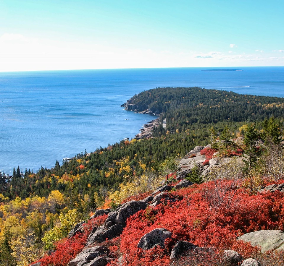
Left image
Aerial view of Acadia National Park
Credit: (NASA / Jeff Williams)
Right image
Fall colors on Otter Point
Credit: (NPS)
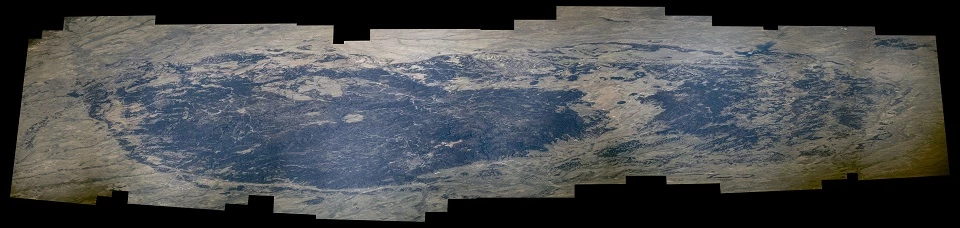
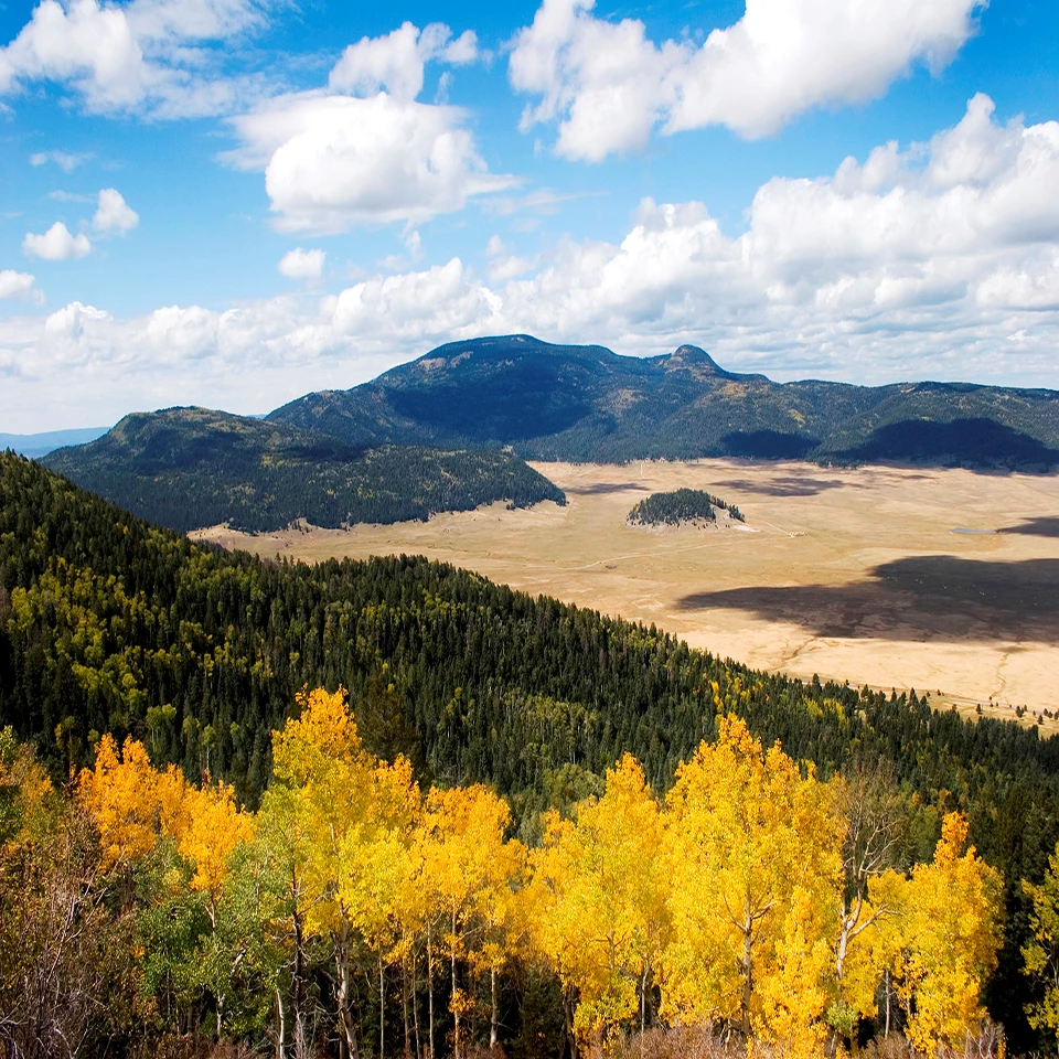
VALLES CALDERA NATIONAL PRESERVE, NEW MEXICO
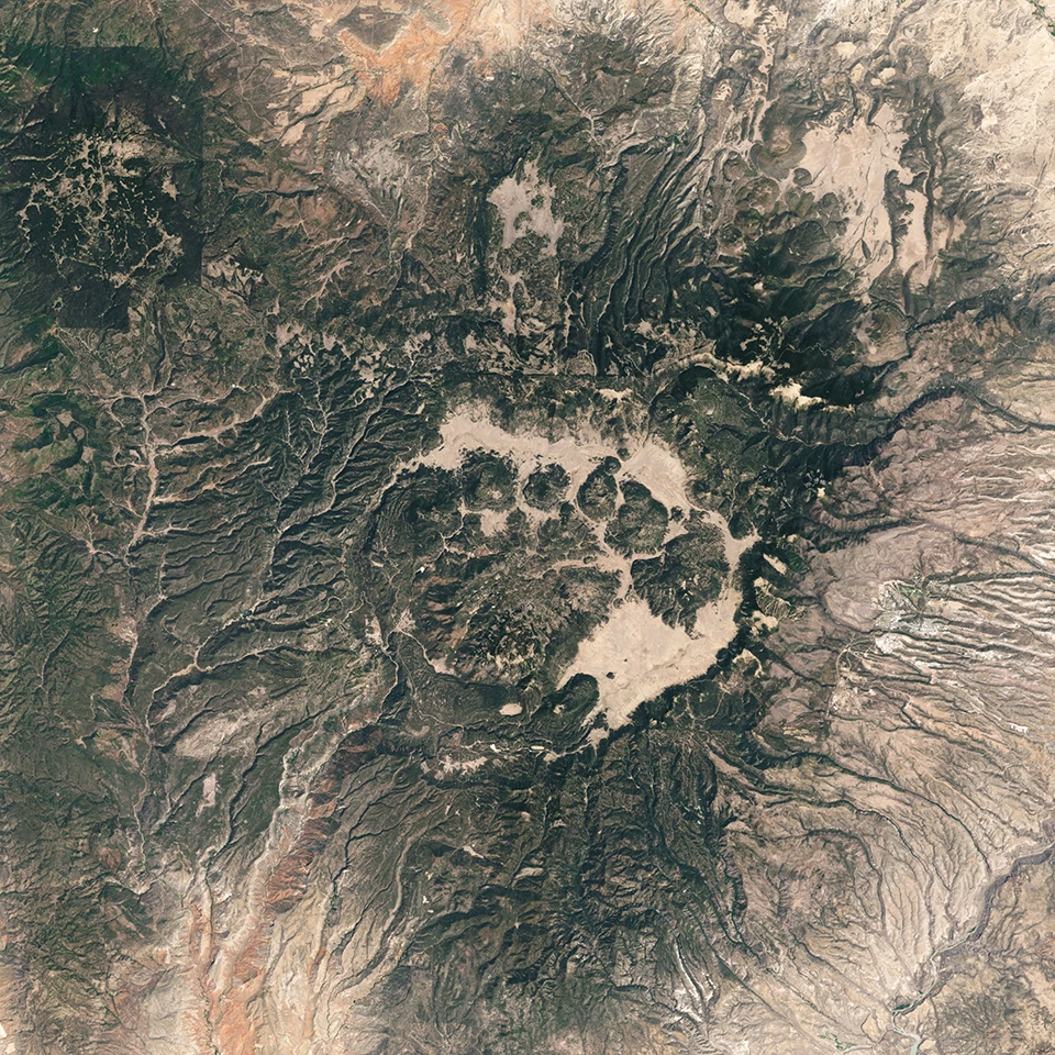
Left image
Valles Caldera from Space.
Credit: NASA
Right image
A view into Valles Caldera during fall.
Credit: NPS: Valles Caldera
Tags
- acadia national park
- arches national park
- badlands national park
- canyonlands national park
- capitol reef national park
- chesapeake & ohio canal national historical park
- death valley national park
- denali national park & preserve
- everglades national park
- fort mchenry national monument and historic shrine
- glacier national park
- glacier bay national park & preserve
- glen canyon national recreation area
- grand canyon national park
- grand teton national park
- jewel cave national monument
- katmai national park & preserve
- mount rainier national park
- mount rushmore national memorial
- olympic national park
- wind cave national park
- wrangell - st elias national park & preserve
- yellowstone national park
- yosemite national park
- nasa
- space station
- photography
- arctic
- coastlines
- deserts
- dunes
- forests
- glaciers
- lakes
- mountains
- night skies
- rivers
- volcanic landscapes
- wetlands
- alaska
- arizona
- california
- dc
- florida
- idaho
- maine
- maryland
- montana
- nevada
- new mexico
- south dakota
- utah
- washington
- west virginia
- wyoming
- ak1