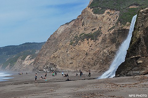
Alamere Falls is a beautiful waterfall deep within the Phillip Burton Wilderness. The falls are a dramatic sight as water cascades over a ~40-foot-tall (~12 m) cliff onto the south end of Wildcat Beach. While no easy trek—a 13-mile (20 km) minimum round-trip hike is required—this spectacular spot is a popular—and a sometimes overcrowded—visitor draw. Take note: it is also the site of multiple search-and-rescue operations each year. Beware of getting too close to cliff edges and be mindful of coastal erosion! There is NO park-sanctioned "Alamere Falls Trail"Please take note! Many social media posts, websites, and older (and some newer) guide books reference an "Alamere Falls Trail" (also sometimes referred to as a "shortcut to the falls"). The "Alamere Falls Trail" is NOT a maintained trail, and poses many hazards to off-trail hikers—crumbling and eroding cliffs, massive poison oak, ticks, and no cell phone service. Visitors who use this unmaintained trail may endanger themselves and rescuers, and inadvertently cause resource damage, such as habitat fragmentation and trampling plants, which may lead to the death of the trampled plants. On an almost weekly basis, visitors get hurt scrambling down the heavily rutted route leading to the top of the falls or sliding down the crumbly cliff-face to get to the beach, sometimes requiring search and rescue teams to be mobilized. The National Park Service strongly advises visitors against using this unmaintained route. Please use the recommended routes described below to visit the falls. 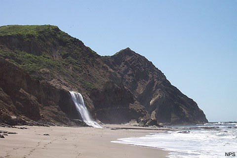
Help Protect Wilderness ValuesWilderness areas are places of refuge—protected and managed to allow for relaxation, self-reliance, opportunities for solitude, and natural quiet. To maintain this extraordinary wilderness character, this area is supposed to be free of mechanized equipment and the imprint of human development is limited.

Please help us keep this extraordinary wilderness wild! ![Map highlighting popular hiking routes to Alamere Falls. [Click on this image to download a 5.1 MB PDF version of this map.] A map of the southern district of Point Reyes National Seashore with more commonly used routes to hike to Alamere Falls highlighted. [Click on this image to download a 5.1 MB PDF version of this map.]](/pore/planyourvisit/images/map_alamere_falls_2019_480x598.gif)
Come Prepared

Emergencies
Directions to the TrailheadsThere are three trailheads at which most visitors park to hike to Alamere Falls: Bear Valley, Palomarin, and Five Brooks. Information about the routes from these trailheads to Alamere Falls via Wildcat Campground may be found below. 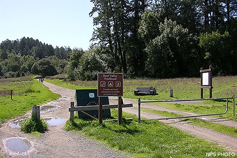
Bear ValleyThe Bear Valley Trailhead is located just south of the Bear Valley Visitor Center. Park your vehicle(s) in the gravel parking lot on the left (east) side of the access road close to the Bear Valley Trailhead, not in the paved parking lot adjacent to the Bear Valley Visitor Center. (Bear Valley Map - 2,875 KB PDF) There is a restroom building with flush toilets at the northeast corner of the trailhead parking area, along with garbage and recycling receptacles. There is also a water faucet from which one may obtain potable water. From Bear Valley, the minimum hiking distance to Alamere Falls is 7.3 miles (11.7 km). Parking Lot Bear Valley Trailhead Parking Lot
Live Status
A gravel parking lot with space for ~210 vehicles. The Bear Valley Trailhead is at the southwest corner of the parking lot. The Bear Valley Picnic Area is to the north of the parking lot and its restroom is at the parking lot's northeast corner. The Bear Valley Visitor Center is located a short distance to the northwest.
Parking Fee No parking or entrance fees are charged at Point Reyes National Seashore. Cost: $0.00 Amenities
Image Gallery
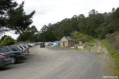
PalomarinThe Palomarin Trailhead is located approximately thirty-five minutes by car from the Bear Valley Visitor Center. It is located at the northwestern end of Mesa Road, approximately 5 miles (8 km) northwest of Bolinas. The last 1.2 miles (1.9 km) of Mesa Road is unpaved and is often severely potholed and washboarded. There are four vault toilets at this trailhead, along with garbage and recycling receptacles. There is no potable water available. From the Palomarin Trailhead, the minimum hiking distance to Alamere Falls is 6.5 miles (10.4 km). Please be aware that on weekends throughout the year and on many weekdays throughout the summer, the parking lot at the Palomarin Trailhead fills very early in the day. Visitors arriving late in the morning or in the afternoon may be turned away. The park will close the Palomarin area to further entry, potentially for several hours, when there are no more parking spaces available in the parking lot. Please observe all "No Parking" signs. If you wish to visit Alamere Falls or other locations accessed via the Palomarin Trailhead, arrive early, or consider visiting mid-week. Some trails, such as the Coast Trail from Palomarin, are more popular than others. Some trailheads, such as Bear Valley, have larger parking areas, while some, such as the Palomarin Trailhead, are very limited. If you get to the Palomarin Trailhead and the parking lot is full, please choose another trail to hike. Let's all do our part to respect wilderness values and reduce resource impacts. There are lots of places to visit in the park and many other hikes from which to choose. Parking Lot Palomarin Trailhead Parking Lot
Live Status
A small dirt/gravel parking lot with space for ~75 vehicles at the northwest end of Mesa Road. The Palomarin Trailhead is located along the north side of the eastern end of the parking lot, along with vault toilet buildings, litter and recycling receptacles, and informational signs. The Palomarin Parking Lot is approximately 35 minutes by car from the Bear Valley Visitor Center via Highway 1, Olema–Bolinas Road, and Mesa Road.
Parking Fee No parking or entrance fees are charged at Point Reyes National Seashore. Cost: $0.00 Amenities
Image Gallery
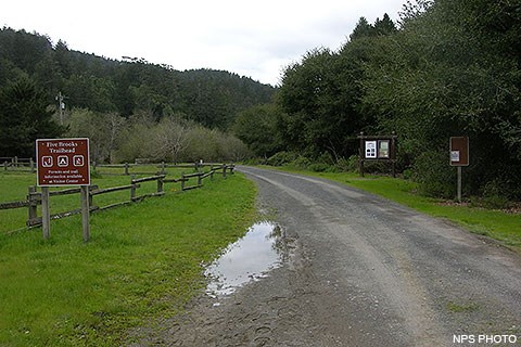
Five BrooksThe Five Brooks Trailhead is located approximately ten minutes by car from the Bear Valley Visitor Center. There are two vault toilets at this trailhead, along with garbage and recycling receptacles. There is no potable water available. From Five Brooks, the minimum hiking distance to Alamere Falls is 7.1 miles (11.4 km); the minimum distance by bicycle is 7.8 miles (12.5 km). Parking Lot Five Brooks Parking Lot
Live Status
A dirt/gravel parking lot at Five Brooks with space for ~50 vehicles and 10 or so trucks pulling horse trailers. There is a vault toilet adjacent to the parking lot and multiple picnic tables along the Stewart Trail, which heads northwest from the northern end of the lot. The Five Brooks Parking Lot is approximately 10 minutes by car from the Bear Valley Visitor Center via Highway 1.
Parking Fee No parking or entrance fees are charged at Point Reyes National Seashore. Cost: $0.00 Amenities
Image Gallery
Stay on designated trailsStay on park-maintained trails. Hiking along the bluff tops is strongly discouraged. Stay away from cliff edges. Loose soil and/or rock can give way suddenly and you may fall. Visitors walking on the beach below the cliffs may be injured or killed by rocks dislodged by visitors at the edge of the clifftops. Do not climb cliffs. Visitors walking off of official trails and paths trample vegetation, which may lead to the death of the trampled plants, or spread seeds from non-native plants to locations where they have yet to be introduced. Over time, as more and more visitors use a route, it starts to look more and more like an official trail, and more and more visitors use it, resulting in a feedback loop that makes the "trail" look "official." However, these "social paths" tend to exacerbate erosion and harm threatened and endangered species. These paths also can lead to locations where visitors may be more at risk to injury, endangering themselves and any potential rescuers. 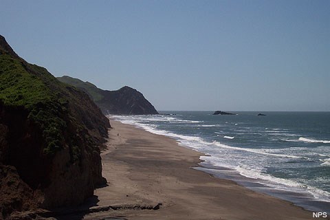
The Routes to Alamere Falls via Wildcat CampgroundTo visit Alamere Falls safely, Point Reyes National Seashore recommends hiking to Wildcat Campground and, from there, walking a mile south on Wildcat Beach (more about this section of the hike below). Many trails lead to Wildcat Campground, but the most commonly used routes are: the 6.3-mile (10.1 km) hike from the Bear Valley Trailhead via the Bear Valley, Glen, and Stewart Trails; the 5.5-mile (8.8 km) hike from the Palomarin Trailhead via the Coast Trail; or the 6- to 6.7-mile (10 to 10.7 km) hike from the Five Brooks Trailhead via the Stewart Trail. The Stewart Trail is open to bicycles for those who wish to ride up and over the 1,300-foot (400 m) Inverness Ridge. Tip: If you are ever in doubt as to which way to go, there are signs at every official trail junction indicating some of the significant trail junctions and destinations in a given direction, as well as distances to those locations. In short, follow the signs for Wildcat Campground on the way out, and the signs for Bear Valley, Palomarin, or Five Brooks trailheads on the way back. 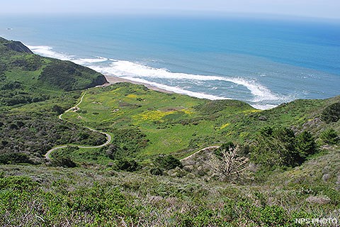
From Bear ValleyFollow the relatively flat Bear Valley Trail south 3.1 miles (5 km) to the Glen Trail. (Bicyclists: read the next paragraph.) Turn left onto the Glen Trail and begin climbing up the side of a ridge. Stay right at 0.6 miles (1 km) to stay on the Glen Trail. After another 0.4 miles (0.6 km), one arrives at the first of two connector trails that lead to the Coast Trail. Turn right if you want to follow the Coast Trail to Wildcat Campground (the distance is 0.3 mile [0.5 km] longer via the Coast Trail) or keep left to stay on the Glen Trail. After another 0.4 miles (0.6 km), one arrives at the second connector trail. If you do opt to hike via the Coast Trail, turn left once you reach the Coast Trail and follow it south to the Stewart Trail. Otherwise, staying on the Glen Trail for an additional 0.5 miles (0.8 km) will bring one to the Stewart Trail. Turn right and follow the Stewart Trail 1.2 miles (1.9 km) downhill to get to Wildcat Campground. A well-worn trail leads along the south side of the campground to the beach. Bicycles are permitted on the northern 3.1 miles (5 km) of the Bear Valley Trail. There is a bicycle rack at the Glen Trail junction to which bicyclists may chain/lock their bicycles. Beyond this location, one enters the Phillip Burton Wilderness, in which bicycles are prohibited. 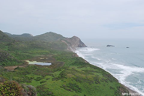
From the Palomarin TrailheadFollow the Coast Trail northwest as it meanders along near the top of an ocean cliff top for approximately one mile (1.6 km). The Coast Trail then heads inland and drops in elevation to a valley floor before switchbacking out the other side. After climbing over a pass, one hikes past a number of small ponds before reaching Bass Lake after 2.8 miles (4.5 km) of hiking. In another 0.6 miles (1 km) one arrives at a view of Pelican Lake. Continuing on 0.8 miles (1.3 km) leads to the junction with the Ocean Lake Loop Trail. Stay right to remain on the Coast Trail as it heads a bit further inland through coastal scrub and forest, or turn left on to the Ocean Lake Loop Trail, which drops initially to pass by Ocean Lake, but then climbs steeply to reach the top of some coastal bluffs with views looking up and down the shoreline. Both routes reconnect after 1.1 miles (1.7 km) after passing on opposite sides of Wildcat Lake. The Coast Trail then descends 0.2 miles (0.3 km) to Wildcat Campground. 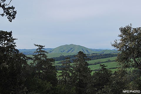
From Five Brooks TrailheadIf you wish to bicycle all the way to Wildcat Campground, this is the trailhead at which you will need to start. Follow the Stewart Trail northwest past Five Brooks Pond for 0.3 miles (0.5 km) to the junction with the Olema Valley Trail. Keep right to stay on the Stewart Trail as it begins to climb up the side of Inverness Ridge. After 0.8 miles (1.3 km), the Greenpicker Trail branches off to the right at a switchback. Hikers may wish to shorten their hike by 0.7 miles (1.2 km) by following the Greenpicker Trail to the ridge crest, but be forewarned that the Greenpicker Trail is steeper than the Stewart Trail. Since the Greenpicker Trail is within the Philip Burton Wilderness, bicycles are prohibited on it. So, bicyclists may continue on the Stewart Trail as it switchbacks 2.6 miles (4.2 km) up the side of the ridge to Fir Top, the highest location (1324 ft/404 m) along the southern end of Inverness Ridge. However, due to the dense Douglas fir forests, there are no far-reaching views. Hikers on the Greenpicker Trail may wish to return to the Stewart Trail at this location, although one could continue hiking on the Greenpicker Trail. But staying on the Greenpicker Trail can result in the hike to Wildcat Campground being 1 mile (1.6 km) longer. The shortest route from Fir Top to Wildcat Campground is to follow the Stewart Trail as it descends 2.7 miles (4.3 miles) from ridge crest to ocean beach, staying on the the Stewart Trail at five different junctions with multiple trails that head off in various directions. 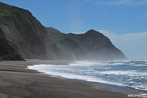
The Walk along Wildcat BeachTo visit Alamere Falls safely, Point Reyes National Seashore recommends hiking to Wildcat Campground and, from there, walking 1.1 mile (1.7 km) south on Wildcat Beach during a low tide. At higher tides, Wildcat Beach may be completely inundated. And, even during low tide periods in the winter and spring, there may be locations along the beach where the waves are lapping (or crashing) at the base of the bluffs. Be aware of tides and surf conditions. Before you visit, check the National Oceanic and Atmospheric Administration's tide predictions and the National Weather Service's Watches, Warnings & Advisories page for the Coastal North Bay to learn whether there are any active Beach Hazards Statements, High Surf Advisories, and/or High Surf Warnings. If there are, you will need a much lower tide to safely walk along the beach...or you may wish to postpone your trip for a day when the surf is smaller. 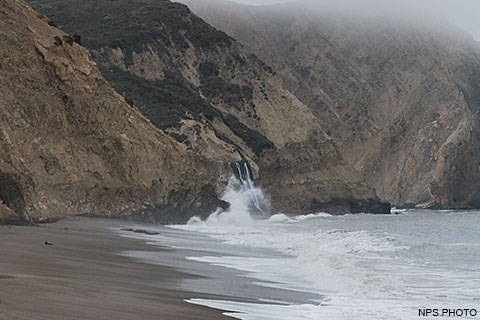
Since the amount of sand "on" the beach varies from season to season, there is no tide height that we can provide to guarantee that the tide will be low enough to allow safe and dry passage along the beach. In general, however, there is more sand "on" the beach in the summer and fall than in the winter and spring. Therefore, one can usually walk along the beach with a higher tide level in the summer and fall, while the tide level needs to be lower in the winter and spring to do so. If you arrive at Wildcat Beach and find that the waves are reaching the base of the bluffs, do NOT attempt to walk to Alamere Falls. You could be injured or die, especially if there is high surf. If the tide is heading out, you could wait until the water level is low enough to allow safe passage along the beach. Be prepared to wait a while. If the tide is coming in, you may wish to come back on a future date rather than waiting for the tide to peak and then retreat. 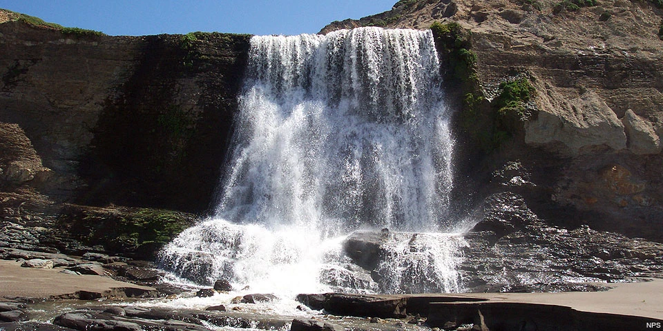
|
Last updated: May 15, 2025
