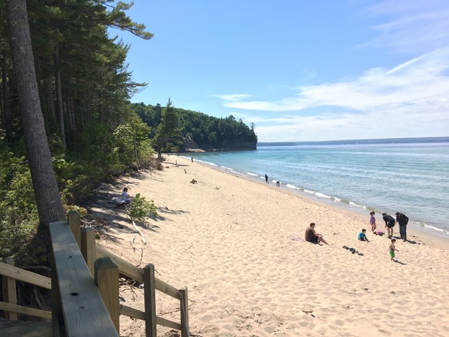
NPS photo Check at a visitor center for current trail conditions. Where allowed, pets must be on a leash no longer than 6 feet. Bicycles are prohibited on all park trails. Walks Of One Mile Or LessSand Point Marsh TrailLength: 0.5 mile loop. Located across from Sand Point Beach, this boardwalk trail takes you through one of the park's most beautiful wetlands. Old beach ridges, a cattail marsh, small ponds, and white cedar and black spruce swamp communities dominate the scene. The best times for wildlife activity are early or late in the day. This trail is wheelchair-accessible. Pets not allowed.Munising FallsLength: 800 feet one way. Walk this paved trail up the cool, shaded sandstone canyon along Munising Creek to the main viewing platform to see the 50-foot waterfall. (This is also a lovely trail in winter.) Two sets of stairs lead to elevated platforms that offer different views of the water as it drops over a sandstone cliff. Please stay on the paved trail. Going into or behind the falls is dangerous and is prohibited. Wheelchairs may be able to go on the slightly sloping trail to the main viewing platform, depending on ability. Leashed pets allowed on trail and platforms.Miners Castle OverlookLength varies: 200 to 1300 feet one way. This is the most popular spot in the park. Miners Castle can be viewed from 3 different viewing platforms. The two upper viewing areas are wheelchair-accessible and are a short distance from the parking lot. The walk to the lower platform includes stairs and steep inclines. Leashed pets are allowed on paved (not dirt) trails, at viewing platforms, and in the picnic area.Superior Overlook BeachLength: Varies depending on how far you walk the beach. A short walk leads to Sullivan's Creek flowing into Lake Superior. There is a stairway leading down to the sand. The overlook platform just off the parking lot is wheelchair-accessible. Leashed pets allowed.Log Slide Overlook TrailLength: 0.25 miles roundtrip. This short trail leads through mature hardwoods to the western edge of the Grand Sable Dunes where logs once slid down to the lake in a wooden chute. The popular overlook platform was destroyed in a winter storm several years ago but the path to the platform location is still there. You'll be rewarded with breathtaking views of Lake Superior, the Grand Sable Dunes, and Au Sable Lighthouse in the distance. Pets not allowed.Grand Sable Dunes TrailLength: 0.6 miles roundtrip. This is the main access point into the Grand Sable Dunes. The trail starts at the Sable Falls parking area near the top of the falls, continues past an old field, and crosses a bridge over Sable Creek. It then winds through a jack pine forest gradually uphill into an open dune environment. Requires some uphill climbing in sand. Pets not allowed.Sable Falls TrailLength: 0.4 miles roundtrip. Part of the North Country Scenic Trail. From the Sable Falls parking lot, this trail starts with 168 steps down to the base of the falls and and continues past the falls along Sable Creek to a rock/sand beach on Lake Superior. The first landing on the stairs provides a view of Sable Falls, although the best view is from the bottom. Leashed pets are allowed on stairs and trail out to the beach.Little Beaver Nature TrailLength 1.0 mile loop. Trail access for those camping at the Little Beaver Lake Campground is at the campground. Other visitors need to park at the day-use lot just uphill from the campground and start on the trail from there. The trail includes a stand of 250-300 year old white pines and mature hemlocks. On a warm summer day, enjoy the cool moist microclimate of this area. Pets not allowed.
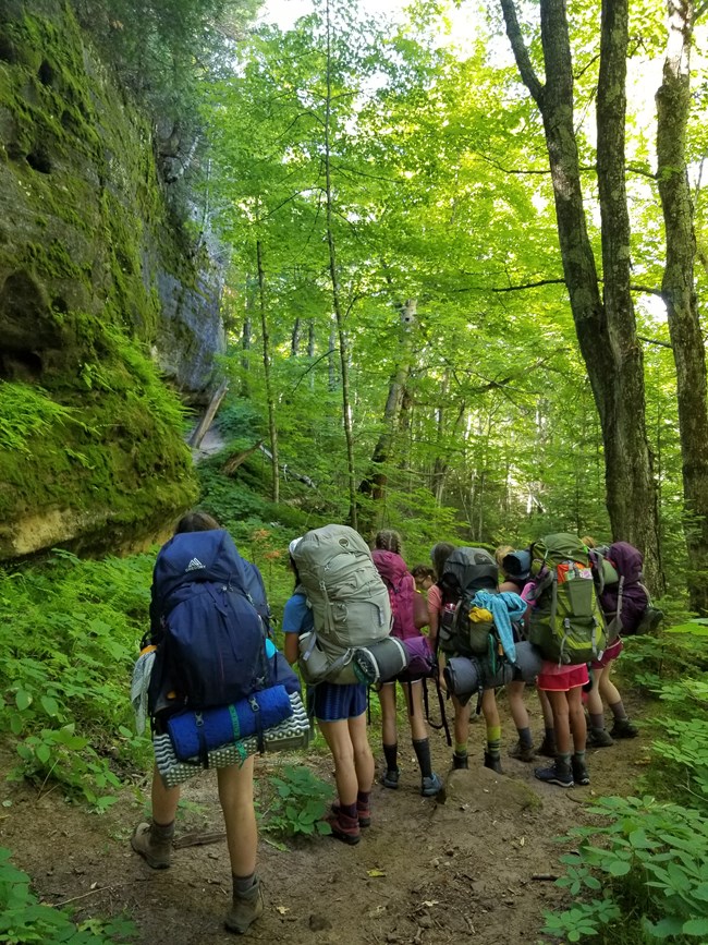
NPS photo Longer HikesMiners Falls TrailLength: 1.2 miles roundtrip. This easy, fairly level trail takes you through the forest to Miners River, where the park's most powerful waterfall cascades 50 feet over a sandstone cliff. Take another 64 steps down to a lower platform. Leashed pets allowed. Miners Castle to Miners BeachLength: 2.0 miles roundtrip. Part of the North Country Scenic Trail. Take the trail from Miners Castle downhill to Miners Beach, crossing the Miners River along the way. Enjoy the beach and then hike back up - or shorten the walk by having a friend pick you up in the Miners Beach west end parking lot. No pets allowed on the trail. (However pets are allowed at Miners Castle and at Miners Beach - just not on the trail between the two.) Sable Creek TrailLength: 2.0 miles roundtrip. Part of the North Country Scenic Trail. This is a pretty walk between the Grand Sable Visitor Center and the Sable Falls parking lot. The trail offers a stroll through a mature maple forest, along Sable Creek, and through an old farm field. Also intersects the Grand Sable Dunes Trail. Pets not allowed. Au Sable Light StationLength: 3.0 miles roundtrip. Leaving from Hurricane River Campground, walk on the old access road (part of the North Country Scenic Trail) back in time to an isolated Lake Superior lighthouse. Exposed shipwreck remains dot the shoreline, and the quiet light station gives you a feeling of yesteryear where families lived and worked from 1874 to 1958. Guided tours of the lighthouse are provided in summer. Leashed pets allowed on road and light station grounds. Bicycles are NOT allowed on this road. White Birch TrailLength: 2.0 mile loop. Self-guided interpretive trail at Twelvemile Beach Campground explores the natural history of the uplands adjacent to the lake - an environment very different from that near the campground. Non-campers park at the day-use picnic area and walk through the campground to Site 6, where trail begins. The trail will end on the campground road, 1/4 mile east of the trailhead - making almost a loop. Leashed pets allowed. Chapel/Mosquito AreaA number of different trails and hikes are available here. All hikes begin at the Chapel/Mosquito trailhead parking lot, at the end of Chapel Road. View and download this map before you hike these trails. NO PETS allowed on any of the trails or beaches in this area. Note: Chapel Road is a rough 5-mile road with deep pot holes and washouts. LIMITED PARKING AT TRAILHEAD - plan to arrive early in the day. Mosquito FallsLength: 2.0 miles roundtrip. From the Chapel parking lot, head towards Mosquito Beach. At 0.3 miles take a side trail that leads 0.7 miles to Mosquito Falls. The Mosquito River cascades in short falls over three rock shelves, the highest being 8 feet. Pets not allowed. Chapel FallsLength: 2.5 miles roundtrip. Leaving from the Chapel parking lot, this easy hike runs along an old roadbed through upland maple forest to stunning, 60-foot high Chapel Falls. Pets not allowed. Mosquito BeachLength: 3.9 miles roundtrip straight out and back; 4.5 miles via loop back past Mosquito Falls. Trail is usually very muddy and rough. Follow the trail from the Chapel parking lot through lowland hemlock and mixed forest to Mosquito Beach. This beautiful beach is bordered by stunning rock cliffs and sandstone terraces. Return on same trail or continue on loop and return past Mosquito Falls. Pets not allowed. Chapel Rock & Chapel BeachLength: 6.2 miles roundtrip from the parking lot. Trail passes Chapel Falls and continues to Chapel Rock and Chapel Beach. Take pictures, but keep off protected Chapel Rock. Return the way you came or make a loop by taking the forest trail back along the north/west side of Chapel Lake. Pets not allowed. Chapel LoopLength: Full loop, including Mosquito Falls, is 10.5 miles. This popular loop begins at the trailhead, passes Chapel Falls, Chapel Rock, Chapel Beach and continues along the Pictured Rocks cliffs to Mosquito River and Beach, and back to the parking lot on the outer loop trail past Mosquito Falls. Or you can go around the loop in the other direction! Pets not allowed. Note: Walk carefully along this cliff edge! Beaver Basin WildernessSeveral hikes can be made in the Beaver Lake area leaving from the day-use trailhead parking lot near the end of Little Beaver Lake Road. Pets not allowed. Beaver Basin Wilderness LoopLength: 5.5 mile loop. Enjoy this scenic and diverse hike through several forest types, around the north side of Beaver Lake, along Beaver Creek, and back along the North Country Scenic Trail near Lake Superior. Pets not allowed. North Country National Scenic Trail (formerly called the Lakeshore Trail)Length: Up to 42 miles (through the park). In addition to some of the trails listed above, there are many other North Country Scenic Trail segments in the park, like Miners Castle to Sand Point, or Log Slide to Au Sable Light Station. No pets allowed on this trail except in some limited areas. Check at a visitor center for more information. Transcript
Excuse me sir, can I ask you a question? What are those!? Have you ever seen one of these things at the beginning of a trail when you go for a hike? Do you walk right past it? Or do you use it? Do you see it but not use it because you don't know how or why it's even there? It's called a boot brush, but i like to call it "The Invasion Annihilation Station". Invasion Annihilation Station!? Yes! The seeds and eggs from invasive species can hide in the dirt on your shoes, and this brush helps stop them from getting into the park. These invasive species are plants or animals from other places that do not belong in the area that you're visiting and cause harm to the environment. Like garlic mustard, forget-me-nots, or spotted knapweed. Here, in the Great Lakes region invasive species like the gypsy moth and emerald ash borer wreak havoc on our forests. Together, they've killed millions of trees across the U.S. and caused billions of dollars in damage. Think about what trees provide for humans. Is that worth losing? Invasive species take over and hurt not only the forests but the lakes, rivers, animals, and humans too! Imagine there's someone who eats all your food, messes up your house, and takes away your heat or air conditioning all the time. That's what these invasive species are doing to the native plants and animals in nature. To help stop the spread of invasive species use a boot brush like this, whenever they're available or bring your own. But what if there isn't a boot brush at the beginning or end of a trail? Consider using these techniques, stomp your feet in the parking lot, clap your shoes together, and brush yourself off after a hike.
Use the boot brush before and after hiking to be sure you aren't bringing unwanted hitchhikers with you. If you use a walking stick clean that too. If you're camping, shake out your tent and clean the dirt off the stakes. If you have a pet with you, comb their fur free of seeds before leaving an area. By using these methods, you can help stop the spread of invasive species and give the native plants and animals a better chance at survival. Otherwise these beautiful places won't stay as pretty and instead of saying "look what the cat dragged in" the plants and animals will say "Ugh, look what the humans dragged in!"
Visit our keyboard shortcuts docs for details
What are invasive species and why are they harmful? What’s a boot brush and why should you use it? Find out in this funny video with Ranger Kristina. Great for all ages and anyone who wants to learn more about the importance of leaving no trace. Things To KnowBE SAFE! BE PREPARED! No matter what length, any hike is more fun if you are properly prepared.
More Information:Find trails on the Park Map (web page) Waterfalls (web page) Information on Backcountry Camping (web page) Leave No Trace (web page) Invasive Species (web page) |
Last updated: August 22, 2024
