More Information
The Natchez Trace Parkway is a 444-mile recreational road and scenic drive through three states. It roughly follows the "Old Natchez Trace," a historic travel corridor used by Native Americans, "Kaintucks," European settlers, slave traders, soldiers, and future presidents. Today, people can enjoy a scenic drive as well as hiking, biking, horseback riding, and camping along the Parkway.
Learn more about the physical access of the stops along the parkway between Milepost 249.6 and Milepost 341.7. Or, check out our other accessibility pages. 
Chickasaw Village Site - Milepost 261.8This was once the location of a large Chickasaw Village. The sizes and shapes of their homes are marked on the ground. Interpretive signs share the site history which is located on a portion of Black Belt Prairie. Parking
Paths
Interpretive ShelterThere are multiple panels where you can learn about the history of this area. 
Parkway Visitor Center - Milepost 266.02680 Natchez Trace Parkway Parking
Restrooms and Drinking FountainsRestrooms can be accessed after hours from exterior doors. When inside the visitor center, the restrooms are past the information desk on the left. Women's
Men's
Drinking Fountain
Exterior Area
Information DeskLocated to the left upon entering the building. Staff are available to help answer questions and provide information. BookstoreItems for sale include t-shirts, hoodies, books, pins, and other collectibles. Staff at the information desk can assist with reaching items on higher shelves. TheaterThe park film plays in a theater just to the right of the bookstore. There is room for wheelchairs. Some of the seats in the theater have armrests. ExhibitsThere are exhibits on the natural and cultural history of the Natchez Trace. 
Bike CampTo reach the campground, go to milepost 266 and follow signs for the Blackland Prairie section of the Natchez Trace National Scenic Trail. You will come to a small parking area. To the left is the trailhead, and to your right is the campground entrance. The bike camp has:
Natchez Trace National Scenic TrailThere is an information board at the start of the trail. The grass is maintained but has leaves and tree roots. 
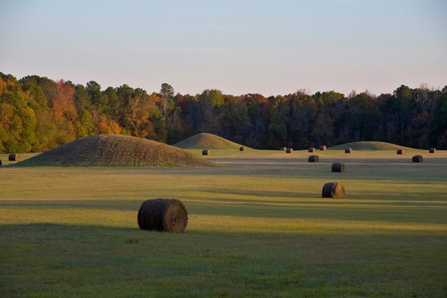
Pharr Mounds - Milepost 286.7Around 2,000 to 1,800 years ago native people built Pharr Mounds, a complex of eight dome-shaped mounds, spread over 90 acres. Skillfully designed and built, these mounds are a source of wonder and pride. Spiritually enduring, they become the cornerstones of civic and religious ceremonies and rituals. Modern Chickasaw feel a strong bond with Pharr Mounds and consider them sacred. Many return here as part of a pilgrimage to their ancestral homeland. Parking
RestroomsWomen's
Men's
Paths

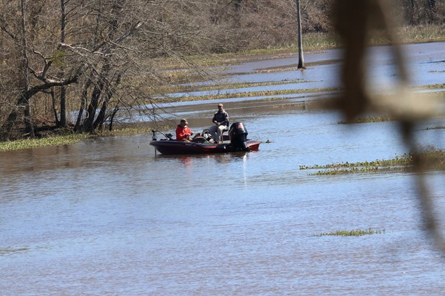
Tenn-Tom Waterway - Milepost 293.2Land and water meet here. The Jamie L. Whitten bridge on the Natchez Trace Parkway crosses over a section of the 234-mile long Tennessee-Tombigbee (Tenn-Tom) Waterway, the largest land moving project in the United States. Parking
Paths
Picnic Area

Cave Spring - Milepost 308.4Paleo hunters who used the Bear Creek Mound site probably used Cave Spring as a water source. A collapsed underground limestone cavern formed this cave. A short, steep, paved trail takes you to its mouth. Although this was an important water source for thousands of years, for safety reasons the NPS guards against drinking this water or entering the cave. Parking
Paths

Bear Creek Mound - Milepost 308.8About 900 years ago, mound building began along Bear Creek. Before the mounds, the site was used by semi-sedentary groups for thousands of years. Typical of a Mississippian period village, a ceremonial building sat on Bear Creek’s flat top, providing a focus for spiritual life. Parking
Paths

Colbert Ferry - Milepost 327.3This area has:
Picnic Area and Boat DockParkingThere are two parking lots in the area. The upper lot serves the picnic area and the lower lot serves the boat dock. The upper parking lot has:
The lower parking lot has:
RestroomsThe restrooms are located between the upper and lower parking areas. Access from the lower parking lot by the boat dock requires climbing several steep stairs. There is an accessible space in front of the restroom. Women's
Men's
Picnic Area
Boat DockTo get to the boat dock, take the sidewalk to the boardwalk, and finally down the steep gangway to the floating dock. The dock has 4 boat hitches. Old Colbert Ferry AreaParking
Paths
Colbert’s StandGeorge Colbert lived atop this ridge overlooking the Tennessee River. As one of the many inns that dotted the Trace between Nashville and Natchez, it provided travelers with food and lodging. Parking
Colbert Ferry Trail AreaLocated just after turning off Natchez Trace Parkway, this small parking area has access to picnic tables and the trailhead. There is a bike maintenance station here. Parking
RestroomsWomen's
Men's
Paths
Picnic Area
Colbert Ferry Bicycle CampAt milepost 327, the Colbert Ferry site provides a bicycle-only campground with picnic tables, grills, and fire rings. 
Trail of Tears Water Route Overlook - Milepost 328.7Three detachments of Cherokee, totaling about 2,800 people, traveled by river past this location. ParkingThe parking lot loop is paved but does not have lines designating spaces. Picnic AreaIn the center of the parking lot there is a grassy area with picnic tables. There are no defined paths to the tables. 
Rock Spring - Milepost 330.2Rock Spring Nature Trail offers you an opportunity to explore a small natural spring as it bubbles forth from the ground. There are a series of rock steps across the water with large gaps in between them. This section is likely impassible for those using mobility devices or for those will balance concerns. Trail Specs
Parking
|
Last updated: June 2, 2025
