
Article
Reclaiming New Deal-Era Civic Archeology: Exploring the Legacy of William S. Webb and the Jonathan Creek Site
by Sissel Schroeder
In the 19th and early 20th centuries, antiquarians and archeologists focused on ancient monuments and documented numerous mound and earthwork sites across eastern North America.(1) Many of these highly visible places subsequently were destroyed by development and dam-building projects, while others were preserved for public edification. Eminent sites that were the focus of early attention, like Moundville in Alabama, Etowah in Georgia, and Cahokia in Illinois, became icons in American archeology, serving to define regional archeological cultures and stimulating inquiry into diverse aspects of mound construction and use.(2)
Early investigations at many of these important places established interpretive frameworks that persist today in popular and even scholarly reviews, part of a disciplinary situation in which "tradition oversees both the production and legitimation of archaeological knowledge."(3) However, the original stories created by archeologists sometimes were based on sketchy impressions of evidence or studies of small, often biased, samples of materials. When fuller analyses were performed, they were conducted within the prevailing paradigms of the times—classification and description, functionalism, culture history, and chronology building.(4) The foreshortened chronology that existed prior to the early 1950s and the first applications of radiocarbon dating(5) facilitated widespread attempts to draw analogies between archeological materials and living or ethnohistorically documented Native American societies. This prompted many scholars to explain similarities and differences in terms of relatively simplistic notions of migration.(6)
Over the past decade or more, many archeologists have chosen to reinvestigate old collections that would be impossible to duplicate today because the sites have been destroyed or the scale of the original excavations could not be achieved due to high costs.(7) This reclamation of curated collections is conducted within new interpretive frameworks that consider ancient social, political, and ethnic diversity; the actions of individuals; and the impact that internal and external sources of variation can have on the establishment of communities and their development. These approaches have come to replace traditional models of cultural evolution that focused on external sources of change. New studies of old collections are significantly altering our understanding of many of these iconic places, even though multiple inferences may still arise from the available evidence. Future studies may disclose fresh information about the ancient past when old collections are reexamined in light of new developments in archeological method and theory, underscoring the importance of the long-term curation of archeological materials and archives.
To examine changing approaches to heritage studies, we can look at the recurring investigations at Jonathan Creek, a Mississippian-era (ca. A.D. 1000-1600) mound site in western Kentucky and the different ways in which archeologists have interpreted time and the use of space at the site.(Figure 1) The Jonathan Creek site is one of those places that has, since its partial excavation in the early 1940s, assumed iconic significance in the archeology of the lower Tennessee and Ohio valleys and the central Mississippi Valley. The site is referenced in most publications dealing with the Mississippian Tradition in this region, mentioned in synthetic overviews of eastern North American archeology, and its name has been used to designate a regional, temporally restricted manifestation of Mississippian.(8) The Mississippian Tradition initially was defined on the basis of artifacts, particularly shell-tempered pottery.(9) Since the 1960s, descriptions have shifted to stress an agricultural adaptation to resource-rich riverine settings, hierarchical sociopolitical systems classified by many archeologists as chiefdoms, and a settlement hierarchy in which the community of the leader or chief often is distinguished archeologically from smaller communities by the presence of flat-topped pyramidal earthen mounds and other monumental architecture of the sort seen at Jonathan Creek.(10)
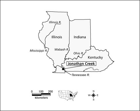 |
Figure 1. Map showing the location of the Jonathan Creek site. |
History of Investigations at Jonathan Creek
The first published account of Jonathan Creek appeared in a late-19th-century report on the geology of western Kentucky. The surveyor, Robert Loughridge, who recognized the ancient earthworks as constructions of American Indians, identified, described, and mapped six earthen mounds situated on a terrace overlooking Jonathan Creek, as well as a seventh mound in the floodplain of the creek.(11)(Figure 2)
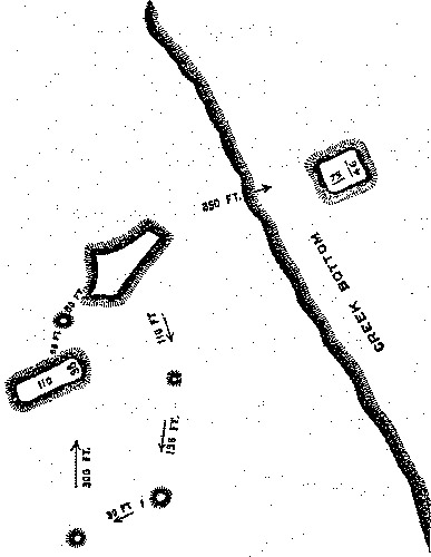 |
Figure 2. While conducting a geological survey of western Kentucky, Robert Loughridge visited the Jonathan Creek site and sketched this map. (From Loughridge, Report on the Geological and Economic Features of the Jackson Purchase Region [1888], 193.) |
The site was mentioned again in the early 20th century, this time by a man of wealth and distinction from Philadelphia, Clarence Bloomfield Moore, who, aboard his riverboat, the Gopher of Philadelphia, plied the waters of major valleys in the southeastern United States between 1891 and 1918 in search of significant and visually prominent archeological sites.(12) Moore stopped at Jonathan Creek in 1914-1915, reported the presence of mounds that had been impacted by more than a century of plowing, and noted that two of them had the flat tops typical of Mississippian mounds.(13) The Henson family, who had owned the property on which the site was located since at least the time of Loughridge's visit, told Moore that they never noticed any artifacts or bones on the mounds. When Moore's limited testing failed to turn up many cultural materials, he quickly moved on to explorations elsewhere.
Jonathan Creek is next mentioned in early statewide summaries of Kentucky's heritage resources produced by University of Kentucky zoologist, William D. Funkhouser, and physicist, William S. Webb,(14) who visited the Jonathan Creek site in September 1924.(15) In 1927, these two scientists established the Department of Archaeology and Anthropology at the University of Kentucky to obtain a truck from the National Research Council to use in their statewide archeological survey. By 1931, they had created the Museum of Anthropology to exhibit the results of their research and house the growing quantity of artifacts that they were systematically collecting on their expeditions around the state.(16) Serious archeological investigation of Jonathan Creek was renewed by Webb in the late 1930s, this time in the context of impending site destruction.
Civic Archeology of the New Deal Era
Shortly after Franklin D. Roosevelt was inaugurated as president in 1933, he delivered on his campaign promise of a New Deal for all Americans by establishing federally funded relief agencies to stimulate the economy, reduce poverty, and provide jobs. One of these agencies, the Tennessee Valley Authority (TVA), was responsible for dam construction along the Tennessee River.(17) Proposed TVA activities produced an urgent crisis for archeologists when they realized the extent to which heritage resources in the Tennessee drainage basin were in danger of destruction. Archeologists began petitioning the TVA to support a program of salvage archeology using labor provided by
other federal work relief agencies. Archeologists in the Southeast successfully tapped into several of these programs, most notably the Works Progress Administration (WPA), in part because they were able to employ and train unskilled laborers, the tools of the trade (e.g., shovels) were simple to use and inexpensive, significant archeological sites were readily identified in many of the areas where unemployment levels were especially high, and the mild climate made it possible to do archeology year-round.
In 1938, TVA asked Webb to document archeological resources in the Kentucky Basin, which was to be created by the construction of the Kentucky Dam across the Tennessee River at Gilbertsville, Kentucky.(18) In 1939, an archeological survey of land that would be flooded by the dam was conducted, and the Jonathan Creek site was designated for further intensive investigation. Excavations were initiated on October 23, 1940, with Civilian Conservation Corps (CCC) labor under the direction of Webb, who corresponded with site supervisors James R. Foster, Glenn E. Martin, and Joseph Spears from his office at the University of Kentucky in Lexington. CCC laborers were young men from across the country who typically worked in the national forests, parks, and range lands.(Figure 3) Webb was reluctant to use them for an archeology project, but western Kentucky lacked a suitable WPA labor pool and Frank Setzler and Matthew W. Stirling of the Smithsonian Institution convinced Webb that CCC laborers could be productively used and were less costly than WPA workers.(19) The plan was to excavate the entire Jonathan Creek site, but fieldwork prematurely terminated on March 20, 1942, when the laborers and site supervisors were mobilized for World War II. Less than half the site had been excavated revealing 89 house structures and 8 stockade lines, or palisades, with bastions.(Figure 4)
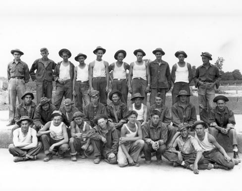 |
Figure 3. CCC laborers from Unit B at Jonathan Creek, May 16, 1941. (Courtesy of the William S. Webb Museum of Anthropology, University of Kentucky.) |
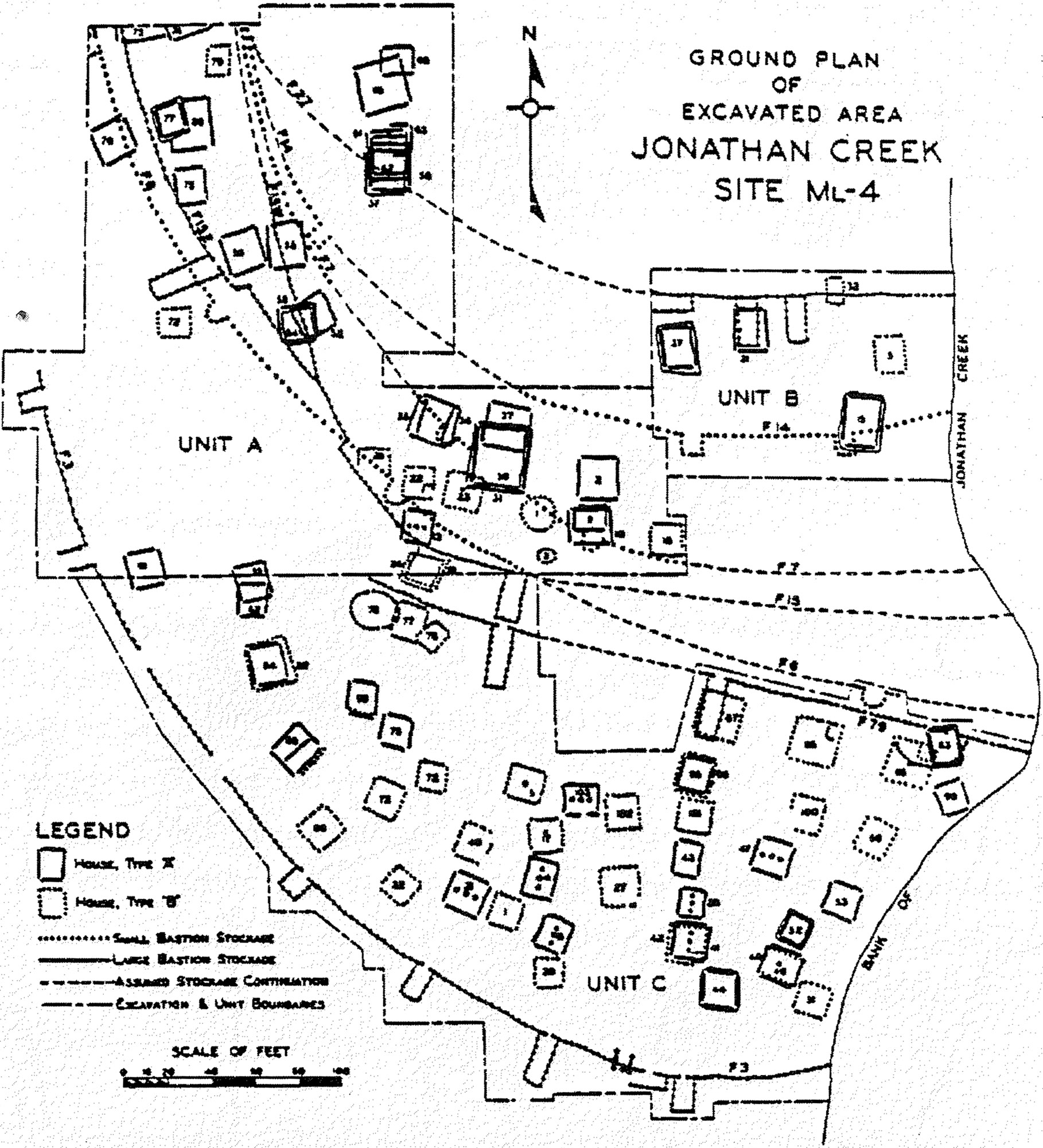 |
Figure 4. Webb prepared this map of excavations at the Jonathan Creek site, which emphasized village residential space and omitted numerous post, pit, and hearth features in order "to present an overall general picture of the relative arrangement of major features." (From Webb, The Jonathan Creek Village [1952], 15-17.) |
A brief report was published in 1952, and, astonishingly, it remains the definitive work on Jonathan Creek. Unfortunately, the artifact analyses are based on a very small fraction of the more than 100 cubic feet of cultural materials recovered. Only 150 stone artifacts and 2,685 ceramic rims, sherds, and other items were tabulated in the report.(20) The analyses are largely descriptive, with some functional interpretation of certain artifact types. Furthermore, the feature contexts from which the inventoried objects came are not known. Webb, like many of his colleagues at the time who also did not have formal training in archeology, did not fully appreciate the extent to which the context of artifacts could help solve some of his questions about time and the use of space, and instead relied on architecture to make these kinds of inferences.
Post-World War II Archeology
Following the completion of the Kentucky Dam in 1944,(21) the waters of Kentucky Lake inundated most of the Jonathan Creek site leaving a small portion, including the two largest mounds, which had not been investigated during the CCC project, exposed on a narrow island. During the past couple of decades, recurring shoreline surveys have documented erosion and looting of the site, but no further major field investigations have been undertaken.(22)
The collections produced by the CCC project at Jonathan Creek have been curated at the University of Kentucky Museum of Anthropology (renamed the William S. Webb Museum of Anthropology in 1995) since the fieldwork ended. Various scholars periodically have viewed portions of the excavated materials and earlier survey collections with the goal of establishing a chronology for the site. Because most of the materials were not washed until the late 1990s, much of this work proceeded in an unsystematic fashion that relied on the relatively small number of ceramics, exotics, and other materials that had been pulled when Webb was preparing his final report. In conjunction with analyses of excavated assemblages from a nearby stratified site, one such study of a sample of Jonathan Creek ceramics established the basic ceramic chronology for the region,(23) which, with minor alterations, continues to be used.(24)
Reclaiming New Deal Archeology: The Present Project
Several years ago, I initiated a major new analysis of Jonathan Creek by mapping the various features excavated in a Geographic Information System (GIS) including those omitted by Webb from his 1952 map, correlated these with topography and established a spatially-based data structure to guide the artifact inventory, which has only recently been initiated. The work that was accomplished would have been impossible without the use of GIS technology to digitally process more than 1,000 topographic measurements taken across the site and manage the data recorded on thousands of postmolds (impressions left in the ground by rotted wooden posts) and more than 100 excavated
features and structures. The mapping phase of the research has clarified some of the spatial and temporal relationships among architectural features and led me to re-evaluate Webb's inferences about space, time, and community layout, and formulate new interpretations of the site.
Origins of a Controversy over Houses and Stockades
The Webb-era excavations uncovered a remarkable range of architectural styles that includes single-post circular structures, single-post square or rectangular structures, rectangular pithouses (basins with interior wall trenches), and square or rectangular wall-trench structures, some of which have three large roof support posts running down the center.(25)(Figure 5) In addition, at least eight separate walls were constructed around the village and another was built through a portion of the community. At the time of the excavation in the early 1940s, there had been little investigation of sites so intensively protected by massive defensive constructions.
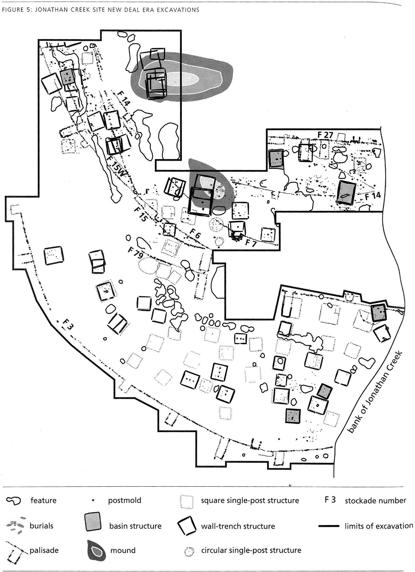 |
Figure 5. Jonathan Creek Site New Deal Era Excavations. The first comprehensive GIS map of Jonathan Creek shows stockades, architecture, features, and the limits of excavation as well as two small mounds. The topography has been simplified to show only the mounds, which are mapped with a 6-inch contour interval. (Courtesy of the author.) |
Webb's detailed descriptions of the stockades are a major contribution to regional culture history. In his monograph, Webb stressed the diverse architecture and numerous stockades, some with long bastions, others with short bastions, and the extensive evidence for rebuilt structures and the repair of stockades.(26) Webb focused his discussion on examples of superimposed architecture as a means to determine the residential history of the village. Webb split the history into two separate occupations based on differences in architectural style and bastion design, thereby sowing the seeds of a controversy over the connection between architectural style and ethnicity.
It was not feasible in the 1950s to create one map that illustrated all excavated areas or a detailed topographic map with a narrow contour interval to show subtle shifts in the topography at the site. With the aid of computer mapping programs, and using the meticulously drawn field maps of individual features, I created a comprehensive map of the residential area of Jonathan Creek that includes all features recorded. This was overlaid on a detailed topographic map reconstructed from the original survey readings.(Figure 5)
As I explored this new map, I noticed several previously unrecognized spatial patterns. In the northwest corner of the map are two long, narrow linear pit features, or trenches, which Webb interpreted as erosional gullies. However, both features run parallel to and just outside one of the stockade lines. They do not appear to follow the entire length of the wall, and consequently may not represent ditches of the sort found surrounding some palisaded Mississippian villages, like King in Georgia, Snodgrass in Missouri, and a number of sites in the Lower Mississippi Valley.(27) Instead, I suggest that these represent pits created as people excavated dirt used to possibly reinforce this extensively repaired segment of the wall that had deteriorated or been damaged in an attack on the community. An area with a continuous line of partially conjoined pit features running east-west through the southern half of the map, parallel to another stockade line, may be the consequence of similar activities. Other large pit features may be places where soil was removed to construct earthen mounds.
I also find it notable that there are relatively few overlapping features and extraneous postmolds in the southern half of the excavated area in contrast to the quantity of extraneous postmolds and intersecting features and stockade walls identified in the northern half, where Webb focused much of his efforts to separate construction sequences. In two places, however, when I overlaid the GIS map on the topographic map it became clear that the sequentially constructed buildings were located on top of low mounds.(Figure 5) One of these mounds, in the northwestern corner of the excavation, had five superimposed wall-trench structures, the most extensive amount of structure rebuilding apparent at the site. These features were excavated near the end of the field project when remnants of the crew were rushing to complete as much work as possible. As a consequence, there are no notes or detailed maps.
I have been able to reclaim more information for the other small mound near the center of the excavation, which was investigated mostly between March and June 1941.(28) In the location of this small mound, at one time on the margins of the community, a burial was placed in a shallow grave and covered by the first stage of mound construction, actions I interpret as indicating a dramatic change in the activities conducted in this part of the site from secular/domestic to ritual/sacred. Once the mound was erected, a wall-trench structure was constructed on the summit. It was later replaced with a second structure, which was destroyed by fire. Following the addition of a thin layer of earth to the mound, a third structure was erected, and it, too, catastrophically burned but was never rebuilt. In addition, nearly a dozen individuals were buried on the mound in shallow graves just outside the structures.
The three structures on top of this small mound are the largest at the site, which I argue signals a sacred and special use, possibly as charnel houses where the bodies and bones of deceased ancestors were stored before being buried in the mound or elsewhere. The final two structures built on this mound may have burned accidentally or been intentionally destroyed as part of a ritual, following a defeat in battle, or upon the death of a particularly beloved leader.(29) Alternatively, these events may have happened during an attack on the community by enemies intent on desecrating the burial place of the ancestors of community leaders.(30) The reasons for the destruction are not entirely clear, but after the last conflagration, the mound was no longer used.
Webb's Interpretive Framework
The Jonathan Creek report was published shortly after the first application of radiocarbon dating and widespread acceptance that the ancient history of the Americas extended back at least 10,000 years, yet Webb's interpretive framework remained entrenched within a sense of foreshortened time depth that characterized American archeology prior to World War II. Webb sought to interpret architecture at the site (Figure 6) in terms of chronology and migration. He also used analogy with the chronicles of the 16th-century de Soto entrada,(31) which described similar kinds of palisaded villages, and ethnohistoric accounts of the Chickasaw, who claimed lands in western Kentucky where Jonathan Creek is located, and the Natchez, who had historic connections with the Chickasaw.(32) He noted the absence of European trade goods from Jonathan Creek and that the ceramics differed from those recovered from known 16th- and 17th-century sites, like Chickasaw Old Fields in Mississippi,(33) leading him to rightly conclude that the site predated European contact.(34) Webb, however, was reluctant to reconstruct ancient lifeways, possibly because of his lack of formal training in anthropology, which seems to have hampered him more than other archeologists of the time, many of whom also did not have strong anthropological backgrounds.(35)
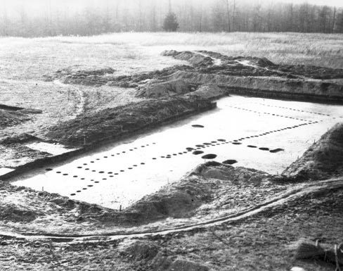 |
Figure 6. Photograph of a segment of the outermost stockade at Jonathan Creek that was excavated with CCC labor. Postmolds that are part of a stockade line, gate, defensive tower, and long bastion are visible. (Courtesy of the William S. Webb Museum of Anthropology, University of Kentucky.) |
Webb did not describe the site as belonging to the Mississippian Tradition, even though this cultural classification had been in use for nearly half a century.(36) Instead, he drew analogies with other sites in the Southeast on the basis of similar ceramics, house styles, and stockades. The material culture descriptions provided in the report are relatively simple, conforming to an approach Webb had used since he first began archeological research in Kentucky in the 1920s, and focused on a limited inventory of the materials recovered, stressed functional interpretations, and avoided accepted typologies.(37) This trait list approach to archeological classification, common practice before World War II, later came under heavy criticism.(38)
The story related by Webb in a section of his report appropriately and cautiously entitled, "Speculations," is that the Jonathan Creek site had been occupied by two distinct sets of people. According to Webb, the first residents of the community lived in wall-trench structures and pit houses and built the stockades with the large, rectangular bastions.(Figure 4) Webb argued that the innermost of these stockades was constructed first and the community gradually expanded in size.(39) He further suggested that the people responsible for the first occupation were Chickasaw. He hints that the site was then abandoned for a period of time.
Webb posited that the second occupation of the site started out small, by people who built the square single-post structures and the stockades with the small bastions. He suggested that the first wall erected was the innermost small-bastioned stockade. Subsequent stockades reflected slight but insignificant increases in community size. Webb associated this second occupation of the site with the Natchez.
A Reconsideration of Webb's Evidence
Structures
Webb used several lines of evidence for his inferences about two occupations at the site, most of which are equivocal or have not been confirmed by a thorough reinspection of the field notes, maps, and photographs. Webb treated the wall-trench buildings as a diagnostic trait of the first occupants of the site and associated the single-post structures with the second occupants.(40) However, very few examples of overlapping buildings of different types exist. When I reexamined the field maps and notes, I identified at least two wall-trench structures that were built over abandoned single-post structures. Other attempts to distinguish consistent sequences in architectural style have been unsuccessful.(41) The evidence for significant temporal differences in structure style at the site is ambiguous, and explanations for architectural variability need to be sought elsewhere.
Different building styles may instead reflect functional distinctions such as seasonal occupations, menstrual huts, public buildings, and small structures used to store corn and other resources.(42) However, at Jonathan Creek different styles that might represent summer (single-post) and winter houses (wall-trench and pithouses) are not clearly paired together as is the case at other Mississippian sites like Chota-Tanasee, Toqua, and Ledford Island in Tennessee.(43) Alternatively, some of the distinctive architecture may symbolize membership in a particular social group or represent ethnic or other differences among contemporaneous occupants of the site.
Stockades
Webb asserted that each of the stockade lines with long bastions(44) was constructed across undisturbed areas and argued that such a pattern would result only from sequential expansion of the village. I have found one exception to his observation of a village expanding across previously unused land—a wall-trench structure on the western margins of the site that had been abandoned before one of the long bastioned stockades was constructed across the same area. It is possible that a few houses were located outside the early stockaded community,(45) and the people who lived there were expected to raise a cry of warning when enemies were approaching the village. However, in all other cases where structures overlap long-bastioned stockade lines and the chronological ordering of the features can be teased apart, the structures were built after the stockades had been dismantled, confirming Webb's conclusion about a community that had grown over time.
In contrast to the walls with the long bastions, the stockades with small bastions(46) were constructed over many features and structures. Because of the different design of these bastions, Webb reasoned that they were built by other people who, he argued, were responsible for the second occupation of the site. After reviewing the maps and field notes, it is clear that one stockade line with small bastions (Feature 6) was definitely constructed after one of the long bastioned stockades, but it is not possible to determine the temporal relationships among the other small-bastioned stockade lines and any of the long-bastioned stockades.
Webb also argued that the three stockades with small bastions were the last three walls to be erected. While I agree that they probably postdate most of the long-bastioned stockades, I think that the outermost wall (Feature 3), which has both long and short bastions, was the final stockade.(47) It is the only wall with no evidence for rebuilding, post replacement, or intentional dismantlement. It was constructed of the largest posts of any stockade at the site, and the posts were sunk deeper into the ground. In short, the construction sequence for the stockades at Jonathan Creek is probably more complex than recognized by Webb, the shifting placement of walls reflects either community growth or a southward shift in the center of the community, and the bastion styles cannot be used reliably to distinguish a temporal order for the stockades.
Cultural Affiliation
In making inferences about the source of variability in architecture, Webb stressed ethnicity and time. The association between the first occupation, represented by wall-trench structures and long-bastioned stockades, and the Chickasaw was based in part on an assumption, common before World War II, of continuity between late prehistoric and early historic times in terms of the geographic distribution of tribes. An 1818 treaty between the United States Government and the Chickasaw Nation recognized the Chickasaw claim to territory that included western Kentucky where the Jonathan Creek site is located. In addition, Webb had been involved in the excavation of a Creek village in Guntersville Basin in Alabama where a stockade with long bastions was uncovered. Because both the Chickasaw and the Creek are Muskhogean speakers, Webb located the origin of the stockade construction in the common history of these two tribes.(48)
Webb's suggestion that the Natchez were responsible for the second occupation of the site, represented by single-post structures and short-bastioned palisades, is based on an 18th-century account of a Natchez fort built of wooden logs and "at every forty paces along the wall a circular tower jets out."(49) Webb found this an apt description of the Jonathan Creek stockades with small bastions, including the distance between bastions, which, at 125 feet (38 m), is roughly equal to 40 paces. As was common in the mid-20th century, Webb assumed that similar material traits between archeological contexts and ethnohistoric and ethnographic descriptions reflected "common origins, history, and ethnicity," failing to recognize, as we do today, that evolutionary convergence and independent invention can produce material similarities.(50) Furthermore, he noted that when the Natchez were defeated and displaced by the French in 1730-1731, some survivors joined with the Chickasaw, reflecting in his view, a deep history of association between the two tribes.(51)
Interpretive Frameworks
Webb's interpretive framework, strongly influenced by his interest in connecting prehistory and history and common in Americanist archeology before World War II, has since been strongly criticized and fallen out of favor.(52) His inference of a historical link between Jonathan Creek and the Chickasaw was predicated on assumptions of regional settlement continuity and cultural stability that are not confirmed by the archeological record.
Archeologists working in the confluence region of the lower Ohio River Valley and western Kentucky have found few sites with radiometric evidence of occupations after about A.D. 1400 or 1450.(53) Radiocarbon dates from Jonathan Creek place a substantial portion of the occupation history of the site between A.D. 1200 and 1300.(54) These data support the notion of regional settlement abandonment in the Mississippi-Ohio confluence area and western Kentucky after circa A.D. 1450 and weaken Webb's direct historic analogies with the Chickasaw. In recent decades, Mississippian societies have been recognized as inherently dynamic and unstable political organizations prone to formation, expansion, cycling back and forth between different levels of complexity, fission-fusion, collapse, migration, and settlement and regional abandonment.(55) This view of Mississippian societies and the regional radiocarbon data is incompatible with the assumption of cultural stability that underlies Webb's approach to connecting prehistory with the historic ethnographic record. Along with the possible multi-ethnic composition of these ancient communities, this poses considerable challenges for scholars and others concerned with the Native American Graves Protection and Repatriation Act (NAGPRA) who are interested in determining specific tribal affiliations for archeological materials from sites that predate European contact.
Implications of Stockades
Most scholars presume that stockades are equated with concerns for security and war,(56) but it is important to consider alternative explanations of variation in wall construction that go beyond those focused strictly on military engineering. Webb, building on the evidence for a heavily fortified site, asserted that the people who established the community were recent migrants into the region. The differences between his first and second occupations can also be attributed to migration.
In the mid-20th century, it was common for archeologists to ascribe major change to migration.(57) However, in the case of Jonathan Creek, the migration question cannot be adequately addressed with the available evidence. The stylistic attributes of the ceramics from the site, although incompletely analyzed, are typical for Mississippian assemblages in western Kentucky and do not hint at an influx of people from a place distant enough to be ceramically distinctive. The investment in stockade construction certainly indicates a great concern for security, but the reasons that lie behind this are more difficult to identify. At their most fundamental level, the stockades demonstrate a serious concern for controlling access to and from the community. These substantial exterior walls, with narrow and protected entryways, enabled community members to control the movement of resources and people in and out of the town.
The substantial walls that surround entire communities, like Jonathan Creek, may have been another way of displaying status. A leader must have the resources and access to labor necessary to construct such an awe-inspiring feature.(58) Such planned and massive constructions also may have been a strategic response to conflict and threats of war. The constructions would have provided a measure of protection against siege attacks and may have been an offensive strategy to intimidate the enemy.
Conclusion
By virtue of the quality of the records and maps developed by the supervisors in charge of the 1940-1942 excavations at Jonathan Creek, which have been curated at the University of Kentucky since 1942, it has been possible to reclaim and expand their interpretive potential more than half a century later. Modern GIS-based analyses of these New Deal-era archival documents, long overlooked and underappreciated, enable a reevaluation of William S. Webb's conclusion that ethnic migration accounted for Jonathan Creek's architectural variability, and to consider the effects of politics and functional, social, and ethnic differences on architectural style.
It appears that the leaders and occupants of Jonathan Creek, a Mississippian-era settlement occupied primarily in the 13th century A.D., were encircled by a precarious political and social landscape, concerned about security and controlling the movement of people and goods into and out of the village, and preoccupied with displaying their status in a fashion that intimidated outsiders. With these reclaimed data, my work has reinterpreted Jonathan Creek, an iconic site in eastern North America that had remained frozen in mid-20th-century archeological frameworks, to consider how the unstable and dynamic nature of interactions among diverse peoples played out through war and conflict, alliance-building, and demographic expansion. Thus, as a result of my work, the significance of the site is extended beyond interpretations framed by culture history to encompass broader contemporary anthropological issues about cultural heterogeneity and complexity. Like the work of other scholars who are reinvestigating New Deal-era archeological materials, the ongoing Jonathan Creek research clearly demonstrates the potential of old collections to answer new questions and augment our understanding of ancient peoples. The Jonathan Creek site has a new kind of iconic status as an emblem of the benefits of archeological curation and the quality of New Deal-era archeology, underscoring how collections can be the foundation of past, present, and future knowledge.
About the Author
Sissel Schroeder is a professor of anthropology at the University of Wisconsin-Madison. She can be contacted at sschroeder2@wisc.edu.
The author is indebted to Mark Dudzik, Antoinette J. Lee, Alan P. Sullivan III, and anonymous reviewers for suggestions and insightful comments. Bryan Haley assisted with digitizing the maps. The William S. Webb Museum of Anthropology at the University of Kentucky encouraged this research and the author is most appreciative of assistance provided by Nancy O'Malley and George Crothers. The research presented in this paper was funded in part by the Vilas Associates Program and the Graduate School at the University of Wisconsin-Madison. The research also was funded in part by a grant from the National Park Service, U.S. Department of the Interior, administered through the Kentucky Heritage Council.
Notes
1. Ephraim G. Squier and Edwin H. Davis, Ancient Monuments of the Mississippi Valley, Smithsonian Contributions to Knowledge, vol. 1 (Washington, DC, 1848); Cyrus Thomas, Report on the Mound Explorations of the Bureau of Ethnology, 12th Annual Report of the Bureau of American Ethnology (Washington, DC, 1894).
2. Adam King, Etowah: The Political History of a Chiefdom Capital (Tuscaloosa: University of Alabama Press, 2003); Vernon J. Knight and Vincas P. Steponaitis, eds., Studies in Moundville Archaeology (Washington, DC: Smithsonian Institution Press, 1998); George R. Milner, The Cahokia Chiefdom (Washington, DC: Smithsonian Institution Press, 1998); Tim R. Pauketat and Tom E. Emerson, eds., Cahokia: Domination and Ideology in the Mississippian World (Lincoln: University of Nebraska Press, 1997).
3. Tim Murray, "Epilogue: Why the History of Archaeology Matters," Antiquity (York) 76 (2002): 236.
4. Bruce G. Trigger, A History of Archaeological Thought (Cambridge, UK: Cambridge University Press, 1989); Gordon R. Willey and Jeremy Sabloff, A History of American Archaeology, 3rd ed. (San Francisco, CA: W. H. Freeman and Co., 1995).
5. James R. Arnold and Willard F. Libby, "Radiocarbon Dates, I," Science 113 (1951): 111-120. The first application to archeological samples of known age, one from the southwestern United States and one from Egypt, occurred in 1949, see James R. Arnold and Willard F. Libby, "Age Determinations by Radiocarbon Content: Checks with Samples of Known Age," Science 110 (1949): 678-680.
6. See David W. Anthony, "Migration in Archaeology: The Baby and the Bathwater," American Anthropologist 92 (1990): 895-914; Clyde Kluckhohn, "Some Reflections on the Method and Theory of the Kulturekreislehre," American Anthropologist 38 (1936): 157-196; Irving Rouse, The Inference of Migrations from Anthropological Evidence, University of Arizona Social Science Bulletin 27: Migration in the New World Culture History, ed. Raymond H. Thompson (1958), 63-68; and William S. Webb, The Jonathan Creek Village (Lexington: University of Kentucky Press, 1954).
7. Included among recently published reinvestigations of old collections, many of which included new fieldwork, are King, Etowah; Milner, Cahokia Chiefdom; and Sissel Schroeder, "Place, Productivity, and Politics: The Evolution of Cultural Complexity in the Cahokia Area," (Ph.D. dissertation, Pennsylvania State University, 1997). For chemical compositional analyses of ceramics, stone, and metal to determine the geographic source of the raw material see, for example, Ronald L. Bishop, Robert L. Rands, and George R. Holley, "Ceramic Compositional Analysis in Archaeological Perspective," in Advances in Archaeological Method and Theory, vol. 5, ed. Michael B. Schiffer (New York: Academic Press, 1982), 275-330; Tom E. Emerson and Randall E. Hughes, "Figurines, Flint Clay Sourcing, the Ozark Highlands, and Cahokian Acquisition," American Antiquity 65 (2000): 79-101; and Douglas J. Kennett et al., "Compositional Characterization of Prehistoric Ceramics: A New Approach," Journal of Archaeological Science 29 (2002): 443-455. For ceramic petrography see James B. Stoltman, "The Role of Petrography in the Study of Archaeological Ceramics," in Earth Sciences and Archaeology, ed. Paul Goldberg, Vance T. Holliday, and C. Reid Ferring (New York: Kluwer Academic/Plenum Publishers, 2001), 297-326; and James B. Stoltman and Robert C. Mainfort Jr., "Minerals and Elements: Using Petrography to Reconsider the Findings of Neutron Activation in the Compositional Analysis of Ceramics from Pinson Mounds, Tennessee," Midcontinental Journal of Archaeology 27 (2002): 1-33. For food residue analyses, see Eleanor A. Reber, "Maize Detection in Absorbed Pottery Residues: Development and Archaeological Application," (Ph.D. dissertation, Harvard University, 2001). For dietary isotopic analysis of human skeletal material, see, for example, Jane E. Buikstra, "Diet and Disease in Late Prehistory," in Disease and Demography in the Americas, ed. John W. Verano and Douglas H. Ubelaker (Washington, DC: Smithsonian Institution Press, 1992), 87-101. For an application of Geographic Information System technology to the analysis of spatial data, see Sissel Schroeder, "Power and Place: Agency, Ecology, and History in the American Bottom, Illinois," Antiquity (York) 78 (2004), forthcoming.
8. Brian M. Butler, "Kincaid Revisited: The Mississippian Sequence in the Lower Ohio Valley," in Cahokia and the Hinterlands: Middle Mississippian Cultures of the Midwest, ed. Tom E. Emerson and R. Barry Lewis (Urbana: University of Illinois Press, 1991), 264-273; R. Berle Clay, "A Mississippian Sequence from Western Kentucky," Tennessee Anthropologist 4 (1979): 111-128; R. Berle Clay, "The Mississippian Succession on the Lower Ohio," Southeastern Archaeology 16 (1997): 16-32; Charles R. Cobb and Brian M. Butler, "The Vacant Quarter Revisited: Late Mississippian Abandonment of the Lower Ohio Valley," American Antiquity 67 (2002): 625-641; Sherri L. Hilgeman, Pottery and Chronology at Angel (Tuscaloosa: University of Alabama Press, 2000); R. Barry Lewis, Mississippian Towns of the Western Kentucky Border: The Adams, Wickliffe, and Sassafras Ridge Sites (Frankfort: Kentucky Heritage Council, 1986); R. Barry Lewis, "The Late Prehistory of the Ohio-Mississippi Rivers Confluence Region, Kentucky and Missouri," in Towns and Temples along the Mississippi, ed. David H. Dye and C. A. Cox (Tuscaloosa: University of Alabama, 1990), 38-58; R. Barry Lewis, "The Early Mississippi Period in the Confluence Region and its Northern Relationships," in Cahokia and the Hinterlands, ed. Tom E. Emerson and R. Barry Lewis (Urbana: University of Illinois Press, 1991), 274-294; R. Barry Lewis, "Mississippian Farmers," in Kentucky Archaeology, ed. R. Barry Lewis (Lexington: University of Kentucky Press, 1996), 127-160; George R. Milner, The Moundbuilders: Ancient Peoples of Eastern North America (London: Thames and Hudson, 2004), 98, 115; Clarence B. Moore, "Aboriginal Sites on Tennessee River," Journal of the Academy of Natural Sciences of Philadelphia, 2nd Ser., 16 (1915): 170-304; Jon Muller, Archaeology of the Lower Ohio River Valley (Orlando, FL: Academic Press, 1986); Douglas W. Schwartz, Conceptions of Kentucky Prehistory: A Case Study in the History of Archaeology (Lexington: University of Kentucky Press, 1967); Charles Stout and R. Barry Lewis, "Mississippian Towns in Kentucky," in Mississippian Towns and Sacred Places, ed. R. Barry Lewis and Charles Stout (Tuscaloosa: University of Alabama Press, 1998), 151-178; Kit W. Wesler, Excavations at Wickliffe Mounds (Tuscaloosa: University of Alabama Press, 2001).
9. William H. Holmes, Aboriginal Pottery of the Eastern United States, Bureau of American Ethnology 20th Annual Report, (Washington, DC: Smithsonian Institution, 1903); William C. McKern, "The Midwestern Taxonomic Method as an Aid to Archaeological Study," American Antiquity 4 (1939): 301-313.
10. For ecologically focused definitions of Mississippian, see James B. Griffin, "Eastern North American Archaeology," Science 156 (1967): 175-191; and Bruce D. Smith, "Variations in Mississippian Settlement Patterns," in Mississippian Settlement Patterns, ed. Bruce D. Smith (New York: Academic Press, 1978), 479-503. The chiefdom classification follows Elman R. Service, Primitive Social Organization (New York: Random House, 1962).
11. Robert H. Loughridge, Report on the Geological and Economic Features of the Jackson Purchase Region (Lexington: Kentucky Geological Survey, 1888), 193.
12. Lawrence E. Aten and Jerald T. Milanich, "Clarence Bloomfield Moore: A Philadelphia Archaeologist in the Southeastern United States," in Philadelphia and the Development of Americanist Archaeology, ed. Don D. Fowler and David R. Wilcox (Tuscaloosa: University of Alabama Press, 2003), 113-133; Vernon J. Knight Jr., ed., The Moundville Expeditions of Clarence Bloomfield Moore (Tuscaloosa: University of Alabama Press, 1996), 1-20; Richard R. Polhemus, ed., The Tennessee, Green, and Lower Ohio Rivers Expeditions of Clarence Bloomfield Moore (Tuscaloosa: University of Alabama Press, 2002), 1-45.
13. Moore, "Aboriginal Sites," 189.
14. Funkhouser and Webb were responsible for professional archeological developments in Kentucky during the first half of the 20th century. See William D. Funkhouser and William S. Webb, Ancient Life in Kentucky (Frankfort: Kentucky Geological Survey, 1928), 119; William D. Funkhouser and William S. Webb, Archaeological Survey of Kentucky, Reports in Anthropology and Archaeology 2 (Lexington: University of Kentucky, 1932), 269-271.
15. Webb and Funkhouser, Ancient Life In Kentucky, 159.
16. Edwin A. Lyon, A New Deal for Southeastern Archaeology (Tuscaloosa: University of Alabama Press, 1996), 20.
17. Ibid.
18. Lyon, Southeastern Archaeology, 158; George R. Milner and Virginia G. Smith, New Deal Archaeology in Kentucky: Excavations, Collections, and Research, Occasional Papers in Anthropology no. 5 (Lexington: University of Kentucky, 1986), 19; Tennessee Valley Authority, A History of the Tennessee Valley Authority, 50th Anniversary Edition (Knoxville: Tennessee Valley Authority, 1983).
19. Lyon, Southeastern Archaeology, 164; Milner and Smith, New Deal Archaeology, 19.
20. Webb, Jonathan Creek Village, 87, 109.
21. Lyon, Southeastern Archaeology, 158; Tennessee Valley Authority, The Kentucky Project, Technical Report no. 13 (Knoxville: Tennessee Valley Authority, 1951), 1; Tennessee Valley Authority, The Tennessee River Navigation System: History, Development, and Operation, Technical Report no. 25 (Knoxville: Tennessee Valley Authority, 1964), 34.
22. Updated site forms on file at the Office of State Archaeology, Department of Anthropology, University of Kentucky; see also Lynne M. Wolforth, "Six House-Basin Structures: The Jonathan Creek Site and its Depositional History," in Current Archaeological Research in Kentucky vol. 1, ed. David Pollack (Frankfort: Kentucky Heritage Council, 1987), 101-119.
23. R. Berle Clay, "Ceramic Complexes of the Tennessee-Cumberland Region in Western Kentucky" (M.A. thesis, University of Kentucky, 1963).
24. Butler, "Kincaid Revisited" and Clay, "Mississippian Sequence."
25. Three single-post circular structures, 6 pithouses, 33 single-post square/rectangular structures, and 47 wall-trench structures. The numbers of each structure type differ slightly from that presented in Webb, Jonathan Creek Village, 58. Feature 18, Unit A, was described in the field notes and by Webb as a single-post rectangular structure, but wall trenches are clearly apparent in the photographs taken of this structure just before it was excavated. Feature 72, Unit A, was classified by Webb as a single-post circular structure, but based on the field maps it is a single-post rectangular structure.
26. Webb, Jonathan Creek Village.
27. David J. Hally, "Archaeology and Settlement Plan of the King Site," in The King Site: Continuity and Contact in Sixteenth-Century Georgia, ed. Robert L. Blakely (Athens: University of Georgia Press, 1988), 3-16; Philip Phillips, James A. Ford, and James B. Griffin, Archaeological Survey in the Lower Mississippi Alluvial Valley, 1940-1947, Papers of the Peabody Museum of American Archaeology and Ethnology no. 25 (Cambridge, MA: Harvard University, 1951), 329-324; James E. Price and James B. Griffin, The Snodgrass Site of the Powers Phase of Southeast Missouri, Anthropological Papers no. 66 (Ann Arbor: University of Michigan, Museum of Anthropology, 1979).
28. Sissel Schroeder, "Angelly Phase Mound Construction at Jonathan Creek," Proceedings of the Twenty-First Annual Kentucky Heritage Council Archaeology Conference, ed. Richard D. Davis and Richard V. Williamson (Frankfort: Kentucky Heritage Council, forthcoming).
29. Such a conflagration is depicted in a 16th-century engraving of Timucua Indians mourning a dead chief and described in Theodor de Bry, Narrative of Le Moyne, An Artist Who Accompanied the French Expedition to Florida under Laudonnière, 1564, trans. Frank B. Perkins (Boston, MA: James R. Osgood and Company, 1875), quoted in Emma Lila Fundaburk, Southeastern Indians: Life Portraits, A Catalogue of Pictures, 1564-1860 (Luverne, AL, 1958), 102.
30. See similar descriptions for Pacaha, Cofitachequi, and Anilco, three communities visited by Hernando de Soto, as described in Garcilaso de la Vega, The Florida of the Inca, trans. John Varner and Jeannette Varner (Austin: University of Texas Press, 1951), 292-293, 437-438, 493.
31. Lawrence A. Clayton, Vernon James Knight Jr., and Edward C. Moore, eds., The De Soto Chronicles: The Expedition of Hernando de Soto to North America in 1539-1543, 2 vols. (Tuscaloosa: University of Alabama Press, 1993).
32. Antoine Simon Le Page du Pratz, The History of Louisiana or the Western Parts of Virginia and Carolina (Baton Rouge, LA: Claitor's Publishing, 1774); John R. Swanton, Indian Tribes of the Lower Mississippi Valley, Bureau of American Ethnology, Bulletin 43 (Washington, DC, 1911).
33. Jesse D. Jennings, "Chickasaw and Earlier Indian Cultures of Northeast Mississippi," The Journal of Mississippi History 3 (1941).
34. See Webb, Jonathan Creek Site, 136. For an introduction to contact-era archeology in the Southeast, see David Hurst Thomas, ed., Archaeological and Historical Perspectives on the Spanish Borderlands East (Washington, DC: Smithsonian Institution Press, 1990).
35. For example, Milner and Smith, New Deal Archaeology in Kentucky; Schwartz, Conceptions of Kentucky Prehistory.
36. Holmes, Aboriginal Pottery.
37. Schwartz, Conceptions of Kentucky Prehistory.
38. Lyon, Southeastern Archaeology, 42; Milner and Smith, New Deal Archaeology, 15-16. For a historical discussion of the problems with the trait-list approach see Albert C. Spaulding, "Fifty Years of Theory," American Antiquity 50 (1985): 301-308.
39. On Webb's published map in Jonathan Creek Village, the labels for 15E and 15W are reversed.
40. Webb, Jonathan Creek Village, 67-74.
41. Clay, "Mississippian Sequence" and Wolforth, "Six House-Basin Structures."
42. For ethnohistoric descriptions of building uses, see William Bartram, Travels through North and South Carolina, Georgia, East and West Florida, The Cherokee Country, The Extensive Territories of the Muscogulges or Creek Confederacy, and the Country of the Chactaws (Philadelphia, PA: James and Johnson, 1791), 189-190, 365; James Hall, A Brief History of the Mississippi Territory (1801; reprint, Spartanburg, SC: The Reprint Company, 1976), 3-4; Gregory A. Waselkov and Kathryn E. Holland Braund, eds., William Bartram on the Southeastern Indians (Lincoln: University of Nebraska Press, 1995), 154-186; and Patricia Dillon Woods, French-Indian Relations on the Southern Frontier, 1699-1762 (Ann Arbor: UMI Research Press, 1979), 14. On menstrual huts, see W. David Baird, The Chickasaw People (Phoenix, AZ: Indian Tribal Series, 1974), 6; Woods, French-Indian Relations, 14; and Patricia Galloway, "Where Have All the Menstrual Huts Gone? The Invisibility of Menstrual Seclusion in the Late Prehistoric Southeast," in Women in Prehistory: North America and Mesoamerica, ed. Cheryl Claassen and Rosemary A. Joyce (Philadelphia: University of Pennsylvania Press, 1997), 47-62.
43. Richard R. Polhemus, The Toqua Site: A Late Mississippian Dallas Phase Town, Report of Investigations 41, Tennessee Valley Authority Publications in Anthropology 44 (Knoxville: Tennessee Valley Authority, 1987); Gerald F. Schroedl, ed., Overhill Cherokee Archaeology at Chota-Tanasee, Report of Investigations 38, Tennessee Valley Authority Publications in Anthropology 42 (Knoxville: Tennessee Valley Authority, 1986); Lynne P. Sullivan, "The Mouse Creek Phase Household," Southeastern Archaeology 6 (1987): 16-29; Lynne P. Sullivan, "Mississippian Household and Community Organization in Eastern Tennessee," in Mississippian Communities and Households, ed. J. Daniel Rogers and Bruce D. Smith (Tuscaloosa: University of Alabama Press, 1995), 99-123.
44. Features 27, 15/15E, 15W, 79, and 3.
45. Excavations at the Toqua Site in Tennessee revealed two structures located just outside the stockade. See Polhemus, The Toqua Site, 84, 1245.
46. Features 6, 7, and 14.
47. Sissel Schroeder, "Walls as Symbols of Political, Economic, and Military Might," in Leadership and Polity in Mississippian Society, ed. Paul Welch and Brian Butler (Carbondale: Center for Archaeological Investigations, Southern Illinois University, forthcoming).
48. Webb, Jonathan Creek Village, 135. Webb was self-conscious about his lack of formal training in anthropology and consequently was especially conscious of establishing the anthropological relevance of his archeological interpretations. See Lyon, Southeastern Archaeology, and Milner and Smith, New Deal Archaeology in Kentucky.
49. Webb, Jonathan Creek Village, 116.
50. Trigger, History of Archaeological Thought, 191. See also R. Lee Lyman and Michael J. O'Brien, "The Direct Historical Approach, Analogical Reasoning, and Theory in Americanist Archaeology," Journal of Archaeological Method and Theory 8 (2001): 303-342.
51. This defeat occurred following more than a year of war, 1729-1731. See du Pratz, History of Louisiana, 356.
52. Trigger, History of Archaeological Thought, 186-195.
53. Cobb and Butler, "Vacant Quarter Revisited" and Stephen Williams, "The Vacant Quarter and Other Late Events in the Lower Valley," in Towns and Temples Along the Mississippi, ed. David H. Dye and C. A. Cox (Tuscaloosa: University of Alabama Press, 1990), 170-180. For an alternative perspective on persistence of occupation in the region, see Lewis, "Late Prehistory of the Ohio-Mississippi Rivers."
54. Schroeder, "Walls as Symbols."
55. David G. Anderson, The Savannah River Chiefdoms: Political Change in the Late Prehistoric Southeast (Tuscaloosa: University of Alabama Press, 1994); John H. Blitz, "Mississippian Chiefdoms and the Fission-Fusion Process," American Antiquity 64 (1999): 577-592; George R. Milner and Sissel Schroeder, "Mississippian Sociopolitical Systems," in Great Towns and Regional Polities in the Prehistoric American Southwest and Southeast, ed. Jill E. Neitzel (Albuquerque: University of New Mexico Press, 1999), 95-107.
56. George R. Milner, "Palisaded Settlements in Prehistoric Eastern North America," in City Walls: The Urban Enceinte in Global Perspective, ed. James D. Tracy (Cambridge, UK: Cambridge University Press, 2000), 46-70; Karl T. Steinen, "Ambushes, Raids, and Palisades: Mississippian Warfare in the Interior Southeast," Southeastern Archaeology 11 (1992): 132-139; Mary Beth D. Trubitt, "Mississippian Period Warfare and Palisade Construction at Cahokia," in Theory, Method, and Practice in Modern Archaeology, ed. Robert J. Jeske and Douglas K. Charles (Westport, CT: Praeger, 2003), 149-162.
57. Trigger, History of Archaeological Thought, 194.
58. Schroeder, "Walls as Symbols."