
In This Issue
Learning Center Offers Self-Guided Smartphone Tour
Insights on Vegetation at Casa Grande Ruins National Monument
Vegetation Map Completed for Coronado National Memorial
Status of Climate and Water Resources
Project Updates
At the Desert Research Learning Center
Arrivals and DeparturesCalendar
Meet the New Boss: Take Our Virtual Tour
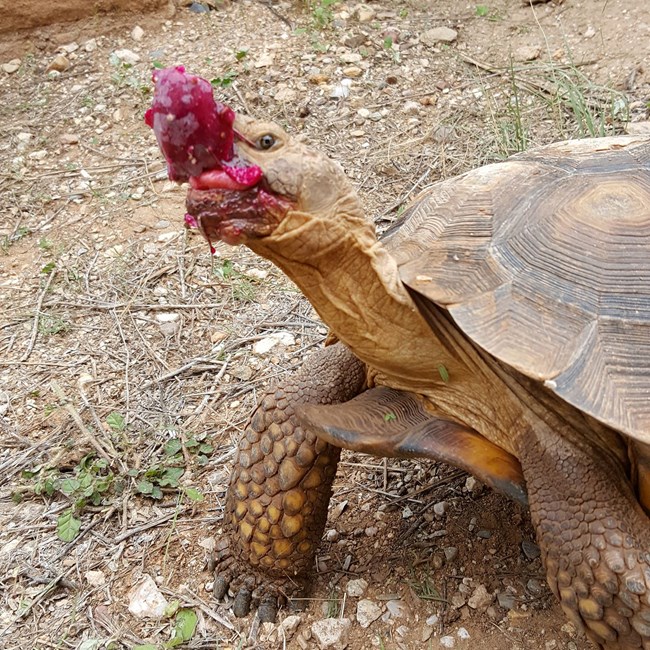
The Desert Research Learning Center now offers visitors a self-guided tour of its grounds via smartphone. The tour showcases the desert environment and demonstrates sustainable practices in arid lands. Tour stops include a pollinator garden, a heritage orchard, an artificial tinaja and flowing stream, and a variety of native plants and foods, all sustained by a rainwater collection system. The webpage for each stop tells users how they can incorporate the displayed techniques at their own homes and help conserve desert wildlife. You can access the tour from your smartphone or desktop.
How the Past Influences Today's Landscape at Casa Grande Ruins National Monument
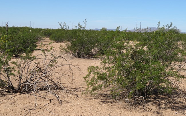
Our vegetation monitoring at Casa Grande Ruins National Monument has shown the park to be surprisingly low in plant diversity. Across six vegetation plots and eight years, only one common perennial species was found on all plots: the shrub, creosotebush (Larrea tridentata). On the other hand, biological soil crusts have colonized nearly 60% of the available habitat—one of the highest rates observed on any Sonoran Desert park. Our recent report uses assessment points to identify a few potential problems park staff should keep their eye on. It also reveals that today's lack of plant diversity may have its roots in the area’s recent—and ancient—history.
Vegetation Map Completed for Coronado National Memorial
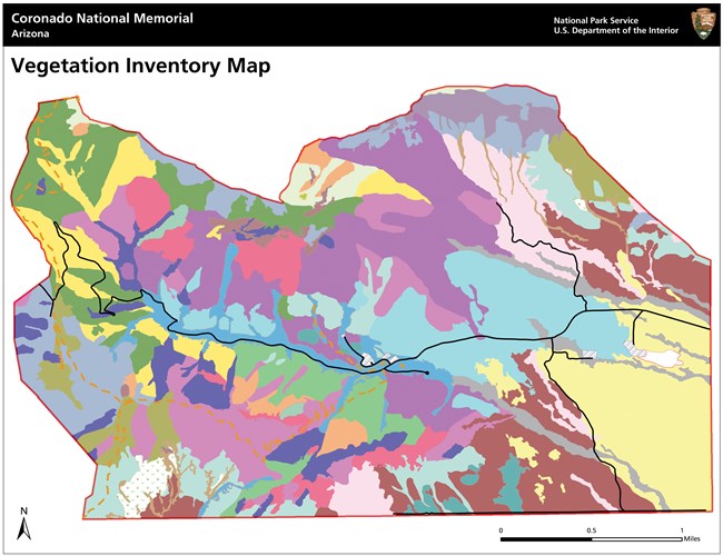
Knowing what’s growing where, and what kinds of habitat occur in a park, helps park managers with park planning, resource monitoring, interpretive programs, prescribed fire, and climate-change response, among other tasks. At Coronado National Memorial, we mapped 25 vegetation associations, ranging from dense, non-native grasslands dominated by exotic Lehmann lovegrass to steep expanses of exposed bedrock dominated by mountain mahogany and evergreen sumac.
Updates on Climate and Water Resources
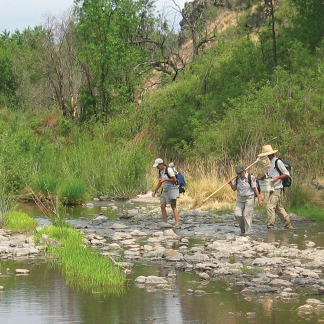
Hydrologic conditions are closely related to climate conditions. Because the two are better understood together, the Sonoran Desert Network reports on climate in conjunction with water resources. In 2018, we completed reports and briefs for climate and water resources at Casa Grande Ruins NM, Gila Cliff Dwellings NM, Montezuma Castle and Tuzigoot NMs, and Tumacácori NHP. To find out what it's like to collect streams data in the Sonoran Desert—and get to know our aquatic ecologist—don't miss our podcast, "A Day in the Field with the SODN Streams Crew."
Project Updates
Streams
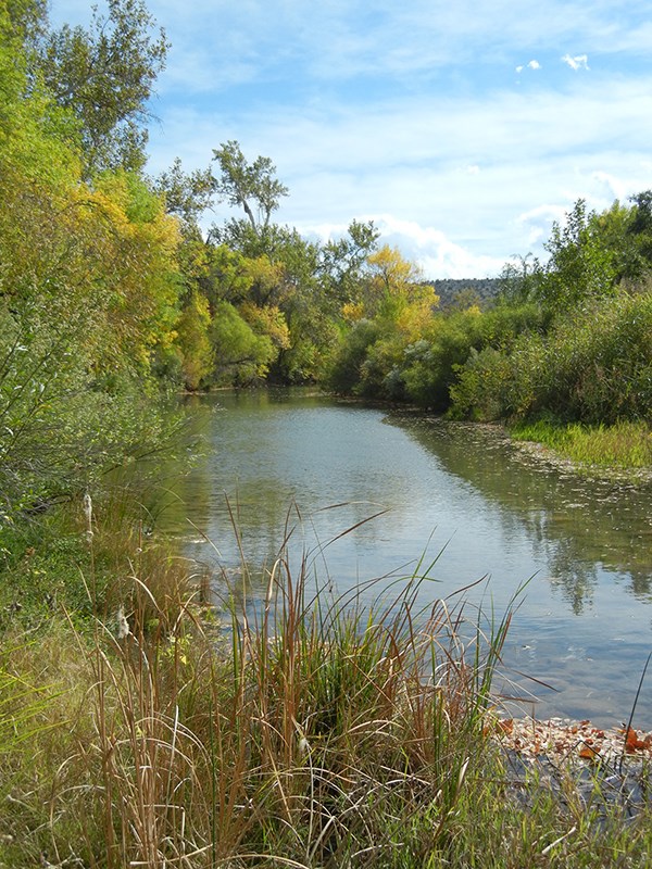
The SODN streams monitoring protocol was published in October. Index sites have been established on all perennial streams in network parks. These sites, located in four parks, were used to pilot methods and test results. In the next phase of this project, at least one index site will be established in each SODN park. These will include monitoring sites on intermittent streams, such as Rincon Creek at Saguaro NP, and on ephemeral streams, such as Bonita Creek at Chiricahua NM. Selection and establishment of sample sites is planned during WY19, with monitoring to begin in WY20. The monitoring crew started the new water year (October–September) with visits to all the perennial sites. Continuous water quality monitoring began on Beaver Creek at Montezuma Castle NM, where measurements of core water quality parameters were collected every 15 minutes for a two-week deployment. Routine monitoring was not significantly impacted by the 37-day funding lapse and consequent cessation of work in 2018–2019, and will continue for the rest of the water year as scheduled. Selection of new index sites was delayed but we are hopeful for its successful completion.
Springs
The second season of springs monitoring was successfully completed in WY2018. The 37-day funding lapse and consequent cessation of work delayed the important start-of-season training for WY2019 springs sampling. Despite this significant setback, training has been rescheduled and sampling all SODN spring sites should occur as planned.
Uplands
A total of 44 plots were re-sampled across the following parks this past season: Casa Grande Ruins NM (3 plots), Chiricahua NM (3; five more were planned but delayed due to weather), Coronado NMem (3), Fort Bowie NHS (10), Organ Pipe Cactus NM (4), Saguaro NP–East (7; more were planned but delayed due to wildland fire considerations), Saguaro NP–West (5) and Tumacácori NHP (9). Delayed plots will be completed during the 2019 season. We also successfully completed installation of 20 plots on Pima County lands, as part of our ongoing collaboration with Pima County's Office of Sustainability and Conservation. Currently, staff are identifying unknown plant collections and performing quality checks on data.
Vegetation Inventory and Mapping
Three reports were completed this past year. The Coronado NMem report is published and available in IRMA (see article in this newsletter). The report for Montezuma Castle NM is in final preparation for publishing. The report for Gila Cliff Dwellings NM report is out for external review. December saw the completion of accuracy assessment (AA) work at Saguaro NP–East, with over 1,900 assessment plots sampled park-wide. This was an enormous, eight-month effort, culminating several years’ work to classify and map the park. Staff are currently reviewing the AA data and beginning the reporting and final product development. Field work at Organ Pipe Cactus NM continued last spring, with several weeks of data collection and ground-based mapping. The data have been incorporated with other datasets and used to update and fill out the classification of vegetation types at the monument, as well as to re-digitize several key areas in the park. We plan to conduct a validation effort this spring, comparing cover data and photos for legacy plots to map attributes in order to quantify the accuracy of current mapping extents within the park’s massive, broad valleys. Results will inform where future field mapping effort should be focused. No field work is currently scheduled.
Wildlife Cameras
Wildlife camera monitoring is designed to estimate occupancy of small to mid-sized wildlife, like this coatimundi. Over the next few months, staff and citizen scientists plan to make routine visits to Casa Grande Ruins, Gila Cliff Dwellings, Montezuma Castle, and Tonto national monuments to check SD cards and replace batteries in wildlife cameras. In these smaller parks, our goal is to keep the cameras out year-round. The 37-day funding lapse and consequent cessation of work forced us to cancel camera deployment planned for Saguaro NP's Tucson Mountain District, and complicated plans for deployment at Organ Pipe Cactus and Chiricahua national monuments.
At the Desert Research Learning Center
- The Learning Center is now offering public programs at 1:00 p.m. on Tuesdays. From now through March 2019, program topics will alternate by week:
- First and Third Tuesdays: Fish, Frogs, and Water—Oh My! Rio Sonoyta pupfish and lowland leopard frogs
- Second and Fourth Tuesdays: A Drink in the Desert: The waters that bring life to a dry land.
- The DRLC has continued to have a strong presence of IVIPs (International Volunteers in Parks). Most recently, we hosted two IVIPS from Slovakia and one from Great Britain.
- Distance learning is coming to the DRLC. The system will enable remote education programs for classes and public centers that cannot physically come to the center. The system will also be available for use by SODN park staff in interpretation and education.
- Through our citizen science program, members of the University of Arizona Wildlife Society and Environmental Awareness Society have gained experience deploying wildlife cameras at Organ Pipe Cactus, Chiricahua, and Gila Cliff Dwellings national monuments.
- We have added two new fish species to the DRLC stream habitat: speckled dace and desert suckers.

Arrivals and Departures
It’s hard to believe we’re saying it, but after 15 years with the Sonoran Desert Network, data manager Kristen Bonebrake has traded in tinajas and columnar cacti for glaciers and seastars. As data manager for the North Coast and Cascades Network, Kristen takes her incredible talents to an organization that monitors everything from subalpine vegetation on the slopes of Mt. Rainier to marine communities where Lewis and Clark wintered on the Pacific shore. It would be hard to overstate the positive impact Kristen has had on SODN operations over the past decade and a half, or how much she will be missed. Happy trails, Kristen!
We’ve also bid farewell to Dávid and Terezia Mach, international interns at the Desert Research Learning Center for almost six months in 2018. Hailing from the Slovak Republic, they were supported through the NPS International VIP program. Dávid and Terezia are recent graduates of Comenius University with Master Degrees in GIS and geoecology, and had previously worked for the Slovakian Ministry of Agriculture and Rural Development. At the DRLC, the couple used geospatial analysis to model the impacts of fire severity on post-fire flow events and stream morphology at Gila Cliff Dwellings NM. Reports on their work are expected to be published mid-2019. Dávid and Terezia have worked in or visited nearly 20 U.S. national parks; hiked in Germany, Poland, Austria and Croatia; and travelled extensively in Thailand. They now live in Bratislava, where they enjoy traditional cooking and professional disco dancing. Na zdravie, Dávid and Terezia!
Calendar
| Park | February | March | April | May |
|---|---|---|---|---|
| CAGR | Wildlife cameras* | |||
| CHIR/FOBO | Springs (Apr 15–22)* | |||
| CORO | Springs (Apr 1–5)* | |||
| GICL | Streams (Feb 6–7) | Wildlife cameras* | Streams (May 1–2) | |
| MOCA/TUZI | Streams (Feb 12–13) | Springs (Mar 11–14) Wildlife cameras (MOCA/MOWE)* |
Streams (May 16–21) | |
| ORPI | Springs (Mar 18–22)* | |||
| SAGE | Springs (Apr 8–10) | |||
| TONT | Springs (Mar 11–14) | Wildlife cameras* | ||
| TUMA | Streams (Feb 18) | Streams (Apr 23) | Streams (May 13–15) |
*tentative
Disclaimer: The National Park Service shall not be held liable for improper or incorrect use of the data described and/or contained herein. These data and related graphics (if available) are not legal documents and are not intended to be used as such. The information contained in these data is dynamic and may change over time. The National Park Service gives no warranty, expressed or implied, as to the accuracy, reliability, or completeness of these data. For more information: http://www.nps.gov/disclaimer.htm.
The Heliograph is produced by the National Park Service Sonoran Desert Network.
Last updated: October 25, 2019
