Last updated: February 11, 2021
Article
Monitoring Climate and Water at Gila Cliff Dwellings National Monument, 2017

Streams, springs, and riparian areas are critical to ecological integrity. Riparian areas supply food, cover, and water, and serve as wildlife migration routes. They also help control water pollution, reduce erosion, mitigate floods, and increase groundwater recharge. Riparian systems perform numerous ecosystem functions important to humans, yet are one of the most endangered forest types in the United States.
Background
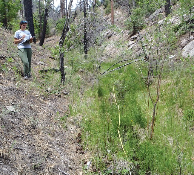
At Gila Cliff Dwellings National Monument and three other National Park Service units, the Sonoran Desert Network monitors stream health. The program is designed to detect broad-scale ecological changes by observing certain parameters over time. This helps us give park managers early warning of any issues they may need to address. The network measures water quality, water quantity (streamflow), channel morphology (the shape and composition of the streambed), riparian vegetation, and macroinvertebrate communities.
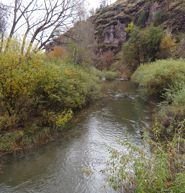
The West Fork Gila River, which crosses the northeastern portion of Gila Cliff Dwellings National Monument (NM), is a mountainous stream located in the Gila Wilderness. There is almost no upstream land use and little visitor impact in its small watershed.
Natural stressors include drought, flooding, and fire. Since 2001, drought has decreased flow in the stream, which sometimes runs dry near the park’s eastern boundary. This area is also prone to flooding. Inside the park, the floodplain is bounded by canyon walls that act as a bottleneck, increasing the destructive force of high flood waters. In 2008, a large rain-on-snow event carved a new stream channel and washed out camping facilities and a bridge, resulting in necessary repairs and reduced visitation.
Two major fires have burned in the watershed in recent years: the 2011 Miller Fire and the Whitewater–Baldy Fire, in 2012. Impacts from these fires have included degraded aquatic habitat, exotic-plant establishment, and potential future flooding and channel change.
Stream conditions are closely related to climate conditions. Because the two are better understood together, the Sonoran Desert Network reports on climate in conjunction with water resources. Reporting is done by water year (WY), which begins in October and ends the following September.

Recent Findings
Climate
Precipitation
In WY2017, overall annual precipitation was 126% of normal for Gila Cliff Dwellings National Monument (20.41" vs 16.26"). A wet winter and strong monsoon season made up for below-normal rainfall in the early fall and early spring. In the fall and winter, precipitation was substantially greater than normal (142% or +2.27"). Overall precipitation was also above normal (114%, 1.38") for the spring and summer months.
Temperature
Fall and early winter air temperatures were generally warmer than normal, with unusually high mean monthly maximum temperatures in October and March (+6.4°F and +8.7°F, respectively). As is typical, mean monthly low temperatures were below freezing in November–March. Mean monthly maximum air temperatures were warmer than normal during the warm season, while mean monthly minimum temperatures were generally lower than normal. Additional information on climate can be found at The Climate Analyzer.

Water Resources
Springs
Two springs are monitored at the monument. A field crew measures water quantity (how much, if any, water is flowing), water quality, and site condition (presence of native and non-native plants, evidence of natural or anthropogenic disturbance). When visited in WY2017, both springs had surface water present and flowing. Both showed little sign of change or disturbance.

Streams
This was the first water year of data for USGS stream gauge 09430010. The U.S. Geological Survey maintains the equipment for this gauge, and also collects and manages its data. As is typical of the Upper Gila Basin, peak streamflow occurred during late February to early April. The largest flow event occurred in late December. Snowmelt and late winter storms made crucial contributions to annual discharge totals. The median value for the winter season (53.2 cfs) was nearly 50% greater than the spring median value (17.0 cfs) and more than eight times the summer value (6.43 cfs).
There were 240 discrete analyses of water samples collected from the West Fork Gila River index site in WY2017. Of these samples, 87 were associated with New Mexico surface-water criteria. Of those 87 samples, there was one exceedance of state standards, meaning that 98.9% of samples were compliant with state standards. The single exceedance was for total cyanide. It is suspected that the volcanic geology of the watershed is the source of this cyanide.
Macroinvertebrates were collected to provide data for compliance with the New Mexico biological standards. In WY2017, the index reach scored 54.99 on the New Mexico integrated biological index, putting it in the “fair” category.
Information found here was summarized from G. Goodrum, E. Gwilliam, L. Palacios, and K. Raymond, Status of climate and water resources at Gila Cliff Dwellings National Monument: Water year 2017.
