Last updated: March 14, 2022
Article
Vegetation Mapping at Coronado National Memorial

Wondering where in the park to look for a certain bird? Trying to plan a prescribed fire? Need help identifying potential habitat for a threatened species? You need a vegetation map!
Vegetation maps visually display the distribution of vegetation communities across a landscape. Knowing what’s growing where, and what kinds of habitat occur in a park, helps park managers with park planning, resource monitoring, interpretive programs, prescribed fire, and climate-change response, among other activities. Vegetation maps also provide a baseline for ecological studies.
The National Park Service (NPS) Vegetation Inventory Program aims to complete baseline mapping and classification inventories at more than 270 NPS units. Each map represents hundreds to thousands of hours of effort by ecologists, field technicians, GIS technicians, data managers, editors, and park staff. The teams gather aerial imagery, collect data from vegetation plots, classify vegetation types and write descriptions, assess the accuracy of the results, create a geodatabase and map, and write a final report. Each finished project comprises not just a map and report, but also an entire library of vegetation data and descriptive information.
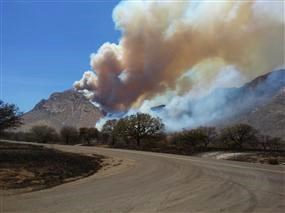
At Coronado National Memorial, the Sonoran Desert Network conducted vegetation mapping from 2010 to 2016. The majority of data collection and mapping was completed during fall 2010. But in summer 2011, the Monument Fire caused the project to be placed on hold. When plot-sampling was eventually completed in 2013 and 2014, it incorporated the effects of this fire, which impacted about 92% of the park.
To create a vegetation map, vegetation is first classified into “associations” and/or “alliances,” which are assemblages of certain plant species repeatedly found in similar habitats. Those assemblages are then organized into map classes that represent existing vegetation and land uses. The final vegetation map for Coronado National Memorial is shown below.
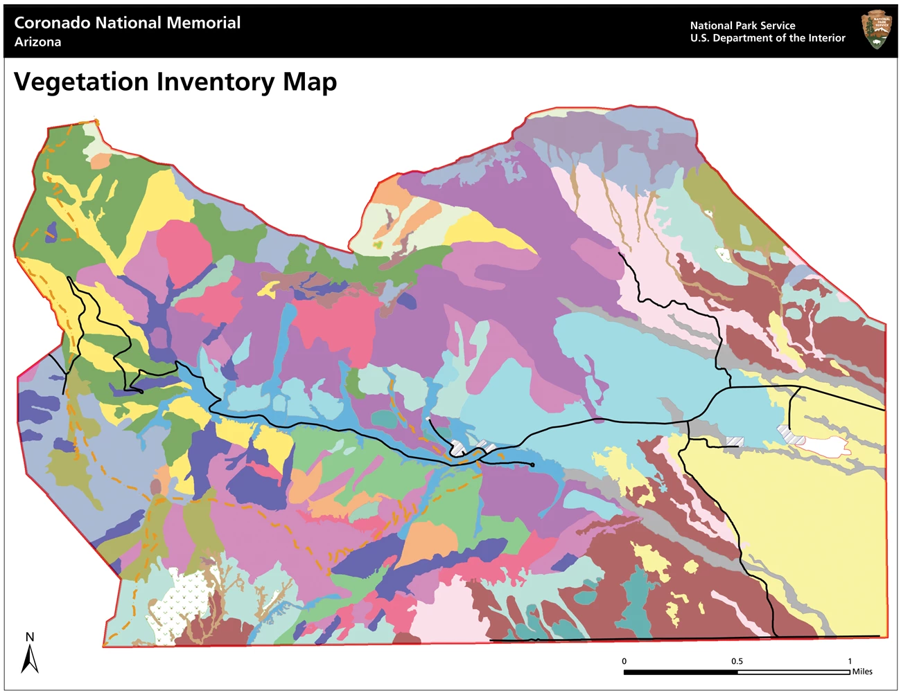
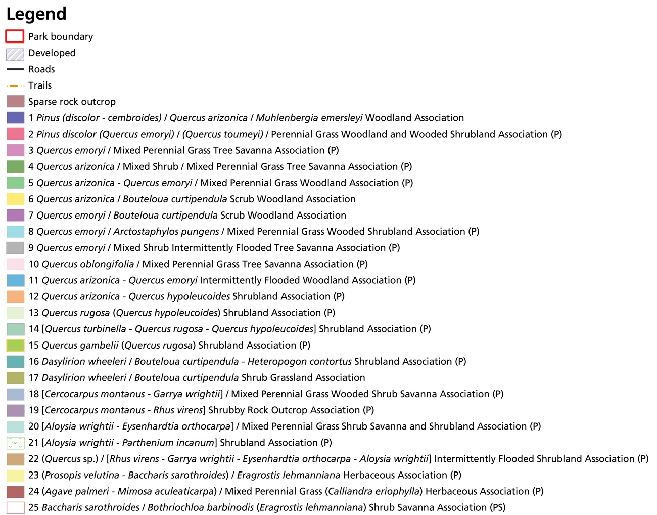
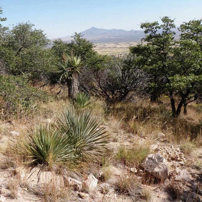
At Coronado National Memorial, the Sonoran Desert Network crew developed 25 map classes represented by 192 map polygons. The mapped vegetation communities ranged from dense, non-native grasslands dominated by Lehmann lovegrass to steep expanses of exposed bedrock dominated by mountain mahogany and evergreen sumac. The Emory oak / Sideoats grama Scrub Woodland Association covered the most area, at over 223 hectares (551 acres), or 11.6% of the park. Gambel oak (Netleaf oak) Shrubland covered the least, at under a quarter of a hectare (0.58 acres). (Map classes follow established naming conventions related to dominant or diagnostic species in each association.)
The herbaceous-dominated areas in the park’s southeast corner were mapped predominantly as two communities, the (Palmer’s century plant - Catclaw mimosa) / Mixed Perennial Grass (Fairyduster) Herbaceous Association and the (Velvet mesquite - Desertbroom) / Lehmann lovegrass Herbaceous Association. Taken together, these two communities represent ~18% of the total park landscape. They are of specific concern to park staff because agave is an important food source for the endangered lesser long-nosed bat.
Woodland communities containing pinyon pine covered approximately 8% of the total park landscape. Other woodlands, dominated by either white oak or emory oak, were more extensive, together covering 19% of the park.
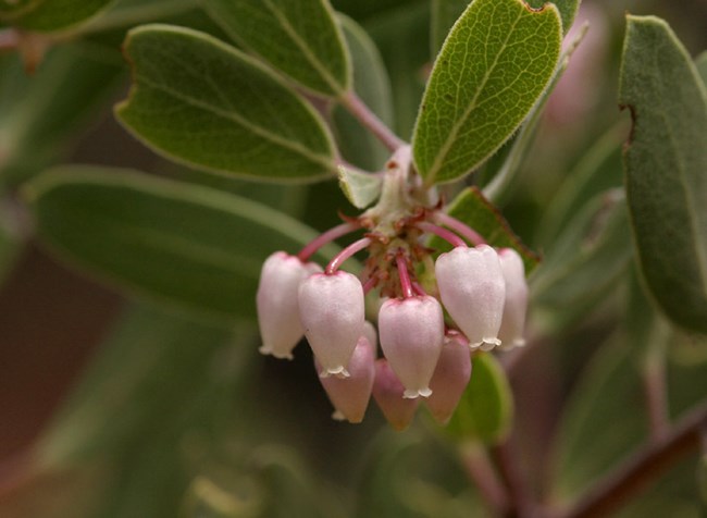
All 25 final associations were altered by the Monument Fire. The degree to which they were altered varied greatly. The largest, longest-lasting changes occurred in communities dominated by species with low resistance and/or resilience to fire. These species included pointleaf manzanita and border pinyon.
Pointleaf manzanita must recolonize through the germination of seeds released from a dormant state by fire. Typically, recruitment occurs 1–5 years of the fire event. However, as of five years post-fire, no seedlings had been observed during field work. It is possible that only a small seed bank of pointleaf manzanita was able to accumulate between a 1988 fire and the Monument Fire. It is also possible that the fire did not cause enough soil heating to rouse the seeds from dormancy.
Sonoran Desert Network crews have also not documented any evidence of border-pinyon recruitment in the five years since the fire. Because Coronado National Memorial experienced severe-to-extreme drought before and after the Monument Fire, conditions for border-pinyon seed production and germination were less than ideal.
The Sonoran Desert Network will continue to monitor post-fire vegetation and soils at Coronado National Memorial as part of its long-term vital signs monitoring program.
Information in this article was summarized from S. E. Studd, J. Galvin, and J. A. Hubbard. 2018. Vegetation Inventory, Mapping, and Characterization Report, Coronado National Memorial.
