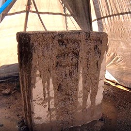
Weathering the Storm: Our Adobe Brick Test Wall Project
A recent experiment at the Desert Research Learning Center (DRLC) sought to help National Park Service managers understand the possible effects of changing climate patterns on historic adobe structures. The project brought together experts from across disciplines—and technology from across millennia. First, archeologists and historic preservationists taught a small army of staff and volunteers the skills they needed to create adobe bricks and fashion them into walls. Adobe—derived from the Arabic “aṭ-ṭūb” (“the bricks”)—is one of humanity’s oldest building materials. Fast-forward several thousand years and, with the help of hydrologists, soil scientists, geographers, climate data, and computers, the walls were subjected to 30-minute rain simulations at different intensities based on one-year, 25-year, and 100-year historical rain events. The results showed a large difference in both precipitation intensity and material loss between the 1-year and 25-year treatments.
Read more or watch a short video on the process . . .
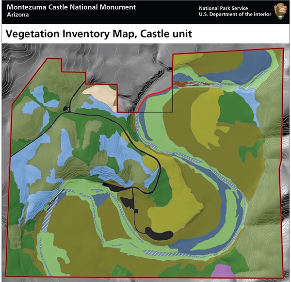
Two More Vegetation Mapping Projects Completed
Knowing what’s growing where, and what kinds of habitat occur in a park, helps park managers with park planning, resource monitoring, interpretive programs, prescribed fire, and climate-change response. SODN recently completed two vegetation mapping projects that provide that important information.
At Montezuma Castle NM, we developed 12 map classes represented by 73 map polygons. Ten associations and 44 polygons were identified at the Castle unit. Nine associations and 29 polygons were identified at the Well unit. Vegetation communities ranged from lush riparian woodlands of Arizona sycamore and velvet ash, along Beaver Creek, to velvet-mesquite bosques and drier upland sites of crucifixion thorn. These communities included a diverse mixture of shrubs, succulents, and perennial grasses. A total of 226 different plant species were recorded during the project.
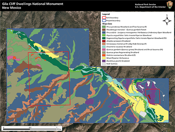
At Gila Cliff Dwellings NM, we developed 16 map classes represented by 203 map polygons. Vegetation communities ranged from lush riparian woodlands to drier upland woodlands and tree savannas with a grassland understory. The most widespread association was Two-needle pinyon - (Oneseed juniper, Alligator juniper) / Blue grama Open Woodland, comprising 34% of the project area. The next most-common association was Ponderosa pine Woodland and Tree Savanna, with 14% of the project area. The 14 other associations accounted for between 10% and >1% each. A total of 349 different plant species were recorded during the project.
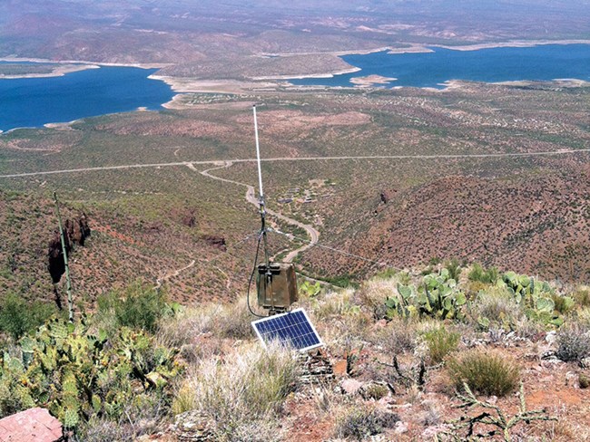
Climate and Water Resources Reports Published
Reports on the status of climate and water resources are now available for six network parks. Water year 2018 was drier than normal in all six parks. Overall annual precipitation ranged from 32% (Tonto NM) to 74% (Tumacácori NHP) of normal compared to 30-year averages. All monitored springs were classified as "undisturbed" except Quitobaquito Spring, at Organ Pipe Cactus NM. Streamflow was extremely low at Montezuma Castle and Tuzigoot NMs, with no snowmelt pulse observed in the hydrographs for Wet Beaver Creek and the Verde River. Compliance with state water-quality standards ranged from 94% at MOCA/TUZI to 100% at Gila Cliff Dwellings NM. For more details, follow the links shown above.
New Book on Water Resources at Saguaro National Park
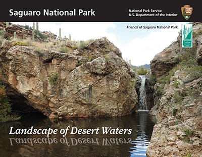
Saguaro National Park: Landscape of Desert Waters is now available. This book celebrates Saguaro National Park’s rare waters, describes how they benefit the local community and wilderness, and addresses the threats to their viability for future generations. The authors explore the many types of water sources in the park and the natural values they provide in the changing ecological, economic, and social landscape of the desert southwest. The book was made possible with funding from the Nina Mason Pulliam Charitable Trust and the Friends of Saguaro National Park. The Sonoran Desert Network provided editing and design support. To obtain a hard copy, contact Don Swann at Saguaro NP.
Other Reports Available
Other SODN-related reports now available in IRMA include Natural Resource Condition Assessments for Casa Grande Ruins and Gila Cliff Dwellings national monuments, and Tumacácori NHP, and an updated report on air quality-related values in Sonoran Desert Network parks.
Project Updates
Springs
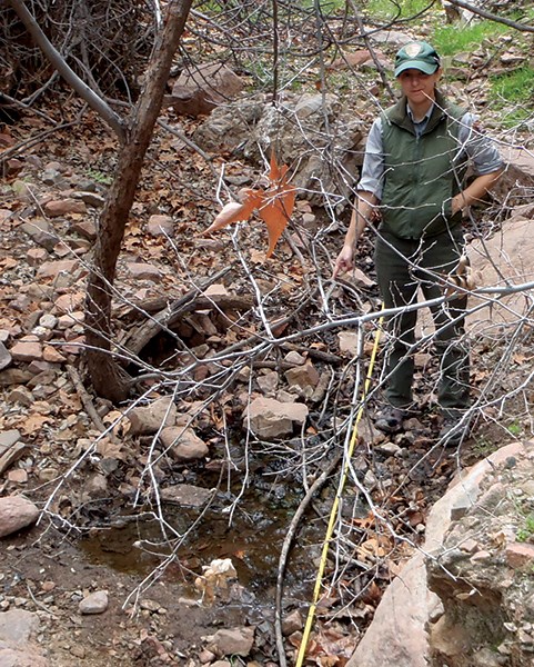
Springs sampling for WY2019 was completed at all SODN parks where springs are monitored. The crew sampled 29 index sites, collecting data on site condition, water quality, and persistence from sites high in the Rincon Mountains (Saguaro NP) to the low Sonoran Desert at Quitobaquito Spring (Organ Pipe Cactus NM), a stone’s throw from the border with Mexico. Reports are available for WY2018 springs monitoring (see article). The Southwest Network Collaboration is exploring cost-effective ways of adding a macroinvertebrate monitoring component to the spring monitoring protocol. In pursuit of this goal, we are investigating use of environmental DNA (eDNA). Filtering, amplifying, and sequencing DNA and RNA found in spring water may be a way to efficaciously sample macroinvertebrate diversity in arid-land springs. Working with international Volunteer-in-Parks Mahee Autunno, an undergraduate student at France’s Univerite De Lorraine, we conducted a feasibility study of using eDNA as a monitoring tool. A report will be published.
Streams
Streams monitoring at Gila Cliff Dwellings NM. Streams monitoring has been completed for WY2019, including stream sampling at Montezuma Castle, Tuzigoot, and Gila Cliff Dwellings national monuments and Tumacácori NHP, and riparian vegetation sampling at Gila Cliff Dwellings NM. Reports are available for WY2018 streams monitoring (see article). SODN is establishing a new stream monitoring segment, on Saguaro NP’s Rincon Creek. This work will be supported by the staff and volunteers at Saguaro NP, including a citizen-science component. We are also installing a telemetry-enabled water-quality monitoring station on Glorieta Creek at Pecos NHP to improve sampling efficiency. This new index station will collect new baseline water quality-data and provide data for park management projects. It will also be used to test the feasibility and cost effectiveness of telemetry-enabled water-quality stations in SWNC parks. A comprehensive update of the stream monitoring database will be completed this fall.
Uplands
Uplands field season is well underway. We completed 12 plots at Chiricahua NM in September and now are switching focus to backcountry work at Saguaro NP (RMD). We will be working out of campsites at Manning Cabin, Happy Valley, and Douglas Springs to sample a total of 12 sites over a five-week period. In November, we will re-sample six sites at Coronado NMem, marking the first year of our third round of sampling. Data are being analyzed for reporting on Saguaro NP, Coronado NMem, and Organ Pipe Cactus NM.
Vegetation Inventory and Mapping
Mapping vegetation at Coronado National Memorial. Final reports and associated products were completed this year for Coronado NMem, Gila Cliff Dwellings NM, and Montezuma Castle NM (see article). All products will be posted to IRMA and available via the Vegetation Inventory Program website. Saguaro NP's report is currently being written. Work is ongoing to update the thematic and spatial elements of the Organ Pipe Cactus NM vegetation map. Several weeks of work were completed in Spring 2019, collecting plot data that facilitated the update of community descriptions and improved our criteria for mapping boundaries. Much of the work to update the map involves digitizing in ArcGIS using high-resolution imagery as a guide. This project requires a final few weeks of field work.
Wildlife Cameras
Project volunteers learn to use compasses at Chiricahua NM. Desert Research Learning Center staff have been busy coordinating fieldwork for the SODN wildlife-camera protocol. At Chiricahua NM, we trained five citizen scientists and volunteers in navigation, communication, deployment methods, and field safety. They helped deploy five cameras over the course of two days. In July, a smaller group helped deploy 14 wildlife cameras at Gila Cliff Dwellings NM over the course of three days (smaller parks require less hiking!).
At the Desert Research Learning Center
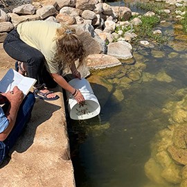
Over the summer, DRLC staff worked with the Arizona Game and Fish Department to add more speckled dace (Rhinichthys osculus) and desert suckers (Catostomus clarkii) to the DRLC’s artificial stream. The fish originated in an area south of Tumacácori NHP. The goal is for us to raise these native fish in a safe environment so they can be used as source populations for future restocking efforts. In the meantime, they are not only fun to have around but also an excellent interpretive tool for discussing native species conservation and what kinds of actions people can take to support these animals.
Crops are rotated seasonally in the DRLC's sustainable foods garden. The DRLC’s sustainable foods garden displays sustainable practices, such as drip irrigation and olla-pot irrigation. For the last two years, a student volunteer from the University of Arizona has helped plant and maintain the garden. Cold-weather crops (fava beans, broccoli, greens, dill, onions, wheat, Swiss chard, lettuce, and peas) were harvested in April. Monsoon-season crops (corn, lima beans, chiltipine, sunflowers, melons, tomatillo, watermelons, and cowpeas) were harvested in September. Most of the food grown in the garden is given to staff and visitors, and our desert tortoise enjoys a snack from time to time. We have seeds available from many of the crops listed above. If you are interested, stop by the DRLC to pick some up!
Arrivals and Departures
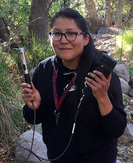
The SWNC and Desert Research Learning Center (DRLC) began working with the Bureau of Indian Affairs’s Water Resources Technician Training Program (WaterCorps) this summer. This program seeks to develop young Native American candidates with knowledge and experience in water-resource science to help their communities and the country. Our initial intern, Xylenia Singer, a member of the Navajo Nation, completed a 16-week DRLC internship this summer. She assisted with streams monitoring and developed a primer for future WaterCorps interns. Thanks, Xylenia!
Sage Ragland has joined the SODN team as the Vegetation Crew Lead. She brings extensive local plant knowledge and a passion for conservation work. Ashley Dang is the new crew lead for wildlife-camera monitoring. Please help us welcome Sage and Ashley!
Ed Kuklinski, crew leader for vegetation and soils monitoring, has moved on to Buenos Aires National Wildlife Refuge, where he's working with the US Fish and Wildlife Service on research and recovery actions for the masked bobwhite quail.
New VIPs Mike Garcia and Bobby Figarotta are helping with DRLC projects and the wildlife-camera protocol.
It's our great pleasure to announce that Helen Thomas has been hired to be SODN's new data manager. Helen comes with a wealth of knowledge and experience, having spent more than a decade as data manager for the Northern Colorado Plateau Network. She recently did a detail as the SODN data manager—and despite getting to know us pretty well, agreed to make the change permanent. Bienvenidos, Helen!
Calendar
| Park | November | December | January |
|---|---|---|---|
| CAGR | Wildlife Cameras (Dec 18) | ||
| CHIR/FOBO | Wildlife Cameras (Dec 2–6, 9–13) | ||
| CORO | Uplands (Nov 13–19) | ||
| GICL | Streams (Nov 7–8) | ||
| MOCA/TUZI | Wildlife Cameras (Nov 5–8) | ||
| SAGE | Uplands (Oct 31–Nov 6) | ||
| SAGW | Uplands (Nov 25–26) | Uplands (Dec 16–18) | Wildlife Cameras (Jan 7–12) |
| TUMA | Streams (Nov 13, 28) |
Acronyms
CAGR=Casa Grande Ruins National Monument; CHIR=Chiricahua National Monument; CORO=Coronado National Memorial; DRLC=Desert Research Learning Center; FOBO=Fort Bowie National Historic Site; GICL=Gila Cliff Dwellings National Monument; MOCA=Montezuma Castle National Monument; NHP=national historical park; NM=national monument; NMem=national memorial; NP=national park; ORPI=Organ Pipe Cactus National Monument; SAGE=Saguaro National Park (East); SAGW=Saguaro National Park (West); SODN=Sonoran Desert Network; SWNC=Southwest Network Collaboration; TUMA=Tumacácori National Historical Park; TUZI=Tuzigoot National Monument Disclaimer:
The National Park Service shall not be held liable for improper or incorrect use of the data described and/or contained herein. These data and related graphics (if available) are not legal documents and are not intended to be used as such. The information contained in these data is dynamic and may change over time. The National Park Service gives no warranty, expressed or implied, as to the accuracy, reliability, or completeness of these data. For more information: http://www.nps.gov/disclaimer.htm. The Heliograph is produced by the National Park Service Sonoran Desert Network.
Last updated: October 25, 2019

