Last updated: March 14, 2022
Article
Vegetation Mapping at Montezuma Castle National Monument

Wondering where in the park to look for a certain bird? Trying to plan a prescribed fire? Need help identifying potential habitat for a threatened species? You need a vegetation map!
Vegetation maps visually display the distribution of vegetation communities across a landscape. Knowing what’s growing where, and what kinds of habitat occur in a park, helps park managers with park planning, resource monitoring, interpretive programs, prescribed fire, and climate-change response, among other activities. Vegetation maps also provide a baseline for other ecological studies. But in the past, not all parks had current vegetation maps.
The National Park Service (NPS) Vegetation Inventory Program aims to complete baseline mapping and classification inventories at more than 270 NPS units. Each map represents hundreds to thousands of hours of effort by ecologists, field technicians, GIS technicians, data managers, editors, and park staff. The teams gather aerial imagery, collect data from vegetation plots, classify vegetation types and write descriptions, assess the accuracy of the results, create a geodatabase and map, and write a final report. Each finished project comprises not just a map and report, but also an entire library of vegetation data and descriptive information.
The Sonoran Desert Network conducted vegetation mapping at both units of Montezuma Castle National Monument from 2009 to 2014. To create a vegetation map, a crew of botanists heads into the field and visits a series of plots. Within these plots, the crews measure the height of all vascular plant species and assign them to categories: field (0–0.5 m), sub-canopy (0.5–2 m), lower canopy (2–5 m), and upper canopy (>5 m). They also determine how much of the plot is covered by each species, and assign that species a cover class, from 1 (<1%) to 9 (96–100%). The most abundant and important species in the community are assigned a dominance rank. Vegetation is then classified into “associations” and/or “alliances,” which are assemblages of certain plant species repeatedly found in similar habitats. Those assemblages are delineated as polygons and organized into map classes that represent existing vegetation and land uses. Generally speaking, the map classes are named according to which plants are most dominant.

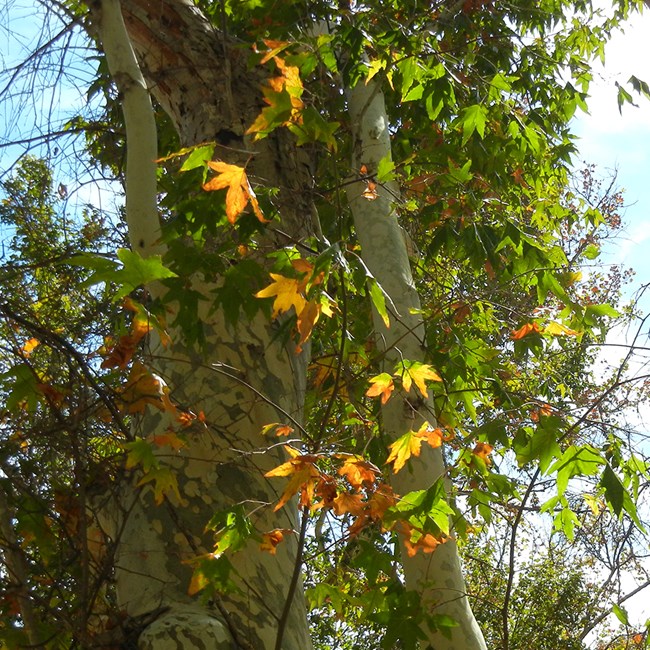
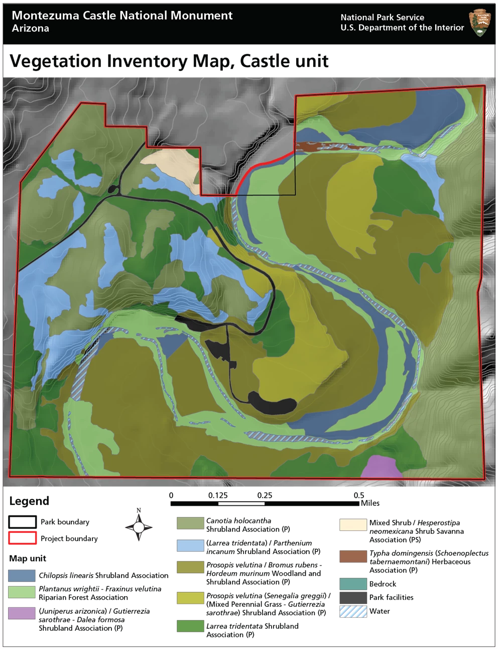
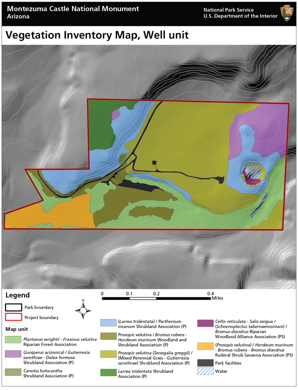
At Montezuma Castle National Monument, the SODN crew developed 12 map classes represented by 73 map polygons. Ten associations and 44 polygons were identified at the Castle unit. Nine associations and 29 polygons were identified at the Well unit. Vegetation communities ranged from lush riparian woodlands of Arizona sycamore and velvet ash, along Beaver Creek, to velvet mesquite bosques and drier upland sites of crucifixion thorn. These communities included a diverse mixture of shrubs, succulents, and perennial grasses. A total of 226 different plant species were recorded during the project.
Despite its small size (408 ha/1,008 ac) and limited elevational range (520 ft/158 m), Montezuma Castle National Monument hosts a wide array of vegetation communities and species. In part, this is because the park is influenced by both the Colorado Plateau and the Basin and Range ecological provinces. It also includes a robust riparian corridor supported by a perennial creek. A legacy of prior disturbances has also left its mark.
Park lands have a long history of human occupation and use, with Hohokam and Sinagua settlements dating back to at least 600 AD. More recently, the broad floodplains and adjacent slopes were used for agriculture. Farming generally ceased in the early 20th century, but one area of the Well unit was actively grazed until 1993. The impacts from this disturbance can still be seen―in many cases, the boundaries of these areas aligned with those of our polygons.
The park’s vegetation can be classified into two broad types: riparian woodlands and gallery forests, and thornscrub communities in rocky uplands. At the Castle unit, upland communities covered around 53% of the vegetated area. Riparian communities covered roughly 20%, and floodplain communities covered 27%. At the Well unit, upland communities covered around 63% of the vegetated area. Riparian communities covered roughly 20%, and floodplain communities covered 16%.
Across both units, the Velvet mesquite / Red brome - Mouse barley Woodland and Shrubland Association covered the most area (23% of the total vegetated area). This community has a canopy (2–5 m) of velvet mesquite, with annual, non-native grasses (red brome and mouse barley) dominating the ground cover (<0.5 m). The next most common community was the Crucifixion thorn Shrubland Association, covering 17% of the total vegetated area. In this shrubland type, crucifixion thorn dominates the canopy (2–5 m) and subcanopy (0.5–2 m), accompanied by a low-cover, diverse understory of shrubs, perennial forbs, and perennial grasses. The distribution of the park’s 12 vegetation community types can be seen on the maps below.


Information in this brief was summarized from S. E. Studd, J. Galvin, and S. Buckley. 2019. Vegetation inventory, mapping and characterization report, Montezuma Castle National Monument: Castle and Well units. Natural Resource Report NPS/SODN/NRR—2019/1889. National Park Service, Fort Collins, Colorado.
