Last updated: December 28, 2022
Article
Stratotype Inventory—Rocky Mountain National Park, Colorado
NPS photo.
Introduction
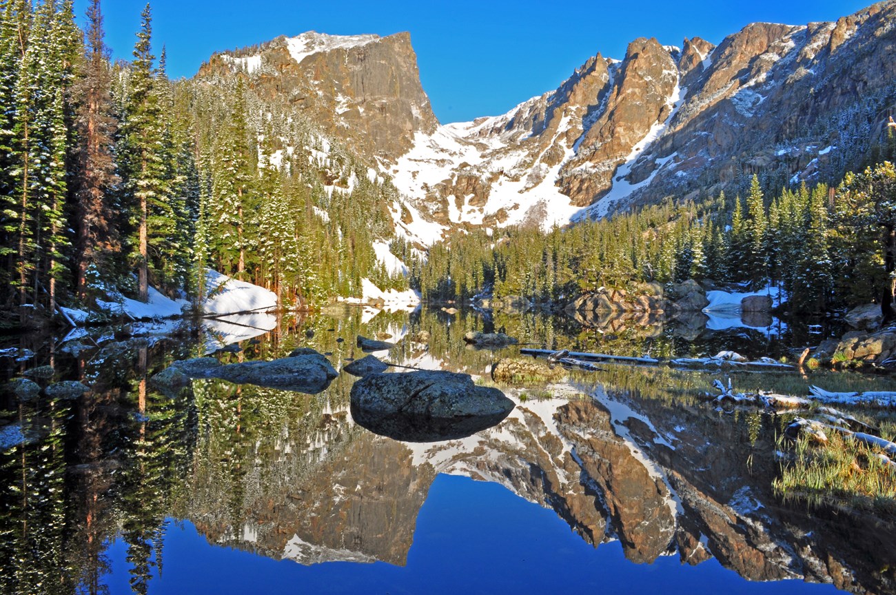
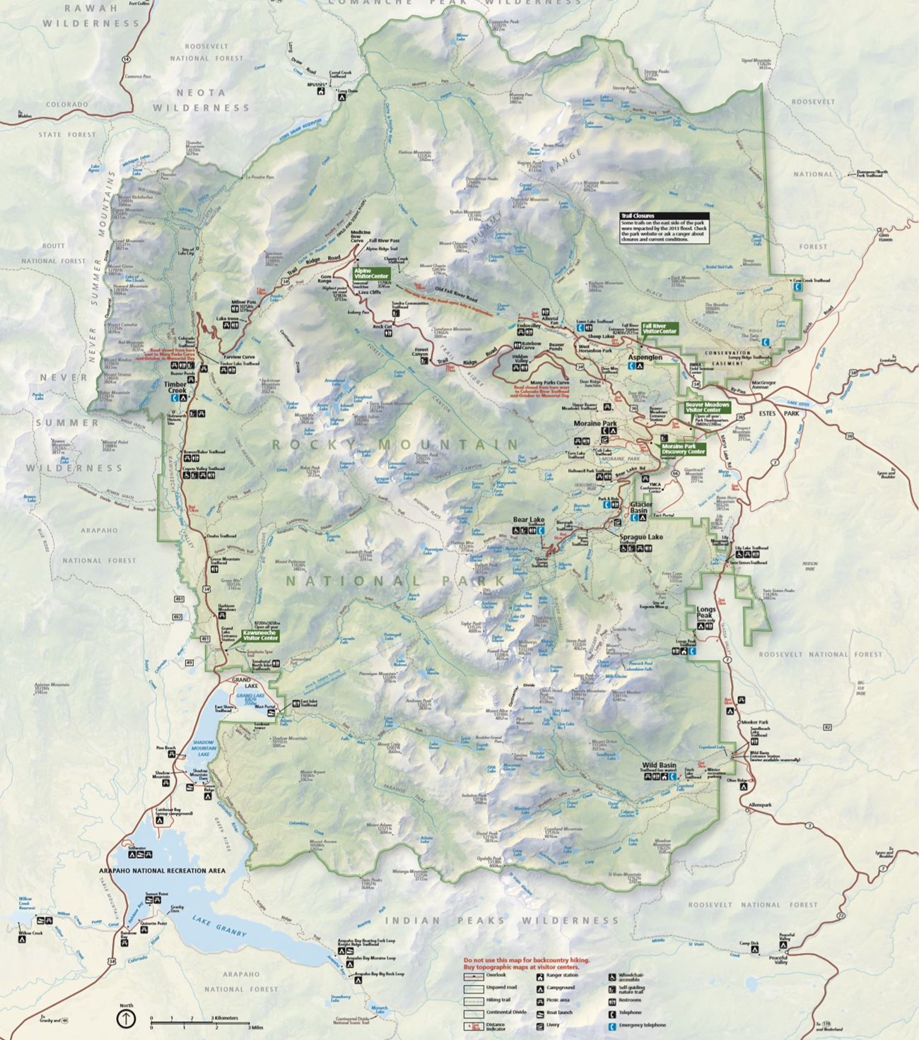
Rocky Mountain National Park (ROMO) was established on January 26, 1915 and is located in Boulder, Grand, and Larimer counties, northern Colorado (Figure 27). ROMO offers the rich scenery of the majestic Rocky Mountains and encompasses 107,563 hectares (265,795 acres) of mountain meadows, snow-fed streams, rolling alpine uplands, glacial moraines and valleys, volcanoes, lava, and ash (KellerLynn 2004; Anderson 2017). The park consists of towering mountain peaks ranging in elevation from 3,350 to 4,270 m (11,000 to 14,000 ft) above sea level that form the Continental Divide, Trail Ridge, the Mummy Range, and the Never Summer Mountains (KellerLynn 2004). Longs Peak, the tallest mountain in ROMO with an elevation of 4,345 m (14,256 ft) above sea level, rises 2,743 m (9,000 ft) over the nearby lowland plain. More than 480 km (300 mi) of hiking trails provide access from roadways and trailheads to remote alpine country areas of the park. ROMO was designated a Biosphere Reserve in 1976.
NPS image.
Significance and Geologic Resource Values
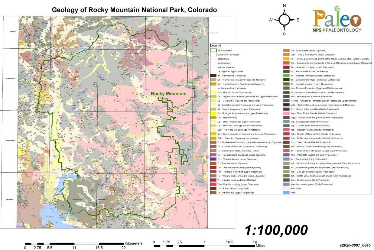
Rocks and deposits record the geologic history and evolution of ROMO, which spans nearly two billion years (Figure 28). The ancient age of the rocks that form the core of the mountains in ROMO is impressive. Although not the oldest rocks in the NPS, they are from the Precambrian, which contains the oldest rocks on Earth and harkens back to a time when Earth’s early crust and continents were forming (KellerLynn 2004). Longs Peak consists of a mass of the Precambrian-age Silver Plume Granite dated at ~1.4 billion years old (Tweto 1987). Timing of the Rocky Mountain uplift (~70 million years ago) is related to a period of mountain building called the Laramide Orogeny. Isolated exposures of Mesozoic strata from the Western Interior Seaway exist in Laramide-age faults in the western area of the park (Braddock and Cole 1990). Tertiary volcanism formed much of the younger rocks (29 to 23 million years ago) found on the western slope of the park and which constitute much of the Never Summer Mountains (KellerLynn 2004).
NPS image.
Stratotypes in Rocky Mountain National Park
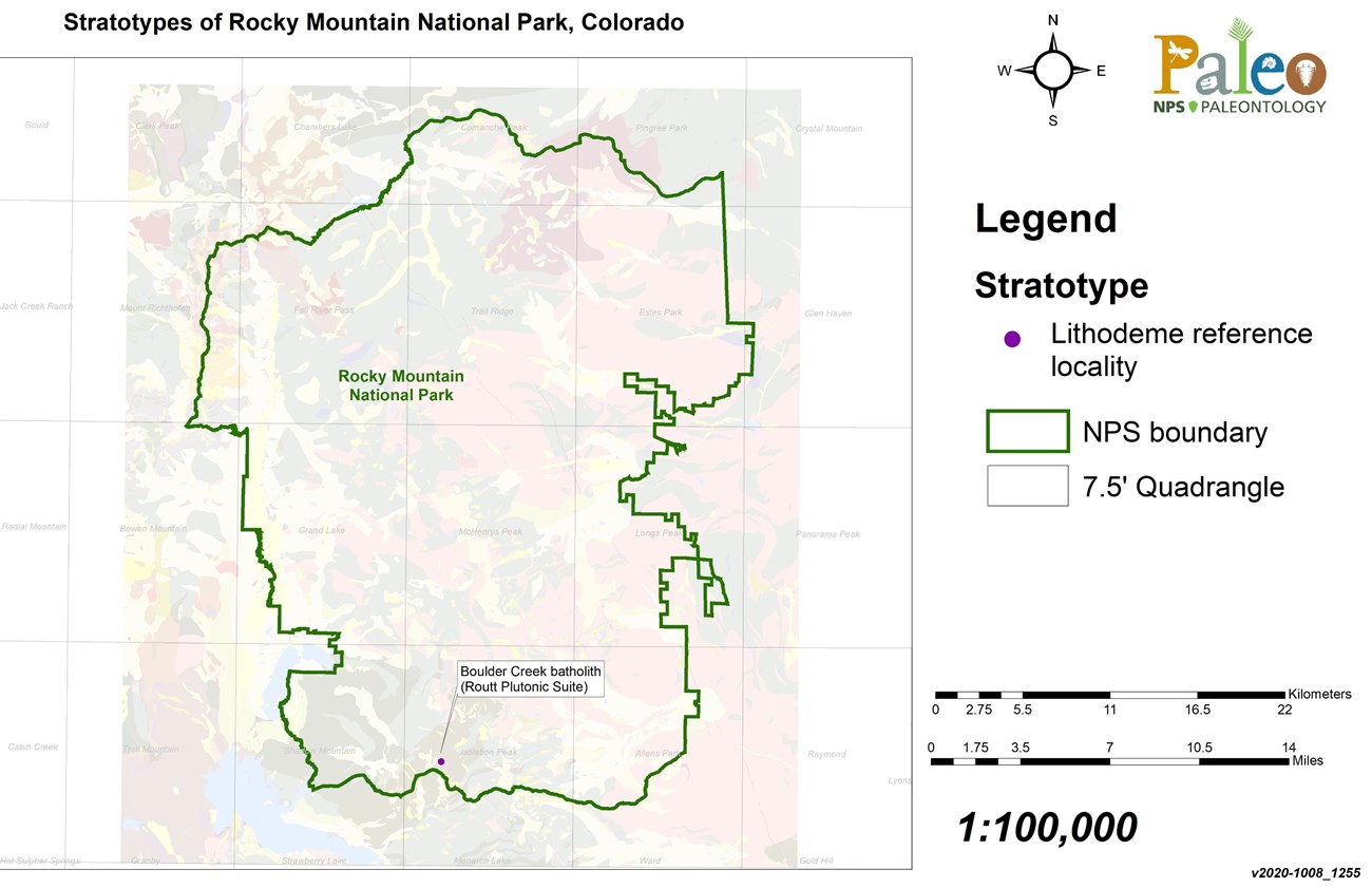
ROMO contains a single stratotype occurrence that is assigned to the Proterozoic Boulder Creek batholith and associated Boulder Creek Granodiorite of the Routt Plutonic Suite (Figures 29 and 30; Table 2). The Boulder Creek batholith body constitutes an important lithodeme reference locality for the Routt Plutonic Suite (Tweto 1987). Dominantly consisting of the Boulder Creek Granodiorite, the batholith is located west and southwest of Boulder, Colorado and is widely exposed on Boulder Creek and on the east flank of the Front Range (Boos and Boos 1934; Lovering and Goddard 1950; Tweto 1977). The best-known masses of Boulder Creek Granodiorite occur in the Georgetown 15-minute quadrangle south of Idaho Springs and in the type batholith region west of Boulder extending north from Coal Creek to Lefthand Creek (Lovering and Goddard 1950). Originally described as the Boulder Creek Granite Gneiss (Boos and Boos 1934) and as the Boulder Creek Granite (Lovering and Goddard 1938, 1950; Lovering and Tweto 1953), it was described more accurately as the Boulder Creek Granodiorite (Wells 1967; Gable 1980). The Boulder Creek Granodiorite is coarse-grained and locally coarsely porphyritic; it contains prismatic potassium feldspar crystals 1–5 cm (0.4–2 in) long (Tweto 1987). Biotite is an abundant constituent that occurs as packets of flakes, and hornblende is found as a minor constituent that is locally abundant (Tweto 1987).
| Unit Name (map symbol) | Reference | Stratotype Location | Age |
|---|
Geologic Time Scale
Location Map
NPS image.
In addition to the designated stratotypes located within ROMO boundaries, a list of stratotypes located within 48 km (30 mi) of park boundaries is included here for reference. These nearby stratotypes include:
- Proterozoic Silver Plume batholith (lithodeme)
- Cretaceous Dakota Group (type section)
- Oligocene–Miocene Troublesome Formation (reference section)
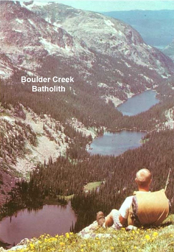
Figure 30. View west from Tanina Peak of Fourth, Spirit, and Verna Lakes, scoured by ice in bedrock of the upper canyon of East Inlet. Mountains to the left of the lakes consist of Boulder Creek Granodiorite of the Boulder Creek batholith.
Figure modified from Richmond (1974: Figure 24).
Type Section Inventory Report—Rocky Mountain Inventory & Monitoring Network
The information on this page is excerpted from a report covering six parks within the Rocky Mountain Inventory and Monitoring Network (ROMN):
- Florissant Fossil Beds National Monument, Colorado
- Glacier National Park, Montana
- Grant-Kohrs Ranch National Historic Site, Montana
- Great Sand Dunes National Park and Preserve, Colorado
- Little Bighorn Battlefield National Monument, Montana
- Rocky Mountain National Park, Colorado
The full Network report is available in digital format from https://irma.nps.gov/DataStore/Reference/Profile/2283702
Please cite this publication as:
- Henderson, T., V. L. Santucci, T. Connors, and J. S. Tweet. 2020. National Park Service geologic type section inventory: Rocky Mountain Inventory & Monitoring Network. Natural Resource Report NPS/ROMN/NRR—2020/2215. National Park Service, Fort Collins, Colorado.
Geodiversity Atlas—Rocky Mountain Network Index
Leave No Trace—Protect Type Sections for Science

Many type sections and paleontological sites are vunerable to damage from careless visitation and over-use. Be sure to practice Leave No Trace princples whenever you are in the outdoors. Of particular importance at geoheritage sites is to:
-
Travel and camp on durable surfaces, and
-
Leave what you find.
If you see signs of vandalism or someone acting inappropriately during your visit to a park site, please contact a ranger at the park or make a report through NPS Investigative Services.
Related Links
- Rocky Mountain National Park, Colorado—[Geodiversity Atlas] [Park Home]
- Geologic Time Scale
- America's Geoheritage
- NPS Paleontological Resource Inventory
- NPS Geologic Resources Inventory
- NPS Geodiversity Atlas
