Trails of Mount Rainier


Trail Conditions

Always check current conditions with a ranger before heading out on a hike. Updated conditions are reported on the website during the summer season.
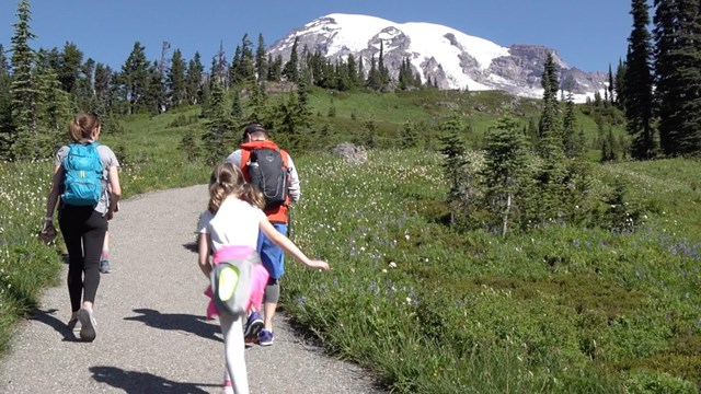
Check Trail Conditions
 
A family walks along a trail through a meadow with a view of Mount Rainier.
Day Hiking

From short family-friendly nature trails to mid-length trails, the park has a variety of options for day hiking.
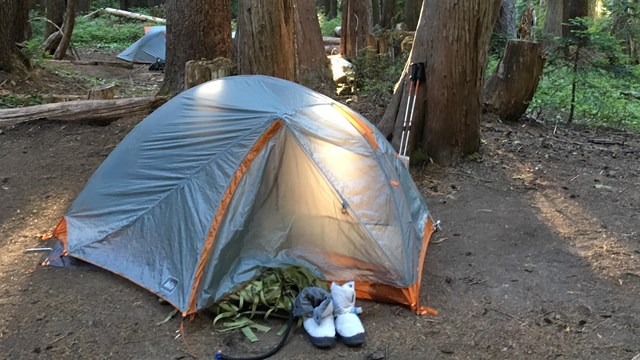
Sunlight illuminates a tent set up at the base of three trees.
Wilderness Camping

Only a small part of the park can be reached by vehicles. Explore the rest through hiking and wilderness camping.
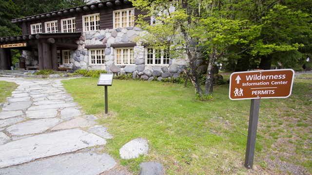
A sign next to a path leading to a rustic building reads "Wilderness Information Center - Permits".
Wilderness Permits

A wilderness permit is required for all overnight camping. Learn how to reserve a permit or acquire a first-come, first-served permit.


Select one of the trails below for more details. ***All hiking distances are round-trip.***

Northwest Area Trails:

Carbon & Mowich

Carbon Glacier Trail (17 miles)
Green Lake Trail (10.8 miles)
Golden Lakes Trail (20.4 miles)

Lake James Trail (27 miles)

Moraine Park Trail (21 miles)

Spray Park Trail (6 miles)

Tolmie Peak Trail (6.5 miles)
Mystic Lake Trail (20.8 miles)

Northeast Area Trails:

Sunrise, White River, & Tipsoo

Burroughs Mountain Trail (7 miles)

Crystal Lakes Trail (6 miles)

Glacier Basin Trail (7 miles)

Mt Fremont Lookout Trail (5.5 miles)

Naches Peak Loop Trail (3.5 miles)

Owyhigh Lakes Trail (7 miles)

Palisades Lakes Trail (7 miles)
Summerland Trail (8.5 miles)
Mystic Lake Trail via Sunrise (21.8 miles)


Southwest Area Trails:

Longmire & Paradise

Bench & Snow Lake Trail (2.5 miles)

Comet Falls & Van Trump Park Trail
(3.8-5.8 miles)

Eagle Peak Trail (7.2 miles)
Emerald Ridge Trail (17.2 miles)

Lake George & Gobblers Knob Trail (11.2 miles)

Indian Henry's Hunting Ground
(11.5-13 miles)

Klapatche Park Trail (21 miles)

Pinnacle Peak Trail (2.5 miles)

Rampart Ridge Trail (4.6 miles)

Skyline Trail (5 miles)


Southeast Area Trails:

Ohanapecosh

Eastside Trail (26.2 miles)
Indian Bar Trail (14.5 miles)

Shriner Peak Trail (8 miles)

Silver Falls Trail (3 miles)

Three Lakes Trail (12 miles)

Other Trails

The Wonderland Trail (93 miles)
Northern Loop Trail (45 miles)
Day Hiking & Family Nature Trails

Area Trail Maps

Printable maps of area trails.
Longmire Area Trails
Paradise Area Trails
Ohanapecosh Area Trails
Sunrise Area Trails
Carbon River & Mowich Area Trails

Pacific Crest Trail

A portion of the Pacific Crest Trail weaves in and out of Mount Rainier National Park along the park's eastern boundary, from Chinook Pass in the north down to Laughingwater Creek in the south (near Three Lakes). Please note that there are no established backcountry camp sites within the park along the Pacific Crest Trail. Camping is permitted on adjacent United States Forest Service lands. For information regarding public lands that require permits, consult the Pacific Crest Trail Association permits page. For more infomation about hiking the portions of the Pacific Crest Trail in the park see the Naches Peak Loop Trail. Learn more about the Pacific Crest Trail at pcta.org.


Pets are not allowed on trails

At Mount Rainier, pets are NOT allowed in the following areas (service animals excepted):

  • On trails**
  • In wilderness and/or off-trail areas
  • Inside buildings
  • In amphitheaters
  • On roads closed for winter

    **The Pacific Crest Trail is the one exception to this rule. Dogs on a leash no longer than 6 feet are permitted on the Pacific Crest Trail.

Last updated: May 4, 2023

Park footer

Contact Info

Mailing Address:

55210 238th Avenue East
Ashford, WA 98304

Phone:

360 569-2211

Contact Us