
NPS/Diane Renkin Explore the West Thumb Geyser BasinWest Thumb Geyser Basin, including Potts Basin to the north, is the largest geyser basin on the shores of Yellowstone Lake. The heat source of the hydrothermal features in this location is thought to be relatively close to the surface—only 10,000 feet (3000 m) down! The West Thumb of Yellowstone Lake was formed by a large volcanic explosion that occurred approximately 174,000 years ago. The resulting collapsed volcano later filled with water forming an extension of Yellowstone Lake. The West Thumb is about the same size as another famous volcanic caldera, Crater Lake in Oregon, but much smaller than the great Yellowstone Caldera which formed 600,000 years ago. It is interesting to note that West Thumb is a caldera within a caldera. Ring fractures formed as the magma chamber bulged up under the surface of the earth and subsequently cracked, releasing the enclosed magma. This created the source of heat for the West Thumb Geyser Basin today. The hydrothermal features at West Thumb are found not only on the lake shore, but extend under the surface of the lake as well. Several underwater geysers were discovered in the early 1990s and can be seen as slick spots or slight bulges in the summer. During the winter, the underwater thermal features are visible as melt holes in the icy surface of the lake. The ice averages about three feet thick during the winter. Visit the West Thumb of Yellowstone LakeLarge volcanic eruptions have occurred in Yellowstone on an approximate interval of 600,000 years. Part of this caldera is the 136-square mile (352-square km) basin of Yellowstone Lake. The original lake was 200 feet (61 m) higher than the present-day lake, extending northward across Hayden Valley to the base of Mount Washburn. Members of the 1870 Washburn party noted that Yellowstone Lake was shaped like "a human hand with the fingers extended and spread apart as much as possible," with the large west bay representing the thumb. In 1878, however, the Hayden Survey used the name West Arm for the bay. West Bay was also used. Norris' maps of 1880 and 1881 used West Bay or Thumb. During the 1930s, park personnel attempted to change the name back to West Arm, but West Thumb remains the accepted name. 
NPS/Jim Peaco Delve into the Cultural HistoryThe shoreline of West Thumb is the location of several Native American hearth sites providing evidence that native peoples once used this area as a travel route, camping ground, and food-gathering area. Learn About Fire EcologyFire plays a natural role in the ecosystems of Yellowstone National Park. The Grant Visitor Center hosts an exhibit that interprets fire's role in the environment, using the fires of 1988 as the example. 
NPS/Diane Renkin Discover BechlerIn the southwest part of the park, accessible via dirt roads outside of the park, is the Bechler region. This is a unique corner of the park, with the lowest visitation and a wetter environment than the rest of the park. This is an ideal location for those with an adventurous spirit and a desire to hike and backcountry camp. Visit the West Thumb Information StationBuilt in 1925, with the open breezeway enclosed in 1966, the West Thumb Information Station is an excellent example of historic architecture associated with ranger stations in Yellowstone. During the winter, this facility serves as the West Thumb Warming Hut. Visitors can warm up, read interpretive exhibits on history and a variety of winter topics, and get their questions answered by an Interpretive staff person. 
NPS/Neal Herbert Paddle About on a LakeCanoeing and kayaking are popular activities in this area. Lewis Lake and Yellowstone Lake both easy boat access. Shoshone Lake can be paddled to from Lewis Lake following the Lewis River section between the two lakes. Always remember to use caution as lake waters are very cold and to clean, drain, and dry your boats before coming to the park. Stay HereGrant Village is a developed area in the park with both a hotel-style lodge and a large campground with lots of amenities. To the south, Lewis Lake campground provides a little more rustic camping experience. Backcountry camping is also available for those looking to stay overnight at one of the park's primitive backcountry campsites. 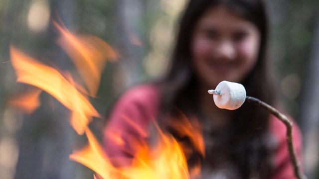
Camp in a Campground
Plan a night in one of twelve park campgrounds. 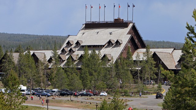
Stay in a Lodge
Pick a lodge that's right for you and make a reservation early! 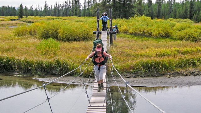
Camp in the Backcountry
Enjoy the solitude of more than 300 backcountry campsites. West Thumb and Grant Village Frequently Asked QuestionsYellowstone Lake resembles the shape of a human hand; West Thumb is the large western bay that would be the thumb. The bay is a caldera within a caldera. It was formed by a volcanic eruption approximately 174,000 years ago. The resulting caldera later filled with water, forming an extension of Yellowstone Lake. West Thumb is also the largest geyser basin on the shore of Yellowstone Lake—and its hydrothermal features lie under the lake too. The heat from these features can melt ice on the lake's surface. People learned they could stand on this shoreside geyser, catch a fish in the cold lake, and cook it in the hot spring. Fortunately for anglers, this geyser has only two years of known eruptions: In 1919, it erupted frequently to 40 feet (12.2 m) and in 1939 to lesser heights. Fishing here is now prohibited.
Temperatures vary from less than 100ºF (38ºC) to just over 200ºF (93ºC).
Abyss is about 53 feet (16.1 m) deep. Black Pool is 35–40 feet (10.7–12.2 m) deep.
Like all hydrothermal features, the West Thumb Paint Pots change over time. During the 1970s and 1980s, they were less active; they became more active in the 1990s.
Early visitors would arrive at West Thumb via stagecoach from the Old Faithful area. They could continue on the stagecoach or board the steamship "Zillah" to reach the Lake Hotel. Later, a gas station, marina, photo shop, store, cafeteria, and cabins were built here. They were removed in the 1980s to protect the hydrothermal features and improve visitor experience. Grant Village now provides most of these facilities. West Thumb still has restrooms, picnic tables, and a bookstore and information station in the historic ranger station. This area provides numerous opportunities for adventure. Take in the spectacular views of West Thumb and the Absaroka Mountains from the shores of Yellowstone Lake. Explore the hot springs, mud pots, and geysers of the West Thumb Geyser Basin. Hike one of the local trails, like the Scenic Lake Overlook or begin an overnight backpacking excursion at one of the many wilderness trailheads. Also, private and commercial paddling excursions launch from the Grant Village Marina.
Grizzly and black bears frequent this area in spring when cutthroat trout spawn in five nearby streams. To protect bears and people, the campground opens after most of the spawn is over.
That's Isa Lake, at Craig Pass. At one time, it was probably the only lake on Earth that drained naturally backwards to two oceans, the east side draining to the Pacific and the west side to the Atlantic. If this still occurs, it is only at the peak of snow melt after winters with deep snowfall.
Shoshone Lake is the park's second largest lake, and is thought to be the largest lake in the lower 48 states that cannot be reached by road. Its maximum depth is 205 feet (62.5 m) and it has an area of 8,050 acres (3258 ha). The Shoshone Geyser Basin contains one of the highest concentrations of geysers in the world—more than 80 in an area 1,600 feet x 800 feet (488 m x 244 m).
In addition to the bears that frequent this area in spring, elk cows and their new calves are often seen here in May and June. Bald eagles and osprey dive into the bay to catch cutthroat trout. Other birds include ravens, common loons, and bufflehead and goldeneye ducks. In winter, pine marten are sometimes seen. River otters pop in and out of holes in the ice. Coyotes and bald eagles eat their fish scraps. 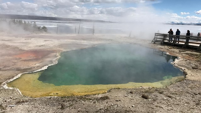
West Thumb Geyser Basin
Learn more about this geyser basin on the edge of Yellowstone Lake. 
Boating
Take in the view from the water. 
West Thumb & Grant Hikes
Hikes in the south part of the park reward hikers with spectacular lake views. 
Accessibility
Discover Yellowstone's accessibility resources like the NPS Mobile App, Access Pass, and assistive services. 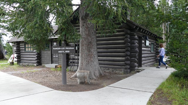
West Thumb Information Station
Stop by this small information station at the West Thumb Geyser Basin for information or a ranger program. 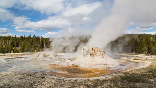
Places To Go
Discover the highlights of Yellowstone's vast 2.2 million acres, ten visitor centers, and eight developed areas. 
Plan Your Visit
Yellowstone changes with the seasons—make the most of your visit! Plan ahead to keep your trip safe, fun, and unforgettable. |
Last updated: June 2, 2025