Environmental Factors

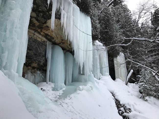
Ice curtains form on the cliffs at Sand Point
Ice curtains on the cliffs along Sand Point Rd.

NPS photo

Due to its geographic location and proximity to Lake Superior, Pictured Rocks National Lakeshore is greatly impacted by environmental factors of weather and climate. The park is located approximately 46 degrees north latitude and 86 degrees west longitude. The average high temperatures in winter months are about 25°F (-4°C) and during summer months about 70°F (22°C).

Lake Superior moderates temperature extremes, preventing deep cold for much of the winter, slowing spring warming, and keeping summers relatively cooler overall. The average date of the last freezing temperature in spring is June 8, and the average first fall freeze is September 23; however, freezing can occur during any month. Ice on Lake Superior's southern shore can last until June.

Lake-effect snow is a common feature of this climate and occurs when air moving across the lake is significantly cooler than the warmer lake surface. Cold winds sweeping across long expanses of warmer lake water can pick up a great deal of water vapor, which freezes and is then deposited over land.

Other environmental factors affecting Pictured Rocks include:
Climate Change
Air Quality
Water Quality
Non-Native Species
Disturbed Lands
Soundscape / Noise


Last updated: August 20, 2021

Park footer

Contact Info

Mailing Address:

P.O. Box 40
Munising, MI 49862

Phone:

906-387-3700
Munising Falls Visitor Center

Contact Us