Current Fire Activity & Restrictions

Three hikers cross a hillside above an alpine lake. A plume of smoke floats to the right from a wildfire in the distance.
A plume of smoke from the 2012 Reading Fire above hikers on the Mt. Harkness Trail above Juniper Lake.

NPS Photo


Wildfire Information

Wildfires within Lassen Volcanic National Park will be reported on this page if they exceed low-impact status, which may include rapid growth, increased impacts, or size exceeding 1/4-acre.

Active Fires: None
Fire Restrictions: No additional restrictions

 
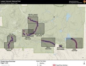
A map of the park with blue dots as individual hazard trees and red areas outlining work areas.
Dixie Fire hazard tree removal project map.

Dixie Post-Fire Recovery

The 2021 Dixie Fire reached 100% containment on October 26, 2021 with a total size of 963,309 acres including 73,240 acres within the park. Learn more about Dixie Fire effects within the park and Dixie Fire recovery.

New! Hazard Tree Removal Project

Crews are removing hazard trees burned from the park highway and Warner Valley and Juniper Lake Areas as part of the 2021 Dixie Fire Burned Area Emergency Response (BAER). Hazard trees pose a threat to safety or infrastructure and are identified by a blue paint mark. Expect temporary traffic control and changes to parking areas in active work zones. Please keep a safe distance from workers and equipment.
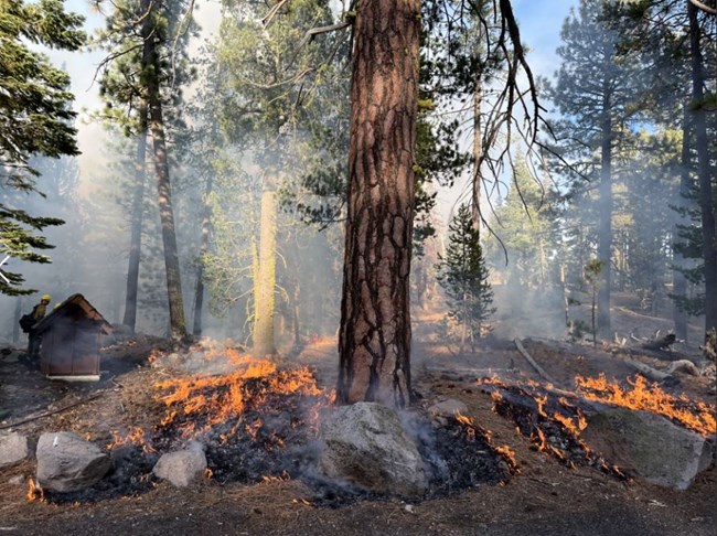
 
broadcast burning along the road near Manzanita Lake
A broadcast burn consumes accumulated forest fuels adjacent to the road near Manzanita Lake.

NPS/Dan Ostmann

Prescribed Burning

Lassen Volcanic National Park will continue prescribed burning in winter 2024 as conditions permit. Smoke from prescribed burns may be visible within and outside of the park. Air quality information including Particle Matter (PM2.5) measurements at Manzanita Lake and Mineral is available at on the Air Quality page.

Treatments may include broadcast burns (application of fire within a predetermined area) or pile burns. Possible treatment areas include Park Headquarters in Mineral, Summertown (north of Manzanita Lake), Juniper Lake and Warner Valley (Dixie Fire cleanup), and areas within the Northwest Gateway Project area.

Northwest Gateway Project Prescribed Burning

Prescribed burning of approximately 65 acres in the northwest corner of the park near the campground, administrative buildings, and park staff residences occurred on November 1, 2023. This is part of the multi-year Northwest Gateway Forest Restoration (NWG) Project and involves the reintroduction of fire to areas that were previously treated by mechanical thinning.

Pile Burning

Week of Jan. 22, 2024
Fire staff plan to begin igniting 90 acres of piles in the Phase 2 section of the NWG. nd the Volcano Adventure Camp. Burning these piles could carry over into the following week, depending on conditions and access.

Nov. 6 - 17, 2023
Firefighters will ignite hand piles east of park headquarters and near the administrative campground and ballfield approximately November 6-17, as conditions allow.
Update: 5 acres have been completed. Another 10 - 20 acres are planned for ignition on Wed. 11/15/2023.

Week of Nov. 13th, 2023
Multiple acres of machine-piled debris is planned for ignition in the the Northwest Gateway Project. The location will be in the vicinity of Lost Creek and Volcano Adventure Camp. Wetting storms are forecast to move in during this time, allowing for safe burning conditions.

Nov. 14, 2023
Ignition of a small area of hand piles near the Loomis Musuem in the Manzanita Lake area is planned.


Fire Restrictions

Normal Fire Restrictions

Campfires are always restricted to fire rings within designated campgrounds. Campfires are not permitted in the backcountry/Wilderness.

There are currently no additional fire restrictions in the park.

Practice Fire Safety

Please be especially cautious with your campfire (where permitted), vehicle, gas/liquid campstoves, and cigarettes to help reduce the risk of wildfire during this period of severe drought. Campfires are always restricted to fire rings within designated campground.

 
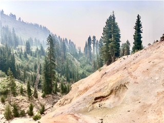
A hazy view of a mudpot on a hillside backed by a windy mountain road.
Hazy air conditions at Sulphur Works in the Southwest Area.

NPS/Catherine Orland

Smoke Impacts from Nearby Wildfires

Smoke impacts in the park from nearby fires vary from day to day. Park staff is not able to predict conditions for your trip. The following resources can help you check conditions prior to your visit:

Last updated: January 20, 2024

Park footer

Contact Info

Mailing Address:

PO Box 100
Mineral, CA 96063

Phone:

530 595-4480

Contact Us