Hackers Trail

A green map of the Cliff Park trail system. Trails are represented with black dotted lines.
Over 9 miles of trails can be connected within the Cliff Park Trail system.
 
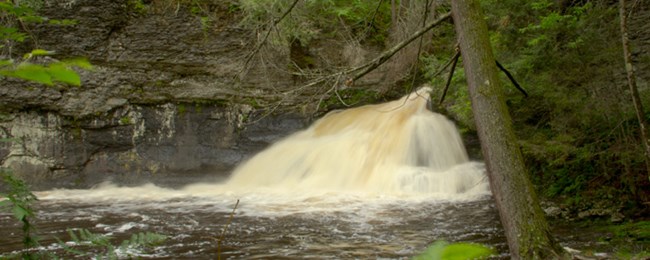
waterfall fanning over rocks into a pool of water
Hackers Falls is a refreshing hike with some great waterfalls to take in. Click on the image for Google Maps directions to the trailhead parking area.

NPS Photo

Trail Information:

Length: 1.4 miles
Type: Out and Back
Difficulty: Moderate
Blaze: Yellow
Elevation Change: 340 feet


Restrictions:

  • Swimming, climbing, and wading are prohibited on or within 50 feet of the waterfall. Don't risk your life!
  • Food, picnicking, and alcohol are prohibited in the Cliff Park Trail system and at Hackers Falls.


Trail Description:

Hackers Falls Trail begins across the street from Raymondskill's lower parking lot.

Enjoy a hike with elevation change, mixed hardwood forest, and hemlock ravine views as you make your way past Hackers Falls. This waterfall has a fan shape as it slides down a short, steep drop. Hackers Trail terminates at the intersection of the Buchanan Trail.


Other trails in the Cliff Park area:


Return to list of trails

Last updated: November 4, 2022

Park footer

Contact Info

Mailing Address:

Delaware Water Gap National Recreation Area
P.O. Box 2

Bushkill, PA 18324

Phone:

570 426-2452

Contact Us