Current ProjectsGeorgetown, DC and Montgomery County, MD (Mile 0-42)
NPS Georgetown Construction ProjectsLearn about all of the upcoming projects in the Georgetown section of C&O Canal NHP.
NPS | Professional Services Division – C&O Canal National Historical Park Rehabilitation of the Capital Crescent Trail (CCT)The National Park Service (NPS) plans to rehabilitate 3.7 miles of the Capital Crecent Trail (CCT) located between the Maryland/DC line and the Water Street, DC, trailhead at the Potomac/Alexandria Aqueduct. Generally, the project consists of resurfacing the 10-foot wide asphalt pavement surface and reestablishing the 2-foot wide stone dust shoulders throughout the project area.Learn more about the project on our Rehabilitation of the Capital Crescent Trail (CCT) project page. 
NPS | Professional Services Division – C&O Canal National Historical Park Flood Damage Repairs to Great Falls Entrance Road and Swains Lock Parking Area, Potomac, MDThe park has awarded a construction contract to repair damages incurred during a flash flood that resulted in high intensity rainfall on July 8, 2019. The current construction project addresses the flood damage to the substructure of the roadway that is necessary to keep the road in-place and safe for use. Design for a large-scale pavement rehabilitation project is currently underway, with construction scheduled to be completed in the future. Frederick and Washington County, MD (Mile 42-136)
NPS | C&O Canal NHP Engineering Services Team Replace Existing Stairway at Byron BridgeNational Park Service (NPS) plans to rehabilitate the existing metal stairway connecting the Goodloe Byron Memorial Footbridge (Byron Bridge) to the Chesapeake & Ohio Canal National Historical Park towpath (mile 60.6). The pedestrian walkway over the Potomac River connects Harpers Ferry National Historical Park with the C&O Canal NHP. The stairway and pedestrian walkway also carry the Appalachian National Scenic Trail, Potomac Heritage National Scenic Trail, and other regional trail systems.Learn more about the project on our Replace Existing Stairway at Byron Bridge project page. 
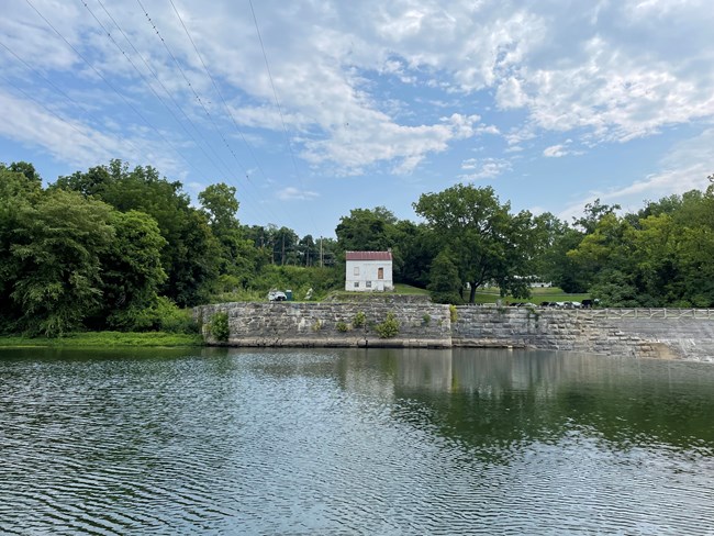
NPS | C&O Canal NHP Engineering Services Team Potomac Dam No. 5 – Left Abutment StabilizationThe park plans to rehabilitate the Left Abutment of the historic Potomac Dam No. 5 near mile 106.8 of the Chesapeake & Ohio Canal National Historical Park in Clear Spring, Maryland. The projects consist of stabilizing a historic stone dam abutment and associated componentsLearn more about the project on our Potomac Dam 5 Left Abutment project page. 
NPS | C&O Canal NHP Engineering Services Team Four Locks Boat RampThe park plans to improve the Four Locks Boating Access near mile marker 108.9 of the Chesapeake & Ohio Canal National Historical Park in Clear Spring, Maryland. Generally, the projects consists of rehabilitating the deteriorated boat ramp structure and increasing accessibility for boaters.Learn more about the project on our Four Locks Boating Access Improvement project page. 
NPS | Stephanie Spencer – C&O Canal National Historical Park Repair of Carderock, Four Locks, & McCoys Ferry TunnelsThe park plans to repair three public vehicular tunnels at Carderock Recreation Area (mile 10.4), Four Locks (mile 108.5), and McCoys Ferry (mile 110.2).The project aims to increase visitor safety and provide a more sustainable method of accessing these recreational areas in the park by repairing the existing tunnels, improving drainage, and installing new traffic signage. Learn more about the project on our Repair of Carderock, Four Locks, & McCoys Ferry Tunnels project page. Allegany County, MD (Mile 136-184.5)
NPS Photo Towpath Resurfacing ProjectVisitors will see towpath resurfacing taking place throughout the park over the course of five to ten years. These improvements will create a smoother, safer visit for the park's nearly 5 million annual visitors. For more information and current work areas, please visit our Towpath Resurfacing Project page.Recently Completed
NPS | Professional Services Division – C&O Canal National Historical Park Stabilize Drylaid Stone Wall at Mile Marker 11 (Log Wall)Complete! 
NPS | C&O Canal NHP Engineering Services Team Rehabilitation of Levels 20, 21, & 22Complete! 
NPS | C&O Canal NHP Engineering Services Team Replace Edwards Ferry, Dargan, & Fifteen Mile Creek BridgesComplete! 
NPS | C&O Canal NHP Engineering Services Team Replacement of Culvert 82 BridgeComplete! 
NPS | C&O Canal NHP Engineering Services Team Repairs to Fletchers Cove Access RoadComplete!Learn more about the project on our Repairs to Fletchers Cove Access Road project page. 
NPS Photo Paw Paw Tunnel Rock Scaling and Pinning ProjectComplete!Learn more about the project on aur Paw Paw Tunnel Rock Scaling and Pinning Project page. 
NPS | C&O Canal NHP Engineering Services Team Reconstruct/Stabilize Historic Stone Wall & Towpath McMahons Mill to Lock 42Complete! 
NPS | C&O Canal NHP Engineering Services Team Replacement of Pedestrian Bridge at Seneca Creek AqueductComplete! Learn more about the project on our Replacement of Pedestrian Bridge at Seneca Creek Aqueduct project page. 
NPS | C&O Canal NHP Engineering Services Team Repairs to Level 33 Dry-Laid Stone WallComplete! |
Last updated: November 25, 2025
