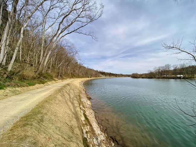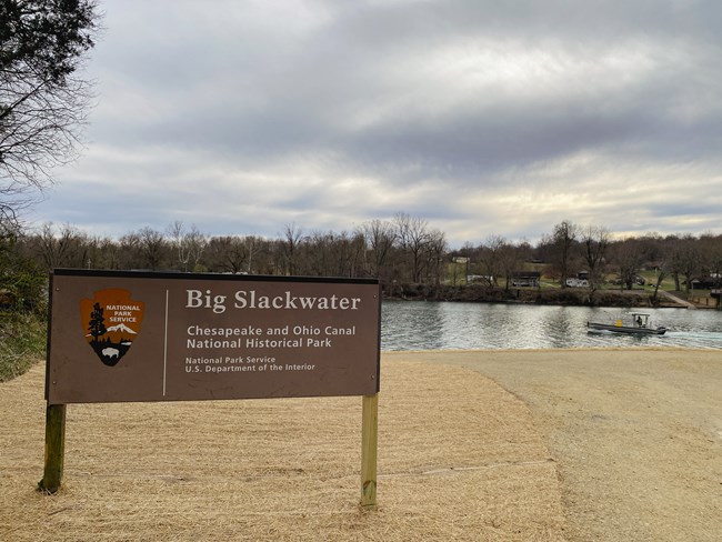
NPS | Joe Reed, Park Engineer The towpath between miles 88 and 89 is open. The McMahons Mill parking lot (mile 88) is open.
CURRENT DETOURS AND CLOSURESThe towpath between miles 88 and 89 is OPEN. No detours are in place. FREQUENTLY ASKED QUESTIONS (FAQs)What is the need for the project?The historic stone wall was weakened by water impacts from the Potomac River, particularly during storm events, and vegetation growing through the structure. Portions of the historic stone wall were washed out or missing. Periodic flood events weakened the stone wall and created sinkholes, washouts, and slope failures in the towpath. What does the project include?The project consisted of work removing vegetation growing within the stone wall and next to the towpath, reconstructing missing or washed out portions of the historic stone wall, stabilizing and building up other portions of the stone wall, and moving some portions of the towpath more inland. It also included re-establishing the towpath with a width to allow for safe, limited passage of emergency/maintenance vehicles, as well as raising the towpath to an elevation that would reduce closures caused by minor flood waters. Even though the towpath was raised at its lowest spots, this section will still go under water during moderate and major river flooding events. 
NPS | Joe Reed, Park Engineer Where will the project take place?This project took place on approximately 0.9 miles of the C&O Canal towpath from McMahons Mill (mile 88) to Lock 42 (mile 89), approximately 10 river miles downstream of Williamsport, MD, and four miles upstream from Dam #4. When will the project begin and end?The project began in August 2021 and was completed in March 2023. How will this project impact park visitors?No closures are currently in place. How will this project benefit park visitors?The towpath is less likely to experience as many high-water event closures, allowing for more frequent and safe passage for visitors. The existing towpath was stabilized, increasing the resiliency of this fragile length of the towpath and preserving the continuity of the 184.5-mile-long trail. Many existing impairments - such as sinkholes, washouts, deposited river sediment, and encroaching trees/roots - were addressed, resulting in a safer and better visitor experience. How will this project impact natural and cultural resources?Every project the NPS executes undergoes review by a multidisciplinary team to ensure compliance with Section 106 of the National Historic Preservation Act (NHPA), National Environmental Policy Act (NEPA), and other federal, state, and local laws. What is the park doing to protect those resources during the project?NPS resource protection experts, engineers, and the contractor’s team monitored the stone and towpath work along this stretch of the towpath, along with contractor’s operations and visitor safety during the project with the goal of safely protecting the environment surrounding the project. Every project undertaken by the NPS is conducted in compliance with the National Environmental Protection Act (NEPA), the National Historic Preservation Act (NHPA), and other regulations. Please see the Environmental Assessment (EA) prepared by the park for further details. How much does the project cost?The design build contract for the rehabilitation of 0.9 miles of towpath and supporting masonry walls between McMahons Mill to Lock 42 near Williamsport, MD, cost around $21 million and was funded from the National Park Service’s Line Item Construction Program. Who can I contact if I have further questions regarding the project?Additional questions are to be directed to the park headquarters at 301-739-4200. 
NPS | Joe Reed, Park Engineer |
Last updated: January 23, 2025
