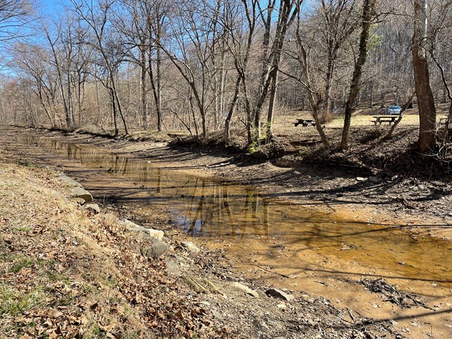
NPS | Engineering Services Team The towpath between Lock 20 (MM 14.3) and Lock 23 (MM 22.1) is OPEN. Inlet Lock #2 valves, diverting water from the Potomac River into the Canal, are OPEN.UPDATE 4/19/24: All major aspects of this construction project have been completed to the extent necessary to rewater the canal. The construction contractor is currently addressing various punch-list (closeout) items, which are anticipated to have a minor impact to park users. This includes towpath resurfacing repairs between Locks 21 and 23, minor site grading on the berm near Great Falls Parking Lot, asphalt repair at the Great Falls Parking Lot, Stone Masonry Wall Repair near Blockhouse Point, and concrete sidewalk repair at Great Falls Parking Lot. As of 4/19/24 NPS has begun the process of rewatering the canal between Violette’s Lock (Lock 23) and Great Falls (Lock 20). Flushing of the canal is anticipated to be undertaken for about one week. Flushing of the canal helps to remove any accumulated debris and reduce operational hazards. When flushing is complete and no concerns have been identified, water levels in the canal will be brought up to operational levels within this stretch of the canal . Staff will be monitoring performance of the embankments and water control structures during the flushing and filling processes. The park plans to rehabilitate portions of the canal in a 7.8-mile section of the Chesapeake & Ohio Canal. The project is located between milepost 14.3 (Lock 20) and milepost 22.1 (Lock 23 & Inlet Lock 2). This reach is the most upstream portion of the watered section of the canal near Great Falls and is a very popular recreation area with over one million visitors per year. The primary objective of the sediment and debris removal is to improve the hydraulic connectivity of the canal along this reach, referred to as levels 20, 21, and 22.
Over time, sediment and debris have accumulated within the project area to the point where it has disrupted canal water flow and impacted many of the park's critical mission components, such as interpretation, operations, maintenance, environmental, & recreation. The mission areas are expected to be improved after completion of this project. Due to funding constraints, it’s anticipated that not all accumulated sediment within this reach of the canal will be addressed. Currently, only sediment removal from the canal prism extending from Lock 20 and moving upstream to just past the Great Falls Tavern Parking Area are included in the awarded construction project. Debris removal will be accomplished along the entire project reach, from Lock 20 – Lock 23. In addition to removing sediment and debris from within the canal prism, the towpath between Lock 21 (MM 16.7) and Lock 23 (MM 22.1) will be resurfaced using the C&O Canal towpath blend, similar in character to the existing type of material in this lower portion of the park. To facilitate the work, the contractor will establish a staging area at the upstream end of Great Falls parking lot and a temporary stone causeway across the canal to access to the towpath. Equipment will also access the towpath from Lock 23. Initially, some smaller equipment will use the existing bridges at Lock 19 to access the lower area of the project to establish erosion and sediment control measures. 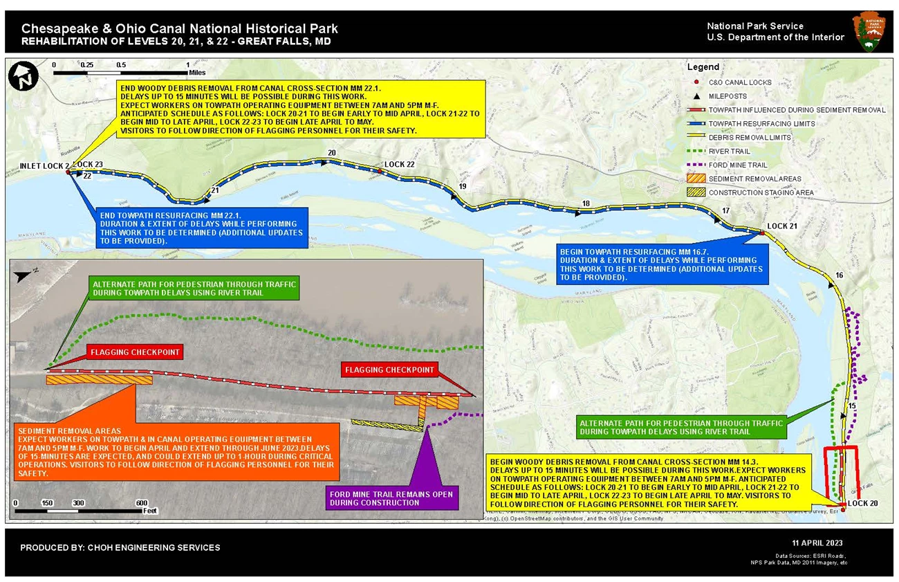
NPS | Engineering Services Team 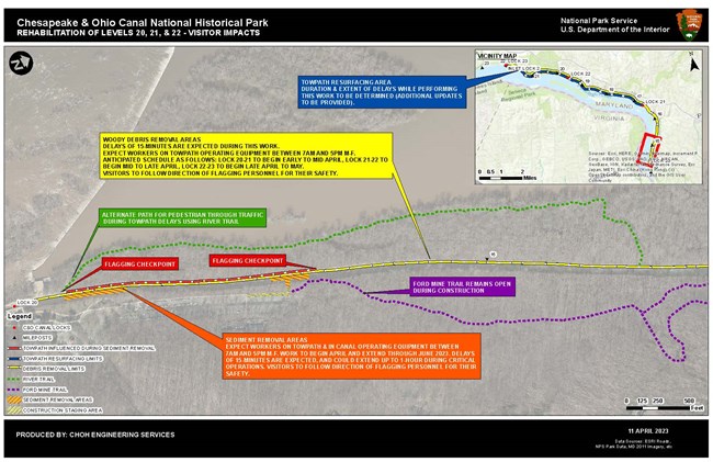
NPS | Joe Reed, Park Engineer CURRENT DETOURS AND CLOSURESThe towpath between Lock 20 (MM 14.3) and Lock 23 (MM 22.1) is OPEN. Inlet Lock #2 valves, diverting water from the Potomac River into the Canal, are Open. Above and to the left are maps showing the project area and previous visitor impacts. FREQUENTLY ASKED QUESTIONS (FAQs)What is the need for the project?Over time, sediment and debris has accumulated within the project reach to the point where it has disrupted canal water flow and impacted many of the park’s critical mission components. The source of the sediments comes from both the Potomac River and the tributaries which flow from adjacent watersheds. Inlet Lock 2 at milepost 22.1 provides for water to be diverted from the Potomac River at Dam #2 to re-water the canal within this reach and further South to Inlet Lock 1 at mile post 5.0 (a total distance of about 17.1 miles). Tree falls occur naturally from the adjacent forest and fall into the canal. If left unaddressed, many of these tree falls accumulate more debris and sediments, which gradually become impediments to the flow of water downstream. Many areas in the canal have accumulated sediment at the adjacent streams’ confluences and with some extending almost the entire way across the canal prism. Although not all the accumulated areas of sediment in the canal will be able to be addressed due to funding constraints, the park’s mission areas are expected to be improved after completion of this project. What does the project include?The project consists of removing sediment from the canal prism extending from Lock 20 and moving upstream to just past the Great Falls Tavern Parking Area. Debris removal will be accomplished along the entire project reach, from Lock 20 to Lock 23. The towpath between Lock 21 (MM 16.7) and Lock 23 (MM 22.1) will be resurfaced using the C&O Canal towpath blend, similar in character to the existing type of material in this lower portion of the park. 
NPS | Engineering Services Team 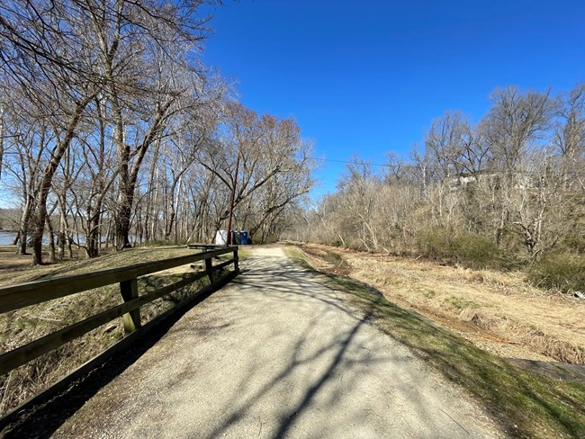
NPS | Engineering Services Team Where will the project take place?This project will take place between Lock 20 (mile 14.3) and Lock 23 (mile 22.1), within the Great Falls area of the Chesapeake & Ohio Canal National Historical Park in Potomac, MD. When will the project begin and end?The project began in March 2023 and completed to the extent necessary to rewater the canal in spring 2024. How will this project impact park visitors?The towpath between Lock 20 (mile 14.3) and Lock 23 (mile 22.1) is OPEN. Inlet Lock #2 valves, diverting water from the Potomac River into the Canal, are Open. How will this project benefit park visitors?Once the project is complete, interpretive and recreational capabilities will be improved in this area of the park. Hydraulic connectivity will be improved within the canal and the operation of the Charles F. Mercer (NPS operated mule-drawn historic canal boat) will be increased. How will this project impact natural and cultural resources?Every project the NPS executes undergoes review by a multidisciplinary team to ensure compliance with Section 106 of the National Historic Preservation Act (NHPA), National Environmental Policy Act (NEPA), and other federal, state, and local laws. What is the park doing to protect those resources during the project?NPS resource protection experts, engineers, and the contractor’s team will be monitoring the canal and towpath work in this area, along with contractor’s operations and visitor safety during the project with the goal of safely protecting the environment surrounding the project. Every project undertaken by the NPS is conducted in compliance with the National Environmental Protection Act (NEPA), the National Historic Preservation Act (NHPA), and other regulations. How is the project funded?The contract for the rehabilitation of Levels 20, 21, & 22 was awarded in September 2022 for $3.7 million. The project was funded from the National Park Service’s Cyclic Program and Transportation Alternative Program Grant from the State of Maryland. It is being executed via an interagency agreement with the US Army Corps of Engineers and National Park Service. Who can I contact if I have further questions regarding the project?Additional questions are to be directed to the park headquarters at 301-739-4200. 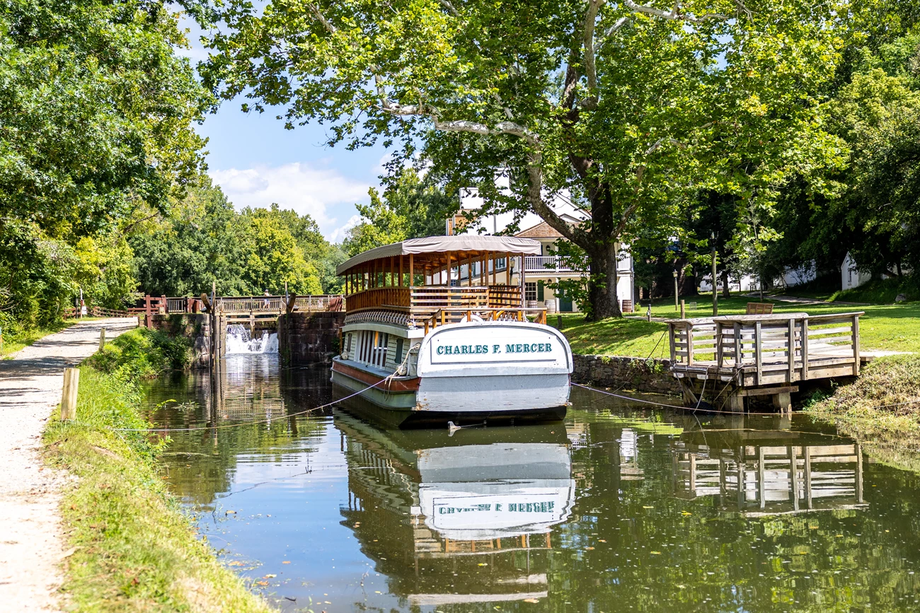
NPS | Stephanie Spencer |
Last updated: April 22, 2024
