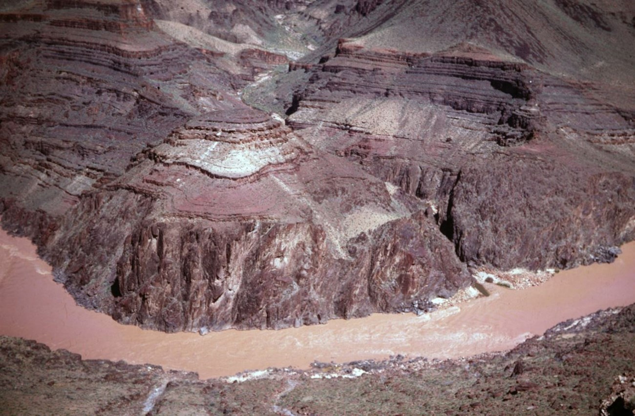
Photograph ES180 from Billingsley et al. (2019).
Geology and Stratigraphy of the Southern Colorado Plateau I&M Network Parks
The Southern Colorado Plateau Inventory and Monitoring Network (SCPN) is composed of 19 national park units in Arizona, Colorado, New Mexico, and Utah. Park units of the Southern Colorado Plateau Network include Aztec Ruins National Monument, Bandelier National Monument, Canyon De Chelly National Monument, Chaco Culture National Historical Park, El Malpais National Monument, El Morro National Monument, Glen Canyon National Recreation Area, Grand Canyon National Park, Hubbell Trading Post National Historic Site, Mesa Verde National Park, Navajo National Monument, Petrified Forest National Park, Petroglyph National Monument, Rainbow Bridge National Monument, Salinas Pueblo Missions National Monument, Sunset Crater Volcano National Monument, Valles Caldera National Preserve, Walnut Canyon National Monument, Wupatki National Monument, and Yucca House National Monument. Parks that comprise the Southern Colorado Plateau Network protect a combined 1,269,514 hectares (3,137,038 acres) of land and vary in size from 13 hectares (34 acres) in Yucca House, to 507,523 hectares (1,254,117 acres) in Glen Canyon.
The Colorado Plateau is characterized as a high-standing crustal block of relatively undeformed strata that exhibit broad flexures, monoclines (step-like folds), normal faults, igneous laccoliths (dome-like intrusions), and volcanoes. The province is surrounded by the Rocky Mountains and Uinta Mountains to the north and northeast, the Rio Grande Rift Valley to the east, and the Mogollon Rim to the south. The western boundary of the Colorado Plateau represents a transition zone where geologic features are transitional between typical Colorado Plateau and the Basin and Range. Many of the parks in the Southern Colorado Plateau Network represent iconic geologic landscapes consisting of sparely vegetated plateaus, mesas, deep canyons, and badlands that encompass the area drained by the Colorado River and its tributaries. Parks of the Southern Colorado Plateau Network occupy four of the six sections of the Colorado Plateau as defined by Rigby (1977):
- Grand Canyon section, the highest structural part of the Colorado Plateau—Grand Canyon, Sunset Crater Volcano, Walnut Canyon, and Wupatki;
- Canyonlands section, a region of deeply incised canyons, large monoclines, and laccolithic mountains—Glen Canyon, Mesa Verde, Rainbow Bridge, and Yucca House;
- Navajo section, an area of scarped plateaus that is less dissected than the Canyonlands section— Aztec Ruins, Canyon De Chelly, Chaco Culture, Hubbell Trading Post, Navajo National Monument, and Petrified Forest; and the
- Datil section, which is largely volcanic in origin—El Malpais and El Morro.
Only Bandelier, Petroglyph, Salinas Pueblo Missions, and Valles Caldera are located outside the Colorado Plateau physiographic province in and near the Rio Grande Rift, an area characterized by east–west crustal extension. Dynamic crustal extensional processes associated with the Rio Grande Rift resulted in thick packages of sedimentary deposits (Santa Fe Group), but also thinned and weakened the crust, producing fault-bounded basins and numerous volcanic fields throughout New Mexico and Colorado (Keller and Baldridge 1999; KellerLynn 2017).
A Brief Geologic History
A few examples of events and Network resources in each geologic time period are highlighted below, from youngest to oldest.
Mapped units in Aztec Ruins include the Paleocene Nacimiento Formation and Pleistocene Naha and Tsegi Alluviums. The Naha Alluvium is also mapped in Chaco Culture. Several Cenozoic-age units are found in Bandelier and adjacent Valles Caldera, including the Eocene Galisteo Formation; Miocene Chamita, Tesuque, and Paliza Canyon Formations; Miocene–Pliocene Cochiti Formation; Pliocene Tschicoma Formation; and Pleistocene Tewa Group (Bandelier Tuff, Cerro Toledo Formation, Valles Rhyolite). Cenozoic volcanic rocks, basalt flows, and dikes are located in both El Malpais, El Morro, Salinas Pueblo Missions, and Wupatki. A number of volcanic units are distributed throughout Grand Canyon and record Miocene, Pliocene, and Pleistocene-age volcanism. The Miocene Bidahochi Formation is found in Petrified Forest. Several Cenozoic-age deposits are mapped in Petroglyph and include the Pliocene–Pleistocene Ceja Formation and Pleistocene Lomatas Negras Formation, Los Duranes Formation, and volcanic rocks associated with the Albuquerque volcanic field. The volcanic landscape of Sunset Crater Volcano consists entirely of Pleistocene-age volcanic rock lava flows, volcanic ash, and cinder deposits of the San Francisco volcanic field.
Geologically young surficial deposits of Pleistocene-Holocene-age are mapped in nearly every park of the Southern Colorado Plateau Network, and predominantly consist of alluvium, colluvium, alluvial fan deposits, eolian sands, terrace gravels, landslide deposits, and slump deposits.
Several units are found is multiple parks, such as the Triassic Moenkopi Formation (Glen Canyon, Grand Canyon, and Wupatki) and Chinle Formation (Canyon De Chelly, Glen Canyon, Grand Canyon, Hubbell Trading Post, and Petrified Forest); Triassic–Jurassic Glen Canyon Group (Glen Canyon, Grand Canyon, Navajo National Monument, and Rainbow Bridge); Jurassic Zuni Sandstone (El Malpais and El Morro); and Cretaceous Naturita Formation (El Malpais, El Morro), Mesaverde Group (Chaco Culture, Mesa Verde), and Mancos Shale (El Malpais, Mesa Verde, Yucca House). Other mapped Mesozoic rocks within the park units of Southern Colorado Plateau Network include the Jurassic Wanakah Formation (El Malpais) and Cretaceous Pictured Cliffs Sandstone and Lewis Shale (Chaco Culture), Tres Hermanos Sandstone (El Malpais), and Point Lookout Sandstone (Mesa Verde).
Other Paleozoic-age units include the Pennsylvanian Hermosa Group (Glen Canyon), Pennsylvanian– Permian Supai Formation (Canyon De Chelly), Permian San Andres Limestone (El Malpais and Salinas Pueblo Missions), Abo Formation (El Malpais and Salinas Pueblo Missions), Cutler Group (Canyon De Chelly and Glen Canyon), Glorieta Sandstone (El Malpais), Yeso Formation (El Malpais), and Arroyo de Alamillo Formation (Salinas Pueblo Missions).
Geology & Soils—Southern Colorado Plateau Network Parks
Type Sections—Southern Colorado Plateau Network

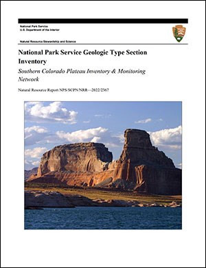
The geologic history above is excerpted from a report titled, "National Park Service geologic type section inventory: Southern Colorado Plateau Inventory & Monitoring Network". Type sections are essential reference locations for the geoscientists who study geologic history and paleontology. A summary of the type sections in each park can be found at the links below.
-
Aztec Ruins National Monument, New Mexico (no designated stratotypes identified)
-
Bandelier National Monument, New Mexico (contains four identified stratotypes)
-
Canyon De Chelly National Monument, Arizona (contains three identified stratotypes)
-
Chaco Culture National Historical Park, New Mexico (no designated stratotypes identified)
-
El Malpais National Monument, New Mexico (no designated stratotypes identified)
-
El Morro National Monument, New Mexico (no designated stratotypes identified)
-
Glen Canyon National Recreation Area, Arizona and Utah (contains seven identified stratotypes)
-
Grand Canyon National Park, Arizona (contains 54 identified stratotypes)
-
Hubbell Trading Post National Historic Site, Arizona (no designated stratotypes identified)
-
Mesa Verde National Park, Colorado (contains five identified stratotypes)
-
Navajo National Monument, Arizona (no designated stratotypes identified)
-
Petrified Forest National Park, Arizona (contains 39 identified stratotypes)
-
Petroglyph National Monument, New Mexico (no designated stratotypes identified)
-
Rainbow Bridge National Monument, Utah (no designated stratotypes identified)
-
Salinas Pueblo Missions National Monument, New Mexico (contains two identified stratotypes)
-
Sunset Crater Volcano National Monument, Arizona (no designated stratotypes identified)
-
Valles Caldera National Preserve, New Mexico (contains 12 identified stratotypes)
-
Walnut Canyon National Monument, Arizona (no designated stratotypes identified)
-
Wupatki National Monument, Arizona (contains one identified stratotype)
-
Yucca House National Monument, Coloradao (no designated stratotypes identified)
The full Network report is available in digital format from:
Please cite this publication as:
-
Henderson TC, Santucci VL, Connors T, Tweet JS, Bowman C. 2022. National Park Service geologic type section inventory: Southern Colorado Plateau Inventory & Monitoring Network. Natural Resource Report. NPS/SCPN/NRR—2022/2367. National Park Service. Fort Collins, Colorado.
NPS Stratotype Inventory
Fossil Resources—Southern Colorado Plateau Network

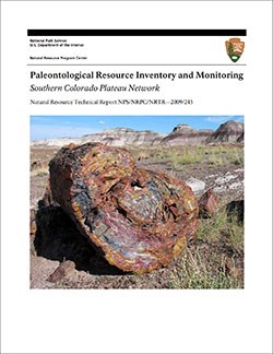
Between 2002 and 2011, network-based paleontological resource inventories were completed for all the 32 I&M networks, and six of the earliest were completely updated between 2012 and 2016. The report linked below summarizes the paleontological resources of all park units in the Southern Colorado Plateau Inventory & Monitoring Network (SCPN). The report provides geologic background and paleontological resource data for each park to support management operations, planning, and science-based decision making as required by NPS management policies and the Paleontological Resources Preservation Act (2009).
The full report is available in digital format from
-
DataStore - Paleontological resource inventory and monitoring—Southern Colorado Plateau Network (nps.gov)
Please cite this publication as:
-
Tweet JS, Santucci VL, Kenworthy JP, Mims AL. 2009. Paleontological resource inventory and monitoring—Southern Colorado Plateau Network. Natural Resource Technical Report. NPS/NRPC/NRTR—2009/245. Natural Resource Program Center. Fort Collins, Colorado.
Geodiversity Atlas pages—by Inventory & Monitoring Network
Arctic Network Index
Central Alaska Network Index
Chihuahuan Desert Network Index
Cumberland Piedmont Network Index
Eastern Rivers and Mountains Network Index
Great Lakes Network Index
Greater Yellowstone Network Index
Gulf Coast Network Index
Heartland Network Index
Klamath Network Index
Mediterranean Coast Network Index
Mid-Atlantic Network Index
Mojave Desert Network Index
National Capital Network Index
North Coast and Cascades Network Index
Northeast Coastal and Barrier Network Index
Northeast Temperate Network Index
Northern Colorado Plateau Network Index
Northern Great Plains Network Index
Pacific Islands Network Index
Rocky Mountain Network Index
San Francisco Bay Area Network Index
Sierra Nevada Network Index
Sonoran Desert Network Index
South Florida/Caribbean Network Index
Southeast Alaska Network Index
Southeast Coast Network Index
Southern Colorado Plateau Network Index
Southern Plains Network Index
Southwest Alaska Network Index
Upper Columbia Basin Network Index
Geodiversity Atlas pages—by State, U.S. Commonwealth, and Territories
Alabama | Alaska | Arizona | Arkansas | California | Colorado | Connecticut | District of Columbia | Delaware | Florida | Georgia | Hawaii | Idaho | Illinois | Indiana | Iowa | Kansas | Kentucky | Louisiana | Maine | Maryland | Massachusetts | Michigan | Minnesota | Mississippi | Missouri | Montana | Nebraska | Nevada | New Hampshire | New Jersey | New Mexico | New York | North Carolina | North Dakota | Ohio | Oklahoma | Oregon | Pennsylvania | Rhode Island | South Carolina | South Dakota | Tennessee | Texas | Utah | Vermont | Virginia | Washington | West Virginia | Wisconsin | Wyoming
U.S. Commonwealth and Territories
Region 2: South Atlantic-Gulf (Includes Puerto Rico and the U.S. Virgin Islands)
Region 3: Great Lakes
Region 4: Mississippi Basin
Region 5: Missouri Basin
Region 6: Arkansas-Rio Grande-Texas-Gulf
Region 7: Upper Colorado Basin
Region 8: Lower Colorado Basin
Region 9: Columbia-Pacific Northwest
Region 10: California-Great Basin
Region 11: Alaska
Region 12: Pacific Islands (American Samoa, Hawaii. Guam, Commonwealth of the Northern Mariana Islands)
Last updated: February 21, 2025
