
NPS photo. Navigating the Parks: Maps and Reliable DirectionsImportant GPS Note:Many popular online maps and GPS apps do not provide accurate coverage of Redwood National and State Parks. Visitors attempting to reach specific locations are often misdirected to isolated towns, remote logging roads, or private property. To avoid navigation issues, we strongly recommend using a printed park map and planning your route in advance. Important Travel Tips
For detailed maps and reliable navigation, visit our National Park Service Map Collection. ADA Accessible Park MapWe also offer text only, audio described, and braille versions of the parks' offical map.Printable Maps for Redwood National and State ParksHaving a reliable map is essential for exploring Redwood National and State Parks, where GPS navigation can be unreliable. Below, you’ll find printable maps to help you plan your visit, from park-wide overviews to detailed regional maps and campground layouts. 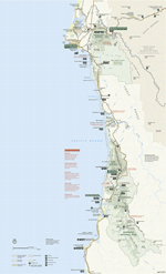
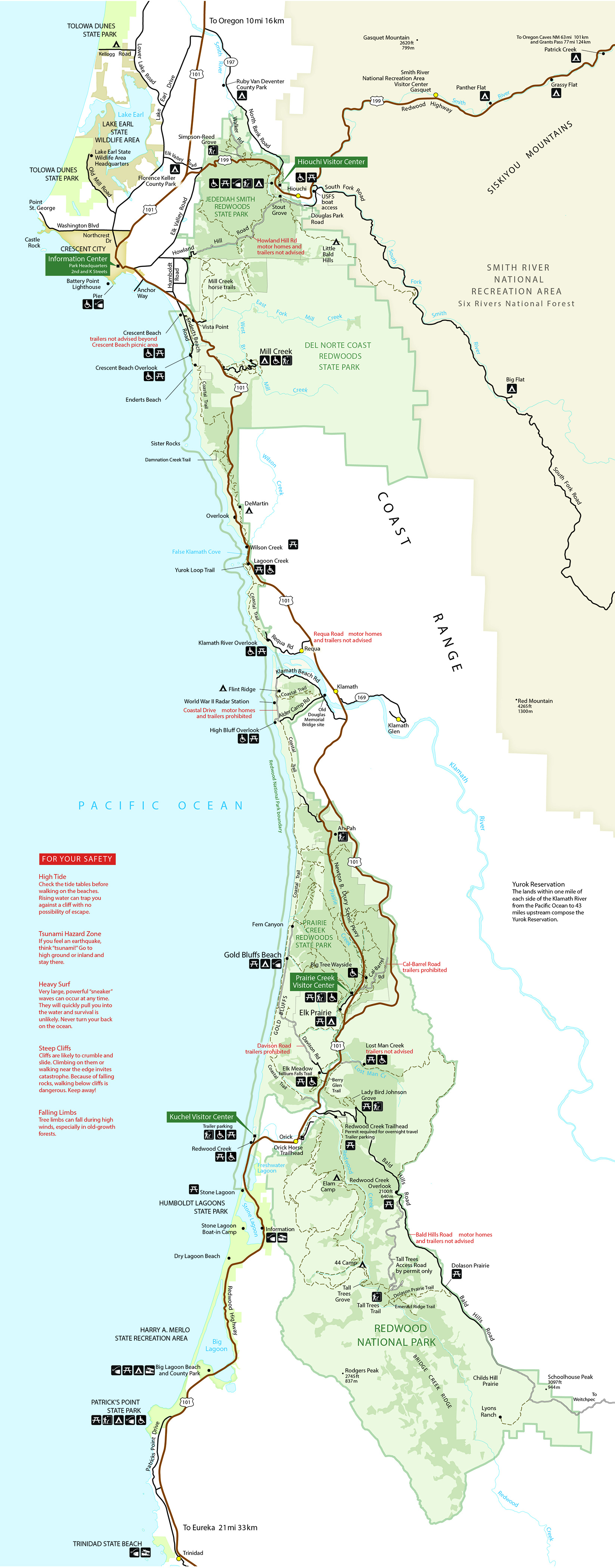
Park Map (JPEG)Prints at 8.5" x 14" (Legal size). From the official brochure for Redwood National and State Parks. Also see pages 6-7 of the Visitor Guide for a similar map but with recommended scenic drives and short walks. The Klamath River cuts across the middle of the Parks.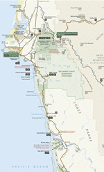
Park Map - Northern Half (JPEG)Prints at 8.5" x 11" (Letter size). From the official brochure for Redwood National and State Parks. Also see pages 6-7 of the Visitor Guide for a similar map but with recommended scenic drives and short walks. This map highlights the parts of the Parks north of the Klamath River. 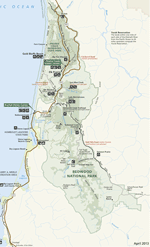
Park Map - Southern Half (JPEG)Prints at 8.5" x 11" (Letter size). From the official brochure for Redwood National and State Parks. Also see pages 6-7 of the Visitor Guide for a similar map but with recommended scenic drives and short walks. This map highlights the part of the Parks south of the Klamath River. Campground MapsYou will be redirected to official California State Parks webpages. Jedediah Smith Campground (in Jedediah Smith Redwoods State Park) Pack Animal and Overnight Camps. (PDF 4.6 MB)Brochure and maps about horse trails in the parks. |
Last updated: January 28, 2025