
NPS Photo/Mitch Smith Walking paths have long been a part of Hot Springs National Park and the preceding Hot Springs Reservation. Today those walking paths form the base of the park’s trail system. There are two concentrated areas of hiking trails within the park, the Hot Springs and North Mountain Trails and the West Mountain Trails. Both of these areas are composed of relatively short, interconnected trails. The Sunset Trail is a longer trail that travels through more remote areas of the park. MapsPaper trail maps can be found at the Fordyce Bathhouse and Visitor Center. Digital maps with real-time GPS location are available by downloading the service-wide NPS App.
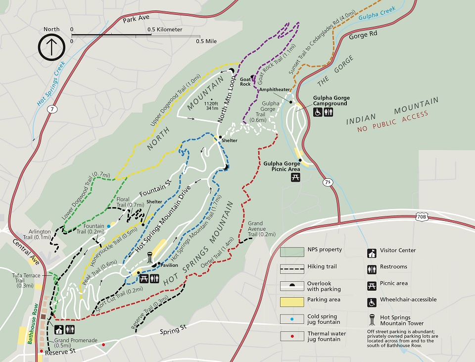
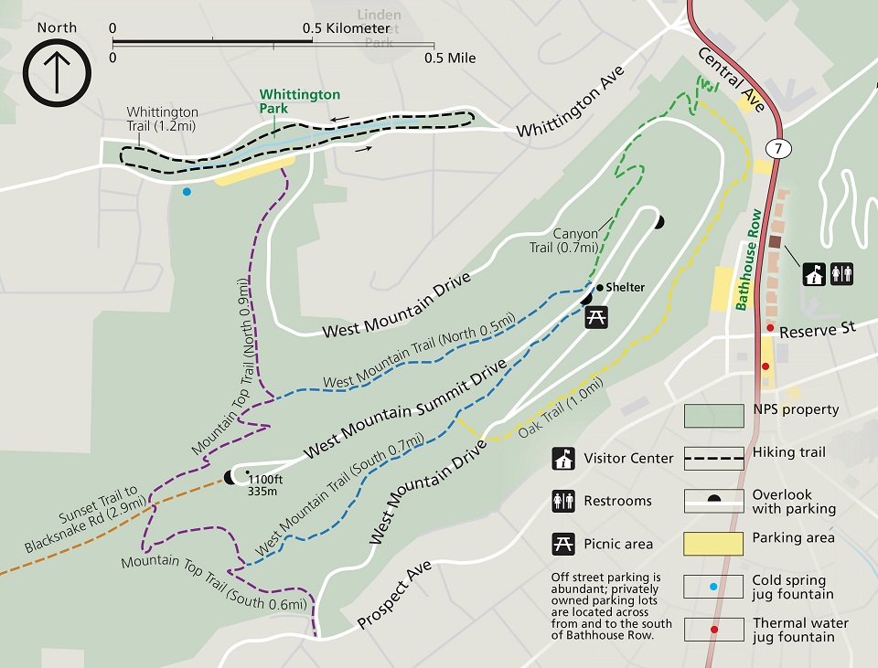
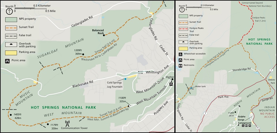
Hot Springs and North Mountain TrailsThe Hot Springs and North Mountain trails are popular since they are easy to reach and provide scenic views. You can get to these trails via Stephen’s Balustrade (grand staircase) behind the Fordyce Bathhouse, Hot Springs Mountain Drive, and the Gulpha Gorge Campground. See the Hot Springs and North Mountain trail map for more information. *Note: Oertel Trail is still labeled as Dead Chief Trail on the park's brochure. West Mountain TrailsThe West Mountain trails are less traveled, providing greater opportunities for wildlife sightings. You can get to these trails via Whittington Park and the Canyon Trailhead. See the West Mountain trail map for more information. Sunset TrailThe Sunset Trail is the longest trail in Hot Springs National Park, covering approximately 10 miles one way or complete the 15-17 mile loop. It completes a circuit near the inner edge of the park boundary. Crossing all types of terrain, the trail makes its way through the most remote areas of the park. Due to the length of this trail, it is frequently broken up into three separate sections: West Mountain (2.8 miles), Sugarloaf Mountain (2.6 miles), and Stonebridge Road (3.8 miles). The Sunset Trail can be combined with Hot Springs Mountain trails, North Mountain trails, and West Mountain trails to complete a strenuous 15-17-mile loop hike. See the Sunset Trail map for more information. 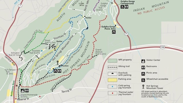
Hot Springs and North Mountain Trails
The trails on Hot Springs Mountain offer a great variety of opportunities to experience a lot of the Park. 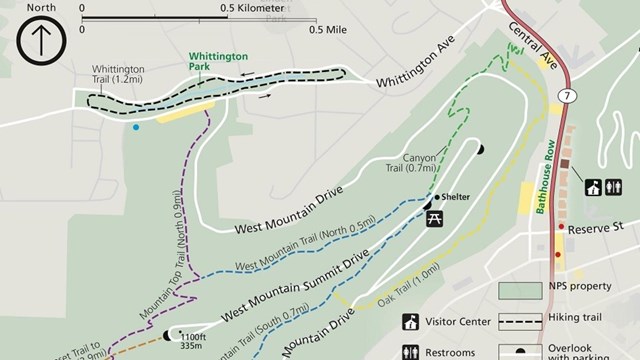
West Mountain Trails
Explore the Western half of the Park via the Canyon Trail, Mountain Top Trail, Oak Trail, Whittington Trail, or West Mountain Trail. 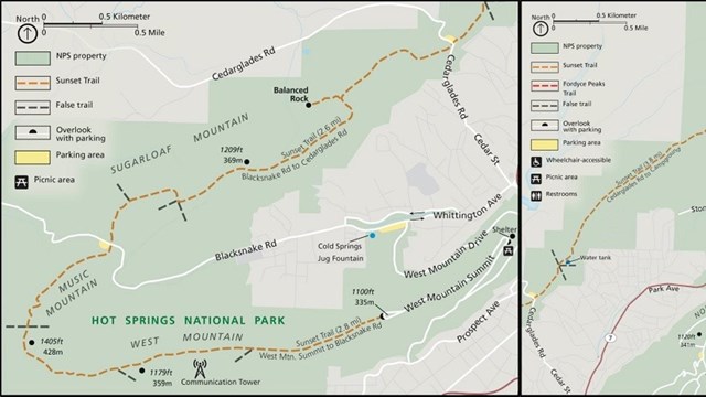
Sunset Trail
Get off the beaten path and take on the longest trail in the Park, the Sunset Trail! 
Iron Ranger Challenge
Hike, bike, swim, paddle, or walk 100 miles on Arkansas Public Lands for a chance to claim your Iron Ranger title! 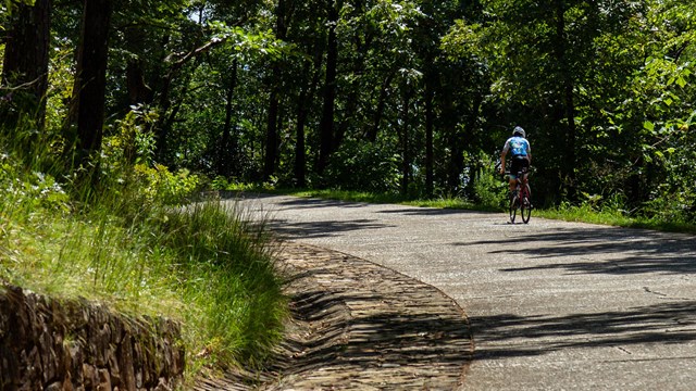
Biking in the Park
Learn about the opportunities and rules for biking in the Park! 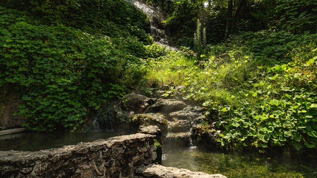
Experience the Water
Learn about the various ways that you can experience the thermal springs in the Park. |
Last updated: September 8, 2022