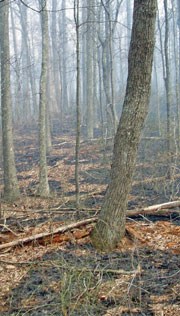
NPS photo. 4. Fire Regimes of the Southern Appalachian Mountains. Lisa LaForest, Henri Grissino-Mayer, Chris Underwood (all from the University of Tennessee), and Charles Lafon and Will Flatley from Texas A & M University, 2007–2009. What scientific questions did researchers ask? How old are trees along Gold Mine, Pine Mountain, and Rabbit Creek Trails? When did fires happen in these areas? How did trees respond to variations in climate (temperature, precipitation, drought/flood/fire conditions)? If trees died, how and when did they die? How did they collect data? At the three sites, scientists collected fire-scarred sections and tree cores (pencil-shaped sections of the inside of the tree) from yellow pines and all other canopy tree species. They took the cores back to the Laboratory of Tree Ring Science to count the rings and compare them with known events: fire, drought, floods, and changes in temperature and climate. Scientists also mapped fires from 1930-2003 to see where fires happened and compare trees they found growing (or dead) in these fire-prone spots. What did researchers find? All of the chronologies show these trees first sprouted as long ago as the 1700s. The earliest recorded fire was in 1728. Researchers found the oldest living shortleaf pine on record—it was 324 years old! Most fires were fairly small, and happened often, with one every 5-7 years. A large fire burned across the area in 1929, but there were no fires during the time the park suppressed fire from 1930 to the time of the study in 2007. The research also showed that the area used to be mainly fire-resistant yellow pines and oaks, but when fire was taken away, trees that would have burned survived, changing the forest to predominantly fire-sensitive white pine and other hardwoods such as red maple and black gum. The age of these fire-sensitive trees corresponds to the last major fire event in 1929. Occasional larger, sprawling trees in the stands suggest that the landscape used to be more open. The understory is now congested with many saplings and small trees. Read about fire research in project 1, project 2, project 3, or project 5. Or, return to the list of all fire research projects in the Partner profile. |
Last updated: November 12, 2015
