|
Explore other places like gardens, churches, country clubs, cemeteries, industrial buildings, private estates, public buildings, residential institutions, city planning, campuses, fairs, and the many, many park designs.

Olmsted Archives Munson Subdivision (Longmeadow, MA)In 1926, Olmsted Brothers drew their first plan for the Munson Subdivision, more commonly known as Glen Arden, in Longmeadow, Massachusetts. After the success of neighboring Colony Hills in Springfield years earlier, business-owner Edwin Munson purchased an empty parcel of land, and asked Olmsted Brothers to design a similar concept. Working with about seventy acres of land nestled next to a Country Club, Olmsted Brothers laid out fifty-four lots, and divided the subdivision into four sections, developing one section at a time.The exclusive suburb was styled after English villages, and a minimum price restriction was enforced at the sale of each home. A ravine cutting through the property acted as a natural divider, as well as providing even more green space. Olmsted Brothers continued consultation at Munson Subdivision well after John Charles Olmsted’s death, and a few years before Frederick Law Olmsted Jr.'s. They closed the book on the Munson Subdivision in 1952. 
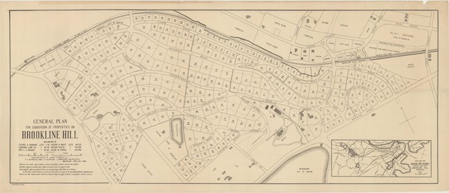
Olmsted Archives Goddard Land Company (Brookline, MA)After moving to Brookline, Massachusetts in 1883, Frederick Law Olmsted would design three subdivisions for his new community, Fisher Hill being one of them. A pair of landowners wrote to Olmsted in February 1884 stating they were combining their properties, and requested Olmsted create a plan for the land. As always, Olmsted referenced the topographical survey to ensure his curving roads would fit into the natural scenery.Despite curved lines not being a popular choice at the time, Olmsted did have a reason to include them. Fisher Hill lies between two major streets, Beacon, and Boylston, however, only one road connects the two within Fisher Hill, and it lies on the border of the subdivision. This means that those curving residential streets aren’t shortcuts to anywhere. They only travel within Fisher Hill, which discourages outside traffic from cutting through the neighborhood, leaving Fisher Hill a peaceful, quiet area. The neighborhood has remained, for the most part, unchanged, making it Olmsted’s most intact subdivision in the country. That cohesiveness of the plan is partly to do with Olmsted’s sensitive layout, as well as the fact that most homes were built under a short time, and under deed restrictions. 
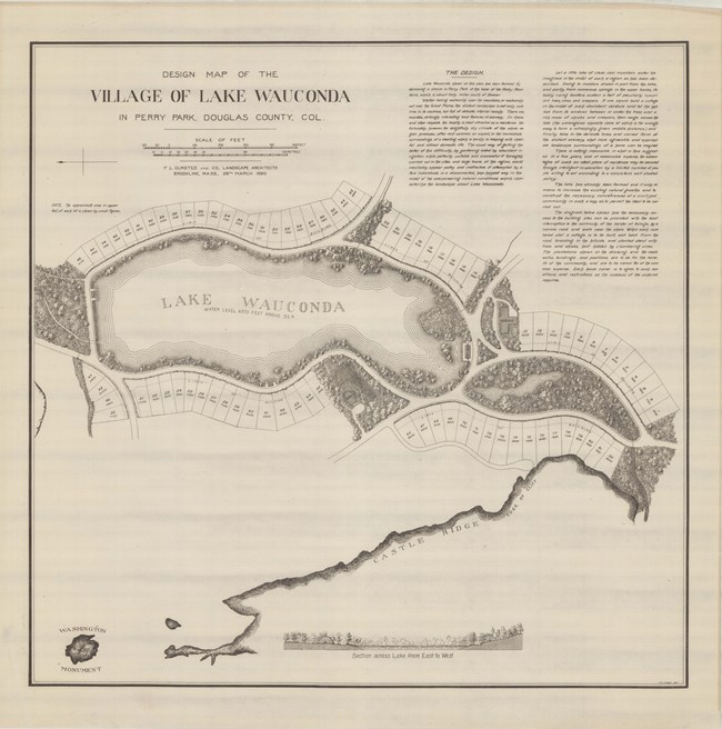
Olmsted Archives Lake Wauconda (Perry Park, CO)Frederick Law Olmsted was hired by the Redstone Town Land & Mining Company in 1889 to prepare a plan for a lakeside village in Perry Park, Colorado. Writing in his Preliminary Plan, Olmsted recognized that “the distant landscape is not only sublime in its vastness, but full of delicate ethereal beauty”. Olmsted was faced with the challenge of designing a community in a dry mountainous region lacking proper irrigation.Developers didn’t give up and gave the community their water source by damming Bear Creek and creating Lake Wauconda, which is also what they wanted to name their subdivision. Despite planning around large formations of stones which dominated the landscape and sketching several designs, Lake Wauconda subdivision never came to be. Ownership was passed around until the area was developed as a resort community. 
Olmsted Archives Monterey Boulevard (San Francisco, CA)In 1916, Olmsted Brothers were hired to prepare an extension for a subdivision they had worked on four years earlier: St. Francis Wood. This new subdivision, Monterey Boulevard, would border the Southern edge of St. Francis Wood, divided by a raised concrete foundation to accommodate the area’s sloping topography. In their proposed plan, Olmsted Brothers drew a series of green medians planted thick with deciduous shrubs and flowers. A set of building restrictions and clauses were created for Monterey Boulevard which also applied to St. Francis Wood, to maintain the character and uniformity of the two subdivisions. |
Last updated: June 26, 2024
