|
Private BoatingVisitors are welcome to take their own boats to Cumberland Island. Please take time to read through the following rules and regulations.

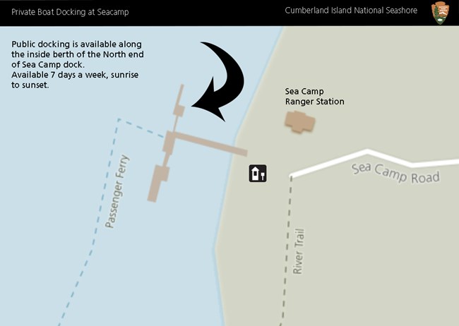
NPS Map Where To DockThere are currently three docks available for private boats: Dungeness, Plum Orchard, and Sea Camp. Note: Docking is available for day use. No overnight docking is permitted.
A map of the island, complete with location coordinates can be found below. KayakingKayaking can be a great way to journey to the island. Kayakers often depart from Crooked River State Park to avoid battling the tide, but some paddlers will launch from St. Marys or Amelia Island as well. Tides are very strong around Cumberland Island, with a rise and fall of 6 to 9 feet twice a day.All Kayakers, 16 or older, must pay the park entry fee or have an America the Beautiful pass with them. Fees can be paid on the island at self pay stations located at each dock, in person at the Mainland Visitor Center, online ahead of time, or over the phone by calling the park. Be prepared for changing weather and surf conditions. Always check tides and weather before disembarking. A compass or GPS unit can aid in wayfinding. Cumberland Island is located at the southern end of the Southeast Coast Saltwater Paddling Trail, an 800 mile trail found in the coastal waters of Virginia, North Carolina, South Carolina, and Georgia. Camping with a KayakKayakers must make a reservation and have a printed permit with them when camping on Cumberland Island. For information on campgrounds and making reservations visit the Camping page.Kayaks can be pulled ashore for camping at:

NPS Map |
Last updated: December 24, 2025
