NPS photo.
Geology and Stratigraphy of the Rocky Mountain I&M Network Parks
The Rocky Mountain Inventory and Monitoring Network (ROMN) consists of six parks located within the central and northern Rocky Mountain region of the United States in the states of Colorado and Montana. Glacier National Park is the northernmost of the network parks and lies along the U.S.–Canadian international border and incorporates the Lewis and Livingston ranges. Florissant Fossil Beds National Monument and Rocky Mountain National Park are associated with the Front Range in Colorado. Great Sand Dunes National Park and Preserve is part of the Sangre de Cristo Range, also in Colorado. The Continental Divide is a prominent feature which extends along the Rocky Mountain Cordillera within Glacier National Park and Rocky Mountain National Park. Florissant Fossil Beds National Monument, Great Sand Dunes National Park and Preserve, and Little Bighorn Battlefield National Monument all are located on the plains east of the Continental Divide, while Grant-Kohrs Ranch National Historic Site is located just west of the divide. The highest point of elevation in the Rocky Mountain I&M Network is 4,346 m (14,259 ft) above sea level on top of Longs Peak within Rocky Mountain National Park. The lowest point of elevation is 933 m (3,061 ft) above sea level at Little Bighorn Battlefield National Monument.
Geologically, the parks of the Rocky Mountain Network are diverse and heavily influenced by orogenic (mountain-building) events, exhibiting varying degrees of metamorphism, deformation, overthrusting, folding and faulting. The geology of Glacier National Park consists predominantly of Mesoproterozoic-age metasedimentary rocks that have undergone low-grade metamorphism. Rocky Mountain National Park is dominated by granite intrusions and metamorphic rock complexes that have been highly deformed. The bedrock of the other network parks consists of sedimentary deposits shed from uplifted mountains into intermountain basins or along the flanks of the mountain ranges. Past and present glacial activity defines the landscape and associated ecosystems in both Glacier National Park and Rocky Mountain National Park.
This network of parks includes a broad range of climatic zones, habitat types, elevation profiles, and encompasses great biological and geological diversity. These parks are characterized by landscapes influenced by a diversity of geologic processes and support distinct plant and animal communities including a diversity of large mammals. Taken together, the unique geologic, hydrologic, and biological characteristics of this region are world-renowned.
A Brief Geologic History
A few examples of events and Network resources in each geologic time period are highlighted below, from youngest to oldest.
A transition from Laramide-related compression to Neogene extension led to the development of the Rio Grande Rift. The San Luis Basin contains Great Sand Dunes National Park and Preserve and is one the most dramatic grabens of the Rio 6 Grande Rift. The abrupt topographic relief along the active San Luis Basin boundary has effectively trapped the famous sands of the park where they remain today.
Eocene and Oligocene sedimentary and volcaniclastic units record the post-Laramide period in many of the Rocky Mountain Monitoring Network parks. These units include the Wall Mountain Tuff and the Florissant Formation at Florissant Fossil Beds National Monument, the Troublesome Formation and some igneous intrusives at Rocky Mountain National Park, the Renova Formation at e Grant-Kohrs Ranch National Historic Site, and the Kishenehn Formation at Glacier National Park. One of the world’s largest volcanic fields is the Oligocene-age San Juan volcanic field, located west of Great Sand Dunes National Park and Preserve. Detritus from the San Juan field is the main source of sand captured at the dunes.
During the Pleistocene, alpine and continental glaciation reshaped and modified the geomorphology and surficial features in the parks of the Rocky Mountain Monitoring Network. This Pleistocene and Holocene glacial activity was most pronounced at Glacier National Park and Rocky Mountain National Park and continues today, although greatly diminished due to the retreat and disappearance of some glaciers due to climate change.
Beginning during the Late Cretaceous, approximately 75 million years ago, a mountain building event referred to as the Laramide Orogeny dramatically altered the landscape of western North America. A series of tectonic events resulted in the uplift and deformation of crust on the central craton with a corresponding retreat of the Interior Seaway. This orogenic event gave birth to the Rocky Mountains extending north to south from Canada into Mexico, and significantly reshaped the landscape of the Rocky Mountain Monitoring Network parks.
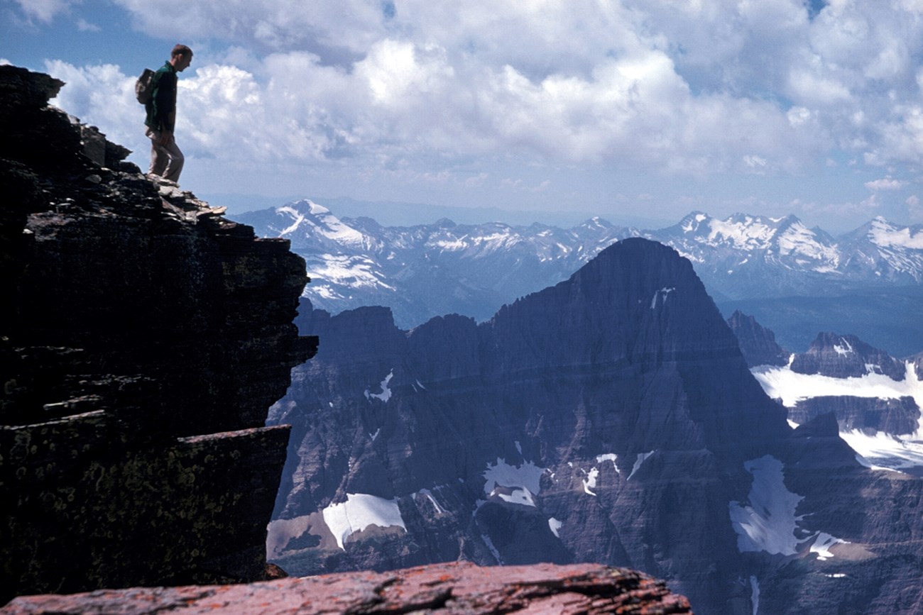
The most extensive Precambrian record is exposed in Glacier National Park. The Waterton Formation is the basement unit upon which lies a thick sequence of Mesoproterozoic formations recording a long geologic history, now uplifted by tectonics and cut by glaciers. The backbone of the northern Rocky Mountains is constructed of at least 13 Mesoproterozoic geologic formations, one of the most extensive Precambrian sequences in the NPS. Similar-aged, well-preserved and un-altered sections of old sedimentary rock are also exposed in the Grand Canyon.
Geology & Soils—Rocky Mountain Network Parks
Type Sections—Rocky Mountain Network

The geologic history above is excerpted from a report titled, "National Park Service geologic type section inventory: Rocky Mountain Inventory & Monitoring Network". Type sections are essential reference locations for the geoscientists who study geologic history and paleontology. A summary of the type sections in each park can be found at the links below.
-
Florissant Fossil Beds National Monument, Colorado (no designated stratotypes identified)
-
Grant-Kohrs Ranch National Historic Site, Montana (no designated stratotypes identified)
-
Great Sand Dunes National Park and Preserve, Colorado (no designated stratotypes identified)
-
Little Bighorn Battlefield National Monument, Montana (no designated stratotypes identified)
The full Network report is available in digital format from:
Please cite this publication as:
- Henderson, T., V. L. Santucci, T. Connors, and J. S. Tweet. 2020. National Park Service geologic type section inventory: Rocky Mountain Inventory & Monitoring Network. Natural Resource Report NPS/ROMN/NRR—2020/2215. National Park Service, Fort Collins, Colorado.
NPS Stratotype Inventory
Fossil Resources—Rocky Mountain Network

Between 2002 and 2011, network-based paleontological resource inventories were completed for all the 32 I&M networks, and six of the earliest were completely updated between 2012 and 2016. The report linked below summarizes the paleontological resources of all park units in the Rocky Mountain Inventory & Monitoring Network (ROMN). The report provides geologic background and paleontological resource data for each park to support management operations, planning, and science-based decision making as required by NPS management policies and the Paleontological Resources Preservation Act (2009).
The full report is available in digital format from
Please cite this publication as:
-
Koch AL, Kenworthy JP, Santucci VL. 2004. Paleontological resource inventory and monitoring, Rocky Mountain Network. National Park Service TIC D-436. National Park Service. Denver, Colorado
Geodiversity Atlas Indexes
Geodiversity Atlas pages—by Inventory & Monitoring Network
Arctic Network Index
Central Alaska Network Index
Chihuahuan Desert Network Index
Cumberland Piedmont Network Index
Eastern Rivers and Mountains Network Index
Great Lakes Network Index
Greater Yellowstone Network Index
Gulf Coast Network Index
Heartland Network Index
Klamath Network Index
Mediterranean Coast Network Index
Mid-Atlantic Network Index
Mojave Desert Network Index
National Capital Network Index
North Coast and Cascades Network Index
Northeast Coastal and Barrier Network Index
Northeast Temperate Network Index
Northern Colorado Plateau Network Index
Northern Great Plains Network Index
Pacific Islands Network Index
Rocky Mountain Network Index
San Francisco Bay Area Network Index
Sierra Nevada Network Index
Sonoran Desert Network Index
South Florida/Caribbean Network Index
Southeast Alaska Network Index
Southeast Coast Network Index
Southern Colorado Plateau Network Index
Southern Plains Network Index
Southwest Alaska Network Index
Upper Columbia Basin Network Index
Geodiversity Atlas pages—by State, U.S. Commonwealth, and Territories
Alabama | Alaska | Arizona | Arkansas | California | Colorado | Connecticut | District of Columbia | Delaware | Florida | Georgia | Hawaii | Idaho | Illinois | Indiana | Iowa | Kansas | Kentucky | Louisiana | Maine | Maryland | Massachusetts | Michigan | Minnesota | Mississippi | Missouri | Montana | Nebraska | Nevada | New Hampshire | New Jersey | New Mexico | New York | North Carolina | North Dakota | Ohio | Oklahoma | Oregon | Pennsylvania | Rhode Island | South Carolina | South Dakota | Tennessee | Texas | Utah | Vermont | Virginia | Washington | West Virginia | Wisconsin | Wyoming
U.S. Commonwealth and Territories
Region 2: South Atlantic-Gulf (Includes Puerto Rico and the U.S. Virgin Islands)
Region 3: Great Lakes
Region 4: Mississippi Basin
Region 5: Missouri Basin
Region 6: Arkansas-Rio Grande-Texas-Gulf
Region 7: Upper Colorado Basin
Region 8: Lower Colorado Basin
Region 9: Columbia-Pacific Northwest
Region 10: California-Great Basin
Region 11: Alaska
Region 12: Pacific Islands (American Samoa, Hawaii. Guam, Commonwealth of the Northern Mariana Islands)
Last updated: February 21, 2025
