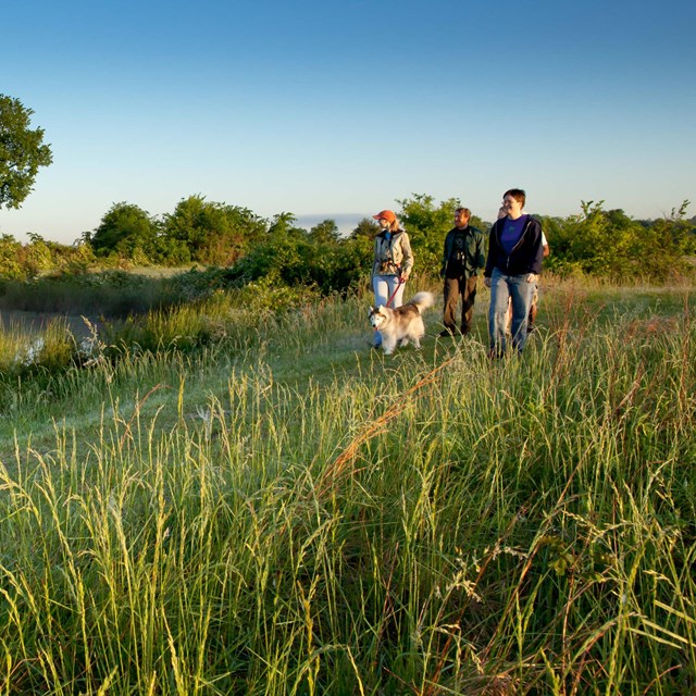
| Trail |
Milepost |
Distance |
Description |
Site Information |
| Elizabeth Female Academy |
5.1 |
450 ft |
Paved trail to the academy remains |
Elizabeth Female Academy, Milepost 5.1 (U.S. National Park Service) (nps.gov) |
| Emerald Mound Walk |
10.3 |
400 ft |
Uphill walk leading to Emerald Mound’s eight-acre plateau with nice views of the countryside |
Emerald Mound, Milepost 10.3 (U.S. National Park Service) (nps.gov) |
| Mount Locust Trail |
15.6 |
0.5 mi |
Network of trails that lead to the historic house, grape arbor, cemeteries of past owners and enslaved workers, and a brick kiln. Paved (some rough) from contact station to a little past the house |
Mount Locust Historic House, Milepost 15.5 (U.S. National Park Service) (nps.gov) |
| Bullen Creek |
18.4 |
1100 ft |
Walk with interpretive stops explaining the characteristics of a mature hardwood forest |
Bullen Creek, Milepost 18.4 (U.S. National Park Service) (nps.gov) |
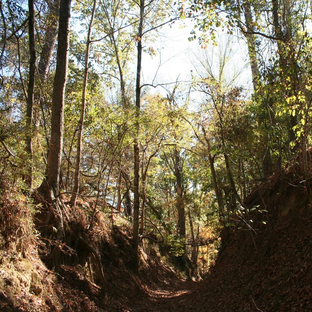
| Sunken Trace Trail |
41.5 |
600 ft |
Section of the Old Trace that is sunken due to thousands of travelers walking on the easily eroded loess soil |
Sunken Trace, Milepost 41.5 (U.S. National Park Service) (nps.gov) |
| Grindstone Ford Trail |
45.7 |
0.5 mi |
Loop trail that takes you to the Old Trace and an old cemetery |
Grindstone Ford and Old Trace, Milepost 45.7 (U.S. National Park Service) (nps.gov) |
| Dean's Stand |
73.5 |
0.25 mi |
Trail near the homestead of William Dean and his wife, Margaret, who settled near here in 1823 |
Dean Stand Site, Milepost 73.5 (U.S. National Park Service) (nps.gov) |
| Ridgeland Cowles Mead Cemetery Trail |
88 |
600 ft |
Walk to Cowles Mead Cemetery |
Cowles Mead Cemetery, Milepost 88.1 (U.S. National Park Service) (nps.gov) |
| Brashear’s Stand Old Trace & Chisha Foka Multi-Use Trailhead |
104.5 |
550 ft
(Chisha Foka 10 mi) |
Loop takes you to a portion of the sunken part of the Old Natchez Trace. A wheelchair accessible boardwalk takes you to the Mississippi Crafts Center and a view of the Old Trace. This lot is also parking and access to the Chisha Foka Multi-Use Trail (For info on Chisha Foka Trail, please visit chishafoka - Natchez Trace Parkway (U.S. National Park Service) (nps.gov) |
Brashears Stand and Old Trace, Milepost 104.5 (U.S. National Park Service) (nps.gov) |
| Boyds Site Trail |
106.9 |
150 ft |
Trail to an American Indian mound site which was constructed during the late Woodland, early Mississippian period around 800 -1100 CE |
Boyd Site, Milepost 106.9 (U.S. National Park Service) (nps.gov) |
| Cypress Swamp Walk |
122 |
2000 ft |
A stairway leads to a boardwalk and a trail with interpretive stops explaining a typical swamp |
Cypress Swamp, Milepost 122 (U.S. National Park Service) (nps.gov) |
| Hurricane Creek |
164.3 |
850 ft |
Trail with a stream, different soil types, and forest |
Hurricane Creek, Milepost 164.3 (U.S. National Park Service) (nps.gov) |
| Cole Creek |
175.6 |
750 ft |
Trail with interpretive stops that explain changes from swamp to mixed hardwood forest |
Cole Creek, Milepost 175.6 (U.S. National Park Service) (nps.gov) |
| Jeff Busby Little Mountain Trail |
193.1 |
1 mi |
Trail to the top of Little Mountain, the highest point on the Parkway in Mississippi |
Jeff Busby Overlook, Milepost 193.1 (U.S. National Park Service) (nps.gov) |
| Bynum Mounds |
232.4 |
200 ft |
Paved loop that includes interpretive displays and two American Indian mounds built during the Middle Woodland period, between 100 BCE and 100 CE |
Bynum Mounds, Milepost 232.4 (U.S. National Park Service) (nps.gov) |
| Witch Dance |
233.2 |
15 mi |
The trailhead of a 15-mile hiking and horse trail in the Tombigbee National Forest |
Witch Dance, Milepost 233.2 (U.S. National Park Service) (nps.gov) |
| Chickasaw Village Trail |
261.8 |
1200 ft |
Directly behind the exhibit shelter, enjoy a trail with interpretive stops that explain American Indian use of plants. This trail also connects to the Blackland Prairie section of the National Scenic Trail. |
Chickasaw Village Site, Milepost 261.8 (U.S. National Park Service) (nps.gov) |
| Beech Springs Trail at the Visitor Center |
266 |
0.5 mi |
At the end of the Visitor Center sidewalk there is a paved trail with interpretive stops that identify plants of a hardwood forest. Wheelchair users may require some assistance on some slopes. |
Beech Springs Nature Trail, Milepost 266 (U.S. National Park Service) (nps.gov) |
| Confederate Gravesites/Old Trace Trail |
269.4 |
1400 ft (up and back) |
Partially paved trail to an interpretive stop at the burial site of 13 unknown Confederate soldiers and a section of the Old Trace. Parkway road sign labeled "Old Trace." |
Old Trace and Confederate Gravesites, Milepost 269.4 (U.S. National Park Service) (nps.gov) |
| Dogwood Valley |
275.5 |
1600 ft |
Trail with interpretive stops that explain the natural history and value of mature hardwood trees. Entrance to the trail is to the right of the wayside sign. |
Dogwood Valley, Milepost 275.5 (U.S. National Park Service) (nps.gov) |
| Donivan Slough |
283.3 |
1600 ft |
Trail with interpretive stops that explain the habitat and the story of a slough |
Donivan Slough, Milepost 283.3 (U.S. National Park Service) (nps.gov) |
| Tenn-Tom Trail |
293.2 |
475 ft |
Paved trail that leads to the waterway. |
Tenn-Tom Waterway/Jamie L Whitten Bridge, Milepost 293.2 (U.S. National Park Service) (nps.gov) |
| Cave Spring Trail |
308.4 |
250 ft |
Short walk to the cave |
Cave Spring, Milepost 308.4 (U.S. National Park Service) (nps.gov) |
| Freedom Hills Overlook Trail |
317 |
2200 ft (up and back) |
Steep, paved trail to scenic overlook with excellent views |
Freedom Hills Overlook, Milepost 317.0 (U.S. National Park Service) (nps.gov) |
| Buzzard Roost Trail |
320.3 |
500 ft |
Trail to a spring, the source of water for the Colbert house and travelers on the Old Trace |
Buzzard Roost Springs, Milepost 320.3 (U.S. National Park Service) (nps.gov) |
| Colbert Ferry Trail |
327.3 |
1200 ft |
Trail to the site of the ferry stand, taking you along the Old Trace to the bluff overlook and back. Trail starts across the parking lot from the restrooms. |
Colbert Ferry Stand Site, Milepost 327.3 (U.S. National Park Service) (nps.gov) |
| Rock Spring |
330.2 |
2200 ft |
Loop trail with stepping-stone stream crossing and interpretive stops about the succession from meadow to bottom land to hillside |
Rock Spring, Milepost 330.2 (U.S. National Park Service) (nps.gov) |
| Holly Picnic Area Trail |
346.2 |
1200 ft |
ADA accessible trail with a picnic area |
Holly Picnic Area, Milepost 346.2 (U.S. National Park Service) (nps.gov) |
| Sunken Trace Trail |
350.2 |
1500 ft |
Section of the Old Trace that is sunken due to thousands of travelers walking on the easily eroded soil |
Sunken Trace, Milepost 350.5 (U.S. National Park Service) (nps.gov) |
| Sweetwater Branch |
363 |
2500 ft (up and back) |
Trail following a stream with interpretive stops that explain the struggle for survival in a poor habitat |
Sweetwater Branch, Milepost 363.0 (U.S. National Park Service) (nps.gov) |
| Metal Ford Trail |
382.8 |
890 ft |
Old Trace crossing of the Buffalo River |
Metal Ford, Milepost 382.8 (U.S. National Park Service) (nps.gov) |
| Meriwether Lewis Site Trails |
385.9 |
varies |
There are multiple trails at the Meriwether Lewis site. For details, please visit Exploring the Meriwether Lewis Site - Natchez Trace Parkway (U.S. National Park Service) (nps.gov) |
Exploring the Meriwether Lewis Site - Natchez Trace Parkway (U.S. National Park Service) (nps.gov) |
| Phosphate Mine Trail |
390.7 |
550 ft |
Trail by a historic phosphate mine |
Phosphate Mine, Milepost 390.7 (U.S. National Park Service) (nps.gov) |
| Fall Hollow Waterfall |
391.9 |
1025 ft |
Trail to a waterfall overlook at Falls Branch |
Fall Hollow Waterfall, Milepost 391.9 (U.S. National Park Service) (nps.gov) |
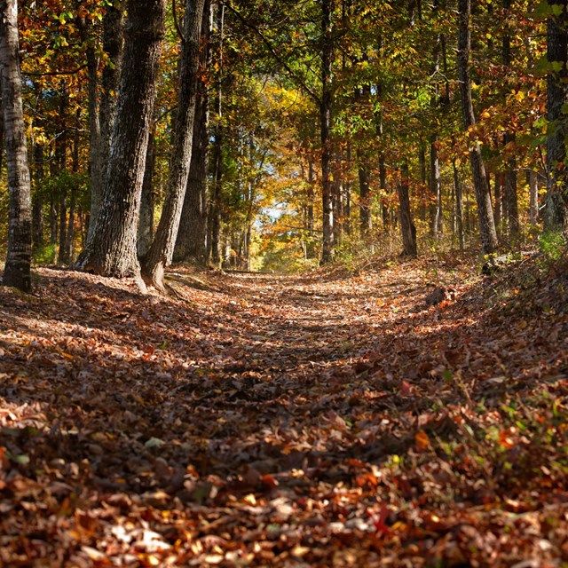
| Old Trace Walk |
403.7 |
2000 ft |
Trail on a section of the Old Trace following a ridge 300 feet above the Duck River |
Old Trace, Milepost 403.7 (U.S. National Park Service) (nps.gov) |
| Jackson Falls |
404.7 |
900 ft |
Paved trail that steeply descends to Jackson Falls. Go right from the restrooms. |
Jackson Falls, Milepost 404.7 (U.S. National Park Service) (nps.gov) |
| Baker Bluff Trail |
404.7 |
2100 ft |
Hiking trail between the Jackson Falls area and Baker Bluff. Head left from Jackson Falls rest area. |
Baker Bluff Overlook, Milepost 405.1 (U.S. National Park Service) (nps.gov) |
| Historic Gordon House Trail |
410 |
0.64 mi |
Trail past the historic Gordon House, then a somewhat difficult crossing of the shallow Fattybread Branch stream. Continue on the Old Trace to find the Duck River. (Do not cross if Fattybread is deep or swift) |
Gordon House Historic Site, Milepost 407.7 (U.S. National Park Service) (nps.gov) |