Last updated: April 13, 2021
Place
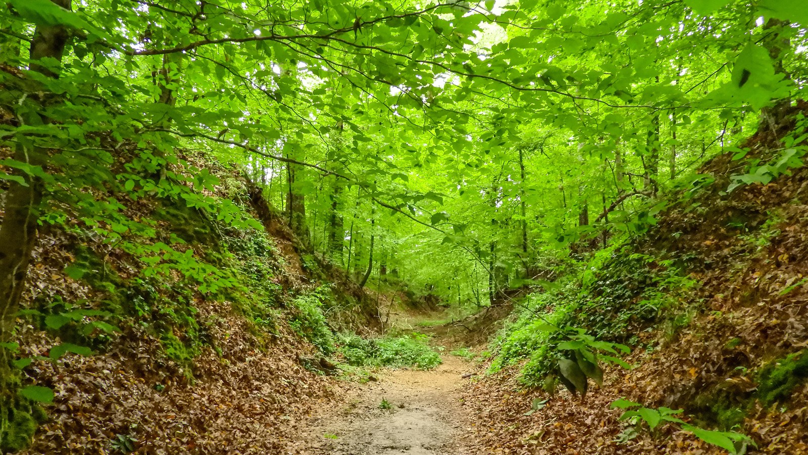
Sunken Trace, Milepost 41.5
NPS/B.Powers
Quick Facts
Location:
Natchez Trace Parkway, Milepost 41.5 near Port Gibson
Significance:
Hiking Trail
Amenities
4 listed
Parking - Auto, Picnic Table, Scenic View/Photo Spot, Trailhead
Here is a section of the deeply eroded or "sunken" Old Trace. The natural corridor that became the Natchez Trace dates back many centuries. Long before Europeans first came to the area, what would become the Old Natchez Trace started out as animal trails that were utilized American Indians tribes. As the United States expanded westward in the late 1700's and early 1800's, growing numbers of travelers trampled the rough trail into a clearly marked path. Where the ground was relatively soft with loess soil, thousands of walkers, riders, and wagons wore down these paths into "sunken" sections, such as this one you see before you. Hardships of journeying on the Old Trace included heat, mosquitoes, poor food, hard beds (if any), disease, swollen rivers, and sucking swamps. This stop also gives you one of the more iconic pictures of the Natchez Trace. Take 5 minutes to walk this sunken trail and let your imagination carry you back to the early 1800's when people walking 500 miles had to put up with these discomforts and where a broken leg or arm could spell death for the lone traveler.