|
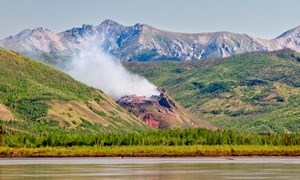
Deep in Interior Alaska, the great Yukon River strikes through bluffs and mountains of an ancient landscape to unmask rocks whose histories reach back a billion years to life's beginnings on Earth. Axis of the region, the silt-laden Yukon here flows constricted and swift through a great geologic fault. Side-streams tumble from the hinterlands - further passageways long inviting human traffic.
Visit our keyboard shortcuts docs for details
A hyperlapse is a moving timelapse and, in this case, it is of the 100 mile stretch of Yukon River from Eagle, Alaska to Slaven's Roadhouse in Yukon-Charley Rivers National Preserve. Complete with notable location descriptions, this virtual tour of the Yukon River is for entertainment and basic orientation purposes. Please use it as a visual and mental reference, in addition to proper river information and maps. Enjoy a boat ride down the Yukon, regardless of your location or the weather! The Yukon River originates in the coastal mountains of Canada and flows 1,979 miles in a wide arc to the Bering Sea. The river flows northwest through Yukon-Charley Rivers National Preserve for 128 miles. The river is silt laden in summer due to glacial runoff, and it is completely clear in winter when glaciers are frozen. As the river enters the preserve near Eagle, it flows across a narrow floodplain flanked by high bluffs and heavily forested hills. The bluffs become less prominent as the river leaves the preserve near Circle. AccessVisitors access Eagle by driving via the Taylor Highway or flying in on small aircraft. After arriving in Circle, visitors may drive out on the Steese Highway or fly to Eagle or Fairbanks. Motorized and non-motorized boats of all sizes and types are the principal means of travel on this section of the Yukon River. Common non-motorized vessels used are canoes, kayaks, homemade wooden rafts, and inflatable rafts. Motorized jet boats are often preferred since props can be easily damaged on unseen gravel bars. Visitors may bring their own vessels or rent canoes or rafts locally. Jet skis and other personal watercraft are prohibited in the preserve. 
NPS/Josh Spice Trip LengthThe journey from Eagle to Circle is 158 miles long with most visitors traveling from late May through September. The Yukon River flows at an average speed of 5 to 8 miles per hour. Trip length varies depending on weather conditions, type of boat, and whether visitors continually float during long daylight hours or if they stop to camp and explore. Visitors who float approximately 30 miles a day and camp each night usually take around 5 days to reach Circle. Extra supplies should always be taken in case trip time is extended due to weather or other unplanned events. For the safety of visitors, the NPS recommends that floaters file a Voluntary Backcountry Trip Plan with the preserve and a friend or relative. Floaters can also file a voluntary backcountry trip plan in-person at the Eagle visitor center. For questions or to obtain a trip plan, contact the Eagle visitor center at (907) 547-2233. What to BringIn Eagle, there is a basic general store, a restaurant, a small hotel, and a bed & breakfast. Gas, propane and diesel are also available. Circle, on the downstream side of the preserve, also has limited facilities, including a general store and fuel. It is recommended that visitors bring all necessary camping gear and supplies. Visitors must be self-sufficient since there are no developed areas between Eagle and Circle and assistance may be days away. Visitors should be prepared for all weather conditions because conditions can change rapidly and may be extreme, even in July. All visitors should wear personal flotation devices (life preservers) and keep emergency gear with them, such as a first aid kit, whistle, signal mirror, knife, magnesium fire starter, waterproof matches, and tightly sealed emergency rations. Other items to bring may include waterproof topographic maps, compass, GPS, two-way radio, and/or personal ELT. 
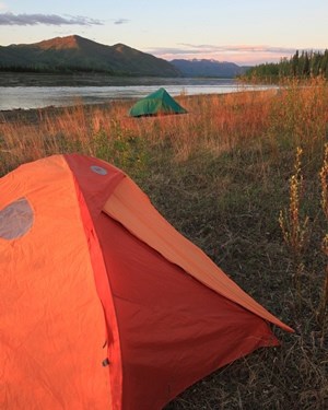
NPS/Josh Spice CampingGravel bars are recommended for camping since they are often breezy and deter the infamous Alaska mosquitoes. Gravel bars also allow ease of access, compared to vast areas of steep cutbanks, and for visitors to be out in the open where they are less likely to surprise or be surprised by wildlife. Minimum impact camping techniques are encouraged. For example, making a campfire on a gravel bar instead of in the trees is not only less likely to start a wildfire, but all evidence will be washed away with the next high water event. Watch a short video on staying safe in bear country to learn safe and responsible practices for recreating on Alaska's wild lands. Learn more about bear safety through the Alaska Public Lands Information Centers' bear safety page. Bear-resistant food containers (BRFCs) are not required but strongly encouraged for your overnight visit to Yukon-Charley Rivers. BRFCs are available free of charge at the Eagle Visitor Center and at the Fairbanks Alaska Public Lands Information Center. BRFCs are provided first come, first serve, and cannot be reserved in advance. Yukon-Charley Rivers provides both steel drum BRFCs with locking lids and smaller backpacker BRFCs. Be aware that backpacker barrels are loaned for hiking, packrafting, and kayaking only, where the large steel BRFCs are impossible to use. Canoeists are required to use the steel BRFCs, available free of charge in Eagle and Fairbanks. For more links on safety and planning your trip to Yukon-Charley Rivers, visit the Fairbanks Alaska Public Lands Information Center's website. 
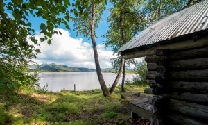
Please replace the firewood, but keep the memories. Topographic Map InformationUSGS maps may be purchased at your local USGS office, online at https://store.usgs.gov, or at the Fairbanks Alaska Public Lands Information Center (limited maps available). 
NPS/Josh Spice |
Last updated: September 6, 2024

