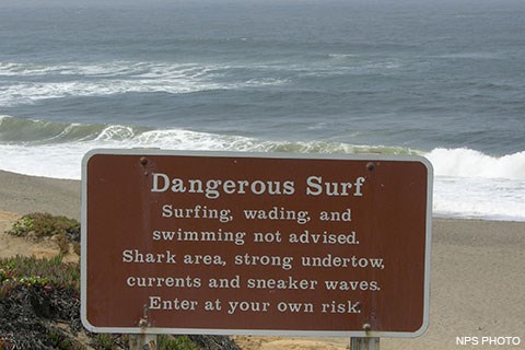
The ocean is one of the most dangerous hazards found at Point Reyes National Seashore. Do not underestimate the power of the ocean. Numerous hazards exist along all beaches, including rough surf, sneaker waves, rip currents, contaminated water, hypothermia, and buried hot ashes. Please use common sense when near the water's edge. There are no lifeguards present at the beaches within Point Reyes National Seashore. Download our Enjoying the Beach Safely brochure. (496 KB PDF) Before visiting beaches at Point Reyes, visit the National Weather Service's Watches, Warnings & Advisories page for the Coastal North Bay to learn whether there are any active Beach Hazards Statements, High Surf Advisories, and/or High Surf Warnings. Cliffs and Rockfalls
Many of the cliffs and bluffs found within Point Reyes National Seashore are composed of friable (e.g., easily crumbled or pulverized) rocks and are quite unstable. Rockfalls and landslides occur regularly, so visitors should stay several meters away from the base of the cliffs (as well as from the edge of clifftops). Because of the crumbly nature of the rocks, rock climbing within Point Reyes National Seashore is discouraged. Some of the more prominent collapses or slumps include: Sneaker WavesVisitors to Point Reyes beaches are advised to be aware of sneaker waves. A sneaker wave is an unexpectedly large wave, higher, stronger and reaching farther up the beach to levels far beyond where the normal waves reach. Beach goers, particularly children, can quickly be caught in the rip current and pulled out to deep water. If the person can not escape the current, they may drown. This has occurred numerous times at Point Reyes Beaches. Sneaker waves also have the ability to toss around large driftwood logs that may fall on a person, injuring or even killing them. Even though the ocean may appear calm, there is still the potential for sneaker waves. Larger waves, moving fast, pick up smaller waves and carry them toward the beach. Some people erroneously think that sneaker waves can be predicted, i.e., every fourth or fifth wave, but in truth they are unpredictable. They can occur at any time, day or night, during incoming and outgoing tides, during storms and during sunny calm weather. How to avoid sneaker waves:
VideosNational Weather Service
Rip CurrentsRip currents are powerful, channeled currents of water flowing away from shore. They typically extend from the shoreline, through the surf zone, and past the line of breaking waves. Rip currents can occur at any beach with breaking waves. Rip currents can be killers. What to do if you get caught in a rip current:
For more information on Rip Currents, check the National Weather Service's Rip Currents web pages. VideosNational Oceanic and Atmospheric Administration
National Weather Service
Contaminated WaterLagoons, such as those found at Abbotts Lagoon, Kehoe Beach, and occasionally at Drakes Beach, and similar bodies of water can be hazardous areas for swimming whether they are in parklands or other urban or rural areas. Rainfall runoff and stream flow from surrounding agricultural areas flows into the lagoons potentially carrying harmful bacteria with it. The lagoons are also collection areas for waste from deer, birds, and other wildlife that congregate there, as well as dog waste. Please exercise caution if you choose to swim/wade in these areas and closely watch dogs and children who may enter the water. Marin County Environmental Health Services monitors a number of ocean, bay and freshwater sites within Point Reyes National Seashore and the surrounding area. These sites are sampled once a week from April 1 through October 31 to determine if a beach meets the California water quality standards for recreational water contact. EHS works cooperatively with the NPS to collect water samples and post advisory signage as needed at the designated sampling sites. For more information, visit the EHS's Marin County Ocean and Bay Water Quality Testing Program page or their Beach Water Quality Information page. 
Glass ContainersPossession of a glass container within fifteen meters (fifty feet) of any riverbank, lakeshore, or beach, or on the water, or in a vessel is prohibited. This restriction is necessary to reduce the amount of injurious trash in the park and for the protection of visitors who frequent these areas in bare feet. HypothermiaThe coastal water temperatures at Point Reyes rarely exceed 50 degrees Fahrenheit. Prolonged exposure to these temperatures can result in hypothermia (abnormally low body temperature) or death. Do not stay in the water for more than a few minutes unless you are wearing a wetsuit. Before swimming or wading, consider the weather conditions and whether you would be able to stay warm if you were to get wet. You have a much better chance of warming up again if the weather is sunny and hot as opposed to overcast, windy and cool. Don't wait until you start to shiver or for your lips to turn blue before you get out of the water. If you start to shiver, you are already suffering from mild hypothermia. Get out of the water and try to warm up. For more information on hypothermia and treatment, check out our Your Safety: Hypothermia page and Rick Curtis' Outdoor Action Guide to Hypothermia And Cold Weather Injuries. Hot CoalsHot coals may exist on the beach surface or just below the sand due to improperly extinguished beach fires. Put all fires out with water. Do not attempt to extinguish fires or cover the coals with sand. For more information on beach fires or on how to obtain a beach fire permit, check our Beach Fires page. TsunamisA tsunami is a series of ocean waves generated by sudden displacements in the sea floor, landslides, or volcanic activity. While in the deep ocean, the tsunami wave may only be a few inches high, but when the tsunami wave encounters a coastline, it may increase in height to become a fast moving wall of turbulent water several meters high. Visitors should be aware that the beaches and shorelines of Point Reyes are locations which could be struck by a tsunami. Whether you live in the Point Reyes area, visit our beaches, or rent or own a home near the coast, it is vital to understand the tsunami threat and take preparation seriously.
Read more... |
Last updated: May 10, 2025
