|
Many areas within Pictured Rocks National Lakeshore are easily accessible by vehicle or short hiking trails. While enjoying these scenic sites, take time to enjoy the park's many beautiful waterfalls too.

NPS photo Pictured Rocks CliffsColorful and bold, the Pictured Rocks cliffs tower 50 to 200 feet above Lake Superior. These sandstone cliffs stretch for about 15 miles along the lake from Sand Point on the west to just after Spray Falls on the east. The most colorful portion of the cliffs begins east of Miners Beach. 
NPS photo Sand PointLocated about 4 miles northeast of Munising, at the end of Sand Point Road. 
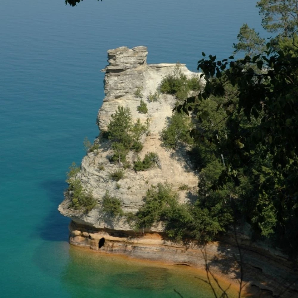
NPS photo Miners CastleLocated about 5 miles east of Munising on Alger County Road H-58, then 6 miles north on Miners Castle Road (H-11). Explore the Before and After of Miners Castle 2006 Northeast Turret Collapse 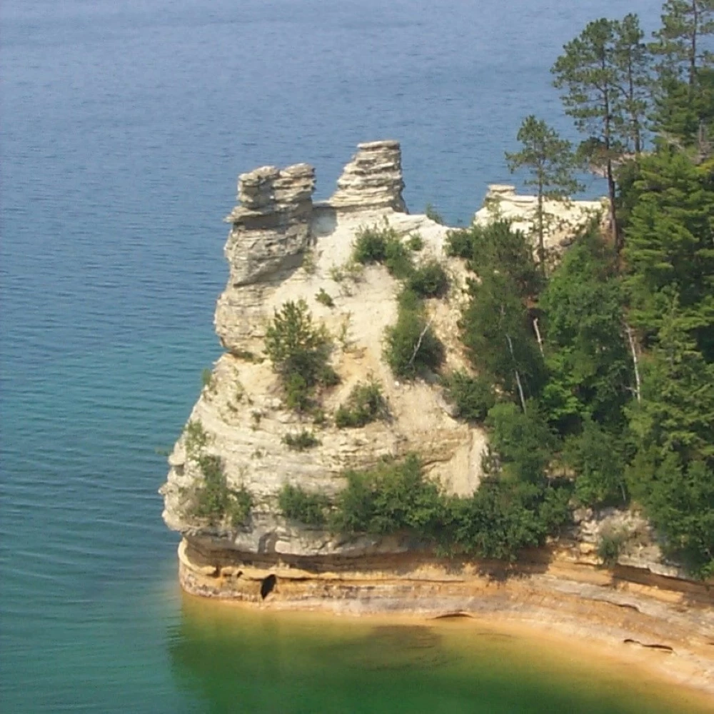
Top image
Bottom image

NPS photo / Ed Lasich Miners Beach and RiverLocated about 5 miles east of Munising on Alger County Road H-58, then approximately 5 miles north on Miners Castle Road (H-11) to Miners Beach Road. Follow Miners Beach Road another mile to the main parking lot at the west end of the beach.Miners Beach stretches for nearly a mile along Lake Superior. The cliffs rise up on either end. Miners River on the west end is popular for steelhead fishing in spring and fall. Leashed pets allowed. When at a beach, waders and swimmers need to be aware of rip currents, powerful currents of water moving away from shore. They can sweep even the strongest swimmer out to sea. 
NPS photo Twelvemile BeachAs the name suggests, there is a long beach stretching 12 miles along the Lake Superior shoreline approximately in the middle of the park. Access Twelvemile Beach from the Lake Superior Overlook on Alger County Road H-58 or from the day-use, picnic area of Twelvemile Beach Campground, about 16 miles west of Grand Marais on H-58. Twelvemile Beach is a wonderful place for long walks along the shore, especially at sunset. Reminder: rock collecting is prohibited in the park. 
NPS photo / Ed Lasich Log SlideNo pets allowed. Located at the end of Log Slide Road, about 7 miles west of Grand Marais on Alger County Road H-58. A short walk from the parking lot past historic logging equipment leads to the Log Slide area on top of the dunes. 
NPS photo Grand Sable Banks and DunesNo pets allowed. These enormous dunes left by glacial action are located at the eastern end of the park. Access into the dunes is limited. The 0.6 mile roundtrip Grand Sable Dunes Trail leads from the Sable Falls parking area (1 mile west of Grand Marais along Alger County Road H-58) through a forested dune environment to the top of open dunes. Be prepared to walk partly uphill in soft sand. Another access point with a steeper climb is from the small parking lot at the far eastern end of Grand Sable Lake on H-58. |
Last updated: August 21, 2024