![]()
Cover Page
MENU
![]() Tule Lake
Tule Lake
|
| |
Confinement and Ethnicity: An Overview of World War II Japanese American Relocation Sites by J. Burton, M. Farrell, F. Lord, and R. Lord |

|
|
| |
Chapter 13 (continued)
Tule Lake Relocation Center
Because many of the evacuees at Tule Lake had renounced their American citizenship, the Tule Lake Center operated until March 20, 1946. At that time the remaining 400 evacuees were transferred to the Crystal City Internment Center in Texas. Custodial administration of the center was transferred to the Bureau of Reclamation on May 5, 1946. The military police compound and one ward of the evacuee residential area were leased to the Tulelake Growers Association for migrant laborer housing (Figure 13.7). The first laborers arrived on May 27. The Growers Association also leased the three large industrial warehouses to store grain.
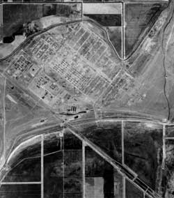 Figure 13.7. 1949 aerial photograph of the Tule Lake Relocation Center, north to the top. (Bureau of Reclamation, Klamath Falls, Oregon) |
 Figure 13.10. 1955 aerial photograph of the Tule Lake Relocation Center, north to top. (Bureau of Reclamation, Klamath Falls, Oregon) |
Some of the buildings and land of the center were distributed to veteran homesteaders and some land was kept by the Bureau of Reclamation. Other buildings were held for later transfer to homesteaders (570 barracks and other buildings), government agencies, and non-profit groups (school and service buildings and over 400 barracks). The remaining buildings were stripped of their furnishings and removed between July 28 and December 9, 1946 (Figures 13.8-13.10). Around 1963, H.A. and Anna Fletcher bought the military police compound and turned it into a subdivision. Many of the original buildings in the compound remain but have been modified, and some have been demolished.
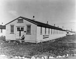 Figure 13.8. Abandoned staff building in the staff area, 1946. (Bureau of Reclamation, Sacramento, California) |
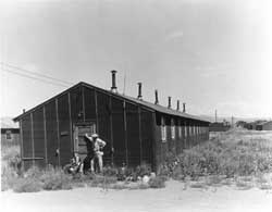 Figure 13.9. Abandoned evacuee barracks, 1946. (Bureau of Reclamation, Sacramento, California) |
The construction and layout of the Tule Lake Center followed the WRA's general design for the relocation centers. The central developed area was adjacent to the Central Pacific Railroad and California State Highway 139 (Figure 13.11). The relocation center road grid was aligned with the highway, at about 50 degrees from true north. Roads parallel with the highway were designated 1st through 13th Street; roads perpendicular to the highway were designated 1st through 16th Avenue. Four roads west of 1st Avenue, the last constructed during the initial building of the relocation center, were named Modoc, Siskiyou, Klamath, and Shasta, since they did not fit in with the pre-existing numbering system. Later, for the segregation center, 17th, 18th, and 19th Avenues were added to the east (Figure 13.12).
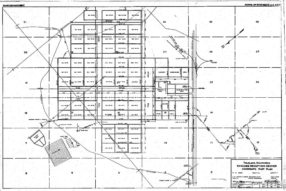
Figure 13.11. Tule Lake Relocation Center central area in 1942.
(Bureau of Reclamation, Klamath Falls, Oregon)
(click image for larger size (~108K) )
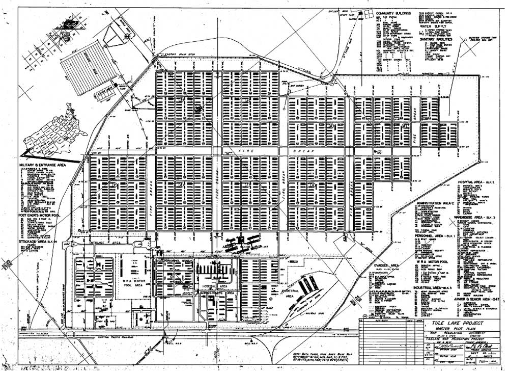
Figure 13.12. Tule Lake Relocation Center central area in 1944.
(Bureau of Reclamation, Klamath Falls, Oregon)
(click image for larger size (~180K) )

 Top
Top
Last Modified: Fri, Sep 1 2000 07:08:48 pm PDT
http://www.cr.nps.gov/history/online_books/anthropology74/ce13b.htm
![]()