|
« Return to Planning a Climb for other climbing area conditions

NPS/F. Preston Mount Challenger The access to Challenger from Hannegan Pass is pretty doable right now, with low water on the Chilliwack River crossing, ripe blueberries on the climb up to Easy Ridge, and no snow in the Imperfect Impasse. As always, the Imperfect Impasse is the crux to this entire Challenger adventure. Water is available on Easy Ridge and at Perfect Pass, but it is not plentiful at all times during the hike. The Challenger Glacier is much drier this year compared to last year, but there is still room to meander across the glacier and the bergschrund is easily passable for now. While the Challenger Glacier looks drier this year, even more noticable is the lack of snow on the south slopes of Whatcom Peak. You will likely ascend rock slabs for quite a bit of the climb to the summit ridge of Whatcom from Perfect Pass. 
NPS/W. Hsieh Mt. Goode, NE Buttress Goode season is here, with low water for crossing rivers, a straightforward glacier route-finding, surmountable moat problems, and dry rock. If that isn't enticing enough, there are plentiful blueberries on the trails so you don't get too hungry on the long march out. Expect some dead and downed trees on the trails above Walker Park and again above Two Mile Camp, but the trails are in great shape with a brand new bridge at North Fork. There is plenty of water at the bivy sites below the glacier, and a lingering snow patch a few hundred feet below the summit for those entertaining the idea of a summit camp. No matter how you break up your days, plan on a long route and a long partially technical descent. The descent route gets increasingly loose as you get farther from the summit. The rappel anchors are in good shape at the moment, but be mindful of loose rock as you pull ropes between stations. 
NPS/A. Brun Ruth Mountain The road to Hannegan Pass Trailhead is snowfree for all but a hundred yards at the end. From there, the summer trail to Hannegan Pass is a challenging mix of dirt trail and avalanche debris for a couple miles. As the trail gains elevation the dirt trail gives way to more and more snow, with Hannegan Pass being completely covered. Many teams have been accessing Ruth Mountain from the Hannegan Pass trail, with some going to Hannegan Pass and then along the ridge, and others, mainly on skis, ascending and/or descending the North Face from lower in the Ruth Creek drainage. 
NPS/J. Shields September 3, 2024 Bacon Peak, Mt. Hagan, Mt. BlumThe Watson-Blum High Route is an adventurous and arduous undertaking that provides endless oportunity for route finding and terrain management from start to finish. Expect to use all of your Cascadian skillsets, including but not limited to bushwacking, glacier travel, rock scrambling, map reading, ridge traversing, scree hopping, and more. The many glaciers along the route are mostly blue ice with some snow bridges so be prepared with your footwear and protection choices. Additionally, the numerous summits of Mt. Hagan offer different flavors of peak ascents if the time allows for side trips to the tops of spires. The shuttle logistics are fairly straightforward but long, as the dirt roads have some post holiday potholes and may take longer than expected. 
Mount Challenger The Easy Ridge approach is in descent shape right now. The old abandoned trail is easy enough to follow once you are on it, but it is overgrown and steep. Once above treeline Easy Ridge has water options and a few lingering snow patches in places. The Imperfect Impasse is snow free, harder than any of the climbing on Challenger, and difficult to protect. Most parties will want to do the extra 1000' descent to bypass the Impasse low. Once at Pefect Pass, the Challenger Glacier route is in great shape for August. Many options exist for getting across the glacier to the Challenger Arm and then up to the summit. The route up from Eiley Wiley Ridge to the summit was equally as snow covered and straightforward. There are some patches of blue ice showing at this time, but are easy to avoid. 
T. Denison/NPS Inspiration Peak and Terror Basin Rangers followed their inspiration to brave the imposingly-named Terror Basin recently. The climber's trail from Goodell Creek is generally easy to follow, with good running water available where it enters and ascends a rocky stream at ~5200'. However, watch out for a nest of aggressive hornets in the 3rd class root-ladder area at ~4900'. When you start using hands to climb up exposed roots and individual kicked steps in the duff, beware. Descending to camp from the trail's high saddle at 6300' requires walking down very loose scree and talus and then onto several snowfields which are very thin with water flowing underneath. The camp area itself is comfortable with many tent sites and good water, but watch out for rodents which will go after food and chew shoes and other equipment. Terror Basin travel is a mosaic of low-angle rock slabs, loose talus, and small snowfields and is frequently incised by sheer-sided ravines with raging streams that can only be crossed in particular places. Plan on more time approaching/deproaching than you might expect from distances and elevations alone. The Terror Glacier is very crevassed, and broken exposed ice extends mostly unbridged from the rock wall under Inspiration Peak far to the west and may require traveling all the way around on climber's left to approach Inspiration. The East Ridge of Inspiration is in good shape as a rock route, with no snow and mostly dry rock. A small moat was encountered at the start but there were several transition locations. Rappel stations have been recently added/renovated to provide a new descent line from the summit down the prominent narrow rock buttress which descends west and then turns south onto the glacier. This entire descent can be made with one 60m rope without skipping any stations, but reaches the glacier above a large crevasse that cuts off travel back to the E Ridge route's start - it is best to carry snow equipment over the climb. West McMillan's West Ridge appears and was reported snow-free and easy to access from the snowfields below. Climbers who camped on its summit report having their shoes chewed on by rodents in the night, which seems common at rocky alpine bivy sites, especially those frequently used - precautions and proper food storage are advised. 
T. Denison/NPS NE Buttress, Mt. Goode Goode times! Crossing the North Fork of Bridge Creek was easy shin-deep wading in late afternoon on a hot day. Several clusters of bivy sites exist at ~5400' beneath the glacier, each with space for probably three single-person shelters and easy water access. Gaining the rock required traveling around small open crevasse features and crossing an easy moat, but the moats will likely become a much greater obstacle soon. The route was almost entirely snow-free and in great condition. One small strip of snow ~300' below the summit required an easy deviation. A large snow patch for melting was found ~100' below the summit, accessible by rappel. The summit bivy area is comfortable, with room for probably 4 people at maximum (one site large enough for a 2-person tent), but food-conditioned packrats will present a nuisance to climbers staying there – proper food storage is still a necessity here, and climbers should note that Ursacks are not absolutely rodent-proof. Descending down the W side of Goode is long and initially technical. Rappel stations were in good condition but some scrambling/downclimbing between them is required even with a 60m rope. The SW couloir was about 2/3-filled with snow which was soft enough to not require crampons. Below the couloir was several hundred feet of easy, slushy snow, then 3rd-class heather ledges (good camping) and ramps into the burned area. A visible climber's trail exists through the burn on the N bank of the major stream that drains Goode's W aspect, but many downed trees and loose footing make it difficult still. 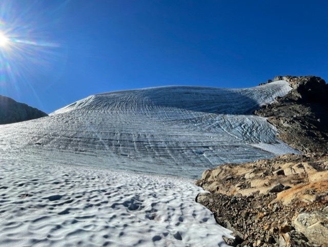
NPS/J.Shields Bacon Peak During the recent heat wave, rangers were bakin’ on Bacon Peak! A high route from Watson-Anderson Lakes trailhead to Bacon Peak starts off as a maintained trail to a social trail leading to Upper Anderson Lake. The social trail disappears when approaching Mount Watson and it becomes a classic Cascade “choose your own adventure”. Before hitting the glacier just below Bacon Peak, snow travel can be completely avoided and multiple water sources were available along the way. The final ascent of Bacon Peak was a couple hundred feet of low/moderate angle blue ice onto low angle snow. Traversing down and across to Canadian Bacon Peak required some micro-navigating across the broken glacier, a combination of blue ice and snow travel. 
Photo NPS/Denison Terror Basin Bears have obtained food in this area and have approached people and destroyed their property. Food, smells, and other odorants are attractants to black bears. When traveling in bear country: • Keep packs and any food and odorants within arm’s reach at all times. • Do not drop packs. • Do not enter a closed area. The trail from Goodell Creek is in fine shape, generally easy to follow but class 3 in sections, with water available starting at ~5900'. Descending to the bivy area is now mostly (or all if desired) steep loose scree with some snow. The bivy area is wonderful with flowing water and a half-dozen sites in durable flat gravel. Accessing most climbs requires short sections of travel on very firm snow just under the bases of the routes. The W Ridge of W McMillan is snow-free once on route. 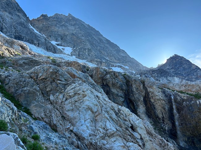
NPS/A.Brun July 16, 2023 The approach to the NE Buttress of Mt. Goode is in great shape. The North Fork trail was recently cleared of brush. The North Fork Bridge Creek crossing is about knee deep and straightforward. A large cairn marks the crossing. The approach requires unprotected scrambling up 3rd and 4th class slabs climber’s right of a waterfall to the “Alder Tunnel,”. The route through the alder grove was easy to follow. There are approximately six bivy sites in the vicinity of the 5700’ elevation below the Goode Glacier. The Goode Glacier is in good shape and is easy to enter and exit. We encountered a handful of open crevasses while crossing the glacier, but they were easy to walk around. The moat between the glacier and the rock (near the “Red Ledges”) involves about 15’ of downclimbing into the moat and onto a rock ledge. This moat will likely melt out soon and create a more challenging problem to negotiate. The NE Buttress itself is in great shape. We found one snow patch on the route at around 8,700ft (near a small bivy site). We heard from other climbing parties of a snow patch adjacent to the Amphitheater Ledge. The summit was snow free. Plan accordingly if you are planning to camp on the summit. The rappels to the Black Tooth Notch and into the Southwest Couloir are in good shape, but please remember to inspect all rappel stations before you start your rappel. This area is in the Goode Cross Country zone and a permit is required for overnight camping. If you plan to camp on the route or the summit, please use blue bags to pack out all solid human waste. 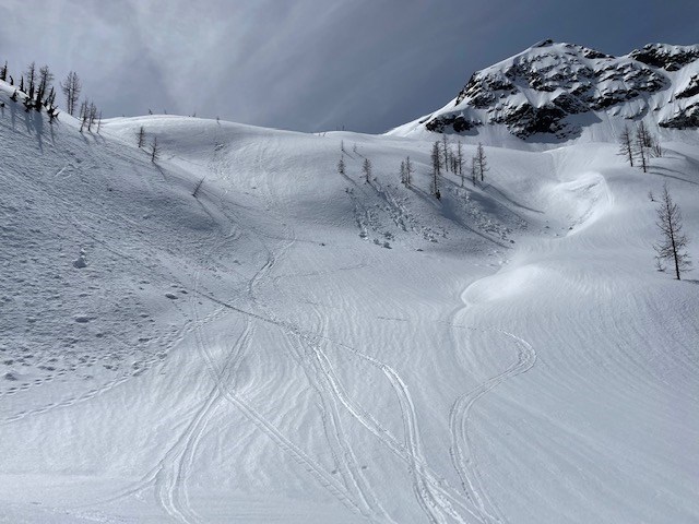
NPS/J.Shields Ruby Mountain The approach from Ross Dam Trailhead parking lot via Happy Creek Trail following the north side of Ruby mountain was mostly snow travel. 30% snow coverage on Happy Creek Trail started ~2700' elevation. Snowshoes, skis, and other flotation devices are suggested to avoid signifcant post-holing. Watch out for ground hazards such as down trees melting out and weak pockets of snow on lower elevation when descending on skis. Creeks are melting out and snow bridges are becoming unstable with the warming temperatures. Multiple wet loose avalanches and debris were observed, particular to steep cliff/rock bands. We expect these conditions to persist and worsen through the weekend due to warm forecasted temperatures. 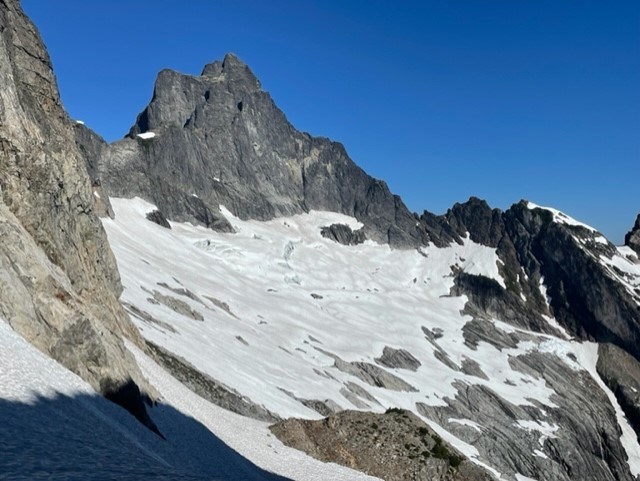
J. Shields/NPS Mount Triumph, NE Ridge Triumph's NE Ridge is a worthy objective currently in great condition. The bivy site at the 5800' col above middle Thornton Lake is still snow-covered (but will melt soon) with good running water and terrible mosquitoes; snow travel is required to reach this site. A site further into the Triumph cirque is dry but has no easily accessible water. The approach from the col across formerly glaciated terrain is 90% snow travel, with a few water sources flowing over rock slabs. There was no flowing water at the base nor on the route itself. Transitioning from snow to rock was easy with no moat to overcome but this may change as the season progresses. One 60m rope is sufficient to rappel the route except the more lateral sections of the ridge which must be downclimbed. As a reminder, inspect preexisting stations before use as some gear is getting old and anchor features change over time - stations are installed by climbers and not maintained by the Park. June 5, 2022 Keep in mind that “above average snowpack” can be misleading if just looking at a percentage. Thunder basin snotel site, for example, is well above average for this date (currently 1500%), and the site currently has 20” of snow on the ground. Easy Pass is also above average at 130% snowpack but is recording 130” or over 10 feet. This amount of snow may sound great to some people and not as great to others. For skiers and riders, it is great to be able to utilize the flotation provided by backcountry gear. For climbers, it might mean more challenging approaches, snow on route, and lots of post-holing. Consider bringing snowshoes depending on the objective. For overnight visitors it might mean melting snow for water if the creeks are still far below the surface of the snow. One thing that backcountry rangers have noticed in recent weeks is that the snow is wet and heavy and not freezing overnight. This seems to be true at fairly high elevations, and for different areas including Rainy Pass, Cascade Pass, and Hannegan Pass. The slushy conditions have made for slow travel, at times adding about 25-50% extra time if not more. This has been true for skiers and riders, and especially true for climbers without any flotation. Along with snow considerations, the amount of snowmelt and rain have increased the flows in the rivers, and this could continue for weeks to come as the weather warms up. Even small creeks might not be crossable at some flows, and the timeline for high flows might look different this year than in years prior. It is important to look into current conditions and plan your trip based on what you might encounter this year rather than assuming that it will be similar to what you saw last year at the same time. This includes many considerations, from travel times if the road is still impassable due to snow, to travel speed on snow versus on a trail, and whether or not a creek will be crossable. It might also include planning for a colder environment if you will be camping on snow, requiring more warm layers and more fuel if you are melting snow for water. Remember, plan accordingly in order to have a fun and safe trip. 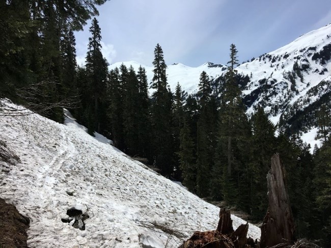
NPS/Preston North Ridge, Ruth Mountain The road to the Hannegan Pass trailhead is currently blocked by snow about ¼ mile from the trailhead. There are not many places to park here, so expect to find an appropriately sized pullout and walk the extra distance to the trailhead. Once on the trail, continuous snow starts between a half mile and a mile in. The trail crosses many avalanche paths, some with evidence of snow avalanches and some with evidence of rockfall. The trail can be hard to locate at times due to a continuous blanket of feet of snow, even on south aspects. Good off-trail navigation skills are highly recommended for anyone going to Hannegan Pass. There are running water sources crossing the trail in a few spots in the first 2 miles, but if you are camping, plan to melt snow for water. 
NPS/Preston 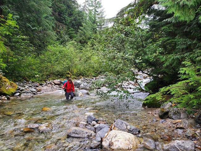
September 1, 2021 The approach route starting at Upper Goodell Group Camp is straightforward with a few down logs and brush in certain sections. After the turn off for Terror Basin, the route continues towards the Terror Creek crossing. The route to the creek crossing is flagged but some route finding is required. There is a cairn marking the creek crossing and we found a suitable place to wade the creek upstream from this cairn. The Terror Creek crossing was straight forward; the water level was low enough that wading the creek was not difficult. The climber’s approach trail up the barrier and to the col near the Chopping Block is flagged, but route-finding is required in the brushiest sections. It is recommended to not lose the trail; if in doubt scout ahead before proceeding - as losing the trail will greatly slow you down. We found running water above 5400 feet among the heather slopes. Due to poor weather conditions including snow and rain, rangers were not able to climb the Chopping Block. Remember: all parties spending the night in the Crescent Creek cross country zone are required to obtain a wilderness permit. 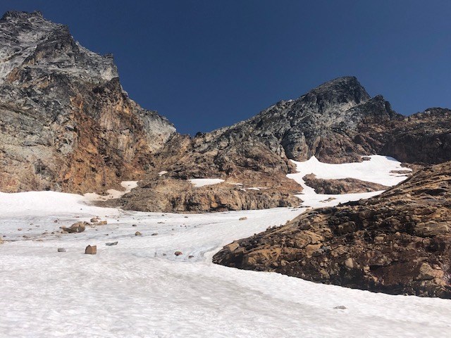
J.Shields/NPS Terror Basin The approach route starting at Upper Goodell Group Camp is straightforward with a few down logs and brush in certain sections. At approximately 4600’, there is a lot of down brush and trees making route navigation difficult – several route variations have formed and some lead to bushwhacking until you rejoin the main “trail”. Coming down the col to the bivy sites requires loose 3rd class scrambling and is currently snow-free. There are multiple water sources and bivy sites in the basin. Please use blue bags and pack out all human waste! Right now the approach to Terror Glacier is snow-free and requires terrain navigation. On the glacier to the base of the Barrier requires some blue ice travel and maneuvering around and over open crevasses. At the upper end of the glacier just below Degenhardt, a large moat (20-30ft deep) has developed. We found one spot to access the rock with a large step over the moat, however this access point may change anytime due to weather. Additional ice protection and advanced techniques may be required to cross in the near future. This section of the Barrier was very loose 3rd/4th class climbing. The descent down the Barrier involved a combination of downclimbing and 3 rappels. From the Terror Basin bivy sites, the ascent of the west ridge of West McMillan Spire currently requires one short section of snow travel to get into the gully. Climbing the gully involves 3rd class scrambling on loose scree. The remainder of the ascent involves a combination of scree and heather with a short section of exposed class 3 climbing just below the summit. 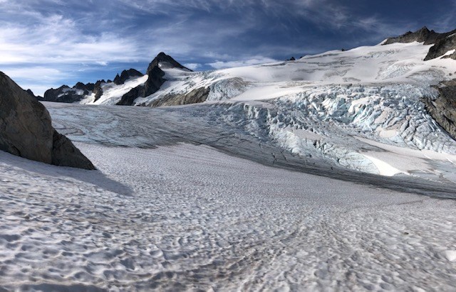
J.Shields/NPS Colonial/Snowfield XC Zones The approach to Colonial Basin from Pyramid Lake is straightforward and requires no snow travel. As a reminder, there is no water source between Pyramid Lake and Colonial Basin. There are multiple bivy sites along the moraine above the lake in the basin and several water sources around. Travel to the Colonial-Neve Col on glacier is blue ice onto moderately steep snow, straightforward with crevasses easily avoided. There is a snow-free bivy spot at the Colonial-Neve Col which currently has running water - camping here requires a Colonial XC zone permit. 
J.Shields/NPS 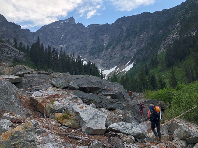
Luna Peak The Big Beaver trail is in good condition, brushy in spots but a lot of water available. Once you arrive at Luna Camp, walk a mile more before turning down towards the river. There is a log jam that provides a great crossing over Big Beaver Creek. The climbers’ trail was often hard to find and very steep while climbing along the Access Creek drainage. Getting out of the forest and traveling across the boulder field to the Access Creek headwaters was easy to navigate. There were a few tent pads and plenty of water at the Access camp. Remember to pack out your waste in blue bags if you are on rock, snow or ice. Permits are required for camping in the Luna cross-country zone. From the Access headwaters there are three gullies to ascend, we chose the middle one. There was a lot of loose rock and a climbers’ trail was visible as points. Two patches of snow remained which was more secure than traveling on the rock. Crampons were used on the way down as the snow in the gully was in the shade. The trail was easy to follow once cresting up over the ridge and out of the gully. There is a lot of water available before you get to Luna Col. Snow travel was required below the col. Luna Col has some patches of snow but it can be easily navigated around. To the summit is snow free. 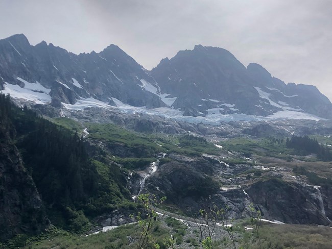
E. Reed/NPS NE Buttress Mt. Goode The approach to the NE Buttress of Mt. Goode is in great shape. The trail is clear until the last mile of the North Fork trail, which has some areas of heavy brush. The North Fork Bridge Creek crossing is about mid calf deep and straightforward. The approach requires unprotected scrambling up 3rd and 4th class slabs to the “Alder Tunnel,” an easier-than-it-looks bushwhack up through an Alder grove. The Goode Glacier is in good shape and currently fairly simple to enter and navigate. The moat between the glacier and the rock (near the “Red Ledges”) involves about 10’ of downclimbing into the moat. This feature will likely melt out soon and create a more challenging problem to negotiate. The NE Buttress itself is in great shape. We found one snow patch on the route at around 8,500ft (near a small bivy site). We found no other snow on the route. The summit was snow free. Plan accordingly if you are planning to camp on the summit. The rappells to the Black Tooth Notch and into the Southwest Couloir are in good shape, but please remember to FULLY inspect all rappel stations yourself before committing! There is a large snow patch in the SW couloir that provides some water. A few reminders: This area is in the Goode Cross Country zone and a permit is required for overnight camping. If you plan to camp on the route or the summit, please use blue bags to pack out all solid human waste. 
W. Tarantino/NPS Colonial and Snowfield Area Climbing Conditions The approach to the Colonial and Snowfield Cross Country Zones and the Colonial and Neve Glaciers are still in early season conditions. The climbers route begins by going around the west side of Pyramid Lake (no camping allowed at the lake!) before beginning to climb steeply up to the ridge separating Colonial and Pyramid Creeks. The trail is in standard condition and easy to follow up to the ridge. Expect to encounter snow soon after gaining the ridge (~4500ft), and becomes consistent after ascending the second of three steps up the ridge (~5000ft). The upper Colonial and Neve glaciers have ample snow coverage and currently present few navigational challenges. 
W. Tarantino/NPS 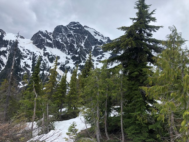
E.Reed/NPS June 12, 2020 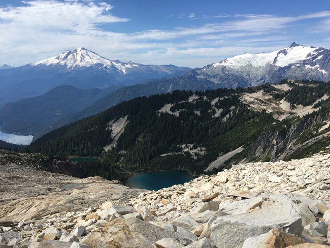
Mt. Blum Conditions on the access trail are in standard conditions, with steep uphill hiking and many blowdowns across the approach trail. The approach trail is an un-maintained route that gains approximately 5000’ of elevation. Some bushwhacking and off trail navigation is required in order to locate the fisherman’s trail adjacent to Blum Creek. The trail is faint for the first ¼ to ½ mile, but once the trail starts climbing up the ridge it become more obvious with flagging marking the way in some places. At approximately 4500’ the trail becomes faint again and some navigation / bushwhacking is required in order to travel to the Blum Lakes area. Many blue berries and huckleberries are present along the approach route. 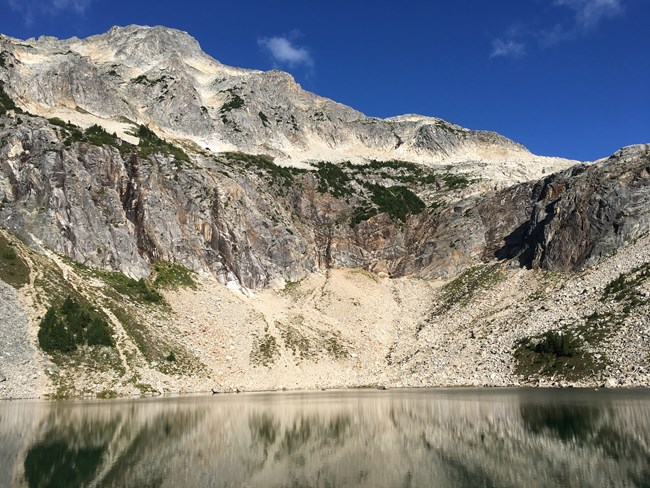
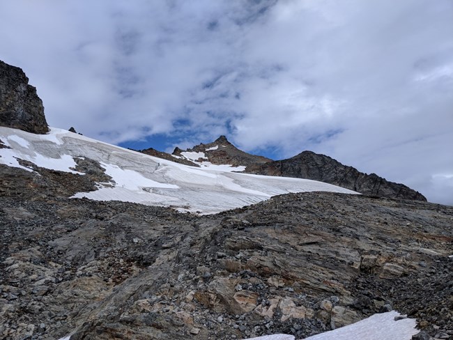
Sahale Glacier The route up to Sahale peak from the camp requires glacier travel, there are currently several crevasses opening up and very little snow. Traveling on steep ice requires mountaineering equipment such as ice axes, crampons and ropes. Please do not attempt to summit unless you have experience with mountaineering. 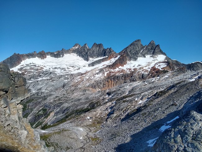
Terror Basin Approach / Goodell Creek / Southern Pickets Starting from Upper Goodell Group Camp the unmaintained old logging road / approach route is brushy and has a number of downed logs over the “trail”. The approach route up to Terror Basin is difficult to follow in a couple places due to braided footpaths. The approach to Terror Basin is snow free until just before the high col just before the drop down to the Terror Basin bivy sites. Coming down the col to the bivy sites involves some snow and some loose 3 rd class scrambling. 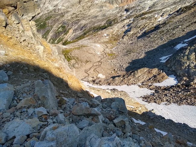
About This BlogCondition reports come from climbing rangers, wilderness rangers, and climbers visiting the park complex. To make a climbing report, please email the Wilderness Information Center in Marblemount. Please include the route, snow level, any hazards encountered (or not), peak(s) attempted, and whether your party successfully summitted. Photos are especially great All of the climbing routes in the park complex are located in wilderness, but some are wilder than others, and there may be limited or outdated information. Use these reports as a baseline, but plan for changing conditions and a true adventure. On many routes, the discovery, physical stress, and route-finding challenges are half the fun. Mt. Challenger & Whatcom Peak
August 26, 2017
Photos and beta from our recent patrol in the Northern Pickets. Crescent Creek Basin- Degenhardt Peak
July 28, 2017
Information about our recent patrol into the Crescent Creek drainage. Snowfield/Colonial Zone
July 28, 2017
Photos and information from our recent patrol to the Snowfield/Colonial zone. Depot Creek- Mt. Redoubt
July 24, 2017
Photos and information from our recent patrol to Depot Creek and the Redoubt/Spickard area. First round of fall snow in NCNP!
September 05, 2016
The seasons are changing and so are conditions! Mt. Goode- 8/21-24 2016
August 25, 2016
Photos and conditions update from our recent climbing patrol on the NE Buttress of Goode. Black Peak- 8/3/16
August 07, 2016
Photos and conditions from our patrol in the eastern portion of the Park, on Black Peak. Photos of peaks in the Southern Half of NCNP
July 29, 2016
Photos of various peaks including: North Face of Buckner, Inspiration-Klawatti, and the Marble Creek Cirque. Mt. Triumph- NE Ridge 7/24/16
July 29, 2016
Conditions and info from our recent patrol of the NE Ridge of Triumph. Mt. Blum- North Glacier- July 12, 2016
July 14, 2016
Conditions for the Blum Lakes approach and our ascent of the North Glacier on Mount Blum. Ruth-Icy Traverse: June 27/28, 2016
July 02, 2016
Photos and conditions report from our recent traverse of Mount Ruth and Icy Peak. Includes a photo of the North side of Shuksan. Colonial Peak- June 30, 2016
July 02, 2016
Conditions and photos from our recent patrol to the Colonial/Snowfield area. Mt Triumph Conditions Sept 14, 2014
September 21, 2014
No running water at the col bivi sites, but snow available for melting. The approach to the route and the route itself are in good condition, crampons useful for approach. All raps are doable with a 60m rope and the anchors were in faily good condition. |
Last updated: August 12, 2025
