|
« Return to Planning a Climb for other climbing area conditions 
NPS/W. Hsieh Fall is approaching and the foliage is just beginning to turn in the North Cascades. It’s a great time of year to get out with cooler temps and plentiful berries in the high country. Intermittent wildfire smoke and inclement weather have kept the crowds away from Boston Basin lately allowing for a true wilderness climbing experience. Expect more parties on popular routes during bouts of good weather as folks are getting one last alpine climb in for the season. We have seen lots of bear activity in Boston Basin this season, and true to form we received reports of a bear on the trail up to Boston Basin. With this in mind, please adhere to proper food storage methods while you are enjoying the alpine to keep fellow backcountry users and wildlife safe. West Ridge Forbidden: The approach to cat scratch gullies is snow free so leave those crampons and axes at home if the West Ridge of Forbidden is your objective. Rappel stations are in good condition, though be aware of loose rock when rappelling the gullies. Sahale via Quien Sabe: The Quien Sabe is in late season condition with numerous crevasses and substantial blue ice showing. Large blocks of snow are still falling in areas with lingering snowpack as evidenced by large debris piles on the rock slabs. 
NPS/F. Preston After a long closure last season due to wildfire, and a brief closure for a resident bear this spring, Boston Basin is open once again. The bear is no longer hanging out on the trail, but don't think that the bear is gone from the area. Remember to make noise on the hike in, and store your food properly to avoid training the bear with bad habits. The road is gated at Eldorado while crews finish road work, so plan for some extra warm up miles on the approach. The route is in fairly good shape, and the creeks seem to be on the lower side for this time of year. The lower bivy is snow free and the toilet is ready and waiting. Expect snow at the upper bivy site for a little while longer. The upper elevation snow is melting fast across the North Cascades, and that is very true in Boston Basin. The lower bivy is snow free and the toilet is open for use. Expect glide cracks on the way towards the bottom of the Quien Sabe Glacier, and watch out for falling blocks of snow on slabby terrain, especially below the Cat Scratch Gullies. 
T. Denison/NPS May 21, 2024 The snow is very wet heavy and forms a breakable crust after cold nights; it is not yet a summer snowpack. There is widespread glide avalanche activity and hazard, as well as active ice/snow/rockfall when steep slopes and cliff ledges receive sun. It's going to take a spell of warm weather and sunshine for the mountains to shed snow and these hazards to dissipate. West Ridge Forbidden: Climbers report that the entire route is still covered in snow and rime-ice. The early-season approach couloir is a feasible route but has avalanched in its lower portion. A large (D3) avalanche deposit can be observed crossing a large swath of the approach, having slid from a face below Forbidden's East Ridge. 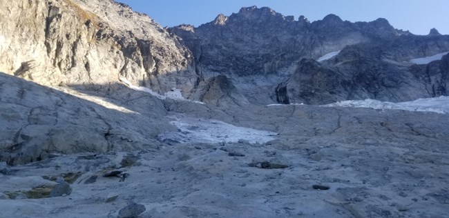
T. Denison/NPS Boston Basin is like a landscape painting filled with beautiful fall colors and fat, happy marmots. Bears have been seen often in the area near the camps but have not approached people – remember to bring require bear-proof food storage. Water is still plentiful at both camps and on the approach to Forbidden. There is still an active bee nest on the trail just below the first major creek crossing. West Ridge Forbidden: It is currently (unprecedentedly?) possible to climb the W Ridge without touching snow or ice. Climbers are encouraged to get an early start with the shorter fall days, and to keep in mind that it is a very popular climb and congestion can slow traffic; parties are often seen descending in the dark, which is not recommended. It is possible to descend by rappelling and walking down ledges entirely on the skier’s right side of Cat Scratch Gully and not enter the gully on descent. As always, be cautious of rockfall between multiple parties in Cat Scratch. Remember that rodents live on the ridge – leaving food unattended while climbing creates a bad situation for everyone. Sahale: Parties are still climbing the Quien Sabe route using several thick snowbridges over large crevasses. The upper glacier requires travelling on a steep slope above a crevasse where a fall would be very consequential. 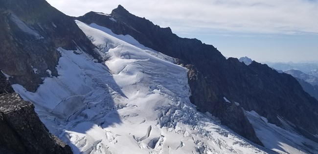
T. Denison/NPS Bears still roam the Basin but have not been reported near the bivy areas. There are, however, bees present on the trail which have been aggressive and stung several parties. The nest is in a rotting log located just before (downhill of) the first major stream crossing at Midas Creek. There are small notes uptrail and downtrail marking the nest and directing people to hike around uphill (easy). Sharkfin Tower: There is no substantial moat to access the approach gully, nor any snow travel at all after leaving the glacier The gully itself is very loose with water actively running through it - parties should be careful of causing rockfall while ascending and rappelling down next to the gully. The SE Ridge route is in fine shape otherwise, with rappel anchors offering several rappel route options: from the summit directly or from the top of the second pitch. Sahale via Quien Sabe: The glacier is very bare with exposed crevasses throughout hindering almost all travel. It is still possible, however, to hug the far climber's left side passing beneath Sharkfin Tower to the upper glacier and saddle of Boston and Sahale - this requires some zig-zagging and crossing two narrow but thick snow bridges across very large crevasses. Boston Peak is actively shedding rockfall just above this path. Climbers on the steepest section of the upper glacier will be directly above the largest crevasse where an unarrested fall would be catastrophic. This area is still snow-covered with no exposed ice, but snow is slushy late in the day. There is no substantial moat to get into the Boston-Sahale col, and no further snow travel required to summit Sahale. 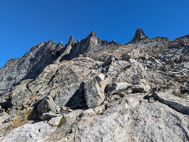
NPS/D. Visnick East Ridge Forbidden: NOCA Climbing Ranger's ventured to one of Forbidden Peaks' less frequented ridges today. Conditions were quite good as the approach from the upper bivy's was dry all the way to the ridge. The approach gully consists of quite a bit of loose rock and scree, so be mindful of parties above and below when navigating this terrain. There is a good water source from glacier runoff as you enter the gully just above the upper bivy sites. The ridge itself consisted of exposed knife ridge traversing and steep pitches up several gendarmes along the way. The rock is mostly solid, but there are several loose blocks so be sure to test holds before commiting. Some lichen covered rock can pose a challenge when trying to find good friction. Rangers opted out of the East Ledges descent and descended the West Ridge to Cat Stratch Gully. Nothing new to report here, just please make sure to be careful with rope management and loose rock on the West Ridge and the Cat Scratch Gully while descending. The snow at the base of Cat Scatch Gully is melting fast, but there currently remains a ~150' patch of steep blue ice/snow from the base of the last rappel to the dry rock slabs below. Consider this terrain when planning what equipment to bring as a slip here could lead to serious injury. Several Bears were seen around Boston Basin upper and lower bivy's so please be responsible with food storage 
There are bears around, and for the most part they seem to be happy eating berries and keeping to themselves. Please remember to store food properly at all times and keep a clean camp, as we don’t want these bears to get even the smallest food reward. The bears in Boston Basin seem to be used to climbers moving between the camps and on the normal approaches, but remember that they are wild animals and we must give them space if they are on or near the routes we frequent. Forbidden: There is only a couple hundred feet of snow below the Cat Scratch Gullies, but this does not mean you should leave the sharps at home. The snow that remains is very firm, and feels more like ice at most times of the day. We strongly recommend steel crampons and ice axes for parties going up any of the routes on Forbidden. Sahale: The Quien Sabe Glacier has a lot of exposed ice at this time. Teams are still able to navigate around crevasses, but the amount of ice warrants the use of steel crampons, an ice axe, and potentially some ice screws in addition to pickets to protect the route. 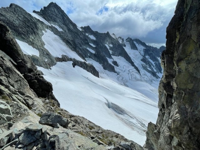
NPS/J.Shields Forbidden - North Ridge Shark Fin Col ascent is completely snow free, including the alternative gully to climber’s right. The descent can be rappelled with a single 60m rope with some down climbing or using an intermediate pin anchor on skier’s left. There is currently a large, detached hanging snow mushroom in the gully. Traversing to the Boston Forbidden Col on the Boston Glacier requires some navigation and end running. Rangers traversed the Boston Glacier to the Boston/Forbidden Col and gained the North Ridge down low. Moats are getting larger and will soon pose a challenge to transition from the glacier to rock. There are enough bivy sites on this col for roughly 4 people, and no water sources nearby. Further south on the ridge, there are additional bivy sites with water sources at ~8000' on the ridge. The North Ridge route is completely snow free for climbing. There are 2 areas on the route that allow for easy snow access for water. The NW Face snow climb variation requires multiple transitions as it is no longer a fully connected snow slope. Route appears to mainly be an ice climb now and picket placement may be difficult. (ice screws recommended for protection). Forbidden – West Ridge Approach is snow-free until a couple hundred feet of steeper ice/snow at the base of cat scratch gully. Ice axes and crampons are recommended for this section as a fall can be consequential. Rangers observed a significant human triggered rock fall event down the south face from a rappel on the West Ridge. Be super mindful when pulling ropes and be sure to test the rock. Bears & rodents were observed lingering around both the upper and lower bivy sites in Boston Basin, be diligent about food storage. 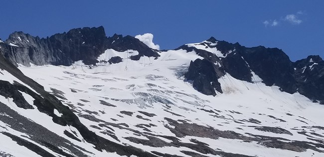
T. Denison/NPS June 28, 2023Boston BasinBasin's lookin' great! The Boston creek crossing has chilled out and can be forded safely with slightly wet feet or one can maintain dry feet with some rock hopping. The Lower Bivy sites are snow free and dry, and the toilet is in good shape. There are three snow-free sites (for 2 or 3-person tents) at the Upper Bivy area that are currently flooded but should dry within a week or so; the upper toilet is also melted out and usable. Forbidden: Both the West Ridge and the East Ridge climbing routes are snow free and climbing well once you are on route. For the W Ridge the Cat Scratch Gully is probably the way to go. The snow couloir has several discontinuities and open moats on the sides. As always, watch out for loose rock and be aware of other parties in Cat Scratch. Sahale: The Quien Sabe Glacier is in good shape with of snow still covering most of the crevasses. The bergschrund has opened about halfway across the upper slope. Early morning with an overnight freeze will provide the best snow for travel, and as it warms up be aware of punchy snow and the possibility of falling through weak snow bridges. There are still multiple route options to get to the Boston-Sahale Col. Sharkfin: Snow still exists in Sharkfin gully with a high potential of rock-fall as the gully warms up throughout the day. The rocks in this approach gulley are wet and make for difficult and insecure climbing. The moat at the entrance of the gully poses as a challenge for climbers, and will continue to change as warm temperatures persist. The route itself on Sharkfin is completely snow free. 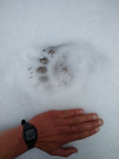
K. Beckwith Check out the links below for climbing condition blog posts from previous years: Climbing Conditions - Boston Basin Area 2022 Climbing Conditions - Boston Basin Area 2021Climbing Conditions - Boston Basin Area 2020 |
Last updated: September 8, 2025
