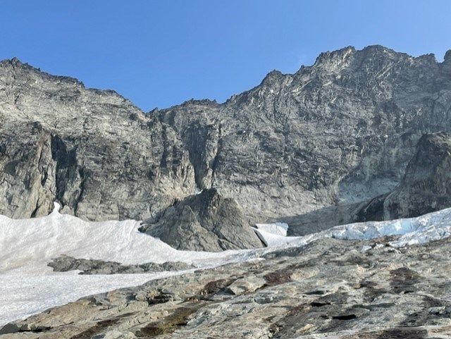
NPS/J.Shields Boston Basin Conditions in Boston Basin are transitioning from summer to fall, with foliage changing color, cool morning temperatures, and shorter days. There is little snow left below the Cat Scratch Gulley, or below the Quien Sabe Glacier, so expect longer rock slab approaches. The slabs below the Cat Scratch Gulley is threatened by serac chunks sliding and falling from the bottom of the remnant glacier that lies beneath the South Face of Forbidden. We urge people to watch weather forecasts closely, and remember that bears are fattening up for the upcoming winter, consuming all the calories they can find. Make sure to properly store your food - do not leave food or smellable items unattended. And make noise on the trail as bears are distracted and might not notice you approaching. 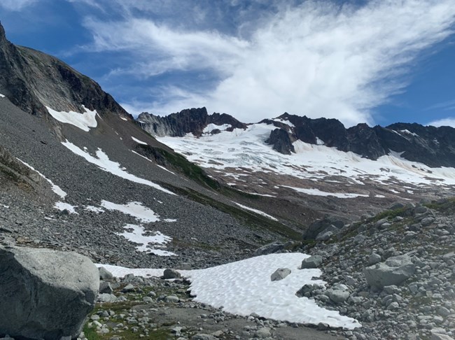
8/18/22 Boston Basin A few different bears are regulars in the Basin, often seen enjoying the berries and generally avoiding people. We remind and urge people to keep clean camps, store all food and scented items properly, and make noise while traveling to avoid habituation or incidents with bears or other wildlife. Some teams have also seen goats in the bivy sites, but they seem to come in and out of the area and there have not been issues at this time 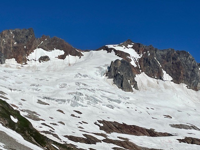
NPS/J.Shields Boston Basin: Even with the current closure on Cascade River Road, the basin is busy. Most parties are camping at the higher bivy site and going for the West Ridge of Forbidden. Several upper bivy sites are now snow-free and both the upper & lower bivy toilets are useable. Please do not put any food or trash into the toilets as this negatively affects the composting process. On the approach, several parties found the crossing of Boston Creek difficult as temperatures increase, especially in the afternoon. Optional crossings can be found higher up the creek. Forbidden: Cat Scratch Gully is now the preferred approach for this climb, however there is still some snow travel left at the base that some parties found challenging. As a reminder, Cat Scratch Gully has a lot of loose rock and rock-fall potential is high with multiple parties travelling through it. We strongly recommend parties to rope up this section. The West Ridge itself is completely snow free. 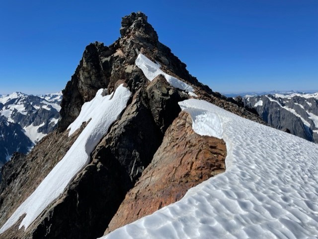
NPS/J.Shields Sharkfin: Snow still exists in Sharkfin gully with a high potential of rock-fall as the gully warms up throughout the day. A large moat at the entrance of the gully still poses as a challenge for climbers. The route itself on Sharkfin is completely snow free. 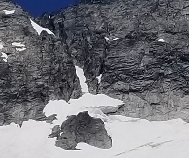
NPS/T. Denison The switch got flipped to "summertime" and Boston Basin is in rapid transition. The initial crossing of Boston Creek when entering the basin can be done without getting wet with some rock-hopping. The toilets at both bivy areas are melted out and usable. The lower bivies have many snow-free sites while the upper area has only one site with room for a 2-person tent. A large billy goat has been hanging around the lower area - try to pee away from campsites so as not to lure it into camp. The approach to W Ridge of Forbidden is presenting mid-season challenges. The snow couloir is fully transected by a crack requiring lowering in and climbing out on reported 5.8 movement to regain the snow above - most parties are now opting for Catscratch Gully. There is still a snowfield present where the Gully and Couloir join eachother, which some parties are protecting with pickets on ascent and rappeling on descent - it's worth bringing boots and ice axes up to the W Ridge notch for this snowfield. The Quien Sabe route up Sahale is in fine shape, with the bergschrund easily bypassed on the right side. 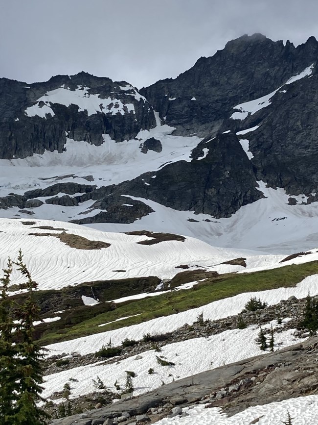
NPS/ K.Vollinger Boston Basin: Snow started just before tree-line on the climbers' trail. The main creek crossing to the lower bivy has melted out, expect to get your feet wet. There is a snow crossing further up but it will not last much longer. Listen for rushing water under the snow before walking across it and give holes in the snow above rushing water a wide berth. There are camp spots on rock melting out at the lower bivy. The toilet at the lower bivy is melted out and open. The upper bivy is under snow currently and the toilet is still completely buried. Sharkfin: The morning rangers went to climb sharkfin the couloir to access it had looked like solid snow from a distance . The bottom turned out to be mostly unsupported blocks that later collapsed that day when they baked in the sun. This makes the access via the couloir more hazardous and potentially not feasible until the larger blocks meltout. The rangers climbed a low angle crack system with an established rap line instead about 50 ft left of the couloir. The most difficult part was stepping across the moat starting to form at the bottom. Movement was probably about 5.5-5.6. The actual route of sharkfin was mostly clear of snow but for a couple of patches on the ledges on the north side on the last pitch. One can avoid pulling out their ice gear or cutting steps, but it wont be the easier ledge walking you usually expect this time of year. 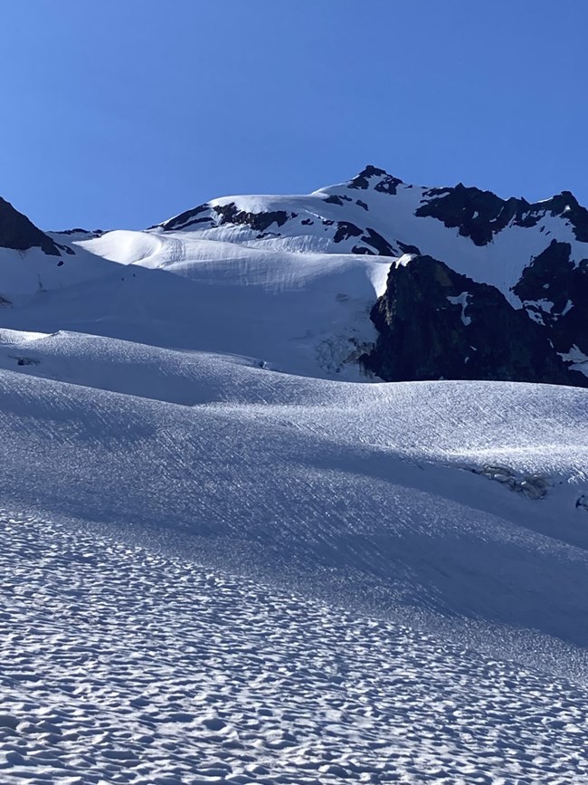
NPS/K.Vollinger Forbidden: The access couloir to the west ridge is becoming more difficult with a bergschrund forming above the central rock outcropping at the bottom. Some reported getting on the rock to navigate around it. Conditions are changing rapidly however and expect this moat to rapidly grow. The cat scratch gulley is not melted out and sounds like it might be an exposed snow fin to get to the top of and folks are rapping the couloir late in the day. New anchors and old anchors are being used and not all are reliable in this very dynamic environment. There are only a few patches of snow left on the West ridge and you can easily climb around them so it is reasonable to leave your snow gear at the notch. Sahale: The Quien sabe glacier is looking like it is in excellent condition, though you can see troughs forming and opening where the highway of tracks went. Just because someone crossed a bridge before you does not mean it is good for you to cross now. There is exposed rock on the shoulder and at the summit. So you may need rock gear and to rappel what you climbed up. 
NPS/J.Shields Boston Basin For those looking to go to Boston Basin, plan for extra time to get to the trailhead as the gate is closed at the Eldorado Climbers Trailhead. This adds just over 2 miles of road walking to access the climber's route. Roadwork and repairs are underway, but there is no estimate of when the road will open past Eldorado at this point. The climbers route to Boston Basin is snow-free until about 4300’, where more continuous snow fully obscures the trail. Off trail navigation skills are necessary for getting to the camps. Below treeline there is still 2-3 feet of snow, while above treeline there is much more snow remaining. 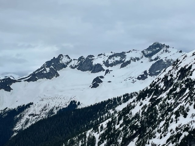
NPS/J.Shields June 5, 2022 Keep in mind that “above average snowpack” can be misleading if just looking at a percentage. Thunder basin snotel site, for example, is well above average for this date (currently 1500%), and the site currently has 20” of snow on the ground. Easy Pass is also above average at 130% snowpack but is recording 130” or over 10 feet. This amount of snow may sound great to some people and not as great to others. For skiers and riders, it is great to be able to utilize the flotation provided by backcountry gear. For climbers, it might mean more challenging approaches, snow on route, and lots of post-holing. Consider bringing snowshoes depending on the objective. For overnight visitors it might mean melting snow for water if the creeks are still far below the surface of the snow. One thing that backcountry rangers have noticed in recent weeks is that the snow is wet and heavy and not freezing overnight. This seems to be true at fairly high elevations, and for different areas including Rainy Pass, Cascade Pass, and Hannegan Pass. The slushy conditions have made for slow travel, at times adding about 25-50% extra time if not more. This has been true for skiers and riders, and especially true for climbers without any flotation. Along with snow considerations, the amount of snowmelt and rain have increased the flows in the rivers, and this could continue for weeks to come as the weather warms up. Even small creeks might not be crossable at some flows, and the timeline for high flows might look different this year than in years prior. It is important to look into current conditions and plan your trip based on what you might encounter this year rather than assuming that it will be similar to what you saw last year at the same time. This includes many considerations, from travel times if the road is still impassable due to snow, to travel speed on snow versus on a trail, and whether or not a creek will be crossable. It might also include planning for a colder environment if you will be camping on snow, requiring more warm layers and more fuel if you are melting snow for water. Remember, plan accordingly in order to have a fun and safe trip.
Return to Climbing Conditions - Boston Basin Area Check out the links below for conditions in other years: Climbing Conditions - Boston Basin Area 2020 Climbing Conditions - Boston Basin Area 2021 Climbing Conditions - Boston Basin Area 2023 |
Last updated: May 17, 2025
