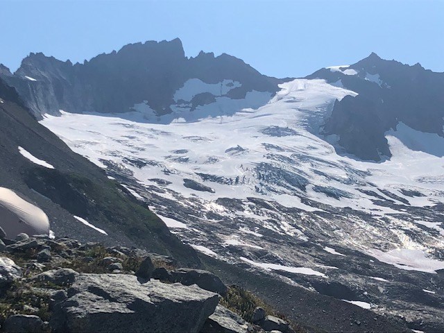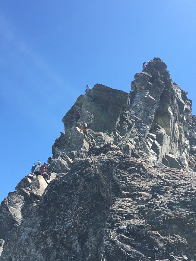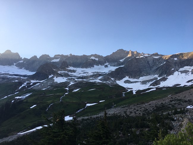
NPS/J. Shields Boston Basin Conditions, Sharkfin Col, Quien Sabe Glacier, Boston Peak It's a beautiful summertime wonderland in the Basin, with a dazzling wildflower display and happy marmots whistling and frolicking about! However, this long high-pressure period has resulted in lower snow levels at snow-to-rock transitions, calving snowfields, and weakening snow bridges. A longtime climbing ranger observed that the snow at Sharkfin Col is around 20' lower than usual, which necessitates that much more 4th class climbing for access. Start early and take care when crossing under snowfields lying on slabby, polished rock, as the day's heat will cause chunks to calve off and travel quickly downslope. Snow is firm in the morning but softens very quickly after sun exposure. Streams are still flowing swiftly at high volume - scout for good crossings and remember flow will increase greatly later in the day. Also be prepared for very bad biting blackflies and horseflies! Quien Sabe Glacier is still navigable but many crevasses have opened. Accessing the steep upper glacier requires dodging several very long cracks and crossing small remaining snow bridges. There is an undercut moat about 6' deep to gain the Boston-Sahale col. There is one short section of flat snow travel (visible in picture) on the ridge to Sahale. The standard route around the E side of Boston Peak traverses a steep snowfield with a 10' moat on its N side. Rappelling from the summit with a single 60-meter will not reach the second station - expect a 15' exposed downclimb on loose rock to reach it. We remind the climbing community that because Boston Basin is rightfully very popular, the permit system exists to prevent overcrowding, which detracts from enjoyment and can cause dangerous situations on routes. Bivying anywhere on the Torment-Forbidden-Boston-Sahale ridgeline is considered part of the Boston Basin cross-country zone and permits must specify this. A permit for the Forbidden cross-country zone necessitates dropping down onto the Forbidden or Boston Glaciers. 
NPS/B.Ducay Boston Basin Conditions, Forbidden Peak The Cascade River Road is now open and Boston Basin is busy! The approach couloir to the West Ridge of Forbidden was confirmed to be out of condition and that the Cat Scratch Gully is the preferred approach for the rest of this season. The Cat Scratch Gully can be deceiving in its difficulty and we recommend that you rope up for this section and to be careful of loose rock! There is no way to escape if a rock becomes dislodged higher up. The rappel stations on route were in good condition, but the rest must be downclimbed. Please keep in mind that going down can take longer than going up, especially with such high visitor use. We also saw numerous parties attempting to bivy at the base of the East Ridge Route on Forbidden Peak. This area is still considered within the boundaries of Boston Basin and your permit must reflect that. It is also not a good idea to be approaching that area so late in the day. The mountain was actively shedding rocks and snow in the heat while climbers were hiking up a confined gully below an area full of loose scree. A better choice would be to camp at the established upper bivy sites, doing the route camp to camp and avoiding the need to carry big packs up the east and down the west ridges. This area is receiving a tremendous amount of impact. There is a reason why we enforce park regulations and we kindly ask you to reflect on maintaining safety and wilderness character when you decide to travel in this spectacular area of the park.
July 18, 2021 Boston Basin Conditions Boston Creek and others are still flowing strongly but are crossable with caution throughout the day at the normal crossing sites. Visitors report the approach couloir for W Ridge of Forbidden has discontinuous snow and a difficult moat. Sharkfin Col's approach gully has continuous snow but shows much recent rockfall. Sharkfin Tower's approach gully is very wet with flowing water and has a ~5' tall and slightly undercut moat at its base, but remaining snow in the gully can now be bypassed. The Quien Sabe Glacier has open crevasses but has a navigable route between them. 
NPS/B.Ducay Boston Basin Conditions, Quien sabe Glacier With the recent high temperatures, Boston Basin currently reflects mid-summer conditions. The approach below treeline is straight-forward with some additional deadfall. The snow line is higher than expected at approximately 6200 feet. Water is flowing high and fast. Both branches of Boston creek were difficult to pass in the evening and necessitated an uphill detour to pass them safely. Both lower and upper bivy sites are melted out and both toilets are available for use. We also noticed that people have been building rock windwalls around bivy spots. We kindly request that you please refrain from doing so to maintain the wilderness environment that Boston Basin is known for. Bears seem to be very active in the area right now with numerous visitor encounters a lot of recent skat on trail. Please properly store your food! The Quien Sabe Glacier is in good condition but does have numerous crevasses to navigate on your way up. The moat at the top was badly undercut in spots and required scouting of safe exits onto rock. Be careful with what you are standing on and be conservative in this area. The approach gully to Sharkfin Tower was half full of snow. The approach gully to Sharkfin Col was still full of snow but also showed significant recent rockfall.
June 28, 2021 Boston Basin Conditions, Sharkfin, and W Ridge Forbidden (Visitor Reports) There are several treacherous creek crossings early on the approach from Cascade River Rd., the most notable being Midas Creek - travel early and cross with care. In Boston Basin the lower bivy sites are melted out along with the toilet, while the upper bivies are partially melted but threatened by glide avalanches from above. There is a strongly flowing creek on the way to the lower bivies that can be avoided by traveling on snow. Sharkin Tower is reported in good conditions but the approach gully is currently very steep - one party led adjacent rock instead of taking the couloir. The W Ridge of Forbidden route is snow-free, but the approach requires traveling under overhead snow and rockfall hazard. The approach couloir is reported easily to be accessed and in great shape. Remember that high temperatures lead to increased shedding of loose rock and snow which is most prevalent later in the day - climb early and be away from overhead hazard by afternoon.
Return to Climbing Conditions - Boston Basin Area Check out the links below for conditions in other years: Climbing Conditions - Boston Basin Area 2020 Climbing Conditions - Boston Basin Area 2022 Climbing Conditions - Boston Basin Area 2023 |
Last updated: May 17, 2025
