News Release

NPS Photo
|
Subscribe
|
Contact: Dana Soehn, 865-436-1207
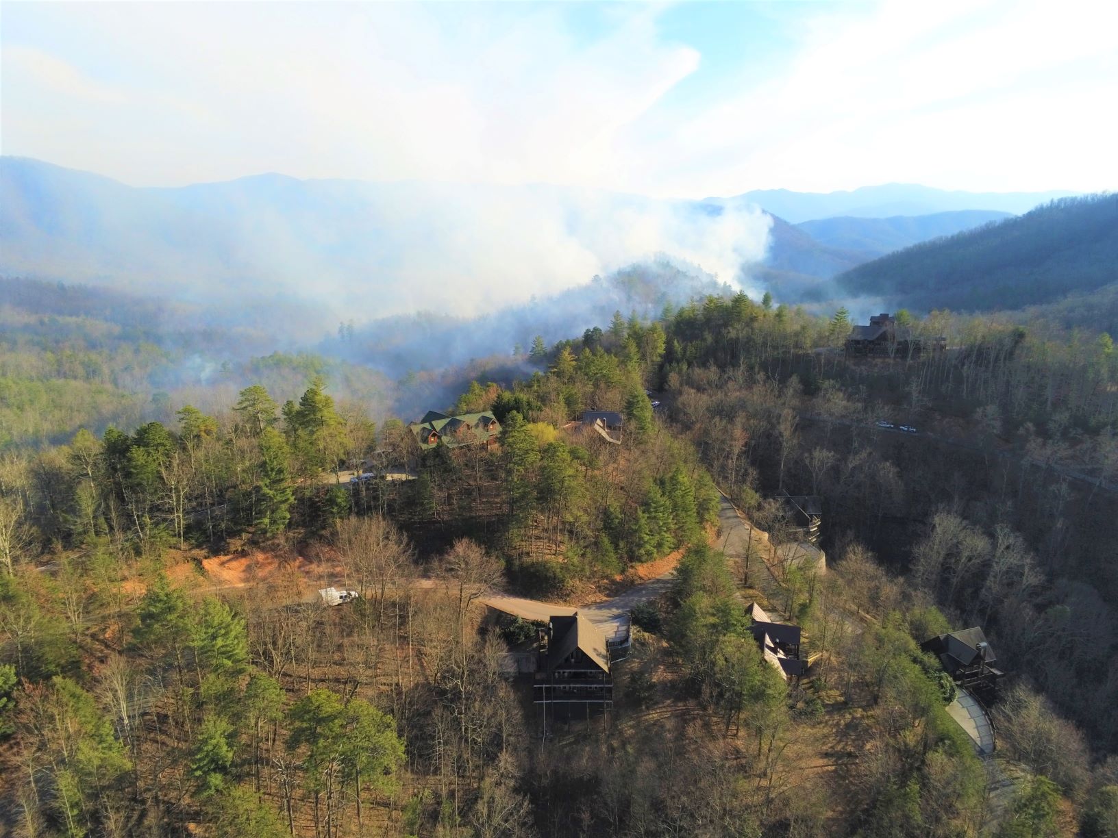
Great Smoky Mountains National Park and the Appalachian-Piedmont-Coastal Zone fire management staff successfully completed a 175-acre prescribed burn along a half-mile of the park boundary in Wears Valley on Tuesday, March 9. The prescribed burn was conducted to reduce the amount of flammable brush along the park's boundary with residential homes, as well as maintaining an open woodland habitat for drought-tolerant trees like oak and pine.
“The wildland fire specialists did an outstanding job planning, prepping, and executing this prescribed burn in an ongoing effort to help communities along our boundary create Firewise space between their homes and parklands,” said Chief Ranger Lisa Hendy. "The success of this burn was not just the protection of structures and the furtherance of the ecosystem, but also the strengthening of relationships within our partner firefighting agencies, which fortifies the foundation from which we all strive as a team to protect our communities.”
Crews established a 3,000-ft hose lay for added protection around homes at the top of the ridge and along the boundary before implementing the prescribed burn. A small test burn was conducted to confirm fire behavior before the prescribed fire was allowed to burn slowly down the slope towards Metcalf Bottoms Picnic Area. As expected, smoke was visible throughout the operations across the Wears Valley area. Flame lengths and fire behavior were within prescription throughout the operations as the low-intensity fire backed down the slope over a six-hour period until the burn reached the natural and manmade control lines at the bottom. Crews remained on scene overnight and continued to staff the area for several days to check control lines and monitor fire activity.
Crews from the Cherokee National Forest, Bureau of Indian Affairs in Cherokee, Townsend Volunteer Fire Department, Pittman Center Volunteer Fire Department, Waldens Creek Volunteer Fire Department, The Nature Conservancy, AmeriCorp, and employees from Great Smoky Mountains National Park, Congaree National Park, and Chickamauga-Chattanooga National Military Park provided assistance throughout the burn operations including site preparation and post-burn monitoring.
In preparation for the prescribed burn operation, crews spent several days clearing brush and leaf litter along the park boundary and Indian Camp Branch, which successfully served as fire control lines to keep the fire within its planned boundaries. The 175-acre unit was bounded by Wear Cove Gap Road, Indian Camp Branch, Little River, and the park boundary along Roundtop Trail.
For more information about this burn unit, please visit the park website at www.nps.gov/grsm/learn/news/park-plans-cades-cove-prescribed-burn-for-thursday-february-25.htm.
--NPS--
www.nps.gov/grsm
www.Facebook.com/GreatSmokyMountainsNPS
www.Twitter.com/GreatSmokyNPS
www.Instagram.com/GreatSmokyNPS
www.flickr.com/photos/greatsmokymountainsnationalpark
Last updated: March 16, 2021
